

$2,500
Total Monthly Price
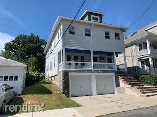
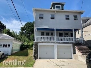
17 Pheasant St
Boston, MA 02132
Favorites
17 Pheasant St

Favorites
Check Back Soon for Upcoming Availability
| Beds | Baths | Average SF |
|---|---|---|
| 2 Bedrooms 2 Bedrooms 2 Br | 1 Bath 1 Bath 1 Ba | — |
Fees and Policies
The fees listed below are community-provided and may exclude utilities or add-ons. All payments are made directly to the property and are non-refundable unless otherwise specified.
Details
Utilities Included
-
Water
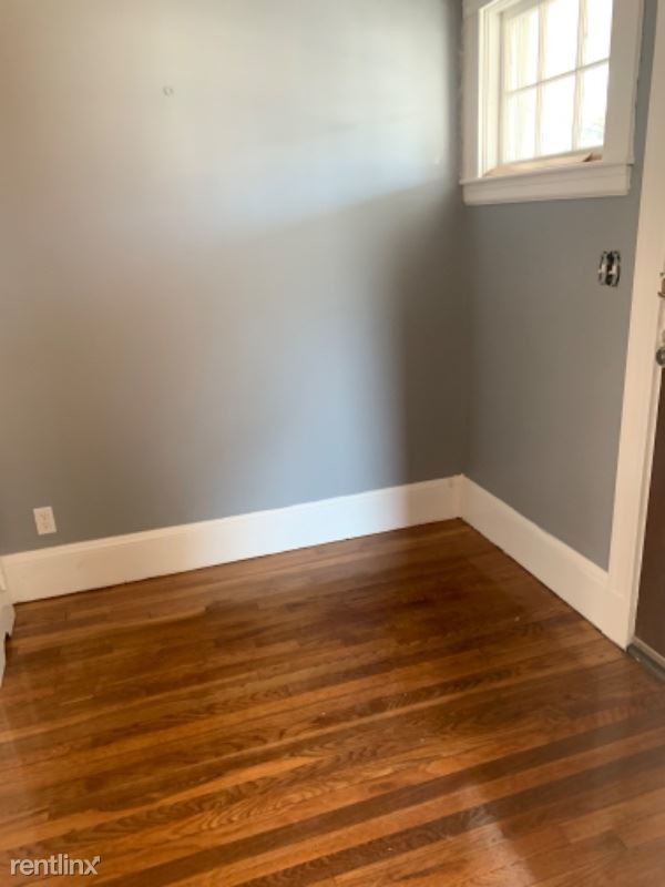
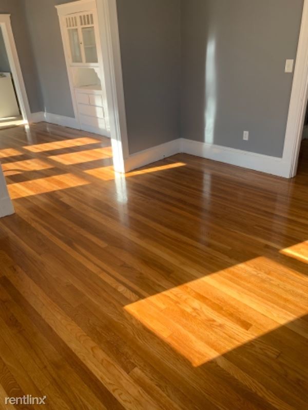
About This Property
(617) 905-7875 - Rental Property - Property Id: 152220 Two family house newly renovated, that should be available to move inn by November 10 Apply at TurboTenant: http://turbo.rent/s/152220p Property Id 152220 No Dogs Allowed (RLNE5355445) Other Amenities: Other (Cooling System: None). Appliances: Refrigerator, Range, Oven, Other (Freezer), Microwave. Lease lengths: Other (Contact for details). Utilities: Water Included, Trash Pick-up Included. Pet policies: No Dogs Allowed.
17 Pheasant St is an apartment community located in Suffolk County and the 02132 ZIP Code.
Unique Features
- No Dogs Allowed, Lease Lengths - Contact for details, Oven, Appliances - Freezer, Amenities - Coolin
17 Pheasant St,
Boston,
MA
02132
Upper Washington-Spring Street is a neighborhood southwest of Boston in West Roxbury. Residents will find that Upper Washington-Spring Street is home to many cozy residential areas and great amenities. The neighborhood’s northern border sits along the Charles River and surrounding parks like Millennium Park, giving residents easy access to outdoor recreation. The hospital that serves this area, West Roxbury VAMC, sits along the river as well. Within Upper Washington-Spring Street, residents will find that picturesque parks like Ohrenberger Woodland Park dot the area. To the east of town, residents can travel along VFW Parkway to get to eateries and retail stores.
This neighborhood is a great town for commuters as the MBTA has both bus stops and rail lines accessible to the area. Apartments and condos scattered throughout town make up the majority of Upper Washington-Spring Street’s diverse rental options.
Learn more about living in Upper Washington-Spring StBelow are rent ranges for similar nearby apartments
| Beds | Average Size | Lowest | Typical | Premium |
|---|---|---|---|---|
| Studio Studio Studio | 509-528 Sq Ft | $1,650 | $2,037 | $2,820 |
| 1 Bed 1 Bed 1 Bed | 1212-1219 Sq Ft | $1,790 | $2,665 | $4,521 |
| 2 Beds 2 Beds 2 Beds | 1343-1353 Sq Ft | $2,350 | $3,295 | $11,126 |
| 3 Beds 3 Beds 3 Beds | 1717 Sq Ft | $3,000 | $4,308 | $15,041 |
| 4 Beds 4 Beds 4 Beds | 1969 Sq Ft | $4,100 | $4,616 | $5,500 |
Amenities
- No Dogs Allowed, Lease Lengths - Contact for details, Oven, Appliances - Freezer, Amenities - Coolin
Expenses
Utilities Included
Water
Included
Education
| Colleges & Universities | Distance | ||
|---|---|---|---|
| Colleges & Universities | Distance | ||
| Drive: | 12 min | 4.5 mi | |
| Drive: | 13 min | 5.8 mi | |
| Drive: | 14 min | 6.5 mi | |
| Drive: | 14 min | 6.6 mi |
17 Pheasant St is within 12 minutes or 4.5 miles from Curry College. It is also near MCPHS University, Boston and Boston College.
Transportation options available in Boston include Forest Hills Station, located 2.6 miles from 17 Pheasant St. 17 Pheasant St is near General Edward Lawrence Logan International, located 10.9 miles or 23 minutes away.
| Transit / Subway | Distance | ||
|---|---|---|---|
| Transit / Subway | Distance | ||
|
|
Drive: | 6 min | 2.6 mi |
|
|
Drive: | 9 min | 3.6 mi |
|
|
Drive: | 9 min | 3.8 mi |
|
|
Drive: | 10 min | 4.4 mi |
|
|
Drive: | 10 min | 4.5 mi |
| Commuter Rail | Distance | ||
|---|---|---|---|
| Commuter Rail | Distance | ||
|
|
Drive: | 3 min | 1.3 mi |
|
|
Drive: | 4 min | 1.4 mi |
|
|
Drive: | 3 min | 1.5 mi |
|
|
Drive: | 4 min | 1.7 mi |
|
|
Drive: | 7 min | 2.8 mi |
| Airports | Distance | ||
|---|---|---|---|
| Airports | Distance | ||
|
General Edward Lawrence Logan International
|
Drive: | 23 min | 10.9 mi |
Walkability Near 17 Pheasant St Boston, MA 02132
Getting Around
 What do Walkability, Transit, Drivability, and Bikeability mean?
Walkability measures the walking distance to day-to-day needs.
Transit measures access to public transportation.
Drivability measures congestion, parking availability, and access to major roads.
Bikeability measures the suitability for cycling.
How It Works
What do Walkability, Transit, Drivability, and Bikeability mean?
Walkability measures the walking distance to day-to-day needs.
Transit measures access to public transportation.
Drivability measures congestion, parking availability, and access to major roads.
Bikeability measures the suitability for cycling.
How It Works
Moderately Walkable
Walkability
60
/ 100
Good Public Transit
Transit
60
/ 100
Moderately Drivable
Drivability
60
/ 100
Very Bikeable
Bikeability
80
/ 100
Scores provided by
-
Soundscore™
-
/ 100
Traffic
-Airport
-Businesses
-Scores provided by
HowLoud What is a Sound Score Rating? A Sound Score Rating aggregates noise caused by vehicle traffic, airplane traffic and local sources. How It WorksTime and distance from 17 Pheasant St.
| Shopping Centers | Distance | ||
|---|---|---|---|
| Shopping Centers | Distance | ||
| Drive: | 3 min | 1.2 mi | |
| Drive: | 4 min | 1.4 mi | |
| Drive: | 5 min | 1.8 mi |
17 Pheasant St has 3 shopping centers within 1.8 miles, which is about a 5-minute drive. The miles and minutes will be for the farthest away property.
| Parks and Recreation | Distance | ||
|---|---|---|---|
| Parks and Recreation | Distance | ||
|
Stony Brook Reservation
|
Walk: | 21 min | 1.1 mi |
|
Brook Farm Historic Site
|
Drive: | 5 min | 2.0 mi |
|
Arnold Arboretum of Harvard University
|
Drive: | 5 min | 2.3 mi |
|
Mass Audubon's Boston Nature Center and Wildlife Sanctuary
|
Drive: | 9 min | 3.3 mi |
|
Franklin Park Zoo
|
Drive: | 11 min | 4.6 mi |
17 Pheasant St has 5 parks within 4.6 miles, including Stony Brook Reservation, Brook Farm Historic Site, and Arnold Arboretum of Harvard University.
| Hospitals | Distance | ||
|---|---|---|---|
| Hospitals | Distance | ||
| Drive: | 5 min | 2.4 mi | |
| Drive: | 6 min | 2.6 mi | |
| Drive: | 10 min | 4.2 mi |
17 Pheasant St has 3 hospitals within 4.2 miles, the nearest is Bournewood Hospital which is 2.4 miles away and a 5 minute drive.
| Military Bases | Distance | ||
|---|---|---|---|
| Military Bases | Distance | ||
| Drive: | 26 min | 12.9 mi | |
| Drive: | 33 min | 18.4 mi | |
| Drive: | 48 min | 27.2 mi |
17 Pheasant St has 3 military bases within 27.2 miles, the nearest is US Military Reservation which is 12.9 miles away and a 26 minute drive.
You May Also Like
-
Washington Crossing Apartments
55 Cedar St
Woburn, MA 01801
$2,945 - $3,717 Plus Fees
2 Br 15.5 mi
-
The Point at Woburn
120 Commerce Way
Woburn, MA 01801
$2,711 - $7,132 Total Monthly Price
2-3 Br 16.9 mi
-
Station 316 Apartments
316 New Boston St
Woburn, MA 01801
$2,765 - $4,741 Total Monthly Price
2-3 Br 17.3 mi
Similar Rentals Nearby
-
-
Plus Fees2 Beds$4,095+1 Month Free
Pets Allowed Fitness Center Pool Dishwasher Refrigerator Kitchen
-
-
-
2 Beds$6,682+Total Monthly PriceTotal Monthly Price NewPrices include all required monthly fees.Specials
Pets Allowed Fitness Center Dishwasher Refrigerator Kitchen In Unit Washer & Dryer Walk-In Closets
-
2 Beds$2,647+3 Beds$4,006+Total Monthly PriceTotal Monthly Price NewPrices include base rent and required monthly fees. Variable costs based on usage may apply.
Pets Allowed Fitness Center Pool Dishwasher Kitchen In Unit Washer & Dryer
-
Plus Fees2 Beds$2,865+1 Month Free
Pets Allowed Fitness Center Pool Dishwasher Refrigerator In Unit Washer & Dryer
-
2 Beds$3,052+3 Beds$3,777+Total Monthly PriceTotal Monthly Price NewPrices include base rent and required monthly fees. Variable costs based on usage may apply.Specials
Pets Allowed Fitness Center Dishwasher Refrigerator Kitchen In Unit Washer & Dryer
-
2 Beds$2,800+Total Monthly PriceTotal Monthly Price NewPrices include base rent and required monthly fees of $16. Variable costs based on usage may apply.Base Rent:2 Beds$2,783+1 Month Free
Fitness Center Clubhouse Balcony Stainless Steel Appliances Granite Countertops Smoke Free Basketball Court
-
2 Beds$3,252+Total Monthly PriceTotal Monthly Price NewPrices include required monthly fees of $130.Base Rent:2 Beds$3,122+2 Months Free
Pets Allowed Fitness Center Pool Walk-In Closets Business Center Package Service Elevator


What Are Walk Score®, Transit Score®, and Bike Score® Ratings?
Walk Score® measures the walkability of any address. Transit Score® measures access to public transit. Bike Score® measures the bikeability of any address.
What is a Sound Score Rating?
A Sound Score Rating aggregates noise caused by vehicle traffic, airplane traffic and local sources.
17 Pheasant St
Boston, MA 02132