$2,150
/ Month
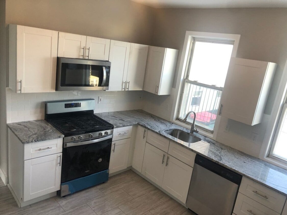
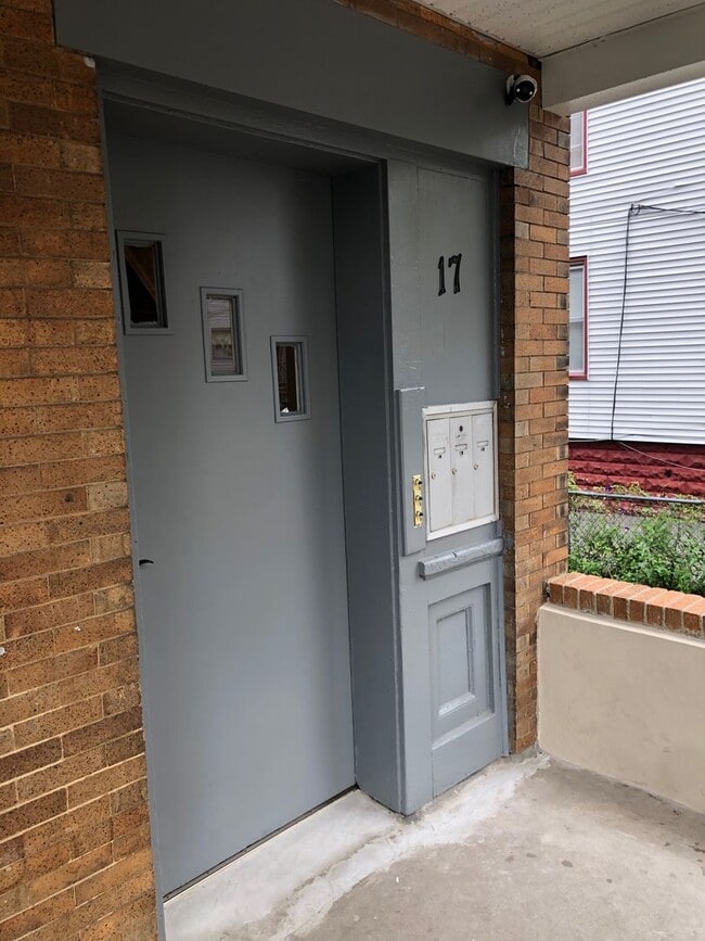
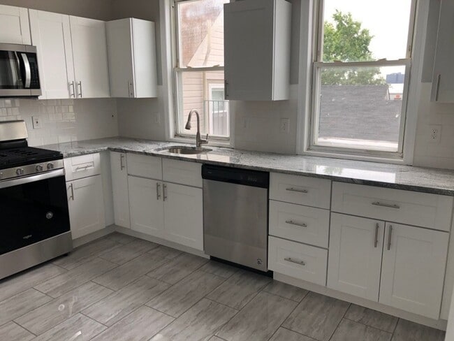
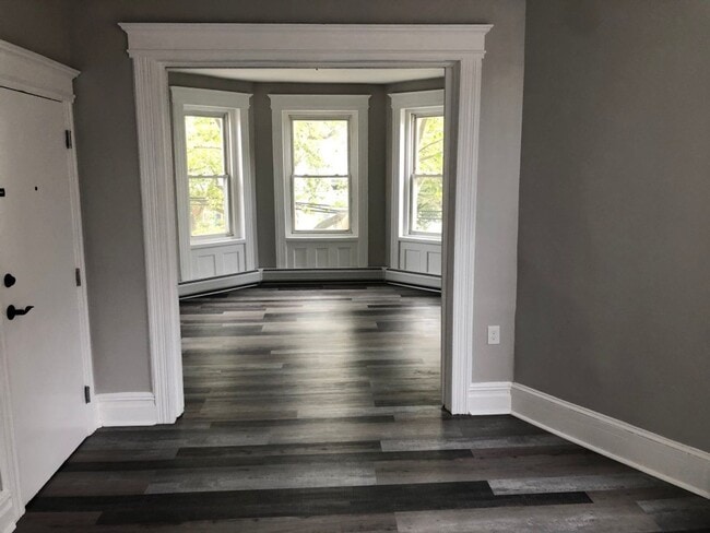
17 Devon St
Kearny, NJ 07032
Today
Favorites
973-376-3925
-
Bedrooms
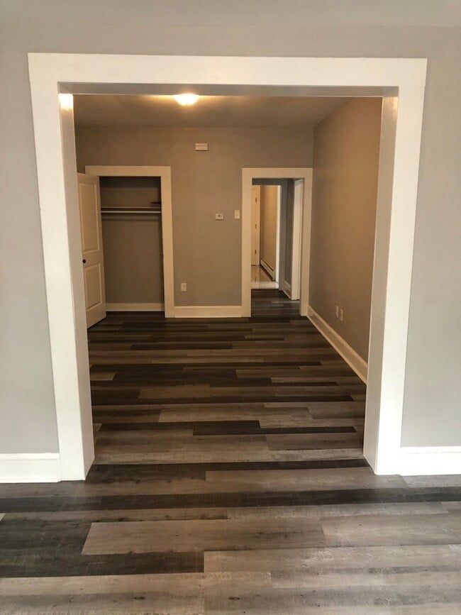
2
-
Bathrooms
1
-
Square Feet
800 sq ft
-
Available
Available Oct 15
17 Devon St

Favorites
17 Devon St is an apartment community located in Hudson County and the 07032 ZIP Code.
* Price shown is base rent. Excludes user-selected optional fees and variable or usage-based fees and required charges due at or prior to move-in or at move-out. Price, availability, fees, and any applicable rent special are subject to change without notice.
* Square footage definitions vary. Displayed square footage is approximate.
Features
- Dishwasher
Contact
- Listed by Corner Property Management | Corner Property Management
- Phone Number
- Contact
Location
Get Directions
Amenities
- Dishwasher
Sitting adjacent to Newark and Jersey City, Kearny is just minutes from Manhattan, giving residents easy access to New York City for work or leisure (either via car or PATH rail service). While most of the town’s area is industrial, the residential area on the northwest side of town is an attractive mix of neighborhoods and storefronts. Kearny Avenue serves as the main drag through town, featuring a wide selection of locally-owned restaurants, shops, and bars. West Hudson Park provides a large open area for outdoor recreation, including a network of trails for running and biking.
Learn more about living in Kearny
Education
| Colleges & Universities | Distance | ||
|---|---|---|---|
| Colleges & Universities | Distance | ||
| Drive: | 4 min | 1.6 mi | |
| Drive: | 5 min | 2.1 mi | |
| Drive: | 6 min | 2.1 mi | |
| Drive: | 10 min | 4.7 mi |
17 Devon St is within 4 minutes or 1.6 miles from Rutgers, Newark Campus. It is also near N.J. Inst. of Technology and Essex County College.
Transportation options available in Kearny include Atlantic Street, located 1.3 miles from 17 Devon St. 17 Devon St is near Newark Liberty International, located 7.9 miles or 11 minutes away, and LaGuardia, located 25.9 miles or 40 minutes away.
| Transit / Subway | Distance | ||
|---|---|---|---|
| Transit / Subway | Distance | ||
|
|
Drive: | 4 min | 1.3 mi |
|
|
Drive: | 4 min | 1.3 mi |
|
|
Drive: | 4 min | 1.3 mi |
|
|
Drive: | 4 min | 1.6 mi |
|
|
Drive: | 5 min | 2.4 mi |
| Commuter Rail | Distance | ||
|---|---|---|---|
| Commuter Rail | Distance | ||
|
|
Walk: | 20 min | 1.0 mi |
|
|
Drive: | 5 min | 2.1 mi |
|
|
Drive: | 5 min | 2.4 mi |
|
|
Drive: | 7 min | 3.8 mi |
|
|
Drive: | 8 min | 4.0 mi |
| Airports | Distance | ||
|---|---|---|---|
| Airports | Distance | ||
|
Newark Liberty International
|
Drive: | 11 min | 7.9 mi |
|
LaGuardia
|
Drive: | 40 min | 25.9 mi |
Time and distance from 17 Devon St.
| Shopping Centers | Distance | ||
|---|---|---|---|
| Shopping Centers | Distance | ||
| Walk: | 13 min | 0.7 mi | |
| Walk: | 19 min | 1.0 mi | |
| Walk: | 19 min | 1.0 mi |
17 Devon St has 3 shopping centers within 1.0 miles, which is about a 19-minute walk. The miles and minutes will be for the farthest away property.
| Parks and Recreation | Distance | ||
|---|---|---|---|
| Parks and Recreation | Distance | ||
|
Newark Museum and Dreyfuss Planetarium
|
Drive: | 5 min | 1.7 mi |
|
Kearny Marsh
|
Drive: | 5 min | 1.8 mi |
|
Branch Brook Park
|
Drive: | 7 min | 2.7 mi |
|
Richard W. DeKorte Park
|
Drive: | 10 min | 3.7 mi |
|
McDowell Observatory
|
Drive: | 18 min | 6.8 mi |
17 Devon St has 5 parks within 6.8 miles, including Newark Museum and Dreyfuss Planetarium, Kearny Marsh, and Branch Brook Park.
| Hospitals | Distance | ||
|---|---|---|---|
| Hospitals | Distance | ||
| Drive: | 4 min | 1.6 mi | |
| Drive: | 6 min | 3.1 mi | |
| Drive: | 8 min | 3.9 mi |
17 Devon St has 3 hospitals within 3.9 miles, the nearest is Saint Michael's Medical Center which is 1.6 miles away and a 4 minute drive.
| Military Bases | Distance | ||
|---|---|---|---|
| Military Bases | Distance | ||
| Drive: | 17 min | 9.5 mi | |
| Drive: | 25 min | 11.4 mi | |
| Drive: | 34 min | 19.0 mi |
17 Devon St has 3 military bases within 19.0 miles, the nearest is Military Ocean Terminal which is 9.5 miles away and a 17 minute drive.
You May Also Like
Similar Rentals Nearby


What Are Walk Score®, Transit Score®, and Bike Score® Ratings?
Walk Score® measures the walkability of any address. Transit Score® measures access to public transit. Bike Score® measures the bikeability of any address.
What is a Sound Score Rating?
A Sound Score Rating aggregates noise caused by vehicle traffic, airplane traffic and local sources

17 Devon St
Kearny, NJ 07032