
Tetris
187 Culver Ave,
Jersey City, NJ 07305
$2,500 - $3,400 Total Monthly Price
1-2 Beds 13 Month Lease
Bedrooms
Studio - 1 bd
Bathrooms
1 ba
Square Feet
400 - 640 sq ft
Situated in heart of Kearny's commercial and shopping area, Kearny Avenue, is the principal thoroughfare running through the Town. Featuring bright sun-lit apartments with thick walls, hardwood floors, new windows and with heat and hot water included, the Apartments at 125-133 Kearny Avenue offer an architecturally diverse urban living experience. Located close to public transportation, our apartments are also in close proximity to Routes 280, 1 & 9, 3, 7, 17, 21, the Garden State Parkway and the New Jersey Turnpike. If city living is what you desire, then the Apartments at 125-133 Kearny Avenue is the community for you. *Advertised photos may not be of actual unit available, please contact for more details.
Situated in heart of Kearny's commercial and shopping area, Kearny Avenue, is the principal thoroughfare running through the Town. Featuring bright sun-lit apartments with thick walls, hardwood floors, new windows and with heat and hot water included, the Apartments at 125-133 Kearny Avenue offer an architecturally diverse urban living experience. Located close to public transportation, our apartments are also in close proximity to Routes 280, 1 & 9, 3, 7, 17, 21, the Garden State Parkway and the New Jersey Turnpike. If city living is what you desire, then the Apartments at 125-133 Kearny Avenue is the community for you. *Advertised photos may not be of actual unit available, please contact for more details.
125-133 Kearny Avenue is an apartment community located in Hudson County and the 07032 ZIP Code. This area is served by the Kearny School District attendance zone.
Unique Features
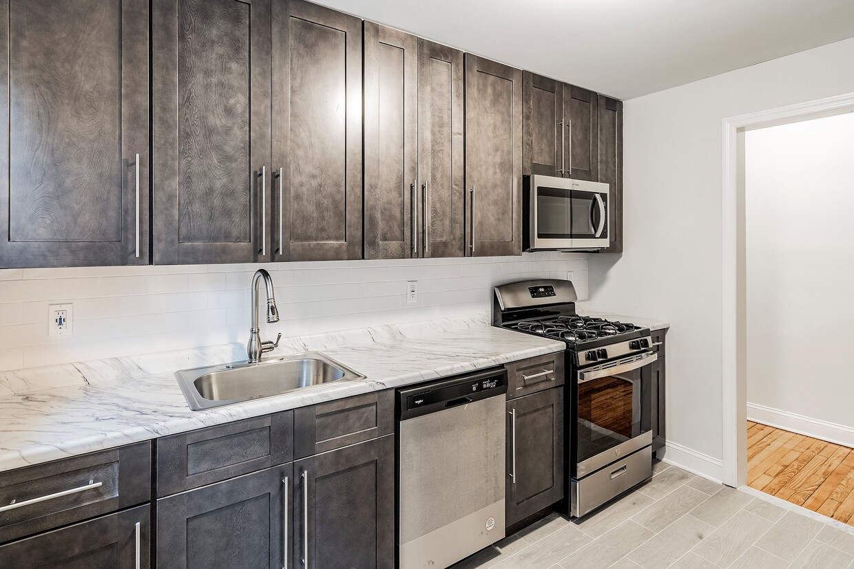
Dishwasher
High Speed Internet Access
Hardwood Floors
Granite Countertops
Kearny sits at a quiet crossroads between Newark and Jersey City, offering a small-town feel just a short hop from Manhattan via PATH rail. Kearny Avenue anchors the heart of town with locally-owned restaurants, shops, and bars that give the area a genuinely neighborhood character. West Hudson Park offers a welcome stretch of green space, complete with running and biking trails that make it easy to unwind after a busy day. Industrial history runs deep here — the town was named after Civil War general Philip Kearny and grew around major manufacturing operations that once defined the region.
The residential northwest side draws renters looking for value without sacrificing access. Apartment communities here range from classic brick walk-ups to updated multi-family buildings, with studio and one-bedroom options that suit commuters well. Larger two-bedroom floor plans are also available for those needing more space.
Learn more about living in Kearny| Colleges & Universities | Distance | ||
|---|---|---|---|
| Colleges & Universities | Distance | ||
| Drive: | 4 min | 1.8 mi | |
| Drive: | 5 min | 2.2 mi | |
| Drive: | 5 min | 2.3 mi | |
| Drive: | 10 min | 4.9 mi |


Transportation options available in Kearny include Atlantic Street, located 1.4 miles from 125-133 Kearny Avenue. 125-133 Kearny Avenue is near Newark Liberty International, located 7.8 miles or 11 minutes away, and LaGuardia, located 25.9 miles or 40 minutes away.
| Transit / Subway | Distance | ||
|---|---|---|---|
| Transit / Subway | Distance | ||
|
|
Drive: | 3 min | 1.4 mi |
|
|
Drive: | 4 min | 1.5 mi |
|
|
Drive: | 3 min | 1.5 mi |
|
|
Drive: | 4 min | 1.7 mi |
|
|
Drive: | 5 min | 2.6 mi |
| Commuter Rail | Distance | ||
|---|---|---|---|
| Commuter Rail | Distance | ||
|
|
Drive: | 2 min | 1.2 mi |
|
|
Drive: | 5 min | 2.3 mi |
|
|
Drive: | 5 min | 2.6 mi |
|
|
Drive: | 7 min | 3.9 mi |
|
|
Drive: | 8 min | 4.2 mi |
| Airports | Distance | ||
|---|---|---|---|
| Airports | Distance | ||
|
Newark Liberty International
|
Drive: | 11 min | 7.8 mi |
|
LaGuardia
|
Drive: | 40 min | 25.9 mi |
Scores provided by
Traffic
-Airport
-Businesses
-Scores provided by
HowLoud What is a Sound Score Rating? A Sound Score Rating aggregates noise caused by vehicle traffic, airplane traffic and local sources. How It WorksTime and distance from 125-133 Kearny Avenue.
| Shopping Centers | Distance | ||
|---|---|---|---|
| Shopping Centers | Distance | ||
| Walk: | 12 min | 0.7 mi | |
| Walk: | 17 min | 0.9 mi | |
| Walk: | 18 min | 0.9 mi |
| Parks and Recreation | Distance | ||
|---|---|---|---|
| Parks and Recreation | Distance | ||
|
Kearny Marsh
|
Drive: | 4 min | 1.6 mi |
|
Newark Museum and Dreyfuss Planetarium
|
Drive: | 4 min | 1.9 mi |
|
Branch Brook Park
|
Drive: | 7 min | 2.8 mi |
|
Richard W. DeKorte Park
|
Drive: | 9 min | 3.5 mi |
|
McDowell Observatory
|
Drive: | 17 min | 6.5 mi |
| Hospitals | Distance | ||
|---|---|---|---|
| Hospitals | Distance | ||
| Drive: | 4 min | 1.8 mi | |
| Drive: | 6 min | 3.2 mi | |
| Drive: | 7 min | 4.1 mi |
| Military Bases | Distance | ||
|---|---|---|---|
| Military Bases | Distance | ||
| Drive: | 17 min | 9.6 mi | |
| Drive: | 24 min | 11.3 mi | |
| Drive: | 34 min | 19.2 mi |
What Are Walk Score®, Transit Score®, and Bike Score® Ratings?
Walk Score® measures the walkability of any address. Transit Score® measures access to public transit. Bike Score® measures the bikeability of any address.
What is a Sound Score Rating?
A Sound Score Rating aggregates noise caused by vehicle traffic, airplane traffic and local sources.

125-133 Kearny Ave
Kearny, NJ 07032


