
TL Residences
361 Turk St,
San Francisco, CA 94102
$1,695 - $1,895
Studio


Apt 2 INNER RICHMOND 2 bedroom 1 bath apt 3500.00 close to USF/St Mary Hospital/GG Park - 5 mins walking Welcome working professionals or Students AVAILABLE NOW New flooring New paint job washer/dryer in building garage parking available @250 credit report and rental history for working professionals guarantor for students Text or email for viewing time Min. One year. Owner pay for water n garbage. Safe n quiet neighborhood. 5 mins walk to Golden Gate Park
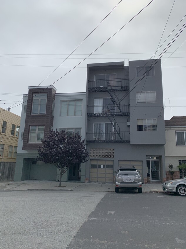
135 N Willard St is an apartment community located in San Francisco County and the 94118 ZIP Code. This area is served by the San Francisco Unified School District attendance zone.
Appropriately named, Lone Mountain is marked by a large hill and has scenic views of the city. Lone Mountain is one of San Francisco’s most historic neighborhoods and is known as one of the best neighborhoods in which to live. This family-friendly neighborhood has good schools and is home to San Francisco University, which is why the area is nicknamed University Terrace. Along with historic architecture, Lone Mountain features a range of condos, houses, and apartments. Residents enjoy access to plenty of restaurants, especially along Geary Boulevard, and proximity to Golden Gate Park, which is directly south of the neighborhood. Lone Mountain is also just two miles from the Presidio of San Francisco and Downtown San Francisco.
Learn more about living in Lone MountainCompare neighborhood and city base rent averages by bedroom.
| Lone Mountain | San Francisco, CA | |
|---|---|---|
| Studio | $1,320 | $2,552 |
| 1 Bedroom | $2,403 | $3,346 |
| 2 Bedrooms | $2,817 | $4,608 |
| 3 Bedrooms | $4,285 | $5,764 |
| Colleges & Universities | Distance | ||
|---|---|---|---|
| Colleges & Universities | Distance | ||
| Walk: | 7 min | 0.4 mi | |
| Drive: | 4 min | 1.5 mi | |
| Drive: | 5 min | 1.9 mi | |
| Drive: | 9 min | 3.0 mi |


Transportation options available in San Francisco include Carl St & Stanyan St, located 0.9 mile from 135 N Willard St. 135 N Willard St is near San Francisco International, located 15.6 miles or 26 minutes away, and Metro Oakland International, located 23.0 miles or 37 minutes away.
| Transit / Subway | Distance | ||
|---|---|---|---|
| Transit / Subway | Distance | ||
| Walk: | 17 min | 0.9 mi | |
| Walk: | 20 min | 1.0 mi | |
|
|
Drive: | 3 min | 1.1 mi |
| Drive: | 3 min | 1.3 mi | |
|
|
Drive: | 3 min | 1.4 mi |
| Commuter Rail | Distance | ||
|---|---|---|---|
| Commuter Rail | Distance | ||
| Drive: | 10 min | 4.7 mi | |
| Drive: | 15 min | 7.8 mi | |
| Drive: | 21 min | 12.2 mi | |
| Drive: | 22 min | 12.6 mi | |
|
|
Drive: | 26 min | 14.6 mi |
| Airports | Distance | ||
|---|---|---|---|
| Airports | Distance | ||
|
San Francisco International
|
Drive: | 26 min | 15.6 mi |
|
Metro Oakland International
|
Drive: | 37 min | 23.0 mi |
Scores provided by
Traffic
-Airport
-Businesses
-Scores provided by
HowLoud What is a Sound Score Rating? A Sound Score Rating aggregates noise caused by vehicle traffic, airplane traffic and local sources. How It WorksTime and distance from 135 N Willard St.
| Shopping Centers | Distance | ||
|---|---|---|---|
| Shopping Centers | Distance | ||
| Walk: | 18 min | 1.0 mi |
| Parks and Recreation | Distance | ||
|---|---|---|---|
| Parks and Recreation | Distance | ||
|
Conservatory of Flowers
|
Walk: | 8 min | 0.4 mi |
|
California Academy of Sciences
|
Walk: | 16 min | 0.9 mi |
|
Steinhart Aquarium
|
Walk: | 19 min | 1.0 mi |
|
San Francisco Botanical Garden
|
Drive: | 5 min | 2.1 mi |
|
Japanese Tea Garden
|
Drive: | 6 min | 2.3 mi |
| Hospitals | Distance | ||
|---|---|---|---|
| Hospitals | Distance | ||
| Walk: | 6 min | 0.3 mi | |
| Walk: | 20 min | 1.1 mi | |
| Drive: | 2 min | 1.2 mi |
| Military Bases | Distance | ||
|---|---|---|---|
| Military Bases | Distance | ||
| Drive: | 9 min | 2.9 mi | |
| Drive: | 10 min | 3.9 mi | |
| Drive: | 19 min | 9.2 mi |
What Are Walk Score®, Transit Score®, and Bike Score® Ratings?
Walk Score® measures the walkability of any address. Transit Score® measures access to public transit. Bike Score® measures the bikeability of any address.
What is a Sound Score Rating?
A Sound Score Rating aggregates noise caused by vehicle traffic, airplane traffic and local sources.
135 N Willard St
San Francisco, CA 94118


