
$4,000
Total Monthly Price
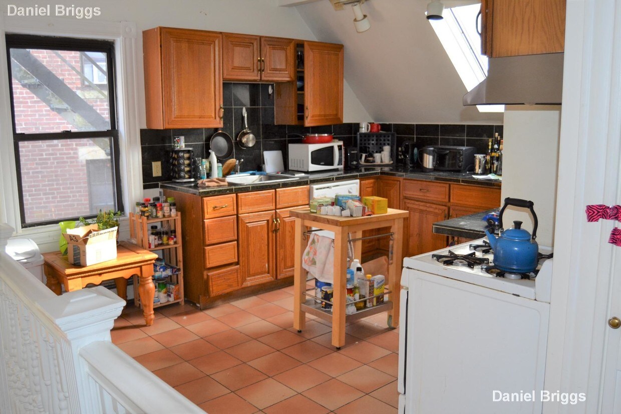
132 Chiswick Rd Unit 2T
Brighton, MA 02135
2 Weeks Ago
Favorites
132 Chiswick Rd Unit 2T

Favorites
Check Back Soon for Upcoming Availability
| Beds | Baths | Average SF |
|---|---|---|
| 5 Bedrooms 5 Bedrooms 5 Br | 2 Baths 2 Baths 2 Ba | — |
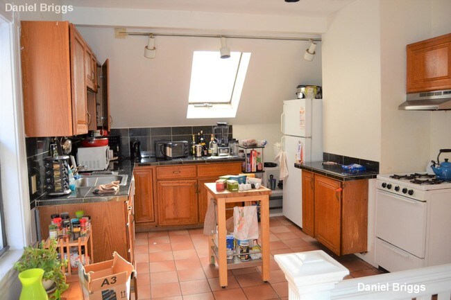
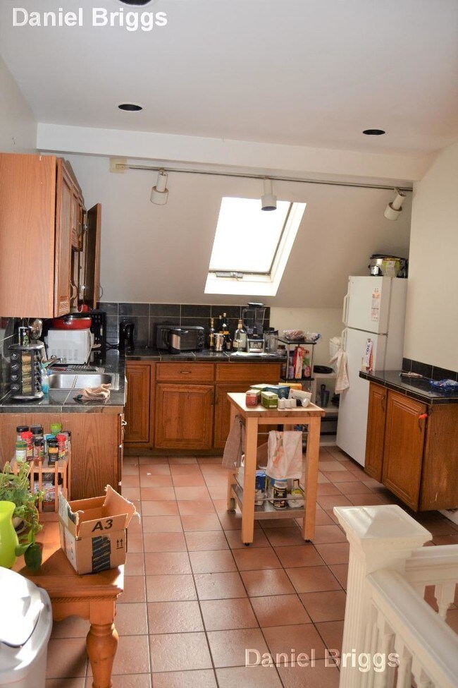
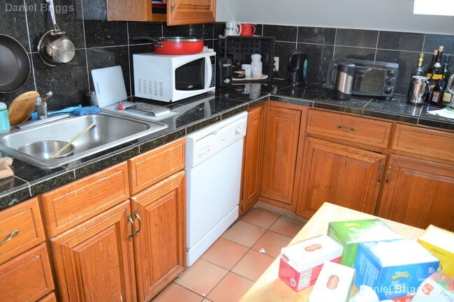
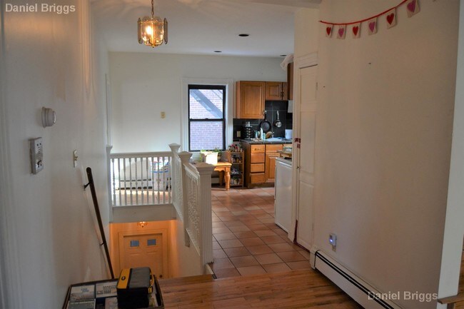
About This Property
Available 9/1/19. Unbelievable deal! MUST SEE! Parking on site.
132 Chiswick Rd is an apartment community located in Suffolk County and the 02135 ZIP Code.
Location
Get Directions
Saint Elizabeth’s is a Brighton neighborhood situated about 10 miles away from Boston. Thanks to Saint Elizabeth’s top border sitting on Highway 20, commuting in and out of Brighton is easy. Some residents travel by car, but buses and railways make commuting via public transportation a breeze.
The neighborhood’s best amenities are two world-renowned hospitals, Saint Elizabeth’s Medical Center and Franciscan Children’s, that sit on the edge of town. Other great amenities of Saint Elizabeth’s include many local parks like Ringer Playground and Chestnut Hill Reservoir, which has great trails and greenspace. This neighborhood is also equipped with cozy coffee shops, restaurants serving international and American classics, and shopping plazas with grocers and convenience stores.
Saint Elizabeth’s has several rental options ranging from apartments to single-family homes.
Learn more about living in St Elizabeth'sBelow are rent ranges for similar nearby apartments
| Beds | Average Size | Lowest | Typical | Premium |
|---|---|---|---|---|
| Studio Studio Studio | 5335 Sq Ft | $1,700 | $2,220 | $5,650 |
| 1 Bed 1 Bed 1 Bed | 4312 Sq Ft | $1,000 | $2,515 | $10,000 |
| 2 Beds 2 Beds 2 Beds | 3435-3436 Sq Ft | $1,680 | $3,217 | $7,000 |
| 3 Beds 3 Beds 3 Beds | 4229 Sq Ft | $1,230 | $3,894 | $6,682 |
| 4 Beds 4 Beds 4 Beds | 4111 Sq Ft | $900 | $5,415 | $17,000 |
Education
| Colleges & Universities | Distance | ||
|---|---|---|---|
| Colleges & Universities | Distance | ||
| Walk: | 14 min | 0.8 mi | |
| Walk: | 19 min | 1.0 mi | |
| Drive: | 6 min | 2.9 mi | |
| Drive: | 7 min | 3.5 mi |
132 Chiswick Rd Unit 2T is within 14 minutes or 0.8 mile from Boston College, Brighton. It is also near Boston College and Boston University.
Transportation options available in Brighton include Chiswick Road Station, located 0.1 mile from 132 Chiswick Rd Unit 2T. 132 Chiswick Rd Unit 2T is near General Edward Lawrence Logan International, located 10.0 miles or 18 minutes away.
| Transit / Subway | Distance | ||
|---|---|---|---|
| Transit / Subway | Distance | ||
|
|
Walk: | 2 min | 0.1 mi |
|
|
Walk: | 3 min | 0.2 mi |
|
|
Walk: | 6 min | 0.3 mi |
|
|
Walk: | 7 min | 0.4 mi |
|
|
Walk: | 10 min | 0.5 mi |
| Commuter Rail | Distance | ||
|---|---|---|---|
| Commuter Rail | Distance | ||
|
|
Drive: | 8 min | 3.6 mi |
|
|
Drive: | 8 min | 4.2 mi |
|
|
Drive: | 9 min | 4.3 mi |
| Drive: | 9 min | 4.5 mi | |
|
|
Drive: | 9 min | 4.9 mi |
| Airports | Distance | ||
|---|---|---|---|
| Airports | Distance | ||
|
General Edward Lawrence Logan International
|
Drive: | 18 min | 10.0 mi |
Time and distance from 132 Chiswick Rd Unit 2T.
| Shopping Centers | Distance | ||
|---|---|---|---|
| Shopping Centers | Distance | ||
| Walk: | 14 min | 0.8 mi | |
| Drive: | 3 min | 1.3 mi | |
| Drive: | 5 min | 2.1 mi |
132 Chiswick Rd Unit 2T has 3 shopping centers within 2.1 miles, which is about a 5-minute walk. The miles and minutes will be for the farthest away property.
| Parks and Recreation | Distance | ||
|---|---|---|---|
| Parks and Recreation | Distance | ||
|
Chestnut Hill Reservation
|
Walk: | 7 min | 0.4 mi |
|
Frederick Law Olmsted National Historic Site
|
Drive: | 4 min | 2.1 mi |
|
Hammond Pond Reservation
|
Drive: | 4 min | 2.1 mi |
|
John Fitzgerald Kennedy National Historic Site
|
Drive: | 4 min | 2.3 mi |
|
Coit Observatory
|
Drive: | 7 min | 3.4 mi |
132 Chiswick Rd Unit 2T has 5 parks within 3.4 miles, including Chestnut Hill Reservation, John Fitzgerald Kennedy National Historic Site, and Frederick Law Olmsted National Historic Site.
| Hospitals | Distance | ||
|---|---|---|---|
| Hospitals | Distance | ||
| Walk: | 16 min | 0.8 mi | |
| Drive: | 3 min | 1.5 mi | |
| Drive: | 4 min | 2.4 mi |
132 Chiswick Rd Unit 2T has 3 hospitals within 2.4 miles, the nearest is St. Elizabeth's Medical Center which is 0.8 mile away and a 16 minute walk.
| Military Bases | Distance | ||
|---|---|---|---|
| Military Bases | Distance | ||
| Drive: | 22 min | 12.8 mi | |
| Drive: | 28 min | 15.4 mi |
132 Chiswick Rd Unit 2T is 12.8 miles from US Military Reservation, and is convenient to other military bases, including Hanscom Air Force Base.
You May Also Like
Similar Rentals Nearby
-
-
$4,995 - $5,600
Plus Fees4 Beds
2 Months FreePets Allowed Balcony Range Patio Stainless Steel Appliances EV Charging
-
-
-
-
-
-
-
-


What Are Walk Score®, Transit Score®, and Bike Score® Ratings?
Walk Score® measures the walkability of any address. Transit Score® measures access to public transit. Bike Score® measures the bikeability of any address.
What is a Sound Score Rating?
A Sound Score Rating aggregates noise caused by vehicle traffic, airplane traffic and local sources
132 Chiswick Rd
Brighton, MA 02135