

$5,200
Total Monthly Price
129 Nonantum St
Boston, MA 02135
Favorites
617-650-7636
-
Bedrooms
4
-
Bathrooms
3
-
Square Feet
1,800 sq ft
-
Available
Available Now
129 Nonantum St

Favorites
About This Home
Available Now
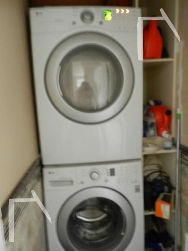
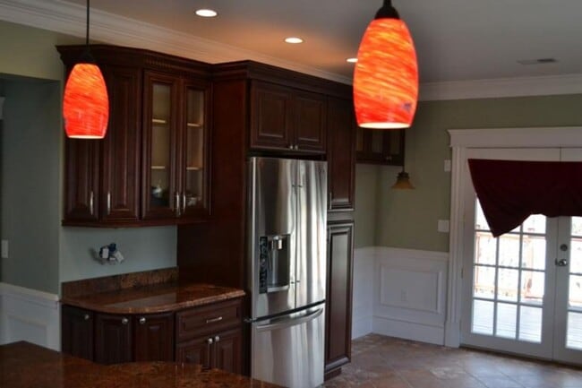
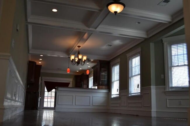
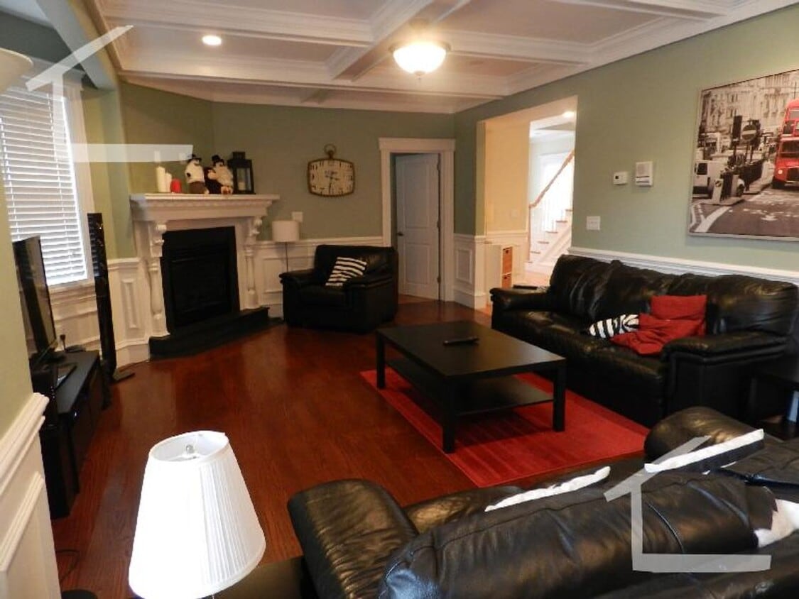
Available June 1 No Broker's Fee No Security Deposit Large Fully Unit With Luxury Finishes Pets Friendly 4 Bed. 3 Full Bathrooms In-unit washer and Dryer Central Heal/AC Two Parking Spaces Included Eat-in Kitchen High-End Kitchen Appliances All Bedrooms are Big With Ample Closet Space ID: 46233669 Rent: $5,200 / Month Beds: 4 Bath: 3 Available Date: 06/01/2026 Pet: Pet Friendly Parking:: off-street parking FEATURES A/C Central Air Ceramic Tiles Deck Eat-in Kitchen
129 Nonantum St is a condo located in Suffolk County and the 02135 ZIP Code. This area is served by the Boston Public Schools attendance zone.
* Price shown is total price based on community-supplied monthly required fees. Excludes user-selected optional fees and variable or usage-based fees and required charges due at or prior to move-in or at move-out. Price, availability, fees, and any applicable rent special are subject to change without notice.
* Square footage definitions vary. Displayed square footage is approximate.
Contact
- Listed by Modern Real Estate (AD) | Modern Real Estate (AD)
- Phone Number
- Contact
Location
Get Directions
Located about nine miles away from Downtown Brighton, Oak Square is a nature lover’s dream. Spend plenty of warm days outdoors in one of Oak Square's many parks, including Gallagher Park, Foster Street Hill, and Rogers Park. These parks allow you to enjoy sports, take in views of the surrounding historic buildings, or have a picnic. Along with lush parks, Oak Square has an abundance of amenities and parking, which is a hot commodity in the area. Great for students, faculty, and staff, Oak Square is convenient to Harvard University, Boston College, and the Massachusetts Institute of Technology. Perfect for all renters, Oak Square has affordable and upscale rentals available. For more dining, shopping, and entertainment options, simply travel east along Interstate 90 to reach the cultural and economic heart of the city.
Learn more about living in Oak Square
Education
| Colleges & Universities | Distance | ||
|---|---|---|---|
| Colleges & Universities | Distance | ||
| Drive: | 4 min | 1.3 mi | |
| Drive: | 5 min | 2.1 mi | |
| Drive: | 8 min | 3.6 mi | |
| Drive: | 9 min | 3.6 mi |
129 Nonantum St is within 4 minutes or 1.3 miles from Boston College, Brighton. It is also near Boston College and Boston University.
Schools


Public Elementary & Middle School
Grades PK-8
455 Students
Attendance Zone
Public Elementary & Middle School
Grades K-8
129 Students
Attendance Zone
Public Middle & High School
Grades 6-12
609 Students
Attendance Zone
Public Middle & High School
Grades 6-12
2,382 Students
Attendance Zone
Public Middle & High School
Grades 6-12
450 Students
Attendance Zone
Public High School
Grades 9-12
27 Students
Attendance Zone
Private Elementary, Middle & High School
Grades PK-12
177 Students
Nearby
Private High School
Grades 9-12
34 Students
Nearby
School data provided by
 The GreatSchools Rating helps parents compare schools within a state based on a variety of school quality indicators and provides a helpful picture of how effectively each school serves all of its students. Ratings are on a scale of 1 (below average) to 10 (above average) and can include test scores, college readiness, academic progress, advanced courses, equity, discipline and attendance data. We also advise parents to visit schools, consider other information on school performance and programs, and consider family needs as part of the school selection process.
View GreatSchools Rating Methodology
Data provided by GreatSchools.org © 2026. All rights reserved.
View GreatSchools Rating Methodology
Data provided by GreatSchools.org © 2026. All rights reserved.
Transportation options available in Boston include Chiswick Road Station, located 1.8 miles from 129 Nonantum St. 129 Nonantum St is near General Edward Lawrence Logan International, located 11.5 miles or 20 minutes away.
| Transit / Subway | Distance | ||
|---|---|---|---|
| Transit / Subway | Distance | ||
|
|
Drive: | 5 min | 1.8 mi |
|
|
Drive: | 5 min | 1.8 mi |
|
|
Drive: | 5 min | 1.9 mi |
|
|
Drive: | 5 min | 2.0 mi |
|
|
Drive: | 5 min | 2.0 mi |
| Commuter Rail | Distance | ||
|---|---|---|---|
| Commuter Rail | Distance | ||
|
|
Drive: | 5 min | 2.3 mi |
| Drive: | 6 min | 3.4 mi | |
|
|
Drive: | 7 min | 3.7 mi |
|
|
Drive: | 9 min | 4.1 mi |
|
|
Drive: | 10 min | 4.3 mi |
| Airports | Distance | ||
|---|---|---|---|
| Airports | Distance | ||
|
General Edward Lawrence Logan International
|
Drive: | 20 min | 11.5 mi |
Getting Around
 What do Walkability, Transit, Drivability, and Bikeability mean?
Walkability measures the walking distance to day-to-day needs.
Transit measures access to public transportation.
Drivability measures congestion, parking availability, and access to major roads.
Bikeability measures the suitability for cycling.
How It Works
What do Walkability, Transit, Drivability, and Bikeability mean?
Walkability measures the walking distance to day-to-day needs.
Transit measures access to public transportation.
Drivability measures congestion, parking availability, and access to major roads.
Bikeability measures the suitability for cycling.
How It Works
Moderately Walkable
Walkability
70
/ 100
Some Public Transit
Transit
50
/ 100
Moderately Drivable
Drivability
70
/ 100
Moderately Bikeable
Bikeability
60
/ 100
Scores provided by
-
Soundscore™
-
/ 100
Traffic
-Airport
-Businesses
-Scores provided by
HowLoud What is a Sound Score Rating? A Sound Score Rating aggregates noise caused by vehicle traffic, airplane traffic and local sources. How It WorksTime and distance from 129 Nonantum St.
| Shopping Centers | Distance | ||
|---|---|---|---|
| Shopping Centers | Distance | ||
| Walk: | 5 min | 0.3 mi | |
| Drive: | 3 min | 1.3 mi | |
| Drive: | 4 min | 1.3 mi |
129 Nonantum St has 3 shopping centers within 1.3 miles, which is about a 4-minute drive. The miles and minutes will be for the farthest away property.
| Parks and Recreation | Distance | ||
|---|---|---|---|
| Parks and Recreation | Distance | ||
|
Chestnut Hill Reservation
|
Drive: | 6 min | 2.0 mi |
|
Hammond Pond Reservation
|
Drive: | 7 min | 2.4 mi |
|
John Fitzgerald Kennedy National Historic Site
|
Drive: | 7 min | 3.0 mi |
|
Frederick Law Olmsted National Historic Site
|
Drive: | 9 min | 3.5 mi |
|
Beaver Brook Reservation
|
Drive: | 11 min | 4.7 mi |
129 Nonantum St has 5 parks within 4.7 miles, including Chestnut Hill Reservation, Hammond Pond Reservation, and John Fitzgerald Kennedy National Historic Site.
| Hospitals | Distance | ||
|---|---|---|---|
| Hospitals | Distance | ||
| Drive: | 3 min | 1.4 mi | |
| Drive: | 5 min | 1.8 mi | |
| Drive: | 6 min | 3.0 mi |
129 Nonantum St has 3 hospitals within 3.0 miles, the nearest is St. Elizabeth's Medical Center which is 1.4 miles away and a 3 minute drive.
| Military Bases | Distance | ||
|---|---|---|---|
| Military Bases | Distance | ||
| Drive: | 26 min | 11.9 mi | |
| Drive: | 24 min | 12.6 mi | |
| Drive: | 44 min | 24.5 mi |
129 Nonantum St has 3 military bases within 24.5 miles, the nearest is Hanscom Air Force Base which is 11.9 miles away and a 26 minute drive.
You May Also Like
Similar Rentals Nearby


129 Nonantum St
Boston, MA 02135