
Miami World Tower
710 NE 1st Ave,
Miami, FL 33132
Studio - 2 Beds $2,500 - $6,490
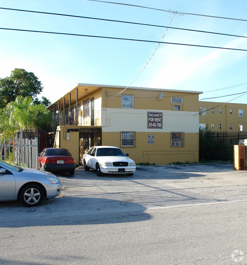
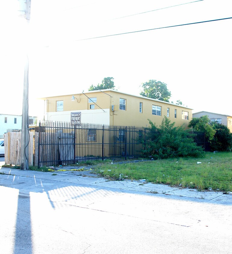
At 1250 NW 60th St in Miami, FL, experience great living. These apartments are located on Nw 60th St. in Miami. The leasing staff is waiting to show you all that this community has in store. Make sure you to view the available floorplans. Life is great at 1250 NW 60th St. Contact or drop by to check the availability and set up a tour today.
1250 NW 60th St is an apartment community located in Miami/Dade County and the 33142 ZIP Code. This area is served by the Miami-Dade County Public Schools attendance zone.
Liberty City is a Miami neighborhood on the rise that’s just six miles north of downtown. Here, you’ll find a hardworking, close-knit community that enjoys a slightly lower cost of living than the rest of the Miami area to the south. The neighborhood’s location directly west of Interstate 95 makes it convenient for the commuting crowd. A vibrant dining scene can be found in Liberty City. Creole food, Jamaican food, seafood, Thai, and so much more makes this area an unsung foodie’s hotspot. With Downtown Miami so close, living in Liberty City puts you close to all the action without the bigger price tags of living closer to the dazzling beaches.
Learn more about living in Liberty City| Colleges & Universities | Distance | ||
|---|---|---|---|
| Colleges & Universities | Distance | ||
| Drive: | 7 min | 2.8 mi | |
| Drive: | 7 min | 2.9 mi | |
| Drive: | 9 min | 4.6 mi | |
| Drive: | 9 min | 5.2 mi |


Transportation options available in Miami include School Board, located 4.5 miles from 1250 NW 60th St. 1250 NW 60th St is near Miami International, located 8.9 miles or 21 minutes away, and Fort Lauderdale/Hollywood International, located 19.8 miles or 29 minutes away.
| Transit / Subway | Distance | ||
|---|---|---|---|
| Transit / Subway | Distance | ||
|
|
Drive: | 9 min | 4.5 mi |
|
|
Drive: | 8 min | 4.8 mi |
|
|
Drive: | 9 min | 5.0 mi |
|
|
Drive: | 9 min | 5.1 mi |
|
Airport Station
|
Drive: | 15 min | 6.0 mi |
| Commuter Rail | Distance | ||
|---|---|---|---|
| Commuter Rail | Distance | ||
|
|
Drive: | 4 min | 1.8 mi |
|
|
Drive: | 4 min | 1.8 mi |
|
|
Drive: | 5 min | 2.5 mi |
|
|
Drive: | 6 min | 3.1 mi |
|
|
Drive: | 6 min | 3.5 mi |
| Airports | Distance | ||
|---|---|---|---|
| Airports | Distance | ||
|
Miami International
|
Drive: | 21 min | 8.9 mi |
|
Fort Lauderdale/Hollywood International
|
Drive: | 29 min | 19.8 mi |
Time and distance from 1250 NW 60th St.
| Shopping Centers | Distance | ||
|---|---|---|---|
| Shopping Centers | Distance | ||
| Walk: | 11 min | 0.6 mi | |
| Walk: | 12 min | 0.7 mi | |
| Walk: | 15 min | 0.8 mi |
| Parks and Recreation | Distance | ||
|---|---|---|---|
| Parks and Recreation | Distance | ||
|
Miami Children's Museum
|
Drive: | 11 min | 6.2 mi |
|
Jungle Island
|
Drive: | 11 min | 6.6 mi |
|
Miami Science Museum - Closed
|
Drive: | 11 min | 7.2 mi |
|
Vizcaya Museum and Gardens
|
Drive: | 13 min | 7.4 mi |
|
Enchanted Forest Elaine Gordon Park
|
Drive: | 14 min | 8.0 mi |
| Hospitals | Distance | ||
|---|---|---|---|
| Hospitals | Distance | ||
| Drive: | 4 min | 2.2 mi | |
| Drive: | 7 min | 2.9 mi | |
| Drive: | 6 min | 3.4 mi |
What Are Walk Score®, Transit Score®, and Bike Score® Ratings?
Walk Score® measures the walkability of any address. Transit Score® measures access to public transit. Bike Score® measures the bikeability of any address.
What is a Sound Score Rating?
A Sound Score Rating aggregates noise caused by vehicle traffic, airplane traffic and local sources

1250 NW 60th St
Miami, FL 33142


