
110 Roy Apartments
110 Roy St,
Seattle, WA 98109
$1,695 - $5,995
Studio - 2 Beds
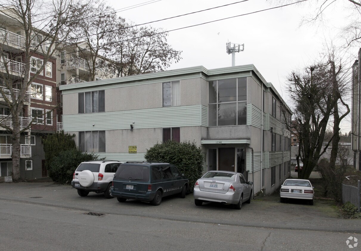
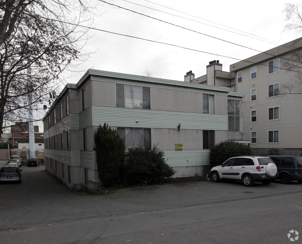

12348 28th Ave NE is ready for you to visit. With a location on 28th Ave Ne in Seattle's 98125 Zip code, local residents can easily connect with a number of attractions found in the neighborhood. The community staff is ready for you to come by for a tour. Make a visit to see the available floorplan options. Visit 12348 28th Ave NE today.
12348 28th Ave Ne is an apartment community located in King County and the 98125 ZIP Code. This area is served by the Seattle Public Schools attendance zone.
Located about eight miles north of Downtown Seattle, the area of Lake City was once a railroad stop. It was named in 1906 and quickly developed into a suburb of Seattle. During Prohibition, the area was unincorporated. So when Seattle joined Prohibition, Lake City supplied the roadhouses and speakeasies barred from the nearby city. Lake City became a Seattle neighborhood in the mid-1950s. With Lake Washington as the neighborhood’s sparkling gem, residents are rediscovering this northern neighborhood.
Lake City stretches from the lake to roughly 15th Avenue in North Seattle. While the speakeasies are long gone, there are several popular destinations along Lake City Way, including HellBent Brewing Company Elliott Bay Public House & Brewery, Brother Barrel, and 2C Thai. If you are moving to Lake City with a pet, you’ll appreciate Dogwood Play Park, an indoor dog park and bar complete with a treat bar and birthday cakes for pet parties.
Learn more about living in Lake CityCompare neighborhood and city base rent averages by bedroom.
| Lake City | Seattle, WA | |
|---|---|---|
| Studio | $1,302 | $1,487 |
| 1 Bedroom | $1,505 | $2,083 |
| 2 Bedrooms | $1,889 | $2,795 |
| 3 Bedrooms | $2,352 | $3,823 |
| Colleges & Universities | Distance | ||
|---|---|---|---|
| Colleges & Universities | Distance | ||
| Drive: | 10 min | 3.6 mi | |
| Drive: | 13 min | 4.5 mi | |
| Drive: | 14 min | 4.7 mi | |
| Drive: | 16 min | 6.7 mi |


Transportation options available in Seattle include Roosevelt, located 3.5 miles from 12348 28th Ave NE. 12348 28th Ave NE is near Seattle Paine Field International, located 16.7 miles or 29 minutes away, and Seattle-Tacoma International, located 22.4 miles or 36 minutes away.
| Transit / Subway | Distance | ||
|---|---|---|---|
| Transit / Subway | Distance | ||
| Drive: | 9 min | 3.5 mi | |
| Drive: | 10 min | 4.4 mi | |
|
|
Drive: | 14 min | 7.4 mi |
|
|
Drive: | 14 min | 7.5 mi |
|
|
Drive: | 14 min | 7.5 mi |
| Commuter Rail | Distance | ||
|---|---|---|---|
| Commuter Rail | Distance | ||
|
|
Drive: | 17 min | 9.2 mi |
|
|
Drive: | 22 min | 10.4 mi |
|
|
Drive: | 34 min | 19.5 mi |
|
|
Drive: | 34 min | 21.7 mi |
|
|
Drive: | 55 min | 40.5 mi |
| Airports | Distance | ||
|---|---|---|---|
| Airports | Distance | ||
|
Seattle Paine Field International
|
Drive: | 29 min | 16.7 mi |
|
Seattle-Tacoma International
|
Drive: | 36 min | 22.4 mi |
Scores provided by
Traffic
BusyAirport
CalmBusinesses
ActiveScores provided by
HowLoud What is a Sound Score Rating? A Sound Score Rating aggregates noise caused by vehicle traffic, airplane traffic and local sources. How It WorksTime and distance from 12348 28th Ave NE.
| Shopping Centers | Distance | ||
|---|---|---|---|
| Shopping Centers | Distance | ||
| Walk: | 4 min | 0.2 mi | |
| Walk: | 6 min | 0.3 mi | |
| Drive: | 6 min | 1.7 mi |
| Parks and Recreation | Distance | ||
|---|---|---|---|
| Parks and Recreation | Distance | ||
|
Northacres Park
|
Drive: | 5 min | 1.6 mi |
|
Paramount Park Open Space
|
Drive: | 7 min | 2.3 mi |
|
Paramount School Park
|
Drive: | 7 min | 2.5 mi |
|
Twin Ponds Park
|
Drive: | 8 min | 2.8 mi |
|
Saint Edward State Park
|
Drive: | 14 min | 6.4 mi |
| Hospitals | Distance | ||
|---|---|---|---|
| Hospitals | Distance | ||
| Drive: | 7 min | 3.0 mi | |
| Drive: | 14 min | 4.8 mi | |
| Drive: | 14 min | 7.2 mi |
| Military Bases | Distance | ||
|---|---|---|---|
| Military Bases | Distance | ||
| Drive: | 27 min | 10.0 mi | |
| Drive: | 79 min | 31.8 mi |
Pets Allowed Fitness Center Dishwasher In Unit Washer & Dryer Patio Stainless Steel Appliances Controlled Access
Pets Allowed Fitness Center In Unit Washer & Dryer Walk-In Closets Patio Granite Countertops Elevator
What Are Walk Score®, Transit Score®, and Bike Score® Ratings?
Walk Score® measures the walkability of any address. Transit Score® measures access to public transit. Bike Score® measures the bikeability of any address.
What is a Sound Score Rating?
A Sound Score Rating aggregates noise caused by vehicle traffic, airplane traffic and local sources.


