
Arden Englewood
3595 S Jason St,
Englewood, CO 80110
$1,710 - $3,255
Studio - 3 Beds

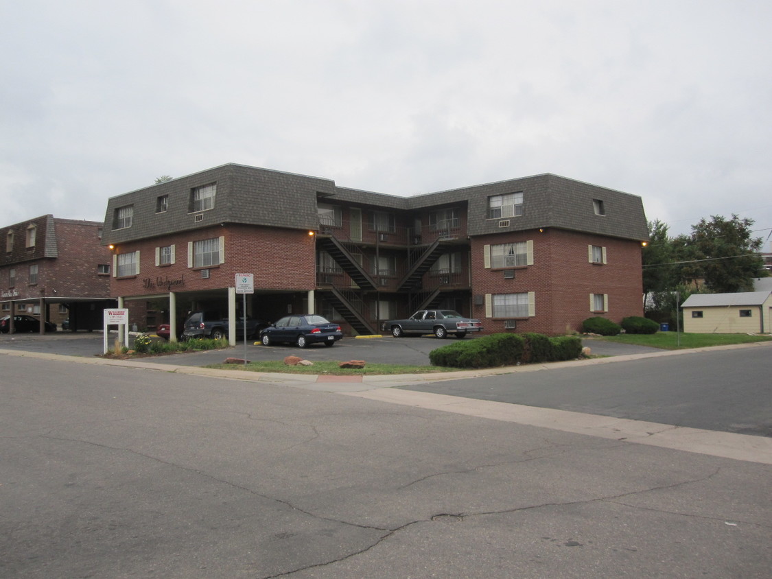
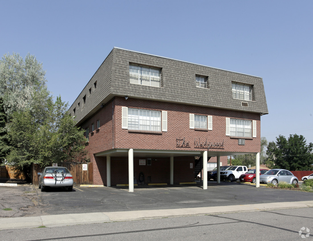
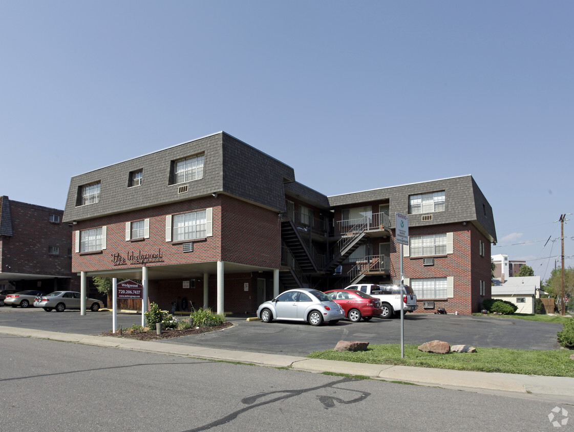
Come enjoy Englewood living at The Wedgewood. These apartments are located in Englewood on S. Marion St. in the 80113 area. Here at this community, the team of leasing professionals is ready to help you find your perfect home. Come for a visit to view the available floorplans. Contact us or stop by today.
The Wedgewood is an apartment community located in Arapahoe County and the 80113 ZIP Code. This area is served by the Englewood 1 attendance zone.
Nestled in the South Platte River Valley just south of Denver, Englewood combines suburban living with easy access to metropolitan amenities. The community offers diverse housing options, from apartment communities near Swedish Medical Center to single-family homes in established neighborhoods like Hampden Hills. Current rental trends show one-bedroom apartments averaging $1,578 and two-bedrooms at $2,072. The city's downtown area centers around CityCenter Englewood, featuring the civic center, library, and light rail stationmaking it convenient for commuters.
Englewood's parks system includes Pirates Cove water park and Belleview Park, providing recreational spaces for residents. The area's history traces back to 1858, when prospectors discovered gold along Little Dry Creek during the Pike's Peak Gold Rush.
Learn more about living in Englewood| Colleges & Universities | Distance | ||
|---|---|---|---|
| Colleges & Universities | Distance | ||
| Drive: | 5 min | 2.3 mi | |
| Drive: | 11 min | 5.9 mi | |
| Drive: | 11 min | 6.3 mi | |
| Drive: | 14 min | 8.4 mi |


Transportation options available in Englewood include Englewood, located 1.8 miles from The Wedgewood. The Wedgewood is near Denver International, located 29.9 miles or 39 minutes away.
| Transit / Subway | Distance | ||
|---|---|---|---|
| Transit / Subway | Distance | ||
|
|
Drive: | 5 min | 1.8 mi |
|
|
Drive: | 6 min | 2.4 mi |
|
|
Drive: | 6 min | 2.7 mi |
|
|
Drive: | 7 min | 3.0 mi |
|
|
Drive: | 9 min | 3.8 mi |
| Commuter Rail | Distance | ||
|---|---|---|---|
| Commuter Rail | Distance | ||
| Drive: | 19 min | 8.9 mi | |
|
|
Drive: | 15 min | 8.9 mi |
|
|
Drive: | 16 min | 9.1 mi |
| Drive: | 27 min | 11.1 mi | |
| Drive: | 18 min | 11.1 mi |
| Airports | Distance | ||
|---|---|---|---|
| Airports | Distance | ||
|
Denver International
|
Drive: | 39 min | 29.9 mi |
Time and distance from The Wedgewood.
| Shopping Centers | Distance | ||
|---|---|---|---|
| Shopping Centers | Distance | ||
| Walk: | 7 min | 0.4 mi | |
| Walk: | 13 min | 0.7 mi | |
| Walk: | 15 min | 0.8 mi |
| Parks and Recreation | Distance | ||
|---|---|---|---|
| Parks and Recreation | Distance | ||
|
Chamberlin & Mt. Evans Observatories
|
Drive: | 6 min | 2.5 mi |
|
Washington Park
|
Drive: | 10 min | 3.7 mi |
|
Bear Creek Park
|
Drive: | 10 min | 4.2 mi |
|
DeKoevend Park
|
Drive: | 10 min | 4.8 mi |
|
Littleton Historical Museum
|
Drive: | 11 min | 4.8 mi |
| Hospitals | Distance | ||
|---|---|---|---|
| Hospitals | Distance | ||
| Walk: | 11 min | 0.6 mi | |
| Drive: | 3 min | 1.1 mi | |
| Drive: | 9 min | 4.1 mi |
| Military Bases | Distance | ||
|---|---|---|---|
| Military Bases | Distance | ||
| Drive: | 43 min | 18.3 mi | |
| Drive: | 74 min | 59.1 mi | |
| Drive: | 83 min | 68.8 mi |
What Are Walk Score®, Transit Score®, and Bike Score® Ratings?
Walk Score® measures the walkability of any address. Transit Score® measures access to public transit. Bike Score® measures the bikeability of any address.
What is a Sound Score Rating?
A Sound Score Rating aggregates noise caused by vehicle traffic, airplane traffic and local sources
3411 S Marion St
Englewood, CO 80113


