
Aerie at Wardman Park
2650 Woodley Rd NW,
Washington, DC 20008
$4,042 - $9,017 Total Monthly Price
1-3 Beds
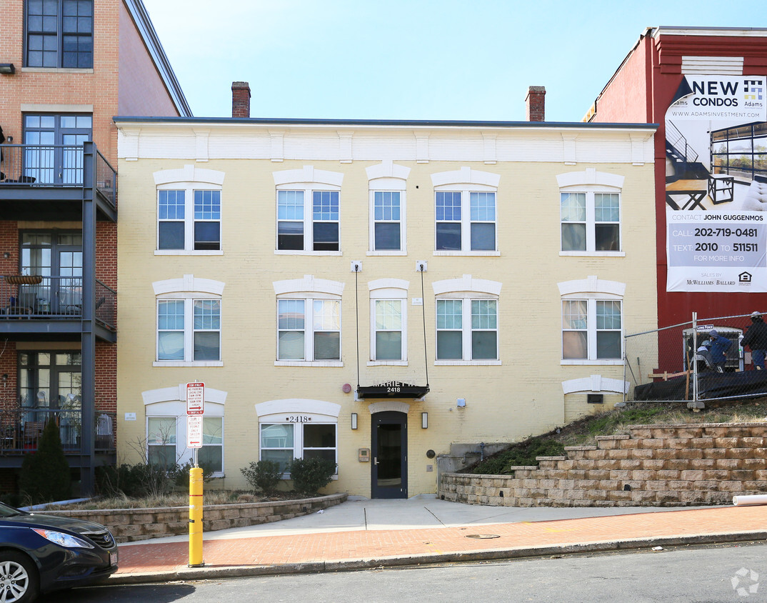
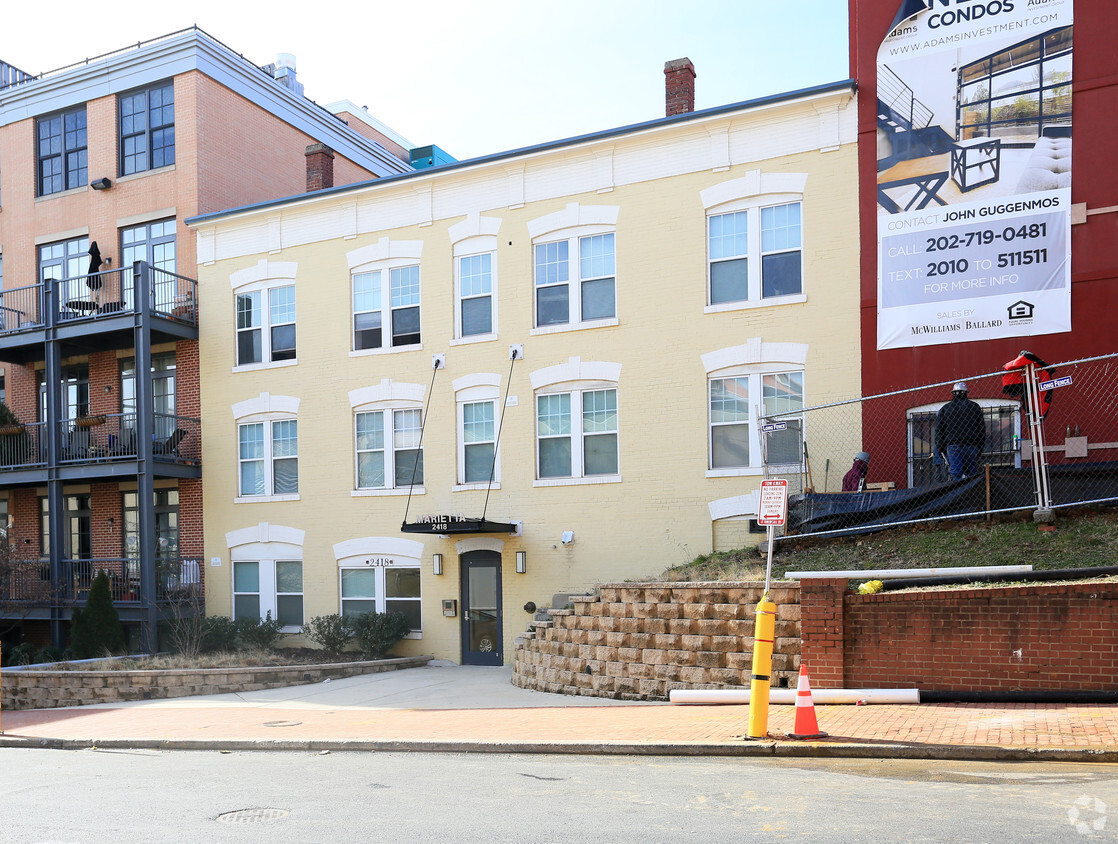

At The Marietta in Washington, DC, you've discovered your new home. This community is located on 17th St. Nw in Washington. Make a visit to see the current floorplan options. From amenities to location, the professional leasing team is available to assist you in finding the perfect new apartment. You're sure to live the good life at The Marietta. Contact or drop by to schedule a tour today.
The Marietta is an apartment community located in District of Columbia County and the 20009 ZIP Code. This area is served by the District Of Columbia Public Schools attendance zone.
The Adams Morgan neighborhood in Washington, D.C. is a diverse community that has a reputation for having the liveliest nightlife in Washington. The area has become popular with new residents by combining a suburban feel with an edgy, urban energy. Mixing 19th- and 20th-century Victorian row houses with large apartment buildings, the neighborhood has a variety of restaurants, art galleries, nightclubs, bars and specialty shops that add personality to the neighborhood.
Adams Morgan rests less than two miles from the White House and is bounded by Dupont Circle on the south, Mount Pleasant on the north and Columbia Heights on the east. The hub for the neighborhood sits at 18th and Columbia Road, which also provides the central location for restaurants and bars. Adams Morgan has a historic and culturally exciting atmosphere full of eccentric shopping, outdoor retailers and community murals.
Learn more about living in Adams MorganCompare neighborhood and city base rent averages by bedroom.
| Adams Morgan | Washington, DC | |
|---|---|---|
| Studio | $1,814 | $1,853 |
| 1 Bedroom | $2,484 | $2,289 |
| 2 Bedrooms | $3,599 | $3,133 |
| 3 Bedrooms | $5,187 | $3,998 |
| Colleges & Universities | Distance | ||
|---|---|---|---|
| Colleges & Universities | Distance | ||
| Drive: | 4 min | 1.4 mi | |
| Drive: | 5 min | 1.5 mi | |
| Drive: | 4 min | 1.5 mi | |
| Drive: | 6 min | 2.1 mi |


Transportation options available in Washington include Columbia Heights, located 0.7 mile from The Marietta. The Marietta is near Ronald Reagan Washington Ntl, located 6.8 miles or 14 minutes away, and Washington Dulles International, located 27.7 miles or 47 minutes away.
| Transit / Subway | Distance | ||
|---|---|---|---|
| Transit / Subway | Distance | ||
|
|
Walk: | 14 min | 0.7 mi |
|
|
Walk: | 17 min | 0.9 mi |
|
|
Drive: | 4 min | 1.2 mi |
|
|
Drive: | 5 min | 1.6 mi |
|
|
Drive: | 5 min | 1.6 mi |
| Commuter Rail | Distance | ||
|---|---|---|---|
| Commuter Rail | Distance | ||
|
|
Drive: | 8 min | 3.4 mi |
|
|
Drive: | 8 min | 4.1 mi |
|
|
Drive: | 9 min | 4.2 mi |
| Drive: | 10 min | 5.3 mi | |
|
|
Drive: | 11 min | 5.5 mi |
| Airports | Distance | ||
|---|---|---|---|
| Airports | Distance | ||
|
Ronald Reagan Washington Ntl
|
Drive: | 14 min | 6.8 mi |
|
Washington Dulles International
|
Drive: | 47 min | 27.7 mi |
Scores provided by
Traffic
-Airport
-Businesses
-Scores provided by
HowLoud What is a Sound Score Rating? A Sound Score Rating aggregates noise caused by vehicle traffic, airplane traffic and local sources. How It WorksTime and distance from The Marietta.
| Shopping Centers | Distance | ||
|---|---|---|---|
| Shopping Centers | Distance | ||
| Walk: | 5 min | 0.3 mi | |
| Walk: | 10 min | 0.6 mi | |
| Walk: | 12 min | 0.6 mi |
| Parks and Recreation | Distance | ||
|---|---|---|---|
| Parks and Recreation | Distance | ||
|
Meridian Hill Park
|
Walk: | 7 min | 0.4 mi |
|
National Zoo
|
Drive: | 4 min | 1.1 mi |
|
National Geographic Museum
|
Drive: | 4 min | 1.5 mi |
|
Mary McLeod Bethune Council House NHS
|
Drive: | 5 min | 1.6 mi |
|
Carter G. Woodson Home National Historic Site
|
Drive: | 6 min | 1.7 mi |
| Hospitals | Distance | ||
|---|---|---|---|
| Hospitals | Distance | ||
| Drive: | 5 min | 1.4 mi | |
| Drive: | 4 min | 1.7 mi | |
| Drive: | 6 min | 2.1 mi |
| Military Bases | Distance | ||
|---|---|---|---|
| Military Bases | Distance | ||
| Drive: | 7 min | 2.8 mi | |
| Drive: | 9 min | 3.0 mi | |
| Drive: | 12 min | 5.2 mi |
Pets Allowed Fitness Center Pool Dishwasher In Unit Washer & Dryer Business Center Package Service
Pets Allowed Pool Clubhouse Business Center Package Service Controlled Access Elevator

Pets Allowed Fitness Center In Unit Washer & Dryer Balcony Courtyard Concierge EV Charging
Pets Allowed Fitness Center Dishwasher Kitchen In Unit Washer & Dryer Walk-In Closets

2418 17th St NW
Washington, DC 20009


