
Hanover Soma West
1140 Harrison St,
San Francisco, CA 94103
$3,475 - $8,729 Total Monthly Price
Studio - 3 Beds

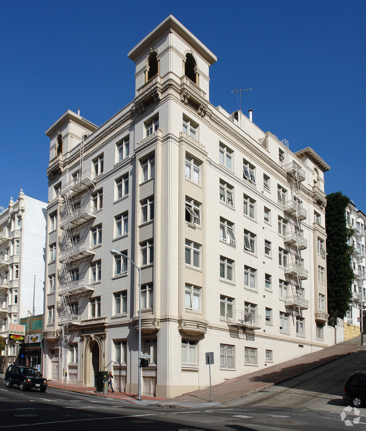
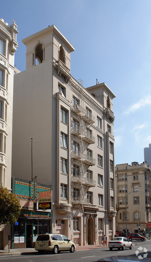
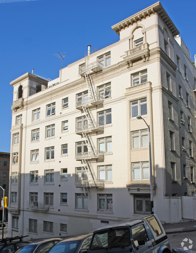

Explore San Francisco living at The Bushwick. This community can be found in San Francisco on Bush St.. From pricing to features, the leasing team is ready to help you find your perfect place. Come by to check out the apartment floorplan options. Welcome to your new home at The Bushwick. Contact or drop by the leasing office to check the availability and schedule a tour today.
The Bushwick is an apartment community located in San Francisco County and the 94108 ZIP Code. This area is served by the San Francisco Unified School District attendance zone.
San Francisco’s Lower Nob Hill sits in the heart of Downtown, offering residents a premier location in one of California’s most popular cities. Situated between Union Square and US-101, locals can easily travel through the city, but why leave when there are so many conveniences right in this neighborhood? Union Square is San Francisco’s expansive and famous shopping plaza known for its upscale shops, restaurants, hotels, and nightlife spots.
Lower Nob’s light rail and bus stations are abundant, making commuting as easy as ever. This neighborhood is a great place for job opportunities due to the vast number of businesses in the area. Lower Nob is home to Saint Francis Memorial Hospital, the Masonic, and Dragon’s Gate, a landmark arch that’s the iconic gateway to Chinatown, Lower Nob’s neighbor. This neighborhood features an array of upscale apartments, houses, and condos that will fit any renter’s preferences and style.
Learn more about living in Lower NobCompare neighborhood and city base rent averages by bedroom.
| Lower Nob | San Francisco, CA | |
|---|---|---|
| Studio | $2,055 | $2,562 |
| 1 Bedroom | $2,691 | $3,386 |
| 2 Bedrooms | $3,751 | $4,646 |
| 3 Bedrooms | $5,904 | $5,814 |
| Colleges & Universities | Distance | ||
|---|---|---|---|
| Colleges & Universities | Distance | ||
| Walk: | 3 min | 0.2 mi | |
| Walk: | 14 min | 0.8 mi | |
| Drive: | 6 min | 1.7 mi | |
| Drive: | 6 min | 2.1 mi |


Transportation options available in San Francisco include California And Mason, located 0.2 mile from The Bushwick. The Bushwick is near San Francisco International, located 14.4 miles or 23 minutes away, and Metro Oakland International, located 19.4 miles or 30 minutes away.
| Transit / Subway | Distance | ||
|---|---|---|---|
| Transit / Subway | Distance | ||
|
|
Walk: | 2 min | 0.2 mi |
| Walk: | 3 min | 0.2 mi | |
|
|
Walk: | 3 min | 0.2 mi |
| Walk: | 3 min | 0.2 mi | |
|
|
Walk: | 3 min | 0.2 mi |
| Commuter Rail | Distance | ||
|---|---|---|---|
| Commuter Rail | Distance | ||
| Drive: | 4 min | 1.5 mi | |
| Drive: | 12 min | 6.7 mi | |
| Drive: | 15 min | 8.9 mi | |
|
|
Drive: | 16 min | 10.5 mi |
|
|
Drive: | 19 min | 11.0 mi |
| Airports | Distance | ||
|---|---|---|---|
| Airports | Distance | ||
|
San Francisco International
|
Drive: | 23 min | 14.4 mi |
|
Metro Oakland International
|
Drive: | 30 min | 19.4 mi |
Scores provided by
Traffic
-Airport
-Businesses
-Scores provided by
HowLoud What is a Sound Score Rating? A Sound Score Rating aggregates noise caused by vehicle traffic, airplane traffic and local sources. How It WorksTime and distance from The Bushwick.
| Shopping Centers | Distance | ||
|---|---|---|---|
| Shopping Centers | Distance | ||
| Walk: | 9 min | 0.5 mi | |
| Walk: | 10 min | 0.5 mi | |
| Walk: | 10 min | 0.5 mi |
| Parks and Recreation | Distance | ||
|---|---|---|---|
| Parks and Recreation | Distance | ||
|
Children's Creativity Museum
|
Walk: | 15 min | 0.8 mi |
|
Aquarium of The Bay
|
Drive: | 5 min | 1.7 mi |
|
San Francisco Maritime National Historical Park
|
Drive: | 5 min | 1.9 mi |
|
Buena Vista Park
|
Drive: | 9 min | 3.1 mi |
|
Exploratorium
|
Drive: | 9 min | 3.5 mi |
| Hospitals | Distance | ||
|---|---|---|---|
| Hospitals | Distance | ||
| Walk: | 7 min | 0.4 mi | |
| Walk: | 9 min | 0.5 mi | |
| Walk: | 15 min | 0.8 mi |
| Military Bases | Distance | ||
|---|---|---|---|
| Military Bases | Distance | ||
| Drive: | 12 min | 5.5 mi | |
| Drive: | 16 min | 5.5 mi | |
| Drive: | 26 min | 13.9 mi |
Pets Allowed Fitness Center In Unit Washer & Dryer Stainless Steel Appliances Business Center Package Service Elevator
What Are Walk Score®, Transit Score®, and Bike Score® Ratings?
Walk Score® measures the walkability of any address. Transit Score® measures access to public transit. Bike Score® measures the bikeability of any address.
What is a Sound Score Rating?
A Sound Score Rating aggregates noise caused by vehicle traffic, airplane traffic and local sources.
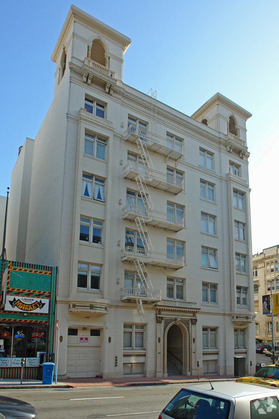
800 Bush St
San Francisco, CA 94108


