
The Watson
11901 Burnet Rd,
Austin, TX 78758
$1,227 - $7,950
Studio - 3 Beds


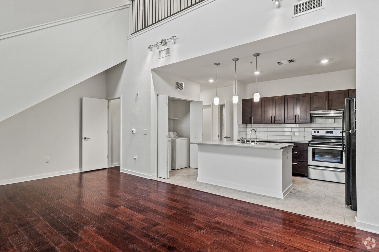
High-end apartment living in a quiet, healthy-living community in a mixed-use development (residential & commercial). Community Gardens, Solar Energy, EV Charging Stations, and Rain & Gray Water Recycling are just a few of the great amenities here. Don't miss this rare opportunity to live with us, this Two-Story 3-bed/2-bath will not be available long. Also enjoy discounted membership to the on-site gym business, which is just one of the many businesses that occupy this mixed-use development. We also have small commercial office spaces available for a live work opportunity.
South Austin Serenity is an apartment community located in Travis County and the 78745 ZIP Code. This area is served by the Austin Independent School District attendance zone.
Recycling
24 Hour Access
Package Service
Picnic Area
Washer/Dryer
Air Conditioning
Dishwasher
Washer/Dryer Hookup
High Speed Internet Access
Hardwood Floors
Island Kitchen
Granite Countertops
Situated in the southwestern stretches of Austin, Cherry Creek is a suburban community brimming with an array of apartments, townhomes, and houses available for rent along tree-lined avenues. Cherry Creek is a largely residential community, exuding a peaceful atmosphere within minutes of all that Austin has to offer.
Cherry Creek is just a short drive away from shopping destinations like Sunset Valley Marketfair, Central Market, and Barton Creek Square. This tranquil suburb is also convenient to a host of outdoor venues, including Lady Bird Johnson Wildflower Center, Mary Moore Searight Metropolitan Park, Dick Nichols District Park, and the Barton Creek Greenbelt in addition to numerous nature preserves and neighborhood parks. Close proximity to the MoPac Expressway and I-35 connects Cherry Creek to Greater Austin and beyond.
Learn more about living in Cherry CreekCompare neighborhood and city base rent averages by bedroom.
| Cherry Creek | Austin, TX | |
|---|---|---|
| Studio | $1,069 | $1,210 |
| 1 Bedroom | $1,207 | $1,397 |
| 2 Bedrooms | $1,573 | $1,823 |
| 3 Bedrooms | $2,008 | $2,405 |
| Colleges & Universities | Distance | ||
|---|---|---|---|
| Colleges & Universities | Distance | ||
| Walk: | 20 min | 1.1 mi | |
| Drive: | 9 min | 4.8 mi | |
| Drive: | 12 min | 5.8 mi | |
| Drive: | 10 min | 6.1 mi |


Transportation options available in Austin include Downtown Station, located 8.3 miles from South Austin Serenity. South Austin Serenity is near Austin-Bergstrom International, located 12.4 miles or 25 minutes away.
| Transit / Subway | Distance | ||
|---|---|---|---|
| Transit / Subway | Distance | ||
| Drive: | 13 min | 8.3 mi | |
| Drive: | 14 min | 8.9 mi | |
| Drive: | 17 min | 10.6 mi |
| Commuter Rail | Distance | ||
|---|---|---|---|
| Commuter Rail | Distance | ||
|
|
Drive: | 13 min | 6.0 mi |
|
|
Drive: | 35 min | 27.2 mi |
|
|
Drive: | 55 min | 43.6 mi |
| Airports | Distance | ||
|---|---|---|---|
| Airports | Distance | ||
|
Austin-Bergstrom International
|
Drive: | 25 min | 12.4 mi |
Scores provided by
Traffic
ActiveAirport
CalmBusinesses
ActiveScores provided by
HowLoud What is a Sound Score Rating? A Sound Score Rating aggregates noise caused by vehicle traffic, airplane traffic and local sources. How It WorksTime and distance from South Austin Serenity.
| Shopping Centers | Distance | ||
|---|---|---|---|
| Shopping Centers | Distance | ||
| Walk: | 5 min | 0.3 mi | |
| Walk: | 9 min | 0.5 mi | |
| Walk: | 19 min | 1.0 mi |
| Parks and Recreation | Distance | ||
|---|---|---|---|
| Parks and Recreation | Distance | ||
|
Goat Cave Nature Preserve
|
Drive: | 3 min | 1.3 mi |
|
Barton Creek Greenbelt (360 Access)
|
Drive: | 6 min | 3.4 mi |
|
Slaughter Creek at Bauerle Ranch
|
Drive: | 9 min | 4.5 mi |
|
Dick Nichols Park
|
Drive: | 9 min | 4.7 mi |
|
Blunn Creek Nature Preserve
|
Drive: | 11 min | 5.3 mi |
| Hospitals | Distance | ||
|---|---|---|---|
| Hospitals | Distance | ||
| Drive: | 3 min | 1.4 mi | |
| Drive: | 5 min | 2.3 mi | |
| Drive: | 5 min | 3.0 mi |
| Military Bases | Distance | ||
|---|---|---|---|
| Military Bases | Distance | ||
| Drive: | 77 min | 62.2 mi | |
| Drive: | 85 min | 72.4 mi | |
| Drive: | 105 min | 80.2 mi |

What Are Walk Score®, Transit Score®, and Bike Score® Ratings?
Walk Score® measures the walkability of any address. Transit Score® measures access to public transit. Bike Score® measures the bikeability of any address.
What is a Sound Score Rating?
A Sound Score Rating aggregates noise caused by vehicle traffic, airplane traffic and local sources.
6700 Menchaca Rd
Austin, TX 78745


