
Solstice - Residential Phase 1
3534 E Capitol St NE,
Washington,
DC
20019
-
Monthly Rent
$1,194 - $1,538
-
Bedrooms
1 - 2 bd
-
Bathrooms
1 - 2 ba
-
Square Feet
--
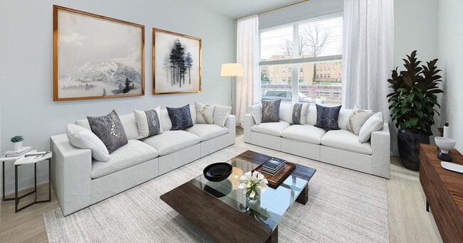
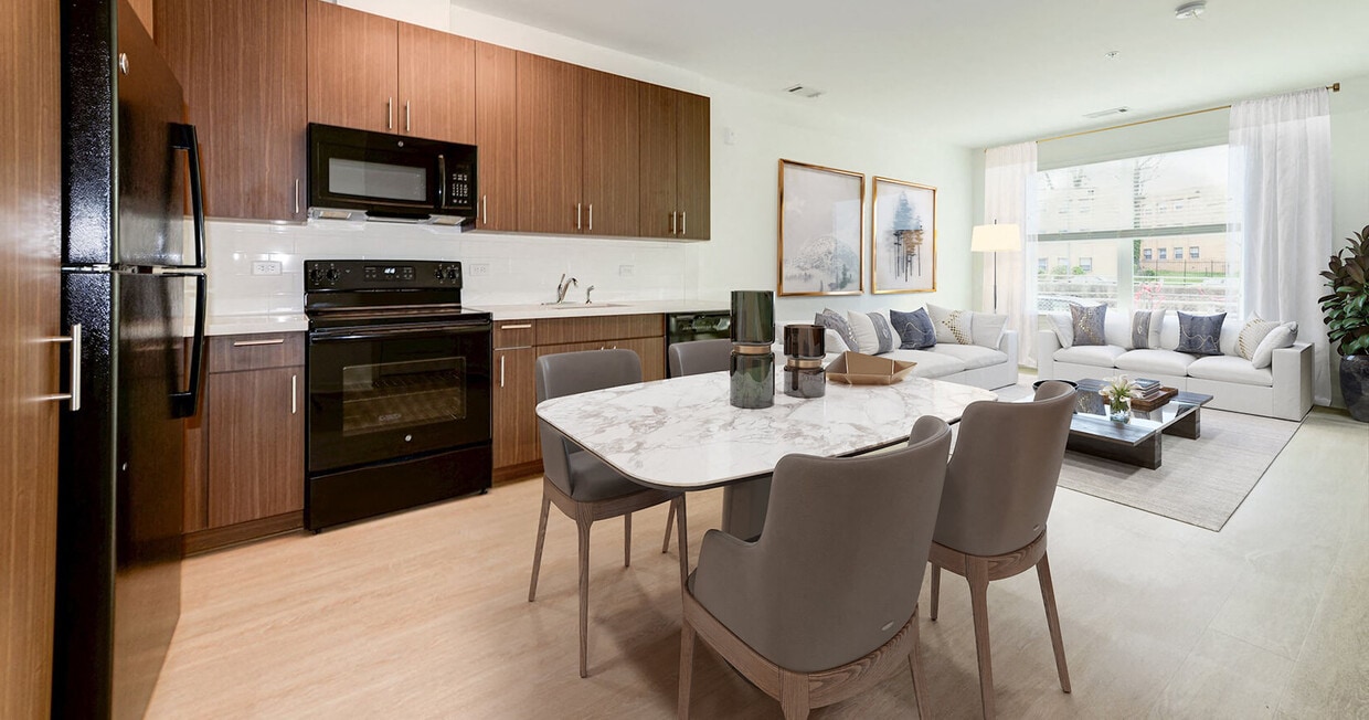
Solstice Apartments – Affordable Living in Southeast D.C. Consistency Has Its Rewards! We offer an On-Time Rental Credit Program that helps you build credit and save with every on-time payment. Solstice offers affordable one-, two-, and three-bedroom apartments in the heart of Southeast Washington, D.C. Designed for comfort and convenience, our spacious homes feature in-home washer and dryer, walk-in closets, large windows with natural light, and modern finishes throughout. Residents enjoy access to a welcoming lobby, a club room with open kitchen, fireplace, and TVs, a business center with workstations and Wi-Fi, a fitness center, and free underground parking. Located near Metro transit, neighborhood parks, shopping, and dining, Solstice combines modern comfort with everyday convenience. Discover affordable D.C. living made easy at Solstice Apartments. Income Guidelines apply. Call the leasing office for details. ResidentialONE will not refuse to rent a rental unit to a person because the person will provide the rental payment, in whole or in part, through a voucher for rental housing assistance provided by the District of Columbia or Federal Government.
Highlights
- Attached Garage
- Walk-In Closets
- Office
- Controlled Access
- On-Site Retail
- Fireplace
- Elevator
- Property Manager on Site
- Business Center
Pricing & Floor Plans
Fees and Policies
The fees listed below are community-provided and may exclude utilities or add-ons. All payments are made directly to the property and are non-refundable unless otherwise specified.
-
Garage - Attached
-
Additional Security Deposit - Non-RefundableUnderground Parking is free.$0
CommentsUnderground Parking is free.Read More Read Less -
-
Additional Parking Options
-
Other
-
Property Fee Disclaimer: Based on community-supplied data and independent market research. Subject to change without notice. May exclude fees for mandatory or optional services and usage-based utilities.
Details
Lease Options
-
None
Property Information
-
Built in 2019
-
137 units/4 stories
Matterport 3D Tours
About Solstice - Residential Phase 1
Solstice Apartments – Affordable Living in Southeast D.C. Consistency Has Its Rewards! We offer an On-Time Rental Credit Program that helps you build credit and save with every on-time payment. Solstice offers affordable one-, two-, and three-bedroom apartments in the heart of Southeast Washington, D.C. Designed for comfort and convenience, our spacious homes feature in-home washer and dryer, walk-in closets, large windows with natural light, and modern finishes throughout. Residents enjoy access to a welcoming lobby, a club room with open kitchen, fireplace, and TVs, a business center with workstations and Wi-Fi, a fitness center, and free underground parking. Located near Metro transit, neighborhood parks, shopping, and dining, Solstice combines modern comfort with everyday convenience. Discover affordable D.C. living made easy at Solstice Apartments. Income Guidelines apply. Call the leasing office for details. ResidentialONE will not refuse to rent a rental unit to a person because the person will provide the rental payment, in whole or in part, through a voucher for rental housing assistance provided by the District of Columbia or Federal Government.
Solstice - Residential Phase 1 is an apartment community located in District of Columbia County and the 20019 ZIP Code. This area is served by the District Of Columbia Public Schools attendance zone.
Unique Features
- Pet-friendly & smoke free community
- Spacious walk-in closets
- Accommodating underground parking
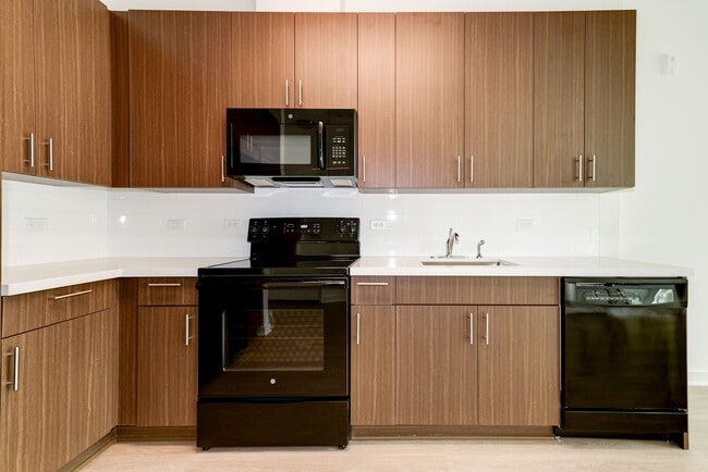
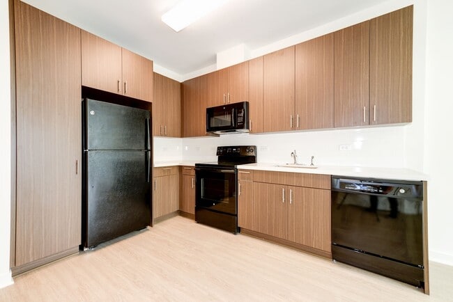
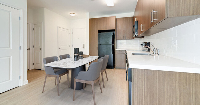
- Dishwashers & kitchen appliances by GE
- Energy efficient washer and dryers
- Spacious welcoming lobby
- Luxury vinyl tile flooring
- On-site retail
- Professional on-site management
- Quartz countertops
- Green community design and standards
- TV-and Internet-ready
Community Amenities
Fitness Center
Elevator
Controlled Access
Business Center
- Package Service
- Wi-Fi
- Controlled Access
- Maintenance on site
- Property Manager on Site
- 24 Hour Access
- On-Site Retail
- Key Fob Entry
- Wheelchair Accessible
- Elevator
- Business Center
- Multi Use Room
- Fitness Center
Apartment Features
Washer/Dryer
Air Conditioning
Dishwasher
High Speed Internet Access
- High Speed Internet Access
- Wi-Fi
- Washer/Dryer
- Air Conditioning
- Smoke Free
- Security System
- Fireplace
- Intercom
- Wheelchair Accessible (Rooms)
- Dishwasher
- Kitchen
- Microwave
- Oven
- Range
- Refrigerator
- Quartz Countertops
- Tile Floors
- Office
- Walk-In Closets
Income Restrictions
How To Qualify
The Minnesota Avenue neighborhood follows Minnesota Avenue from Capitol Street northward to Nannie Helen Burroughs Avenue. It extends east from the Anacostia River to the Capitol View neighborhood. It includes the Minnesota Avenue Metro Station, located on the Orange line. Fort Mahan Park, located on a hill in the middle of the neighborhood, features hiking trails, a lake, and remnants of a Civil War fort. The Minnesota Avenue neighborhood is located about four miles southeast of Downtown DC.
Learn more about living in Minnesota AveCompare neighborhood and city base rent averages by bedroom.
| Minnesota Ave | Washington, DC | |
|---|---|---|
| Studio | $1,248 | $1,808 |
| 1 Bedroom | $1,220 | $2,238 |
| 2 Bedrooms | $1,632 | $3,069 |
| 3 Bedrooms | $2,060 | $3,956 |
- Package Service
- Wi-Fi
- Controlled Access
- Maintenance on site
- Property Manager on Site
- 24 Hour Access
- On-Site Retail
- Key Fob Entry
- Wheelchair Accessible
- Elevator
- Business Center
- Multi Use Room
- Fitness Center
- Pet-friendly & smoke free community
- Spacious walk-in closets
- Accommodating underground parking
- Dishwashers & kitchen appliances by GE
- Energy efficient washer and dryers
- Spacious welcoming lobby
- Luxury vinyl tile flooring
- On-site retail
- Professional on-site management
- Quartz countertops
- Green community design and standards
- TV-and Internet-ready
- High Speed Internet Access
- Wi-Fi
- Washer/Dryer
- Air Conditioning
- Smoke Free
- Security System
- Fireplace
- Intercom
- Wheelchair Accessible (Rooms)
- Dishwasher
- Kitchen
- Microwave
- Oven
- Range
- Refrigerator
- Quartz Countertops
- Tile Floors
- Office
- Walk-In Closets
| Monday | 9am - 6pm |
|---|---|
| Tuesday | 9am - 6pm |
| Wednesday | 9am - 6pm |
| Thursday | 9am - 6pm |
| Friday | 9am - 6pm |
| Saturday | Closed |
| Sunday | Closed |
| Colleges & Universities | Distance | ||
|---|---|---|---|
| Colleges & Universities | Distance | ||
| Drive: | 8 min | 3.6 mi | |
| Drive: | 9 min | 4.0 mi | |
| Drive: | 9 min | 4.0 mi | |
| Drive: | 11 min | 5.6 mi |

View GreatSchools Rating Methodology
Data provided by GreatSchools.org © 2026. All rights reserved.
Transportation options available in Washington include Minnesota Avenue, located 1.3 miles from Solstice - Residential Phase 1. Solstice - Residential Phase 1 is near Ronald Reagan Washington Ntl, located 9.1 miles or 19 minutes away, and Baltimore/Washington International Thurgood Marshall, located 28.6 miles or 43 minutes away.
| Transit / Subway | Distance | ||
|---|---|---|---|
| Transit / Subway | Distance | ||
|
|
Drive: | 4 min | 1.3 mi |
|
|
Drive: | 3 min | 1.4 mi |
| Drive: | 4 min | 1.8 mi | |
|
|
Drive: | 5 min | 2.2 mi |
| Drive: | 4 min | 2.3 mi |
| Commuter Rail | Distance | ||
|---|---|---|---|
| Commuter Rail | Distance | ||
|
|
Drive: | 9 min | 3.7 mi |
|
|
Drive: | 9 min | 4.2 mi |
|
|
Drive: | 10 min | 4.6 mi |
| Drive: | 13 min | 6.4 mi | |
| Drive: | 13 min | 7.5 mi |
| Airports | Distance | ||
|---|---|---|---|
| Airports | Distance | ||
|
Ronald Reagan Washington Ntl
|
Drive: | 19 min | 9.1 mi |
|
Baltimore/Washington International Thurgood Marshall
|
Drive: | 43 min | 28.6 mi |
Time and distance from Solstice - Residential Phase 1.
| Shopping Centers | Distance | ||
|---|---|---|---|
| Shopping Centers | Distance | ||
| Walk: | 6 min | 0.4 mi | |
| Walk: | 10 min | 0.5 mi | |
| Drive: | 3 min | 1.3 mi |
| Parks and Recreation | Distance | ||
|---|---|---|---|
| Parks and Recreation | Distance | ||
|
Fort Dupont Park
|
Drive: | 4 min | 1.5 mi |
|
Kingman and Heritage Island Park
|
Drive: | 4 min | 1.8 mi |
|
Frederick Douglass National Historic Site
|
Drive: | 8 min | 2.9 mi |
|
Washington Youth Garden
|
Drive: | 6 min | 3.3 mi |
|
National Arboretum
|
Drive: | 10 min | 4.2 mi |
| Hospitals | Distance | ||
|---|---|---|---|
| Hospitals | Distance | ||
| Drive: | 13 min | 4.6 mi | |
| Drive: | 11 min | 5.0 mi | |
| Drive: | 11 min | 5.6 mi |
| Military Bases | Distance | ||
|---|---|---|---|
| Military Bases | Distance | ||
| Drive: | 9 min | 3.8 mi | |
| Drive: | 14 min | 5.3 mi |
Solstice - Residential Phase 1 Photos
-
Make your move home to Solstice Apartments
-
2BR, 2BA - 952SF - Unit 117
-
-
-
See What Solstice has to Offer!
-
Get the best out of your home life with features like GE appliances, washer and dryer and walk-in closets!
-
-
Beautiful apartments and amenities let in natural light for refreshing, happy experiences.
-
Soon Solstice will be open for touring!
Models
-
Unit 110 - 1BR, 1BA - 630SF
-
Unit 117 - 2BR, 2BA - 952SF
Nearby Apartments
Within 50 Miles of Solstice - Residential Phase 1
-
Hillstone Apartments
3048 Stanton Rd SE
Washington, DC 20020
$1,613 - $2,494
1-3 Br 3.0 mi
-
Unity Place
4419 3rd St SE
Washington, DC 20032
$1,294 - $1,504
1-2 Br 5.2 mi
-
Woodland Creek
5301 Haras Pl
Fort Washington, MD 20744
$1,570 - $1,780
2 Br 5.3 mi
-
Gateway Station by OneWall
5215 Morris Ave
Suitland, MD 20746
$1,250 - $1,695
1-3 Br 5.9 mi
-
Metro Village Apartments
7051 Spring Pl
Washington, DC 20012
$1,490 - $1,690
1 Br 6.9 mi
-
Alate Old Town 62+ Senior Living
1112 First St
Alexandria, VA 22314
$2,228 - $4,975 Plus Fees
1-2 Br 12 Month Lease 7.3 mi
Solstice - Residential Phase 1 has units with in‑unit washers and dryers, making laundry day simple for residents.
Utilities are not included in rent. Residents should plan to set up and pay for all services separately.
Parking is available at Solstice - Residential Phase 1. Fees may apply depending on the type of parking offered. Contact this property for details.
Solstice - Residential Phase 1 has one to two-bedrooms with rent ranges from $1,194/mo. to $1,538/mo.
Solstice - Residential Phase 1 does not allow pets, though service animals are always welcome in accordance with applicable laws.
A good rule of thumb is to spend no more than 30% of your gross income on rent. Based on the lowest available rent of $1,194 for a one-bedroom, you would need to earn about $47,760 per year to qualify. Want to double-check your budget? Calculate how much rent you can afford with our Rent Affordability Calculator.
Solstice - Residential Phase 1 is not currently offering any rent specials. Check back soon, as promotions change frequently.
Yes! Solstice - Residential Phase 1 offers 4 Matterport 3D Tours. Explore different floor plans and see unit level details, all without leaving home.
What Are Walk Score®, Transit Score®, and Bike Score® Ratings?
Walk Score® measures the walkability of any address. Transit Score® measures access to public transit. Bike Score® measures the bikeability of any address.
What is a Sound Score Rating?
A Sound Score Rating aggregates noise caused by vehicle traffic, airplane traffic and local sources
3534 E Capitol St NE
Washington, DC 20019