
150 Van Ness
150 Van Ness Ave,
San Francisco, CA 94102
Studio - 3 Beds $2,795 - $8,013
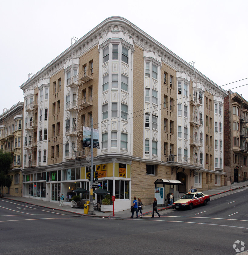

Discover your new home at Pleasanton Apartments. Located at 812 Sutter St in San Francisco, this community is a terrific place to live. From pricing to features, the professional leasing staff is available to help you find your perfect new place. Contact us today to see available floor plans and see Pleasanton Apartments.
Pleasanton Apartments is an apartment community located in San Francisco County and the 94109 ZIP Code. This area is served by the San Francisco Unified attendance zone.
Dishwasher
High Speed Internet Access
Refrigerator
Smoke Free
San Francisco’s Lower Nob Hill sits in the heart of Downtown, offering residents a premier location in one of California’s most popular cities. Situated between Union Square and US-101, locals can easily travel through the city, but why leave when there are so many conveniences right in this neighborhood? Union Square is San Francisco’s expansive and famous shopping plaza known for its upscale shops, restaurants, hotels, and nightlife spots.
Lower Nob’s light rail and bus stations are abundant, making commuting as easy as ever. This neighborhood is a great place for job opportunities due to the vast number of businesses in the area. Lower Nob is home to Saint Francis Memorial Hospital, the Masonic, and Dragon’s Gate, a landmark arch that’s the iconic gateway to Chinatown, Lower Nob’s neighbor. This neighborhood features an array of upscale apartments, houses, and condos that will fit any renter’s preferences and style.
Learn more about living in Lower Nob| Colleges & Universities | Distance | ||
|---|---|---|---|
| Colleges & Universities | Distance | ||
| Walk: | 1 min | 0.1 mi | |
| Walk: | 17 min | 0.9 mi | |
| Drive: | 5 min | 1.5 mi | |
| Drive: | 6 min | 2.2 mi |


Transportation options available in San Francisco include California And Jones, located 0.2 mile from Pleasanton Apartments. Pleasanton Apartments is near San Francisco International, located 14.6 miles or 23 minutes away, and Metro Oakland International, located 19.7 miles or 31 minutes away.
| Transit / Subway | Distance | ||
|---|---|---|---|
| Transit / Subway | Distance | ||
|
|
Walk: | 3 min | 0.2 mi |
| Walk: | 5 min | 0.3 mi | |
|
|
Walk: | 5 min | 0.3 mi |
|
|
Walk: | 5 min | 0.3 mi |
|
|
Walk: | 7 min | 0.4 mi |
| Commuter Rail | Distance | ||
|---|---|---|---|
| Commuter Rail | Distance | ||
| Drive: | 4 min | 1.5 mi | |
| Drive: | 4 min | 1.6 mi | |
| Drive: | 6 min | 3.0 mi | |
| Drive: | 6 min | 3.1 mi | |
| Drive: | 12 min | 6.7 mi |
| Airports | Distance | ||
|---|---|---|---|
| Airports | Distance | ||
|
San Francisco International
|
Drive: | 23 min | 14.6 mi |
|
Metro Oakland International
|
Drive: | 31 min | 19.7 mi |
Time and distance from Pleasanton Apartments.
| Shopping Centers | Distance | ||
|---|---|---|---|
| Shopping Centers | Distance | ||
| Walk: | 9 min | 0.5 mi | |
| Walk: | 12 min | 0.6 mi | |
| Walk: | 12 min | 0.6 mi |
| Parks and Recreation | Distance | ||
|---|---|---|---|
| Parks and Recreation | Distance | ||
|
Children's Creativity Museum
|
Walk: | 17 min | 0.9 mi |
|
San Francisco Maritime National Historical Park
|
Drive: | 4 min | 1.6 mi |
|
Aquarium of The Bay
|
Drive: | 6 min | 2.1 mi |
|
Buena Vista Park
|
Drive: | 9 min | 2.9 mi |
|
Randall Museum
|
Drive: | 10 min | 3.4 mi |
| Hospitals | Distance | ||
|---|---|---|---|
| Hospitals | Distance | ||
| Walk: | 5 min | 0.3 mi | |
| Walk: | 10 min | 0.6 mi | |
| Walk: | 14 min | 0.7 mi |
| Military Bases | Distance | ||
|---|---|---|---|
| Military Bases | Distance | ||
| Drive: | 15 min | 5.3 mi | |
| Drive: | 13 min | 5.8 mi | |
| Drive: | 27 min | 14.2 mi |
What Are Walk Score®, Transit Score®, and Bike Score® Ratings?
Walk Score® measures the walkability of any address. Transit Score® measures access to public transit. Bike Score® measures the bikeability of any address.
What is a Sound Score Rating?
A Sound Score Rating aggregates noise caused by vehicle traffic, airplane traffic and local sources


