
Lux: Wonderland in Crossroads / Katz on Main
1923 Broadway Blvd,
Kansas City, MO 64108
$1,157 - $3,109
Studio - 2 Beds
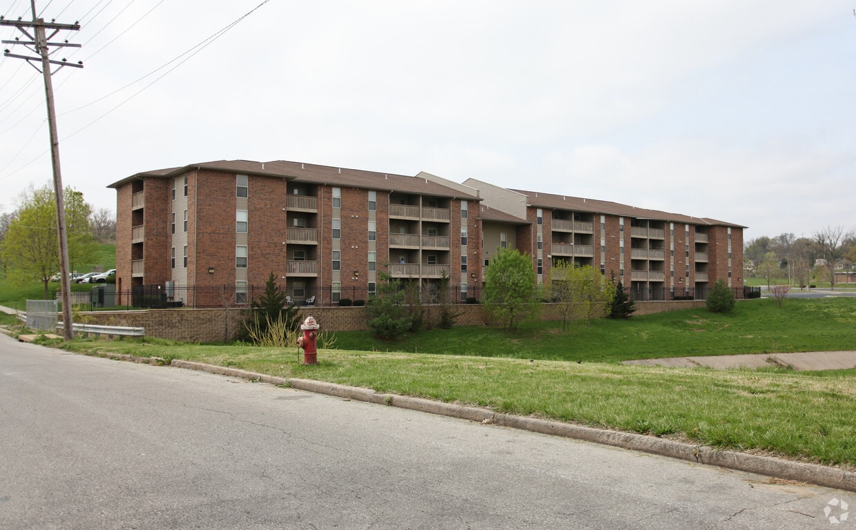
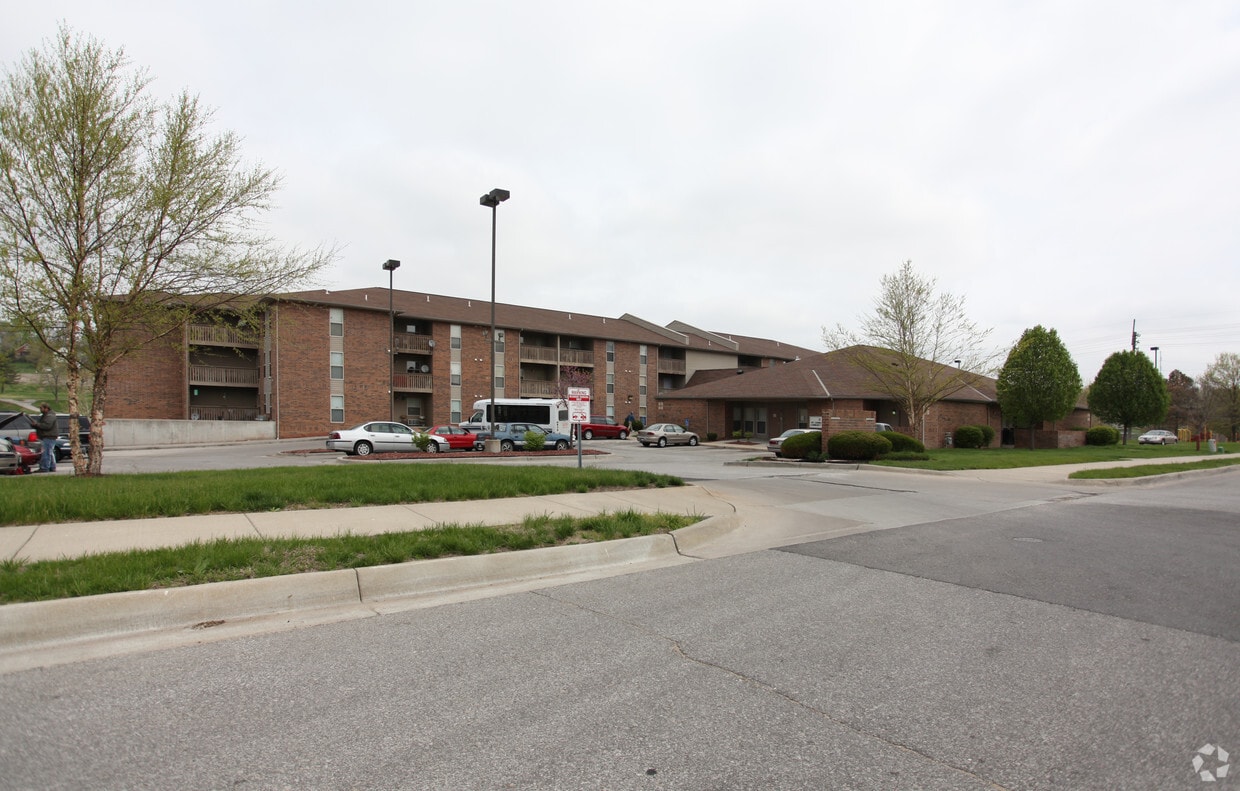
Find your new apartment at Mt. Carmel Place. You'll find this community on Troup Ave in the 66104 area of Kansas City. The professional leasing team is ready to show off our wonderful community. Compare 1 to 2 bedroom floor plans and then swing by for a visit to see them in person. Drop by the leasing office to discuss your new apartment and find your new home at Mt. Carmel Place.
Mt. Carmel Place is an apartment community located in Wyandotte County and the 66104 ZIP Code. This area is served by the Kansas City attendance zone.
Laundry Facilities
Controlled Access
Trash Pickup - Door to Door
Lounge
Air Conditioning
Tub/Shower
Patio
Heating
With its distinctive Old West architecture and funky murals, Downtown Kansas City, Kansas has a unique and distinctive vibe that sets it apart from its twin across the river. The "KCK" incorporated in 1872, and many of the city's important historical events are represented in the collection of murals along Michigan Avenue. Known for its barbecue, head to SLAPS BBQ in the Strawberry Hill neighborhood. The Reardon Convention Center, also located downtown, provides an eclectic mix of tradeshows and special events.
Downtown Kansas City is very close to its neighbor, providing two fantastic downtown areas to explore. It is also a short distance from the Kansas Speedway, the location of many NASCAR events. Other nearby destinations include the Kauffman Center for the Performing Arts, Charles B. Wheeler Downtown Airport, and the Strawberry Hill Museum and Cultural Center, a downtown landmark built in 1887.
Learn more about living in Downtown Kansas City KS| Colleges & Universities | Distance | ||
|---|---|---|---|
| Colleges & Universities | Distance | ||
| Drive: | 14 min | 7.1 mi | |
| Drive: | 16 min | 7.9 mi | |
| Drive: | 15 min | 8.0 mi | |
| Drive: | 17 min | 9.1 mi |


Transportation options available in Kansas City include North Loop On Main At 7Th St Sb, located 4.2 miles from Mt. Carmel Place. Mt. Carmel Place is near Kansas City International, located 17.0 miles or 24 minutes away.
| Transit / Subway | Distance | ||
|---|---|---|---|
| Transit / Subway | Distance | ||
| Drive: | 8 min | 4.2 mi | |
| Drive: | 9 min | 4.2 mi | |
| Drive: | 8 min | 4.2 mi | |
| Drive: | 9 min | 4.4 mi | |
| Drive: | 8 min | 4.5 mi |
| Commuter Rail | Distance | ||
|---|---|---|---|
| Commuter Rail | Distance | ||
|
|
Drive: | 12 min | 5.7 mi |
|
|
Drive: | 26 min | 14.2 mi |
|
|
Drive: | 38 min | 24.6 mi |
|
|
Drive: | 44 min | 37.5 mi |
| Airports | Distance | ||
|---|---|---|---|
| Airports | Distance | ||
|
Kansas City International
|
Drive: | 24 min | 17.0 mi |
Time and distance from Mt. Carmel Place.
| Shopping Centers | Distance | ||
|---|---|---|---|
| Shopping Centers | Distance | ||
| Drive: | 5 min | 2.5 mi | |
| Drive: | 6 min | 2.9 mi | |
| Drive: | 7 min | 3.8 mi |
| Parks and Recreation | Distance | ||
|---|---|---|---|
| Parks and Recreation | Distance | ||
|
Science City at Union Station
|
Drive: | 12 min | 5.6 mi |
|
Frank Vaydik Park
|
Drive: | 15 min | 7.1 mi |
|
English Landing Park
|
Drive: | 13 min | 7.4 mi |
|
Richard Berkley Riverfront Park
|
Drive: | 15 min | 7.7 mi |
|
Parkville Nature Sanctuary
|
Drive: | 14 min | 7.8 mi |
| Hospitals | Distance | ||
|---|---|---|---|
| Hospitals | Distance | ||
| Drive: | 11 min | 5.9 mi | |
| Drive: | 12 min | 6.1 mi | |
| Drive: | 12 min | 6.5 mi |
| Military Bases | Distance | ||
|---|---|---|---|
| Military Bases | Distance | ||
| Drive: | 49 min | 29.0 mi |
What Are Walk Score®, Transit Score®, and Bike Score® Ratings?
Walk Score® measures the walkability of any address. Transit Score® measures access to public transit. Bike Score® measures the bikeability of any address.
What is a Sound Score Rating?
A Sound Score Rating aggregates noise caused by vehicle traffic, airplane traffic and local sources

1130 Troup Ave
Kansas City, KS 66104


