
110 Roy Apartments
110 Roy St,
Seattle, WA 98119
$2,225 - $5,495
Studio - 2 Beds

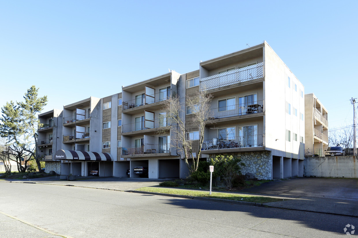
Experience your new home at Montridge Arms Apartments in Seattle, WA. Located at 9000 20th Ave Sw in Seattle, this community is an ideal place to move. Schedule a time to see the current floorplan options. Experience a wide selection of amenities like smoke free options, convenient on-site parking options, and high-speed internet access. Contact us or drop by to schedule a tour and find your new place at Montridge Arms Apartments.
Montridge Arms Apartments is an apartment community located in King County and the 98106 ZIP Code. This area is served by the Seattle Public Schools attendance zone.
Dishwasher
High Speed Internet Access
Refrigerator
Disposal
Located just a few miles off the coast of the Puget Sound, South Delridge is a bustling neighborhood in southeastern Seattle, Washington. Residents can travel a quick eight miles to arrive in Downtown Seattle where they’ll discover a variety of entertainment from the Seattle Art Museum, the Seattle Aquarium, Paramount Theatre, and so much more.
South Delridge resides a few miles from Lincoln Park, a popular community space on the coast of the Puget Sound. Playgrounds, rocky beaches, hiking and biking trails, and picnic and grill areas can be found in the park. Lincoln Park even has its own heated saltwater pool at the peak of the land overlooking the rocky coastline of the Puget Sound.
With shopping centers, restaurants, and local businesses throughout town and nearby, South Delridge is an amenity-filled suburb. The Seattle-Tacoma International Airport is located just nine miles south of the neighborhood and is surrounded by several interstate highways for quick and easy travels.
Learn more about living in South Delridge| Colleges & Universities | Distance | ||
|---|---|---|---|
| Colleges & Universities | Distance | ||
| Drive: | 8 min | 2.4 mi | |
| Drive: | 19 min | 8.8 mi | |
| Drive: | 18 min | 8.8 mi | |
| Drive: | 19 min | 9.6 mi |


Transportation options available in Seattle include St Light Rail & Columbia City Station (Sb), located 6.0 miles from Montridge Arms Apartments. Montridge Arms Apartments is near Seattle-Tacoma International, located 8.0 miles or 18 minutes away, and Seattle Paine Field International, located 31.9 miles or 49 minutes away.
| Transit / Subway | Distance | ||
|---|---|---|---|
| Transit / Subway | Distance | ||
|
|
Drive: | 17 min | 6.0 mi |
|
|
Drive: | 18 min | 6.2 mi |
|
|
Drive: | 18 min | 6.2 mi |
|
|
Drive: | 16 min | 7.9 mi |
|
|
Drive: | 16 min | 8.0 mi |
| Commuter Rail | Distance | ||
|---|---|---|---|
| Commuter Rail | Distance | ||
|
|
Drive: | 16 min | 7.4 mi |
|
|
Drive: | 17 min | 9.3 mi |
|
|
Drive: | 27 min | 15.0 mi |
| Drive: | 26 min | 16.1 mi | |
|
|
Drive: | 35 min | 22.5 mi |
| Airports | Distance | ||
|---|---|---|---|
| Airports | Distance | ||
|
Seattle-Tacoma International
|
Drive: | 18 min | 8.0 mi |
|
Seattle Paine Field International
|
Drive: | 49 min | 31.9 mi |
Time and distance from Montridge Arms Apartments.
| Shopping Centers | Distance | ||
|---|---|---|---|
| Shopping Centers | Distance | ||
| Walk: | 8 min | 0.4 mi | |
| Walk: | 12 min | 0.6 mi | |
| Walk: | 13 min | 0.7 mi |
| Parks and Recreation | Distance | ||
|---|---|---|---|
| Parks and Recreation | Distance | ||
|
Westcrest Park
|
Walk: | 12 min | 0.7 mi |
|
Fauntleroy Park
|
Drive: | 3 min | 1.2 mi |
|
South Seattle Community College Arboretum
|
Drive: | 6 min | 2.0 mi |
|
Camp Long
|
Drive: | 7 min | 2.2 mi |
|
Lincoln Park - West Seattle
|
Drive: | 7 min | 2.4 mi |
| Hospitals | Distance | ||
|---|---|---|---|
| Hospitals | Distance | ||
| Walk: | 21 min | 1.1 mi | |
| Drive: | 11 min | 5.0 mi | |
| Drive: | 11 min | 5.0 mi |
| Military Bases | Distance | ||
|---|---|---|---|
| Military Bases | Distance | ||
| Drive: | 34 min | 14.5 mi | |
| Drive: | 88 min | 63.2 mi |
What Are Walk Score®, Transit Score®, and Bike Score® Ratings?
Walk Score® measures the walkability of any address. Transit Score® measures access to public transit. Bike Score® measures the bikeability of any address.
What is a Sound Score Rating?
A Sound Score Rating aggregates noise caused by vehicle traffic, airplane traffic and local sources
9000 20th Ave SW
Seattle, WA 98106


