
Colette
2099 1st St SW,
Washington, DC 20024
$1,240 - $15,075
Studio - 6 Beds
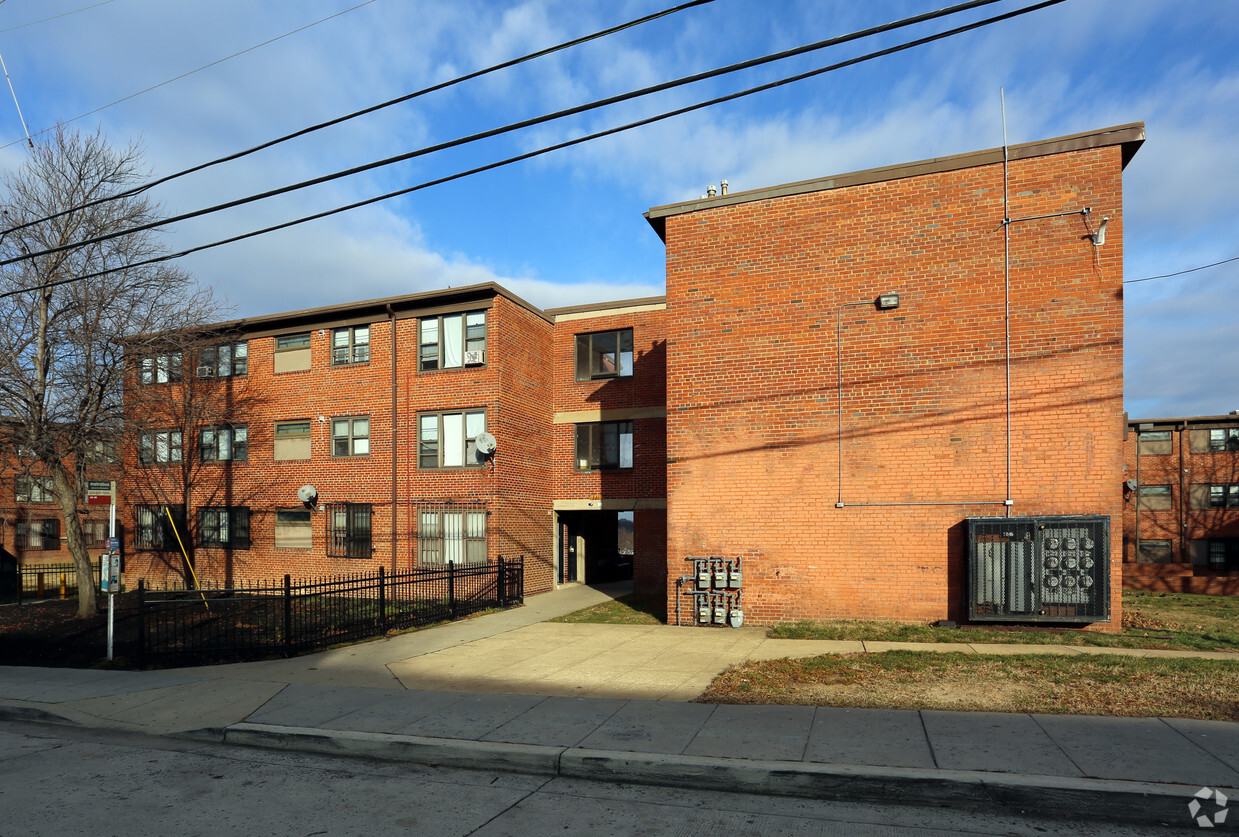
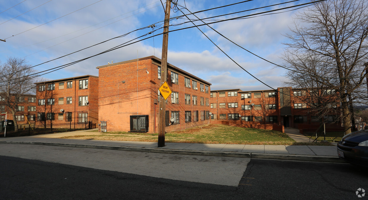
At Lincoln Heights in Washington, find a great place to live. Situated in Washington's 20019 area, living here offers a variety of nearby experiences to check out. Be sure to see the available floorplan options. You'll experience a wide selection of features and amenities at this community. Some of these include: smoke free options, convenient on-site parking options, and high-speed internet access. Drop by the leasing office to check current floorplan availability.
Lincoln Heights is an apartment community located in District of Columbia County and the 20019 ZIP Code. This area is served by the District Of Columbia Public Schools attendance zone.
Brick-faced apartment buildings and one- and two-family houses provide rental options in the Washington, D.C. neighborhood of Lincoln Heights. This historic neighborhood in the northeast section of the nation's capital enjoys nearby access to RFK Stadium and the Anacostia Waterfront, and it sits about four miles east of the heart of D.C.
Meet up with your neighbors on the running trails and playgrounds of Marvin Gaye Park. The Evans Recreation Center provides a hub for locals who want to take advantage of the weight room and exercise classes, and the center also hosts neighborhood meetings. While most of the local favorite restaurants sit on the other side of the Anacostia River, you can enjoy a great evening when you pick up a pizza at Pizza Movers.
Learn more about living in Lincoln Heights| Colleges & Universities | Distance | ||
|---|---|---|---|
| Colleges & Universities | Distance | ||
| Drive: | 10 min | 4.5 mi | |
| Drive: | 10 min | 5.4 mi | |
| Drive: | 10 min | 5.4 mi | |
| Drive: | 11 min | 6.1 mi |


Transportation options available in Washington include Benning Road, located 0.7 mile from Lincoln Heights. Lincoln Heights is near Ronald Reagan Washington Ntl, located 10.9 miles or 20 minutes away, and Baltimore/Washington International Thurgood Marshall, located 28.0 miles or 42 minutes away.
| Transit / Subway | Distance | ||
|---|---|---|---|
| Transit / Subway | Distance | ||
|
|
Walk: | 14 min | 0.7 mi |
|
|
Drive: | 3 min | 1.3 mi |
|
|
Drive: | 3 min | 1.3 mi |
|
Capitol Heights, Blue/Silver Line Center Platform
|
Drive: | 4 min | 2.1 mi |
|
|
Drive: | 7 min | 3.2 mi |
| Commuter Rail | Distance | ||
|---|---|---|---|
| Commuter Rail | Distance | ||
|
|
Drive: | 8 min | 4.7 mi |
|
|
Drive: | 10 min | 4.9 mi |
|
|
Drive: | 12 min | 5.8 mi |
| Drive: | 12 min | 7.2 mi | |
|
|
Drive: | 12 min | 7.2 mi |
| Airports | Distance | ||
|---|---|---|---|
| Airports | Distance | ||
|
Ronald Reagan Washington Ntl
|
Drive: | 20 min | 10.9 mi |
|
Baltimore/Washington International Thurgood Marshall
|
Drive: | 42 min | 28.0 mi |
Time and distance from Lincoln Heights.
| Shopping Centers | Distance | ||
|---|---|---|---|
| Shopping Centers | Distance | ||
| Walk: | 13 min | 0.7 mi | |
| Drive: | 3 min | 1.1 mi | |
| Drive: | 4 min | 1.6 mi |
| Parks and Recreation | Distance | ||
|---|---|---|---|
| Parks and Recreation | Distance | ||
|
Fort Dupont Park
|
Drive: | 7 min | 2.3 mi |
|
Kingman and Heritage Island Park
|
Drive: | 5 min | 2.7 mi |
|
Bladensburg Waterfront Park
|
Drive: | 7 min | 3.9 mi |
|
Washington Youth Garden
|
Drive: | 7 min | 4.2 mi |
|
National Arboretum
|
Drive: | 11 min | 5.4 mi |
| Hospitals | Distance | ||
|---|---|---|---|
| Hospitals | Distance | ||
| Drive: | 7 min | 3.2 mi | |
| Drive: | 16 min | 6.4 mi | |
| Drive: | 15 min | 6.7 mi |
| Military Bases | Distance | ||
|---|---|---|---|
| Military Bases | Distance | ||
| Drive: | 11 min | 5.7 mi | |
| Drive: | 16 min | 6.8 mi |
What Are Walk Score®, Transit Score®, and Bike Score® Ratings?
Walk Score® measures the walkability of any address. Transit Score® measures access to public transit. Bike Score® measures the bikeability of any address.
What is a Sound Score Rating?
A Sound Score Rating aggregates noise caused by vehicle traffic, airplane traffic and local sources

321 50th St NE
Washington, DC 20019


