
Legacy Commons at Signal Hills 55+ Apartments
45 Butler Ave E,
West Saint Paul, MN 55118
$1,441 - $1,732 Total Monthly Price
1-3 Beds
Bedrooms
2 - 3 bd
Bathrooms
2 ba
Square Feet
1,088 - 1,399 sq ft
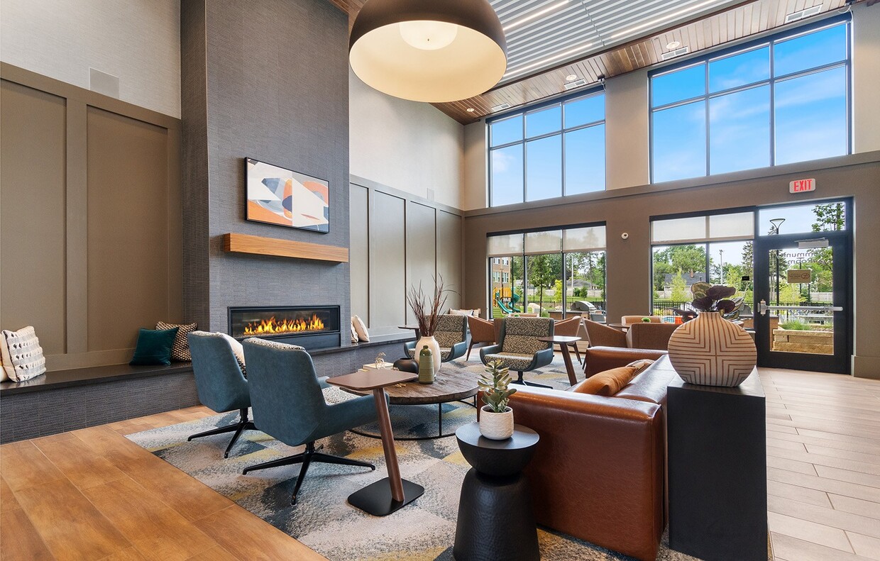
Welcome to Hilltop at Signal Hills, West St. Paul's modern affordable living community! Offering a variety of spacious 1, 2 and 3 bedroom apartment homes, we are experts at combining quality and comfort, making Hilltop at Signal Hills the perfect place to call home! Every feature is designed with you in mind! From the outdoor swimming pool and playground to the on-site fitness center and cozy community clubhouse, we have made certain that there is something for everyone. *Hilltop at Signal Hills Apartments participates in the affordable housing program where income limits apply. Please visit our website or call for more details.
Welcome to Hilltop at Signal Hills, West St. Paul's modern affordable living community! Offering a variety of spacious 1, 2 and 3 bedroom apartment homes, we are experts at combining quality and comfort, making Hilltop at Signal Hills the perfect place to call home! Every feature is designed with you in mind! From the outdoor swimming pool and playground to the on-site fitness center and cozy community clubhouse, we have made certain that there is something for everyone. *Hilltop at Signal Hills Apartments participates in the affordable housing program where income limits apply. Please visit our website or call for more details.
Hilltop at Signal Hills is an apartment community located in Dakota County and the 55118 ZIP Code. This area is served by the St. Paul Public School District attendance zone.
Unique Features
Pool
Fitness Center
Playground
Clubhouse
Controlled Access
Recycling
Grill
Key Fob Entry
Air Conditioning
High Speed Internet Access
Hardwood Floors
Walk-In Closets
Granite Countertops
Microwave
Refrigerator
Tub/Shower
West Saint Paul earned its name not from geography but from history — it once sat across the river from Saint Paul on the west bank of the Mississippi, and the name stuck. Tucked into Dakota County, this compact city covers just six square miles yet packs in a surprising amount of green space, from Garlough Park and Marthaler Park to the sprawling Thompson County Park. The Dodge Nature Center draws outdoor enthusiasts year-round, while Lilydale/Harriet Island Regional Park sits just minutes away along the riverfront.
South Robert Street anchors daily life with grocery stores, shops, and dining, and downtown Saint Paul is practically a neighbor, making it easy to tap into the bigger city's museums, arts scene, and entertainment.
The rental market here offers solid variety, with traditional apartment communities, townhomes, and garden-style buildings spread throughout walkable stretches of the city.
Learn more about living in West Saint PaulCompare neighborhood and city base rent averages by bedroom.
| South St Paul | West Saint Paul, MN | |
|---|---|---|
| Studio | $1,204 | $1,164 |
| 1 Bedroom | $1,250 | $1,180 |
| 2 Bedrooms | $1,477 | $1,453 |
| 3 Bedrooms | $2,192 | $2,273 |
| Colleges & Universities | Distance | ||
|---|---|---|---|
| Colleges & Universities | Distance | ||
| Drive: | 9 min | 4.1 mi | |
| Drive: | 9 min | 4.1 mi | |
| Drive: | 13 min | 6.2 mi | |
| Drive: | 12 min | 6.5 mi |


Transportation options available in West Saint Paul include Central Station, located 2.9 miles from Hilltop at Signal Hills. Hilltop at Signal Hills is near Minneapolis-St Paul International/Wold-Chamberlain, located 9.6 miles or 18 minutes away.
| Transit / Subway | Distance | ||
|---|---|---|---|
| Transit / Subway | Distance | ||
| Drive: | 7 min | 2.9 mi | |
| Drive: | 6 min | 2.9 mi | |
| Drive: | 7 min | 3.1 mi | |
| Drive: | 8 min | 3.3 mi | |
| Drive: | 8 min | 3.5 mi |
| Commuter Rail | Distance | ||
|---|---|---|---|
| Commuter Rail | Distance | ||
|
|
Drive: | 7 min | 3.1 mi |
|
|
Drive: | 25 min | 13.3 mi |
|
|
Drive: | 29 min | 19.7 mi |
|
|
Drive: | 39 min | 27.8 mi |
|
|
Drive: | 40 min | 29.5 mi |
| Airports | Distance | ||
|---|---|---|---|
| Airports | Distance | ||
|
Minneapolis-St Paul International/Wold-Chamberlain
|
Drive: | 18 min | 9.6 mi |
Scores provided by
Traffic
-Airport
-Businesses
-Scores provided by
HowLoud What is a Sound Score Rating? A Sound Score Rating aggregates noise caused by vehicle traffic, airplane traffic and local sources. How It WorksTime and distance from Hilltop at Signal Hills.
| Shopping Centers | Distance | ||
|---|---|---|---|
| Shopping Centers | Distance | ||
| Walk: | 5 min | 0.3 mi | |
| Drive: | 4 min | 1.2 mi | |
| Drive: | 4 min | 1.5 mi |
| Parks and Recreation | Distance | ||
|---|---|---|---|
| Parks and Recreation | Distance | ||
|
Dodge Nature Center
|
Drive: | 5 min | 1.9 mi |
|
Cherokee Regional Park
|
Drive: | 6 min | 2.2 mi |
|
Kellogg Mall Park
|
Drive: | 6 min | 2.8 mi |
|
Irvine Park
|
Drive: | 8 min | 3.3 mi |
|
Science Museum of Minnesota
|
Drive: | 8 min | 3.8 mi |
| Hospitals | Distance | ||
|---|---|---|---|
| Hospitals | Distance | ||
| Drive: | 7 min | 3.2 mi | |
| Drive: | 8 min | 3.4 mi | |
| Drive: | 8 min | 3.5 mi |
| Military Bases | Distance | ||
|---|---|---|---|
| Military Bases | Distance | ||
| Drive: | 16 min | 8.4 mi |
Pets Allowed Fitness Center Pool Dishwasher Refrigerator Clubhouse Maintenance on site
Pets Allowed Fitness Center Pool Dishwasher Refrigerator Kitchen In Unit Washer & Dryer
Pets Allowed Fitness Center Pool Dishwasher Refrigerator Kitchen
Pets Allowed Pool Dishwasher Microwave Granite Countertops
What Are Walk Score®, Transit Score®, and Bike Score® Ratings?
Walk Score® measures the walkability of any address. Transit Score® measures access to public transit. Bike Score® measures the bikeability of any address.
What is a Sound Score Rating?
A Sound Score Rating aggregates noise caused by vehicle traffic, airplane traffic and local sources.

15 Butler Ave E
West Saint Paul, MN 55118


