
The Bosk Apartment Homes
6850 Ashwood Rd,
Woodbury, MN 55125
$1,467 - $1,745 Plus Fees
1-2 Beds

Find your new home at Harmony Gardens in Maplewood, MN. This property is situated in the Maplewood Oakdale area of Maplewood. The professional leasing staff will assist you in finding your dream apartment. Compare 1 to 2 bedroom floor plans and then swing by for a visit to see them in person. Experience a new standard at Harmony Gardens.
Harmony Gardens is an apartment community located in Ramsey County and the 55109 ZIP Code. This area is served by the North St Paul-Maplewood School Dist attendance zone.
Fitness Center
Lounge
Walking/Biking Trails
On-Site Retail
Refrigerator
Tub/Shower
Oven
Range
Thanks to some odd geography, Maplewood has something of a split personality. This first-ring St. Paul suburb can be described as being shaped like a frying pan. The main business and residential area lies primarily to the north and east of St. Paul, while the chief amenities, such as the community center and an indoor mall, lie in the "pan." South Maplewood, or the "pan handle," runs south along Interstate 494 and has fewer business amenities. Residents of this area tend to shop in bordering Woodbury, since it takes a good half hour to get from the southern tip of Maplewood to the main northern business district.
Meanwhile, Oakdale lies between the two sections, just east of Maplewood's pan handle and north of Woodbury. This young suburb is a quiet bedroom community with a scattering of business districts. Cornfields make up its eastern portion, giving the area a distinctly rural vibe, even though it's just 10 minutes outside of downtown St. Paul.
Learn more about living in Maplewood-Oakdale| Colleges & Universities | Distance | ||
|---|---|---|---|
| Colleges & Universities | Distance | ||
| Drive: | 9 min | 4.6 mi | |
| Drive: | 11 min | 5.5 mi | |
| Drive: | 14 min | 8.5 mi | |
| Drive: | 14 min | 8.6 mi |


Transportation options available in Maplewood include Robert St Station, located 7.4 miles from Harmony Gardens. Harmony Gardens is near Minneapolis-St Paul International/Wold-Chamberlain, located 17.1 miles or 27 minutes away.
| Transit / Subway | Distance | ||
|---|---|---|---|
| Transit / Subway | Distance | ||
| Drive: | 12 min | 7.4 mi | |
| Drive: | 12 min | 7.6 mi | |
| Drive: | 12 min | 7.6 mi | |
| Drive: | 13 min | 7.7 mi | |
| Drive: | 13 min | 7.8 mi |
| Commuter Rail | Distance | ||
|---|---|---|---|
| Commuter Rail | Distance | ||
|
|
Drive: | 13 min | 7.7 mi |
|
|
Drive: | 24 min | 14.4 mi |
|
|
Drive: | 21 min | 14.9 mi |
|
|
Drive: | 32 min | 23.1 mi |
|
|
Drive: | 33 min | 24.7 mi |
| Airports | Distance | ||
|---|---|---|---|
| Airports | Distance | ||
|
Minneapolis-St Paul International/Wold-Chamberlain
|
Drive: | 27 min | 17.1 mi |
Time and distance from Harmony Gardens.
| Shopping Centers | Distance | ||
|---|---|---|---|
| Shopping Centers | Distance | ||
| Drive: | 4 min | 1.4 mi | |
| Drive: | 4 min | 1.4 mi | |
| Drive: | 5 min | 1.7 mi |
| Parks and Recreation | Distance | ||
|---|---|---|---|
| Parks and Recreation | Distance | ||
|
Phelan Regional Park
|
Drive: | 8 min | 3.6 mi |
|
Keller Regional Park
|
Drive: | 8 min | 3.6 mi |
|
Phalen Park
|
Drive: | 9 min | 3.7 mi |
|
Arlington/Arkwright Park
|
Drive: | 9 min | 4.2 mi |
|
Harriet Alexander Nature Center
|
Drive: | 9 min | 5.4 mi |
| Hospitals | Distance | ||
|---|---|---|---|
| Hospitals | Distance | ||
| Drive: | 3 min | 1.2 mi | |
| Drive: | 12 min | 7.2 mi | |
| Drive: | 11 min | 7.3 mi |
| Military Bases | Distance | ||
|---|---|---|---|
| Military Bases | Distance | ||
| Drive: | 26 min | 15.8 mi |
Pets Allowed Fitness Center Pool Dishwasher Refrigerator Clubhouse Maintenance on site
Pets Allowed Fitness Center Pool In Unit Washer & Dryer Walk-In Closets High-Speed Internet Controlled Access
What Are Walk Score®, Transit Score®, and Bike Score® Ratings?
Walk Score® measures the walkability of any address. Transit Score® measures access to public transit. Bike Score® measures the bikeability of any address.
What is a Sound Score Rating?
A Sound Score Rating aggregates noise caused by vehicle traffic, airplane traffic and local sources
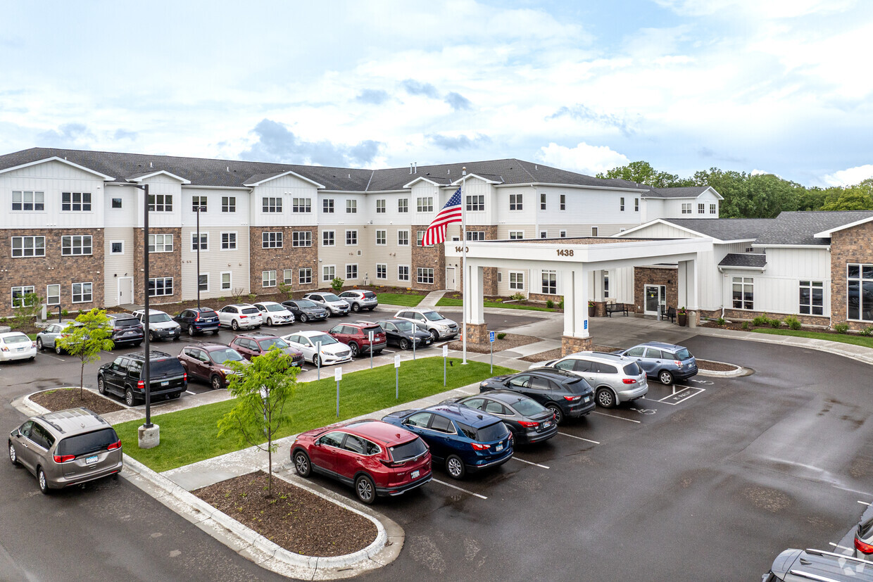
1438 Country Rd
Maplewood, MN 55109


