
1213 Walnut
1213 Walnut St,
Philadelphia, PA 19107
$1,945 - $7,060
Studio - 2 Beds
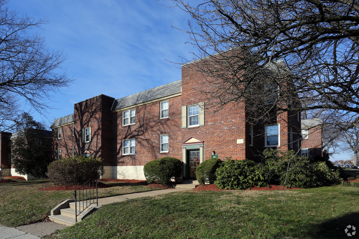
You'll love coming home to this intimate community nestled in a serene residential neighborhood. Our community is a short one-block walk to local shops and a variety of restaurants. Each secured entry door opens to either two or four apartments with private entrances. Our common areas have been recently updated. Large sunlit windows will brighten your day when you come home from an invigorating stroll through the neighborhood. Private garages are available for rent for our residents convenience.
Forest Village is an apartment community located in Philadelphia County and the 19150 ZIP Code. This area is served by the The School District of Philadelphia attendance zone.
Air Conditioning
Refrigerator
Freezer
Window Coverings
Located in the northwestern stretches of Philadelphia, Cedarbrook-Stenton is a historic community boasting suburban amenities along with quick urban access. Cedarbrook-Stenton is primarily residential, offering an array of apartments, townhomes, and houses available for rent in a laid-back locale.
Shopping and dining options in the neighborhood are largely clustered on Cheltenham Avenue, including at popular venues like Cedarbrook Plaza Shopping Center and Greenleaf at Cheltenham. All that Center City Philadelphia has to offer is within close reach of the community via Septa’s Chestnut Hill East Line as well.
Learn more about living in Cedarbrook-StentonCompare neighborhood and city base rent averages by bedroom.
| Cedarbrook-Stenton | Philadelphia, PA | |
|---|---|---|
| Studio | $1,040 | $1,433 |
| 1 Bedroom | $1,240 | $1,786 |
| 2 Bedrooms | $1,484 | $2,227 |
| 3 Bedrooms | - | $2,919 |
| Colleges & Universities | Distance | ||
|---|---|---|---|
| Colleges & Universities | Distance | ||
| Drive: | 4 min | 1.4 mi | |
| Drive: | 6 min | 3.5 mi | |
| Drive: | 7 min | 3.5 mi | |
| Drive: | 10 min | 4.4 mi |


Transportation options available in Philadelphia include Olney Transit Center, located 3.8 miles from Forest Village. Forest Village is near Philadelphia International, located 20.9 miles or 37 minutes away, and Trenton Mercer, located 35.3 miles or 49 minutes away.
| Transit / Subway | Distance | ||
|---|---|---|---|
| Transit / Subway | Distance | ||
| Drive: | 7 min | 3.8 mi | |
| Drive: | 8 min | 4.0 mi | |
|
|
Drive: | 9 min | 4.5 mi |
|
|
Drive: | 9 min | 4.9 mi |
|
|
Drive: | 11 min | 5.4 mi |
| Commuter Rail | Distance | ||
|---|---|---|---|
| Commuter Rail | Distance | ||
|
|
Drive: | 3 min | 1.3 mi |
|
|
Drive: | 3 min | 1.4 mi |
|
|
Drive: | 4 min | 1.6 mi |
|
|
Drive: | 4 min | 1.9 mi |
|
|
Drive: | 5 min | 2.2 mi |
| Airports | Distance | ||
|---|---|---|---|
| Airports | Distance | ||
|
Philadelphia International
|
Drive: | 37 min | 20.9 mi |
|
Trenton Mercer
|
Drive: | 49 min | 35.3 mi |
Scores provided by
Traffic
ActiveAirport
CalmBusinesses
ActiveScores provided by
HowLoud What is a Sound Score Rating? A Sound Score Rating aggregates noise caused by vehicle traffic, airplane traffic and local sources. How It WorksTime and distance from Forest Village.
| Shopping Centers | Distance | ||
|---|---|---|---|
| Shopping Centers | Distance | ||
| Walk: | 7 min | 0.4 mi | |
| Walk: | 15 min | 0.8 mi | |
| Drive: | 3 min | 1.3 mi |
| Parks and Recreation | Distance | ||
|---|---|---|---|
| Parks and Recreation | Distance | ||
|
Awbury Arboretum
|
Drive: | 6 min | 3.0 mi |
|
The Morris Arboretum
|
Drive: | 11 min | 4.1 mi |
|
Wissahickon Environmental Center
|
Drive: | 10 min | 4.3 mi |
|
Wissahickon Valley Park
|
Drive: | 8 min | 4.9 mi |
|
Schuylkill Center for Environmental Education
|
Drive: | 17 min | 5.8 mi |
| Hospitals | Distance | ||
|---|---|---|---|
| Hospitals | Distance | ||
| Drive: | 7 min | 2.9 mi | |
| Drive: | 8 min | 4.0 mi | |
| Drive: | 12 min | 5.5 mi |
| Military Bases | Distance | ||
|---|---|---|---|
| Military Bases | Distance | ||
| Drive: | 27 min | 11.3 mi | |
| Drive: | 23 min | 14.3 mi | |
| Drive: | 30 min | 17.6 mi |
What Are Walk Score®, Transit Score®, and Bike Score® Ratings?
Walk Score® measures the walkability of any address. Transit Score® measures access to public transit. Bike Score® measures the bikeability of any address.
What is a Sound Score Rating?
A Sound Score Rating aggregates noise caused by vehicle traffic, airplane traffic and local sources.

1325-1337 E Wadsworth Ave
Philadelphia, PA 19150


