
Clairmont Reserve Apartment Homes
1575 Clairmont Rd,
Decatur, GA 30033
$1,279 - $2,075
1-2 Beds

Bedrooms
1 bd
Bathrooms
1 ba
Square Feet
750 sq ft
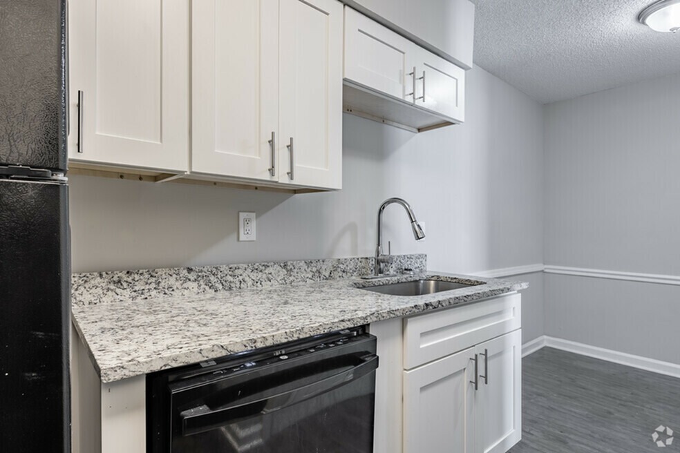
Decatur Lofts is a pet and family-friendly community in Decatur, Georgia offering one-bedroom apartment homes for rent. Our apartments include features like well-equipped kitchens with dishwashers, spacious closets, and washer and dryer connections. We also have convenient amenities for our residents to enjoy, including a picnic and barbecue area and laundry facilities. Decatur Lofts offers spacious homes and a convenient location just minutes from downtown Atlanta, local restaurants, shopping destinations, and beautiful parks
Decatur Lofts is an apartment community located in DeKalb County and the 30034 ZIP Code. This area is served by the DeKalb County attendance zone.
Unique Features
Located about nine miles southeast of Downtown Atlanta, Panthersville is a suburban community teeming with apartments and houses for rent along tree-dense roads. Panthersville residents enjoy the community’s forest-like environment, along with quick access to an array of everyday conveniences strewn along Candler Road and Flat Shoals Road, including those found at the Gallery at South DeKalb.
The neighborhood provides plenty of opportunities for outdoor recreation, with access to Exchange Park, Misty Waters Park, and Gresham Park. Panthersville also sits adjacent to Georgia State University-Perimeter College, making it a great choice for many students, faculty, and staff. Direct access to both I-20 and I-285 connects Panthersville to the rest of the Greater Atlanta area within minutes.
Learn more about living in PanthersvilleCompare neighborhood and city base rent averages by bedroom.
| Panthersville | Decatur, GA | |
|---|---|---|
| Studio | $850 | $1,490 |
| 1 Bedroom | $1,040 | $1,396 |
| 2 Bedrooms | $1,246 | $1,563 |
| 3 Bedrooms | $1,482 | $1,776 |
| Colleges & Universities | Distance | ||
|---|---|---|---|
| Colleges & Universities | Distance | ||
| Drive: | 4 min | 1.3 mi | |
| Drive: | 11 min | 5.2 mi | |
| Drive: | 16 min | 7.8 mi | |
| Drive: | 15 min | 8.9 mi |


Transportation options available in Decatur include Decatur, located 6.1 miles from Decatur Lofts. Decatur Lofts is near Hartsfield - Jackson Atlanta International, located 12.0 miles or 20 minutes away.
| Transit / Subway | Distance | ||
|---|---|---|---|
| Transit / Subway | Distance | ||
|
|
Drive: | 13 min | 6.1 mi |
|
|
Drive: | 13 min | 6.4 mi |
|
|
Drive: | 13 min | 6.5 mi |
|
|
Drive: | 10 min | 6.6 mi |
|
|
Drive: | 12 min | 7.5 mi |
| Commuter Rail | Distance | ||
|---|---|---|---|
| Commuter Rail | Distance | ||
|
|
Drive: | 21 min | 13.4 mi |
| Airports | Distance | ||
|---|---|---|---|
| Airports | Distance | ||
|
Hartsfield - Jackson Atlanta International
|
Drive: | 20 min | 12.0 mi |
Time and distance from Decatur Lofts.
| Shopping Centers | Distance | ||
|---|---|---|---|
| Shopping Centers | Distance | ||
| Walk: | 7 min | 0.4 mi | |
| Walk: | 15 min | 0.8 mi | |
| Walk: | 16 min | 0.9 mi |
| Parks and Recreation | Distance | ||
|---|---|---|---|
| Parks and Recreation | Distance | ||
|
Ferns of the World Garden
|
Drive: | 3 min | 1.1 mi |
|
Wylde Center and Oakhurst Community Garden
|
Drive: | 11 min | 4.9 mi |
|
Bradley Observatory
|
Drive: | 11 min | 5.5 mi |
|
South River Watershed Alliance
|
Drive: | 13 min | 6.1 mi |
|
Glenn Creek Nature Preserve
|
Drive: | 15 min | 6.8 mi |
| Hospitals | Distance | ||
|---|---|---|---|
| Hospitals | Distance | ||
| Walk: | 14 min | 0.7 mi | |
| Drive: | 14 min | 7.2 mi | |
| Drive: | 17 min | 8.2 mi |
| Military Bases | Distance | ||
|---|---|---|---|
| Military Bases | Distance | ||
| Drive: | 17 min | 9.7 mi | |
| Drive: | 22 min | 13.8 mi |
What Are Walk Score®, Transit Score®, and Bike Score® Ratings?
Walk Score® measures the walkability of any address. Transit Score® measures access to public transit. Bike Score® measures the bikeability of any address.
What is a Sound Score Rating?
A Sound Score Rating aggregates noise caused by vehicle traffic, airplane traffic and local sources
2889 Panthersville Rd
Decatur, GA 30034


