
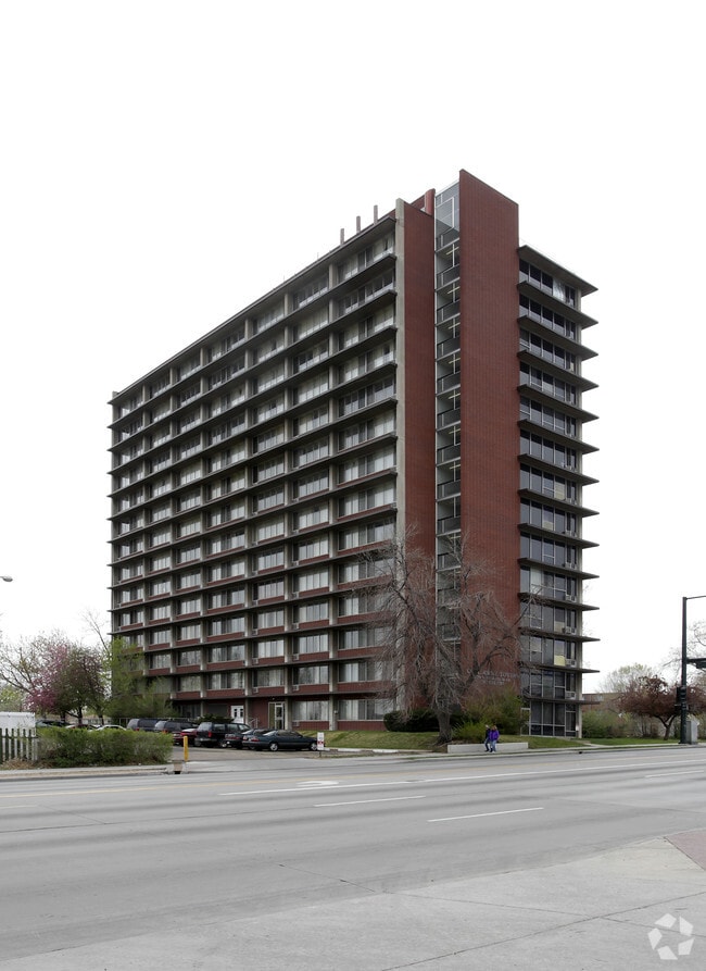
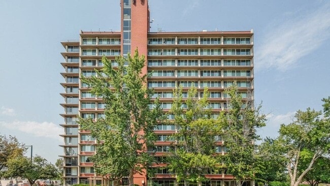
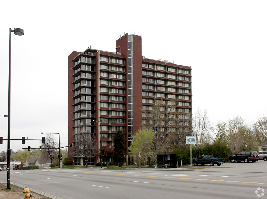
Columbine Towers
1750 S Federal Blvd,
Denver,
CO
80219
-
Monthly Rent
$1,962 - $2,102
Plus Fees12 Month Lease
-
Bedrooms
Studio - 2 bd
-
Bathrooms
1 ba
-
Square Feet
434 - 1,000 sq ft
Pricing & Floor Plans
-
Unit 0410price $1,962square feet 434availibility Now
-
Unit 0710price $2,102square feet 434availibility Now
-
Unit 0412price $2,102square feet 587availibility Now
-
Unit 0410price $1,962square feet 434availibility Now
-
Unit 0710price $2,102square feet 434availibility Now
-
Unit 0412price $2,102square feet 587availibility Now
Fees and Policies
The fees listed below are community-provided and may exclude utilities or add-ons. All payments are made directly to the property and are non-refundable unless otherwise specified. Use the Cost Calculator to determine costs based on your needs.
-
Dogs
-
Dog DepositCharged per pet.$100
-
Dog FeeCharged per pet.$300
-
Dog RentCharged per pet.$35 / mo
Restrictions:Give us a call to find out more about our breed restrictions.Read More Read LessComments -
-
Cats
-
Cat DepositCharged per pet.$100
-
Cat FeeCharged per pet.$300
-
Cat RentCharged per pet.$35 / mo
Restrictions:Comments -
Property Fee Disclaimer: Based on community-supplied data and independent market research. Subject to change without notice. May exclude fees for mandatory or optional services and usage-based utilities.
Details
Lease Options
-
12 mo
Property Information
-
Built in 1964
-
170 units/14 stories
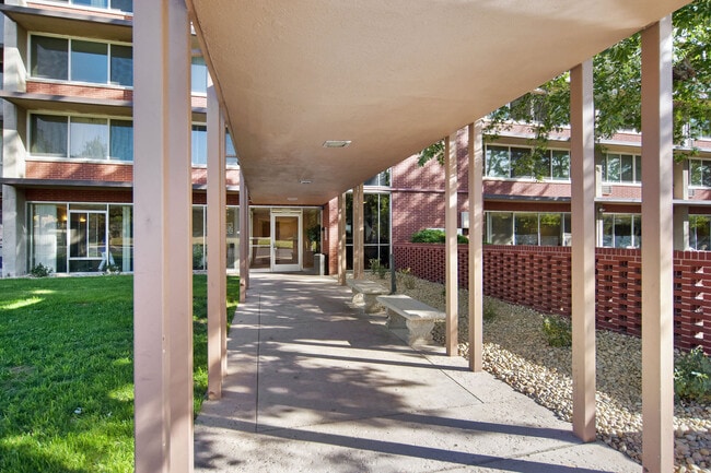
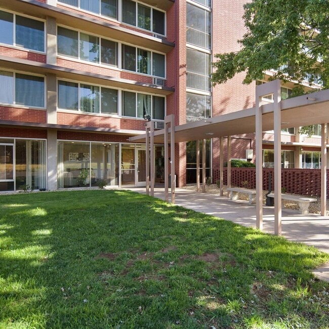
About Columbine Towers
When it comes to contemporary and pet-friendly, low-income tax credit apartments, Broadway Lofts is at the top of the list. With our communitys ideal location, stylish floor plans, and amenity-rich community, your search for your next home ends here.
Columbine Towers is an apartment community located in Denver County and the 80219 ZIP Code. This area is served by the Denver County 1 attendance zone.
Ruby Hill is a fairly large neighborhood located just minutes south of downtown Denver, filled with gorgeous natural landmarks. Numerous parks, trails, and the South Platte River provide great areas for enjoying the outdoors, and Ruby Hill Park’s slopes are excellent for sledding in the winter (plus the views of the Denver skyline are unbeatable).
A string of shops and restaurants along Federal Boulevard to the west makes it easy to pick up your groceries or grab a quick bite to eat anytime. Several public schools in the neighborhood and the surrounding area ensure that local students are able to walk to class quickly and safely.
Learn more about living in Ruby HillCompare neighborhood and city base rent averages by bedroom.
| Ruby Hill | Denver, CO | |
|---|---|---|
| Studio | $820 | $1,396 |
| 1 Bedroom | $964 | $1,610 |
| 2 Bedrooms | $1,232 | $2,116 |
| 3 Bedrooms | $1,287 | $2,876 |
| Monday | 10am - 6pm |
|---|---|
| Tuesday | 10am - 6pm |
| Wednesday | 10am - 6pm |
| Thursday | 10am - 6pm |
| Friday | 10am - 6pm |
| Saturday | 10am - 5pm |
| Sunday | Closed |
| Colleges & Universities | Distance | ||
|---|---|---|---|
| Colleges & Universities | Distance | ||
| Drive: | 8 min | 3.8 mi | |
| Drive: | 11 min | 5.2 mi | |
| Drive: | 11 min | 5.2 mi | |
| Drive: | 12 min | 5.8 mi |


View GreatSchools Rating Methodology
Data provided by GreatSchools.org © 2026. All rights reserved.
Transportation options available in Denver include Evans, located 2.5 miles from Columbine Towers. Columbine Towers is near Denver International, located 30.0 miles or 42 minutes away.
| Transit / Subway | Distance | ||
|---|---|---|---|
| Transit / Subway | Distance | ||
|
|
Drive: | 6 min | 2.5 mi |
|
|
Drive: | 7 min | 3.2 mi |
|
|
Drive: | 6 min | 3.4 mi |
|
|
Drive: | 8 min | 3.7 mi |
|
|
Drive: | 8 min | 4.2 mi |
| Commuter Rail | Distance | ||
|---|---|---|---|
| Commuter Rail | Distance | ||
|
|
Drive: | 12 min | 5.7 mi |
|
|
Drive: | 12 min | 6.0 mi |
| Drive: | 15 min | 7.9 mi | |
| Drive: | 23 min | 7.9 mi | |
| Drive: | 15 min | 7.9 mi |
| Airports | Distance | ||
|---|---|---|---|
| Airports | Distance | ||
|
Denver International
|
Drive: | 42 min | 30.0 mi |
Time and distance from Columbine Towers.
| Shopping Centers | Distance | ||
|---|---|---|---|
| Shopping Centers | Distance | ||
| Walk: | 5 min | 0.3 mi | |
| Walk: | 6 min | 0.3 mi | |
| Walk: | 8 min | 0.4 mi |
| Parks and Recreation | Distance | ||
|---|---|---|---|
| Parks and Recreation | Distance | ||
|
Bear Creek Park
|
Drive: | 6 min | 3.2 mi |
|
Chamberlin & Mt. Evans Observatories
|
Drive: | 10 min | 4.4 mi |
|
Washington Park
|
Drive: | 11 min | 4.7 mi |
|
Civic Center Park
|
Drive: | 12 min | 5.8 mi |
|
History Colorado Center
|
Drive: | 12 min | 6.1 mi |
| Hospitals | Distance | ||
|---|---|---|---|
| Hospitals | Distance | ||
| Drive: | 6 min | 3.5 mi | |
| Drive: | 8 min | 3.8 mi | |
| Drive: | 9 min | 4.6 mi |
| Military Bases | Distance | ||
|---|---|---|---|
| Military Bases | Distance | ||
| Drive: | 49 min | 23.7 mi | |
| Drive: | 80 min | 64.5 mi | |
| Drive: | 89 min | 74.2 mi |
Columbine Towers Photos
-
Columbine Towers
-
-
-
-
Nearby Apartments
Within 50 Miles of Columbine Towers
-
The Julian at Sloan's Lake
1515 Julian St
Denver, CO 80204
$2,109 - $6,659 Plus Fees
1-3 Br 3.9 mi
-
The Penrose
3595 Wynkoop St
Denver, CO 80216
$1,892 - $3,597 Total Monthly Price
1-2 Br 6.4 mi
-
Park Place at Expo Apartments
10785 E Exposition Ave
Aurora, CO 80012
$959 - $2,274 Total Monthly Price
1-2 Br 8.6 mi
-
Hidden Lake Apartments
3791 W 68th Ave
Westminster, CO 80030
$915 - $1,881 Plus Fees
1-2 Br 9.4 mi
-
The Richfield
2134 S Richfield Way
Aurora, CO 80013
$1,023 - $2,772 Total Monthly Price
1-3 Br 12.7 mi
-
Parker Hilltop
19600 Clubhouse Dr
Parker, CO 80138
$1,584 - $3,887 Plus Fees
1-3 Br 18.4 mi
Columbine Towers does not offer in-unit laundry or shared facilities. Please contact the property to learn about nearby laundry options.
Utilities are not included in rent. Residents should plan to set up and pay for all services separately.
Contact this property for parking details.
Columbine Towers has studios to two-bedrooms with rent ranges from $1,962/mo. to $2,102/mo.
Yes, Columbine Towers welcomes pets. Breed restrictions, weight limits, and additional fees may apply. View this property's pet policy.
A good rule of thumb is to spend no more than 30% of your gross income on rent. Based on the lowest available rent of $1,962 for a studio, you would need to earn about $78,480 per year to qualify. Want to double-check your budget? Calculate how much rent you can afford with our Rent Affordability Calculator.
Columbine Towers is offering Specials for eligible applicants, with rental rates starting at $1,962.
While Columbine Towers does not offer Matterport 3D tours, renters can request a tour directly through our online platform.
Applicant has the right to provide the property manager or owner with a Portable Tenant Screening Report (PTSR) that is not more than 30 days old, as defined in § 38-12-902(2.5), Colorado Revised Statutes; and 2) if Applicant provides the property manager or owner with a PTSR, the property manager or owner is prohibited from: a) charging Applicant a rental application fee; or b) charging Applicant a fee for the property manager or owner to access or use the PTSR.
What Are Walk Score®, Transit Score®, and Bike Score® Ratings?
Walk Score® measures the walkability of any address. Transit Score® measures access to public transit. Bike Score® measures the bikeability of any address.
What is a Sound Score Rating?
A Sound Score Rating aggregates noise caused by vehicle traffic, airplane traffic and local sources
1750 S Federal Blvd
Denver, CO 80219