
Williamsburg
200 W Galbraith Rd,
Cincinnati, OH 45215
$718 - $2,777
Studio - 3 Beds
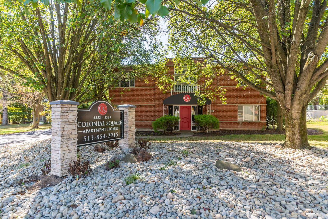
A Renovated and Spacious Retreat in Western Hills! - Welcome home to your new spacious and tastefully renovated apartment home at The Colonial Square Apartments. Colonial Square offers a secluded private community surrounded by mature trees and private homes. The property grants easy access to I-74, Harrison Avenue, and Glenway Avenue which is home to great Shopping, Retail, and Grocery Outlets. All of these locations will be at your doorstep when you call this community home! Come and see our newly renovated community! Apply Now while availability remains!
Colonial Square is an apartment community located in Hamilton County and the 45238 ZIP Code. This area is served by the Cincinnati Public Schools attendance zone.
Unique Features
Air Conditioning
Yard
Refrigerator
Tub/Shower
Situated about five miles northwest of Downtown Cincinnati, Westwood is the largest neighborhood in the city. Residents flock to Westwood for its many affordable historic homes and modern apartments available for rent in addition to its close proximity to I-74, I-75, and all that Downtown Cincinnati has to offer.
While Westwood is a predominantly residential neighborhood, it is also home to a slew of convenient stores and restaurants. Shopping opportunities abound in Westwood, with plenty of national retailers in Western Hills Plaza and local shops in the growing Town Hall District. Numerous neighborhood parks provide ample space to enjoy the outdoors in town as well as the sprawling 1,400-acre Mount Airy Forest, which is partially located in Westwood.
Learn more about living in WestwoodCompare neighborhood and city base rent averages by bedroom.
| Westwood | Cincinnati, OH | |
|---|---|---|
| Studio | $582 | $1,066 |
| 1 Bedroom | $777 | $1,144 |
| 2 Bedrooms | $1,026 | $1,436 |
| 3 Bedrooms | $1,320 | $1,749 |
| Colleges & Universities | Distance | ||
|---|---|---|---|
| Colleges & Universities | Distance | ||
| Drive: | 10 min | 4.4 mi | |
| Drive: | 16 min | 6.4 mi | |
| Drive: | 14 min | 6.7 mi | |
| Drive: | 16 min | 7.1 mi |


Transportation options available in Cincinnati include Brewery District Station - Elm & Henry, located 5.6 miles from Colonial Square. Colonial Square is near Cincinnati/Northern Kentucky International, located 19.9 miles or 38 minutes away.
| Transit / Subway | Distance | ||
|---|---|---|---|
| Transit / Subway | Distance | ||
| Drive: | 13 min | 5.6 mi | |
| Drive: | 14 min | 5.8 mi | |
| Drive: | 14 min | 5.9 mi | |
| Drive: | 14 min | 6.0 mi | |
| Drive: | 14 min | 6.1 mi |
| Commuter Rail | Distance | ||
|---|---|---|---|
| Commuter Rail | Distance | ||
|
|
Drive: | 14 min | 5.9 mi |
| Airports | Distance | ||
|---|---|---|---|
| Airports | Distance | ||
|
Cincinnati/Northern Kentucky International
|
Drive: | 38 min | 19.9 mi |
Scores provided by
Traffic
-Airport
-Businesses
-Scores provided by
HowLoud What is a Sound Score Rating? A Sound Score Rating aggregates noise caused by vehicle traffic, airplane traffic and local sources. How It WorksTime and distance from Colonial Square.
| Shopping Centers | Distance | ||
|---|---|---|---|
| Shopping Centers | Distance | ||
| Walk: | 11 min | 0.6 mi | |
| Walk: | 14 min | 0.7 mi | |
| Walk: | 16 min | 0.8 mi |
| Parks and Recreation | Distance | ||
|---|---|---|---|
| Parks and Recreation | Distance | ||
|
Mt. Airy Forest
|
Drive: | 10 min | 3.8 mi |
|
Imago Earth Center
|
Drive: | 11 min | 4.1 mi |
|
Embshoff Woods
|
Drive: | 13 min | 4.7 mi |
|
Wilson Commons
|
Drive: | 13 min | 4.8 mi |
|
Buttercup Valley
|
Drive: | 13 min | 5.3 mi |
| Hospitals | Distance | ||
|---|---|---|---|
| Hospitals | Distance | ||
| Drive: | 10 min | 3.9 mi | |
| Drive: | 13 min | 5.9 mi | |
| Drive: | 16 min | 6.7 mi |
| Military Bases | Distance | ||
|---|---|---|---|
| Military Bases | Distance | ||
| Drive: | 76 min | 56.1 mi | |
| Drive: | 82 min | 61.2 mi | |
| Drive: | 84 min | 64.5 mi |
What Are Walk Score®, Transit Score®, and Bike Score® Ratings?
Walk Score® measures the walkability of any address. Transit Score® measures access to public transit. Bike Score® measures the bikeability of any address.
What is a Sound Score Rating?
A Sound Score Rating aggregates noise caused by vehicle traffic, airplane traffic and local sources.

3353 Queen City Ave
Cincinnati, OH 45238


