
7 West 7th Apartments
7 W 7th St,
Cincinnati, OH 45202
$1,607 - $5,145
1-3 Beds
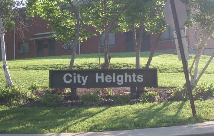

City Heights in Covington, KY is ready for you to visit. In a location on Todd Ct. in Covington's 41011 area, you can easily connect with a number of attractions. At this community, you'll have a wide selection of features and amenities like . The community staff is ready and waiting to show you our community. Stop by the leasing office to talk about your next apartment.
City Heights is an apartment community located in Kenton County and the 41011 ZIP Code. This area is served by the Covington Independent attendance zone.
Northern Kentucky is a sprawling region located just south of Cincinnati, Ohio. The Ohio River hugs the northern, eastern, and western portions of the region, serving as a scenic destination for all kinds of outdoor recreation throughout the year. Florence, Dayton, Newport, Covington, Burlington, and Highland Heights are among the many communities included in the Northern Kentucky region.
Each community in Northern Kentucky offers its own unique identity and sense of character. The rentals in the area are just as diverse as Northern Kentucky itself, ranging from luxury apartments to charming houses and everything in between. Getting around the region is a breeze with convenience to Interstates 71, 75, 275, and 471.
Learn more about living in Northern KentuckyCompare neighborhood and city base rent averages by bedroom.
| Northern Kentucky | Covington, KY | |
|---|---|---|
| Studio | $1,001 | $1,284 |
| 1 Bedroom | $1,220 | $1,371 |
| 2 Bedrooms | $1,444 | $1,845 |
| 3 Bedrooms | $1,733 | $1,613 |
| Colleges & Universities | Distance | ||
|---|---|---|---|
| Colleges & Universities | Distance | ||
| Drive: | 13 min | 6.1 mi | |
| Drive: | 17 min | 7.5 mi | |
| Drive: | 17 min | 8.3 mi | |
| Drive: | 17 min | 9.4 mi |


Transportation options available in Covington include The Banks Station, 2Nd & Main, located 4.2 miles from City Heights. City Heights is near Cincinnati/Northern Kentucky International, located 12.0 miles or 26 minutes away.
| Transit / Subway | Distance | ||
|---|---|---|---|
| Transit / Subway | Distance | ||
| Drive: | 10 min | 4.2 mi | |
| Drive: | 11 min | 4.3 mi | |
| Drive: | 11 min | 4.4 mi | |
| Drive: | 12 min | 4.5 mi | |
| Drive: | 12 min | 4.5 mi |
| Commuter Rail | Distance | ||
|---|---|---|---|
| Commuter Rail | Distance | ||
|
|
Drive: | 13 min | 5.2 mi |
| Airports | Distance | ||
|---|---|---|---|
| Airports | Distance | ||
|
Cincinnati/Northern Kentucky International
|
Drive: | 26 min | 12.0 mi |
Time and distance from City Heights.
| Shopping Centers | Distance | ||
|---|---|---|---|
| Shopping Centers | Distance | ||
| Drive: | 5 min | 1.6 mi | |
| Drive: | 7 min | 2.4 mi | |
| Drive: | 10 min | 3.7 mi |
| Parks and Recreation | Distance | ||
|---|---|---|---|
| Parks and Recreation | Distance | ||
|
Newport Aquarium
|
Drive: | 13 min | 4.0 mi |
|
John G. & Phyllis W. Smale Riverfront Park
|
Drive: | 11 min | 4.2 mi |
|
OMNIMAX Theater
|
Drive: | 13 min | 5.2 mi |
|
Cincinnati History Museum
|
Drive: | 14 min | 5.2 mi |
|
Theodore M. Berry Friendship Park
|
Drive: | 12 min | 5.9 mi |
| Hospitals | Distance | ||
|---|---|---|---|
| Hospitals | Distance | ||
| Drive: | 14 min | 4.9 mi | |
| Drive: | 12 min | 5.3 mi | |
| Drive: | 15 min | 6.7 mi |
| Military Bases | Distance | ||
|---|---|---|---|
| Military Bases | Distance | ||
| Drive: | 80 min | 58.7 mi | |
| Drive: | 86 min | 63.8 mi | |
| Drive: | 88 min | 67.1 mi |
What Are Walk Score®, Transit Score®, and Bike Score® Ratings?
Walk Score® measures the walkability of any address. Transit Score® measures access to public transit. Bike Score® measures the bikeability of any address.
What is a Sound Score Rating?
A Sound Score Rating aggregates noise caused by vehicle traffic, airplane traffic and local sources

2500 Todd Ct
Covington, KY 41011


