
AdMo Heights
1777 Columbia Rd NW,
Washington, DC 20009
$1,991 - $2,793
Studio - 1 Bed

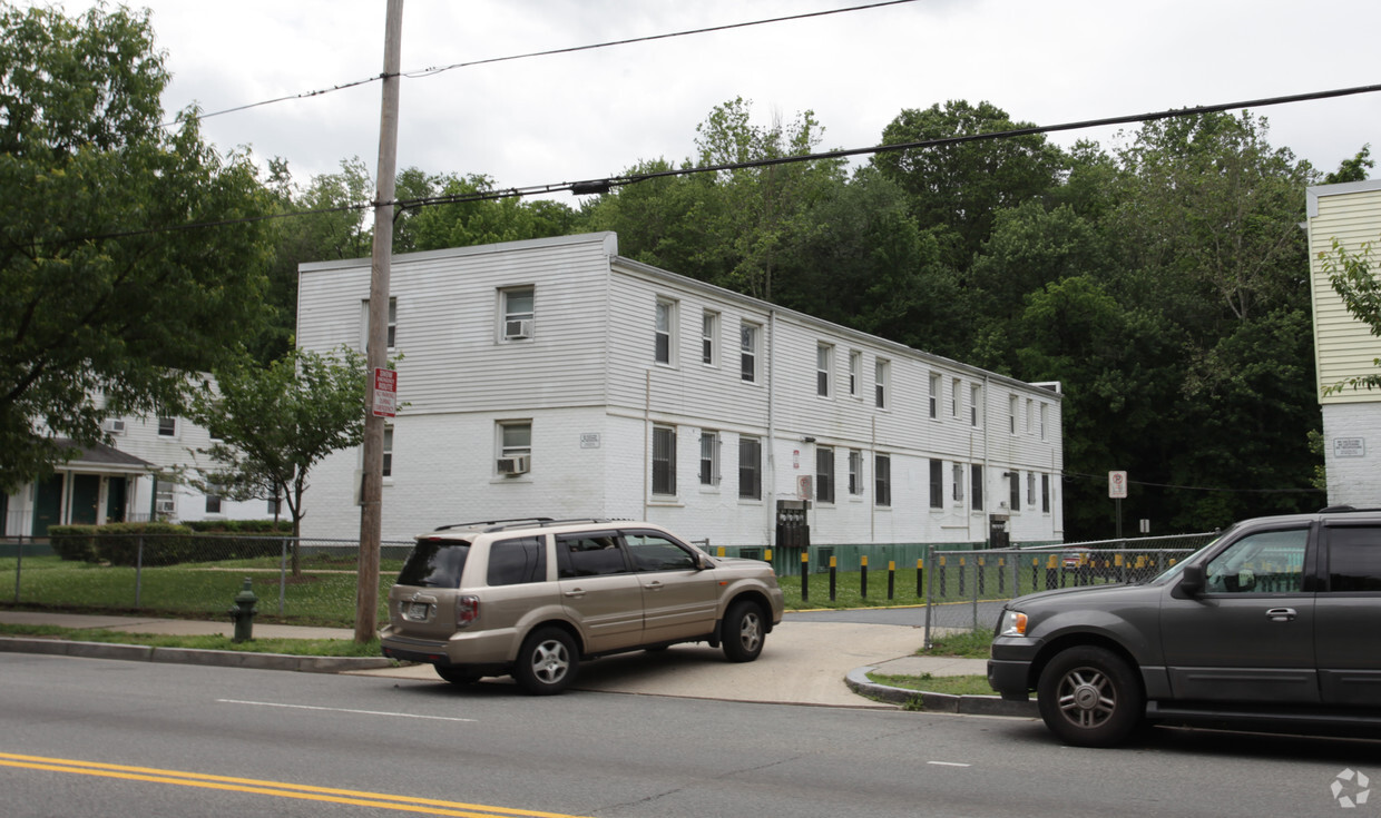
At Benning Road Housing Cooperative, experience fine living. The 20019 location has much to offer its residents. The leasing team is ready to take you for a tour. You'll experience a great selection of amenities at this community like high-speed internet access, convenient on-site parking options, and smoke free options. Come see Benning Road Housing Cooperative today.
Benning Road Housing Cooperative is an apartment community located in District of Columbia County and the 20019 ZIP Code. This area is served by the District Of Columbia Public Schools attendance zone.
Dishwasher
High Speed Internet Access
Refrigerator
Disposal
The residential neighborhood of Fort Dupont sits just east of the Anacostia River in Southeast Washington, DC. The neighborhood has ample green space provided by two adjacent parks — Fort Circle Park and Fort Chaplin Park — and distinguishes itself within the Greater Anacostia area by housing the only public indoor ice rink in Washington, DC.
There’s a diverse mix of rentals in Fort Dupont, from more recent and upscale developments to long-standing apartment homes closer to the Anacostia River. Proximity to the Benning Road Metro Station makes Fort Dupont perfect for the Capitol Hill commuter who wishes to reside outside the bustle of DC.
Learn more about living in Fort Dupont| Colleges & Universities | Distance | ||
|---|---|---|---|
| Colleges & Universities | Distance | ||
| Drive: | 9 min | 4.1 mi | |
| Drive: | 9 min | 5.1 mi | |
| Drive: | 9 min | 5.1 mi | |
| Drive: | 12 min | 6.1 mi |


Transportation options available in Washington include Benning Road, located 0.4 mile from Benning Road Housing Cooperative. Benning Road Housing Cooperative is near Ronald Reagan Washington Ntl, located 10.6 miles or 19 minutes away, and Baltimore/Washington International Thurgood Marshall, located 29.1 miles or 44 minutes away.
| Transit / Subway | Distance | ||
|---|---|---|---|
| Transit / Subway | Distance | ||
|
|
Walk: | 8 min | 0.4 mi |
|
|
Drive: | 4 min | 1.8 mi |
|
Capitol Heights, Blue/Silver Line Center Platform
|
Drive: | 5 min | 1.9 mi |
|
|
Drive: | 6 min | 2.3 mi |
| Drive: | 4 min | 2.4 mi |
| Commuter Rail | Distance | ||
|---|---|---|---|
| Commuter Rail | Distance | ||
|
|
Drive: | 8 min | 4.4 mi |
|
|
Drive: | 9 min | 4.5 mi |
|
|
Drive: | 11 min | 5.9 mi |
|
|
Drive: | 11 min | 5.9 mi |
|
|
Drive: | 14 min | 6.9 mi |
| Airports | Distance | ||
|---|---|---|---|
| Airports | Distance | ||
|
Ronald Reagan Washington Ntl
|
Drive: | 19 min | 10.6 mi |
|
Baltimore/Washington International Thurgood Marshall
|
Drive: | 44 min | 29.1 mi |
Time and distance from Benning Road Housing Cooperative.
| Shopping Centers | Distance | ||
|---|---|---|---|
| Shopping Centers | Distance | ||
| Walk: | 6 min | 0.4 mi | |
| Drive: | 3 min | 1.1 mi | |
| Drive: | 4 min | 1.2 mi |
| Parks and Recreation | Distance | ||
|---|---|---|---|
| Parks and Recreation | Distance | ||
|
Fort Dupont Park
|
Drive: | 4 min | 1.3 mi |
|
Kingman and Heritage Island Park
|
Drive: | 4 min | 2.3 mi |
|
Washington Youth Garden
|
Drive: | 7 min | 3.8 mi |
|
Frederick Douglass National Historic Site
|
Drive: | 11 min | 4.2 mi |
|
National Arboretum
|
Drive: | 11 min | 4.6 mi |
| Hospitals | Distance | ||
|---|---|---|---|
| Hospitals | Distance | ||
| Drive: | 9 min | 4.3 mi | |
| Drive: | 13 min | 5.0 mi | |
| Drive: | 13 min | 5.3 mi |
| Military Bases | Distance | ||
|---|---|---|---|
| Military Bases | Distance | ||
| Drive: | 10 min | 4.7 mi | |
| Drive: | 13 min | 6.9 mi |
What Are Walk Score®, Transit Score®, and Bike Score® Ratings?
Walk Score® measures the walkability of any address. Transit Score® measures access to public transit. Bike Score® measures the bikeability of any address.
What is a Sound Score Rating?
A Sound Score Rating aggregates noise caused by vehicle traffic, airplane traffic and local sources
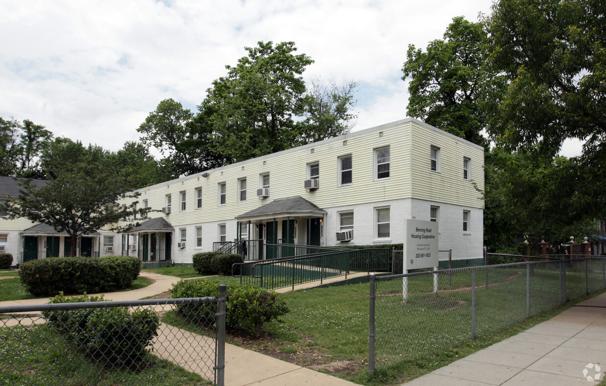
4625 Benning Rd SE
Washington, DC 20019


