
The Village at Town Center
6410 Schmidt Ln,
El Cerrito, CA 94530
$1,990 - $2,980
Studio - 2 Beds

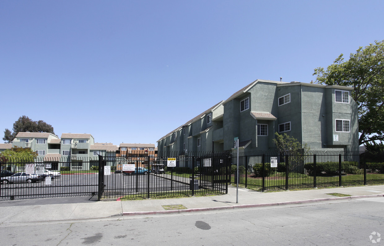
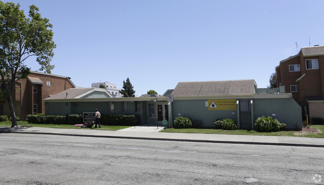
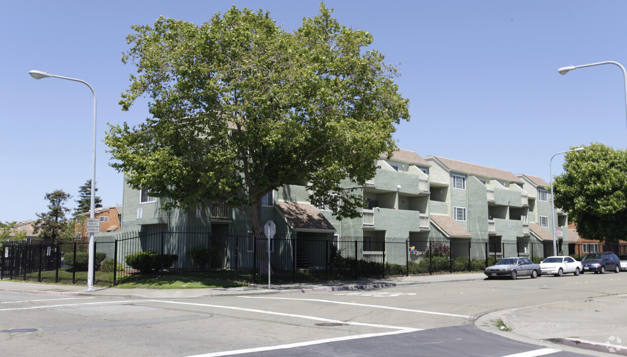

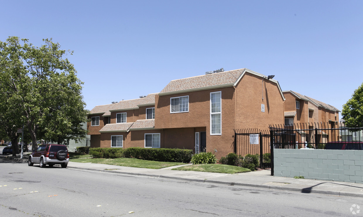
Barrett Terrace Apartments offers a mixture of comfort and quality. The 700 Barrett Ave location in the Iron Triangle neighborhood of Richmond has much to offer its residents. The leasing staff is ready to help you find the best floor plan for your lifestyle. Leasing 1 to 4 bedroom floor plans. It's time to find your new home. Contact or stop by Barrett Terrace Apartments to see available floor plans!
Barrett Terrace Apartments is an apartment community located in Contra Costa County and the 94801 ZIP Code. This area is served by the West Contra Costa Unified attendance zone.
Laundry Facilities
Recycling
Business Center
24 Hour Access
Air Conditioning
High Speed Internet Access
Refrigerator
Patio
The Iron Triangle neighborhood sits in the heart of Central Richmond, California. With the area being largely residential, most rentals reside in the upper part of the triangle and an easy three-mile commute north to Point Richmond, a major shipping and industrial area. To the south, Berkeley and Oakland lie roughly 10 miles away via Interstate 580.
Locals often head for the Miller/Knox Regional Shoreline for a bit of jogging or cycling, or to cast a line off the fishing pier. Wade into the waters of San Francisco Bay at Keller Beach on the northern end of the park, or enjoy a show at the Masquers Playhouse, also just outside the Iron Triangle's southern border. Most eateries sit along Interstate 580, including several fast food chains. The MacDonald 80 Shopping Center lies roughly three miles east of the neighborhood. Drive another three miles and find Wildcat Canyon Regional Park and the Tilden Nature Area.
Learn more about living in Iron TriangleCompare neighborhood and city base rent averages by bedroom.
| Iron Triangle | Richmond, CA | |
|---|---|---|
| Studio | $901 | $1,099 |
| 1 Bedroom | $905 | $1,716 |
| 2 Bedrooms | $1,658 | $2,070 |
| 3 Bedrooms | $2,151 | $2,491 |
| Colleges & Universities | Distance | ||
|---|---|---|---|
| Colleges & Universities | Distance | ||
| Drive: | 7 min | 3.2 mi | |
| Drive: | 16 min | 9.2 mi | |
| Drive: | 20 min | 10.3 mi | |
| Drive: | 19 min | 11.3 mi |


Transportation options available in Richmond include Richmond Station, located 0.6 mile from Barrett Terrace Apartments. Barrett Terrace Apartments is near Metro Oakland International, located 22.3 miles or 31 minutes away, and San Francisco International, located 29.9 miles or 43 minutes away.
| Transit / Subway | Distance | ||
|---|---|---|---|
| Transit / Subway | Distance | ||
|
|
Walk: | 10 min | 0.6 mi |
|
|
Drive: | 6 min | 3.0 mi |
|
|
Drive: | 9 min | 5.1 mi |
|
|
Drive: | 14 min | 8.6 mi |
|
|
Drive: | 16 min | 9.3 mi |
| Commuter Rail | Distance | ||
|---|---|---|---|
| Commuter Rail | Distance | ||
| Walk: | 9 min | 0.5 mi | |
|
|
Drive: | 10 min | 7.4 mi |
| Drive: | 17 min | 9.5 mi | |
| Drive: | 14 min | 9.7 mi | |
| Drive: | 17 min | 10.4 mi |
| Airports | Distance | ||
|---|---|---|---|
| Airports | Distance | ||
|
Metro Oakland International
|
Drive: | 31 min | 22.3 mi |
|
San Francisco International
|
Drive: | 43 min | 29.9 mi |
Time and distance from Barrett Terrace Apartments.
| Shopping Centers | Distance | ||
|---|---|---|---|
| Shopping Centers | Distance | ||
| Walk: | 8 min | 0.4 mi | |
| Drive: | 4 min | 1.8 mi | |
| Drive: | 3 min | 2.0 mi |
| Parks and Recreation | Distance | ||
|---|---|---|---|
| Parks and Recreation | Distance | ||
|
Rosie the Riveter WWII Home Front National Historical Park
|
Drive: | 5 min | 2.2 mi |
|
Marina Park & Green
|
Drive: | 5 min | 2.4 mi |
|
Miller/Knox Regional Shoreline
|
Drive: | 5 min | 2.6 mi |
|
Shimada Friendship Park
|
Drive: | 6 min | 3.1 mi |
|
Brooks Island Regional Preserve
|
Drive: | 10 min | 4.3 mi |
| Hospitals | Distance | ||
|---|---|---|---|
| Hospitals | Distance | ||
| Drive: | 18 min | 10.8 mi | |
| Drive: | 16 min | 11.8 mi | |
| Drive: | 16 min | 11.8 mi |
| Military Bases | Distance | ||
|---|---|---|---|
| Military Bases | Distance | ||
| Drive: | 7 min | 3.3 mi | |
| Drive: | 12 min | 5.7 mi | |
| Drive: | 24 min | 15.9 mi |
Pets Allowed Fitness Center In Unit Washer & Dryer High-Speed Internet Controlled Access EV Charging Rooftop Deck
Pets Allowed Pool Business Center Tennis Court
Pets Allowed Fitness Center In Unit Washer & Dryer High-Speed Internet Controlled Access Concierge Rooftop Deck
What Are Walk Score®, Transit Score®, and Bike Score® Ratings?
Walk Score® measures the walkability of any address. Transit Score® measures access to public transit. Bike Score® measures the bikeability of any address.
What is a Sound Score Rating?
A Sound Score Rating aggregates noise caused by vehicle traffic, airplane traffic and local sources
700 Barrett Ave
Richmond, CA 94801


