
IMT Desert Palm Village
1215 E Vista Del Cerro Dr,
Tempe, AZ 85281
$1,245 - $1,765
1-3 Beds
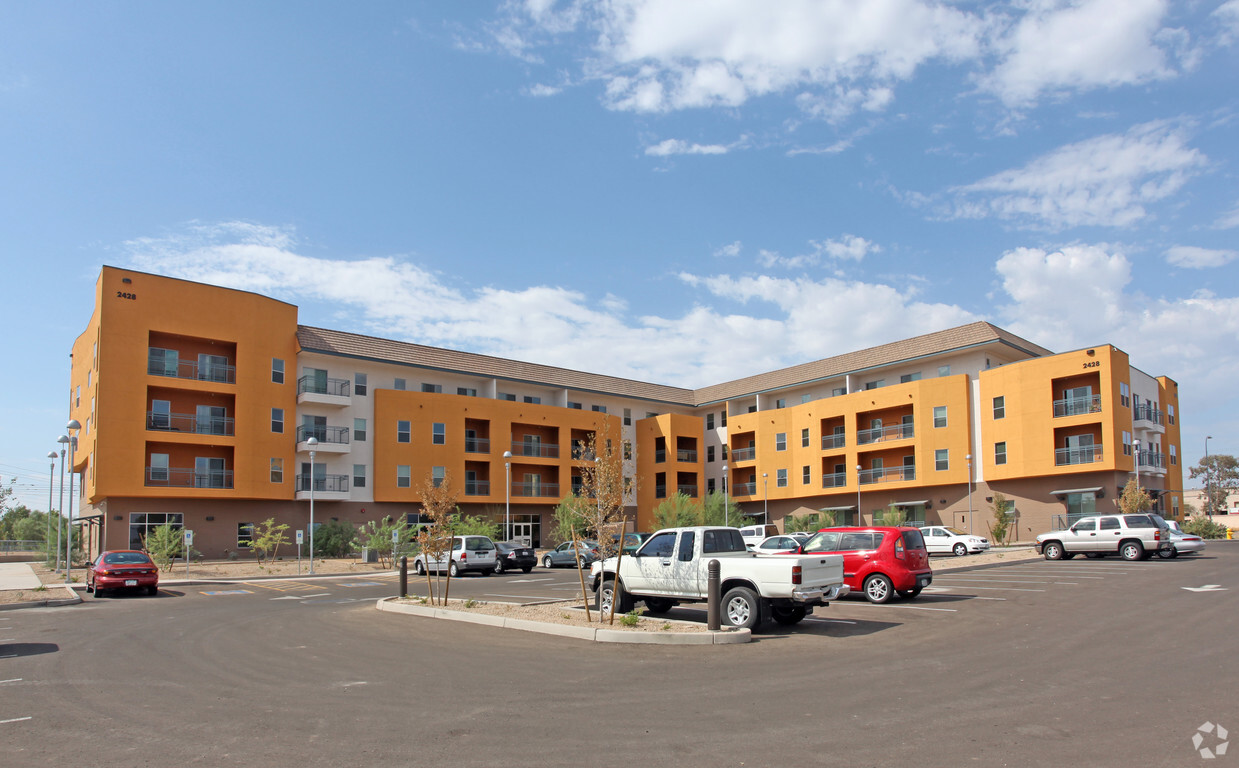
Experience Tempe living at Apache ASL Trails Apartments. The 2428 E. Apache Blvd location in Tempe's 85281 Zip code is an ideal place to move. Make a visit to see the available floorplan options. The professional leasing staff is waiting to show you all that this community has in store. Stop by the leasing office to ask about the current floorplan availability.
Apache ASL Trails Apartments is an apartment community located in Maricopa County and the 85281 ZIP Code. This area is served by the Tempe attendance zone.
Washer/Dryer
Air Conditioning
Dishwasher
High Speed Internet Access
The Apache neighborhood in Tempe is conveniently located near Price and Red Mountain Freeways. The Valley Metro Rail transit system makes it convenient to travel throughout Tempe. For quick bites, residents enjoy Waffle House and Jack in the Box. Be sure to sip a refreshing craft beer on the Four Peaks Brewing Company patio, or head on over to the Sleepy Dog Saloon for soft beer pretzels.
The Tempe Marketplace in Apache is an excellent place to eat and shop. Restaurants in this outdoor mall include California Pizza Kitchen, King’s Fish House, and the Keg Steakhouse. With stores like Nordstrom Rack, Old Navy, and Ulta Beauty, there’s a shop for every budget. Sloan Park, the spring training facility of the Chicago Cubs, is nearby. Students attending Arizona State University enjoy a quick commute to campus, since Apache is just two miles away.
Learn more about living in ApacheCompare neighborhood and city base rent averages by bedroom.
| Apache | Tempe, AZ | |
|---|---|---|
| Studio | $1,402 | $1,353 |
| 1 Bedroom | $1,476 | $1,461 |
| 2 Bedrooms | $1,870 | $1,739 |
| 3 Bedrooms | $2,573 | $2,550 |
| Colleges & Universities | Distance | ||
|---|---|---|---|
| Colleges & Universities | Distance | ||
| Drive: | 7 min | 3.0 mi | |
| Drive: | 7 min | 3.5 mi | |
| Drive: | 8 min | 3.6 mi | |
| Drive: | 8 min | 3.7 mi |


Transportation options available in Tempe include Price-101 Fwy/Apache Blvd, located 0.1 mile from Apache ASL Trails Apartments. Apache ASL Trails Apartments is near Phoenix Sky Harbor International, located 8.7 miles or 15 minutes away, and Phoenix-Mesa Gateway, located 20.1 miles or 31 minutes away.
| Transit / Subway | Distance | ||
|---|---|---|---|
| Transit / Subway | Distance | ||
|
|
Walk: | 2 min | 0.1 mi |
|
|
Walk: | 17 min | 0.9 mi |
|
|
Walk: | 17 min | 0.9 mi |
|
|
Drive: | 3 min | 1.3 mi |
|
|
Drive: | 3 min | 1.8 mi |
| Commuter Rail | Distance | ||
|---|---|---|---|
| Commuter Rail | Distance | ||
|
|
Drive: | 41 min | 31.0 mi |
| Airports | Distance | ||
|---|---|---|---|
| Airports | Distance | ||
|
Phoenix Sky Harbor International
|
Drive: | 15 min | 8.7 mi |
|
Phoenix-Mesa Gateway
|
Drive: | 31 min | 20.1 mi |
Time and distance from Apache ASL Trails Apartments.
| Shopping Centers | Distance | ||
|---|---|---|---|
| Shopping Centers | Distance | ||
| Walk: | 14 min | 0.8 mi | |
| Walk: | 15 min | 0.8 mi | |
| Drive: | 3 min | 1.3 mi |
| Parks and Recreation | Distance | ||
|---|---|---|---|
| Parks and Recreation | Distance | ||
|
i.d.e.a. Museum
|
Drive: | 6 min | 3.0 mi |
|
Arizona Museum of Natural History
|
Drive: | 6 min | 3.3 mi |
|
ASU Center for Meteorite Studies
|
Drive: | 8 min | 3.5 mi |
|
Desert Arboretum Park
|
Drive: | 7 min | 3.6 mi |
|
Papago Park
|
Drive: | 11 min | 5.5 mi |
| Hospitals | Distance | ||
|---|---|---|---|
| Hospitals | Distance | ||
| Drive: | 4 min | 2.4 mi | |
| Drive: | 9 min | 6.0 mi | |
| Drive: | 11 min | 6.5 mi |
| Military Bases | Distance | ||
|---|---|---|---|
| Military Bases | Distance | ||
| Drive: | 19 min | 10.7 mi | |
| Drive: | 46 min | 34.4 mi | |
| Drive: | 109 min | 89.8 mi |
Pets Allowed Fitness Center Pool Dishwasher Grill Hardwood Floors Individual Locking Bedrooms
Pets Allowed Fitness Center Pool Dishwasher In Unit Washer & Dryer Controlled Access EV Charging
What Are Walk Score®, Transit Score®, and Bike Score® Ratings?
Walk Score® measures the walkability of any address. Transit Score® measures access to public transit. Bike Score® measures the bikeability of any address.
What is a Sound Score Rating?
A Sound Score Rating aggregates noise caused by vehicle traffic, airplane traffic and local sources

2428 E Apache Blvd
Tempe, AZ 85281


