
$4,500
Total Monthly Price
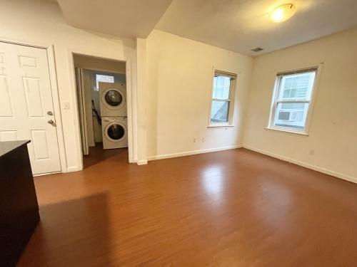
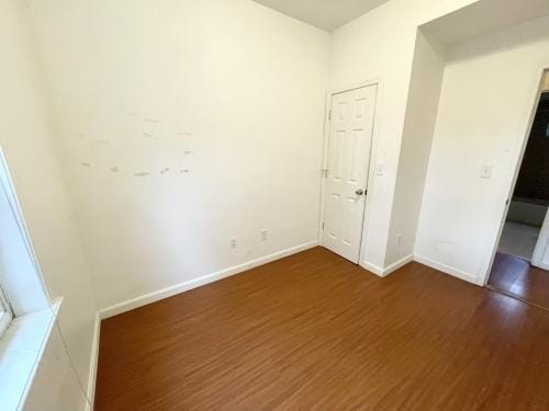
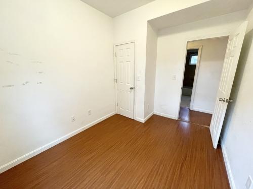
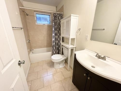
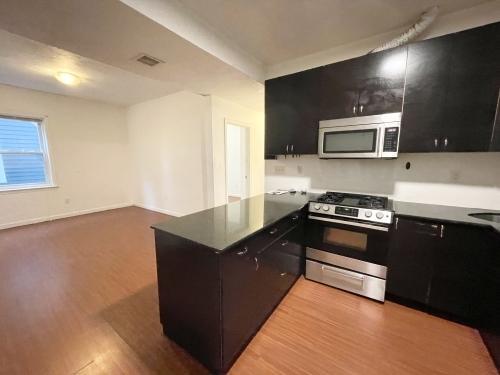
93 Hillside St
Newton, MA
Favorites
93 Hillside St

Favorites
Check Back Soon for Upcoming Availability
| Beds | Baths | Average SF |
|---|---|---|
| 4 Bedrooms 4 Bedrooms 4 Br | 1 Bath 1 Bath 1 Ba | — |
About This Property
APS46058470 - Please inquire for more information!Bus: 39 Huntington Ave @ Wigglesworth St (0.28 mi)Bus: 41 Centre St @ Cedar St (0.46 mi)Bus: 22 Columbus Ave @ New Cedar St (0.38 mi)Bus: 14 107 Heath St opp Bickford Ave (0.32 mi)Tram: E Fenwood Road (0.22 mi)Subway: Orange Line Roxbury Crossing (0.43 mi)Bus: 66 Tremont St @ Saint Alphonsus St (0.19 mi)Bus: 60 Brookline Ave opp Aspinwall Ave (0.48 mi)Bus: 47 Longwood Ave @ Blackfan St (0.49 mi)
93 Hillside St is a condo located in Middlesex County and the ZIP Code. This area is served by the Newton School District attendance zone.
93 Hillside St,
Newton,
MA
Located seven miles west of downtown Boston, Newton combines residential comfort with easy city access. Known as "The Garden City," this community features tree-lined streets, expansive parks, and thirteen distinct villages. The housing market reflects the area's desirability, with current average rents ranging from $2,415 for studios to $4,899 for three-bedroom homes. Crystal Lake offers swimming and outdoor recreation, while the historic Heartbreak Hill, a challenging section of the Boston Marathon route, provides scenic views of the area.
Newton's educational landscape includes Boston College's Gothic campus in Chestnut Hill and highly regarded public schools. Housing options span from apartments near MBTA stations in Newton Centre to historic Victorian homes in West Newton and contemporary residences in Newtonville. The Newton History Museum at Jackson Homestead, a documented Underground Railroad site, preserves local history.
Learn more about living in Newton
Education
| Colleges & Universities | Distance | ||
|---|---|---|---|
| Colleges & Universities | Distance | ||
| Drive: | 7 min | 3.5 mi | |
| Drive: | 9 min | 3.9 mi | |
| Drive: | 12 min | 5.9 mi | |
| Drive: | 13 min | 6.2 mi |
93 Hillside St is within 7 minutes or 3.5 miles from Boston College. It is also near Boston College, Brighton and Babson College.
Schools


Public Elementary School
Grades K-5
263 Students
Nearby
Public Elementary School
Grades K-5
389 Students
Attendance Zone
Public Middle School
Grades 6-8
698 Students
Attendance Zone
Public High School
Grades 9-12
1,865 Students
Attendance Zone
Private Elementary School
Grades PK-5
319 Students
Nearby
Private Middle & High School
Grades 6-12
Nearby
School data provided by
 The GreatSchools Rating helps parents compare schools within a state based on a variety of school quality indicators and provides a helpful picture of how effectively each school serves all of its students. Ratings are on a scale of 1 (below average) to 10 (above average) and can include test scores, college readiness, academic progress, advanced courses, equity, discipline and attendance data. We also advise parents to visit schools, consider other information on school performance and programs, and consider family needs as part of the school selection process.
View GreatSchools Rating Methodology
Data provided by GreatSchools.org © 2026. All rights reserved.
View GreatSchools Rating Methodology
Data provided by GreatSchools.org © 2026. All rights reserved.
Transportation options available in Newton include Newton Highlands Station, located 0.4 mile from 93 Hillside St. 93 Hillside St is near General Edward Lawrence Logan International, located 13.7 miles or 25 minutes away, and Worcester Regional, located 41.6 miles or 60 minutes away.
| Transit / Subway | Distance | ||
|---|---|---|---|
| Transit / Subway | Distance | ||
|
|
Walk: | 7 min | 0.4 mi |
|
|
Walk: | 10 min | 0.6 mi |
|
|
Drive: | 4 min | 1.4 mi |
|
|
Drive: | 4 min | 1.6 mi |
|
|
Drive: | 6 min | 2.8 mi |
| Commuter Rail | Distance | ||
|---|---|---|---|
| Commuter Rail | Distance | ||
|
|
Drive: | 6 min | 3.1 mi |
|
|
Drive: | 8 min | 3.7 mi |
|
|
Drive: | 10 min | 4.5 mi |
|
|
Drive: | 12 min | 5.9 mi |
|
|
Drive: | 13 min | 6.7 mi |
| Airports | Distance | ||
|---|---|---|---|
| Airports | Distance | ||
|
General Edward Lawrence Logan International
|
Drive: | 25 min | 13.7 mi |
|
Worcester Regional
|
Drive: | 60 min | 41.6 mi |
Walkability Near 93 Hillside St Newton, MA
Getting Around
 What do Walkability, Transit, Drivability, and Bikeability mean?
Walkability measures the walking distance to day-to-day needs.
Transit measures access to public transportation.
Drivability measures congestion, parking availability, and access to major roads.
Bikeability measures the suitability for cycling.
How It Works
What do Walkability, Transit, Drivability, and Bikeability mean?
Walkability measures the walking distance to day-to-day needs.
Transit measures access to public transportation.
Drivability measures congestion, parking availability, and access to major roads.
Bikeability measures the suitability for cycling.
How It Works
Moderately Walkable
Walkability
60
/ 100
Some Public Transit
Transit
50
/ 100
Very Drivable
Drivability
80
/ 100
Moderately Bikeable
Bikeability
70
/ 100
Scores provided by
-
Soundscore™
-
/ 100
Traffic
-Airport
-Businesses
-Scores provided by
HowLoud What is a Sound Score Rating? A Sound Score Rating aggregates noise caused by vehicle traffic, airplane traffic and local sources. How It WorksTime and distance from 93 Hillside St.
| Shopping Centers | Distance | ||
|---|---|---|---|
| Shopping Centers | Distance | ||
| Walk: | 19 min | 1.0 mi | |
| Drive: | 3 min | 1.2 mi | |
| Drive: | 3 min | 1.2 mi |
93 Hillside St has 3 shopping centers within 1.2 miles, which is about a 3-minute drive. The miles and minutes will be for the farthest away property.
| Parks and Recreation | Distance | ||
|---|---|---|---|
| Parks and Recreation | Distance | ||
|
Hemlock Gorge Reservation
|
Drive: | 5 min | 2.1 mi |
|
Hammond Pond Reservation
|
Drive: | 5 min | 2.3 mi |
|
Cutler Park Reservation
|
Drive: | 6 min | 2.8 mi |
|
Chestnut Hill Reservation
|
Drive: | 7 min | 3.8 mi |
|
Brook Farm Historic Site
|
Drive: | 8 min | 4.2 mi |
93 Hillside St has 5 parks within 4.2 miles, including Hemlock Gorge Reservation, Hammond Pond Reservation, and Cutler Park Reservation.
| Hospitals | Distance | ||
|---|---|---|---|
| Hospitals | Distance | ||
| Drive: | 5 min | 2.5 mi | |
| Drive: | 8 min | 4.2 mi | |
| Drive: | 10 min | 4.6 mi |
93 Hillside St has 3 hospitals within 4.6 miles, the nearest is Newton - Wellesley Hospital which is 2.5 miles away and a 5 minute drive.
| Military Bases | Distance | ||
|---|---|---|---|
| Military Bases | Distance | ||
| Drive: | 16 min | 9.4 mi | |
| Drive: | 23 min | 13.3 mi | |
| Drive: | 48 min | 27.2 mi |
93 Hillside St has 3 military bases within 27.2 miles, the nearest is US Military Reservation which is 9.4 miles away and a 16 minute drive.
You May Also Like
-
31-33 Raymond Ave. Unit 33-2
31-33 Raymond Ave
Somerville, MA 02144
$4,800 Plus Fees
4 Br 12 Month Lease 7.2 mi
-
31-33 Raymond Ave. Unit 33-2
31-33 Raymond Ave
Somerville, MA 02144
$5,500 Plus Fees
4 Br 12 Month Lease 7.2 mi
-
31-33 Raymond Ave. Unit 33-3
31-33 Raymond Ave
Somerville, MA 02144
$5,000 Plus Fees
4 Br 12 Month Lease 7.2 mi
Similar Rentals Nearby
-
-

-

-

-

-

-

-

-
 4 Beds$4,400Total Monthly Price12 Month LeaseTotal Monthly Price NewPrices include all required monthly fees.Condo for Rent
 -


What Are Walk Score®, Transit Score®, and Bike Score® Ratings?
Walk Score® measures the walkability of any address. Transit Score® measures access to public transit. Bike Score® measures the bikeability of any address.
What is a Sound Score Rating?
A Sound Score Rating aggregates noise caused by vehicle traffic, airplane traffic and local sources.
93 Hillside St
Newton, MA