
$2,600 / Month
90 Safford St Unit 2
Quincy, MA 02170
Today
Favorites
832-668-9712
-
Bedrooms
2
-
Bathrooms
1
-
Square Feet
1,070 sq ft
-
Available
Available Now
90 Safford St Unit 2

Favorites
About This Home
$2,600 deposit,
Available Now
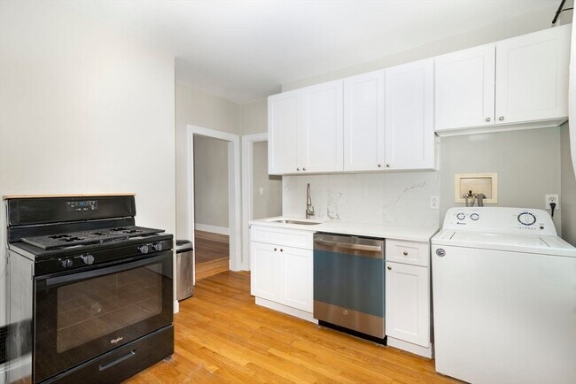
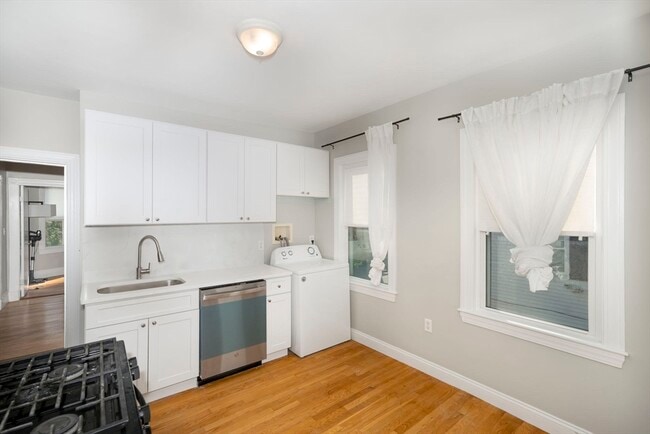
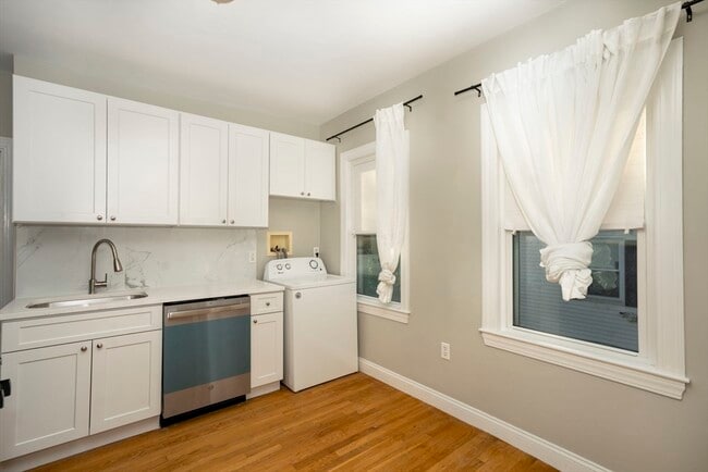
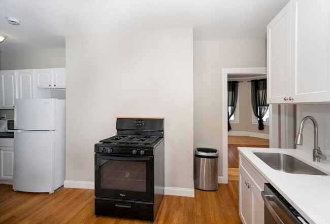
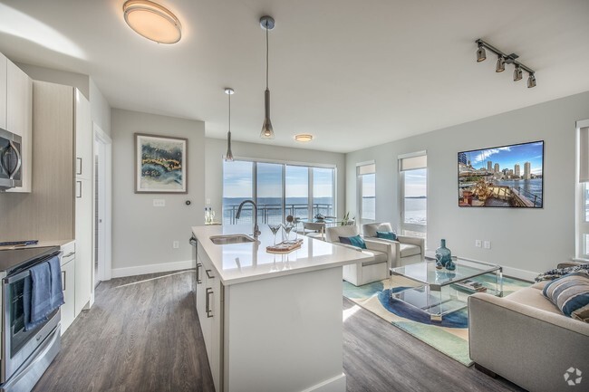
Spacious 2-bedroom apartment with a home office on the 2nd floor,featuring hardwood floors and a prime North Quincy/Wollaston location—less than a 10-minute walk to the Red Line T station! Excellent access to highways and shopping areas. This unit includes in-unit laundry,gas heating,and an updated kitchen and bath. Per owner: NO smoking. Good credit and references required. MLS# 73375964
90 Safford St is an apartment community located in Norfolk County and the 02170 ZIP Code.
* Price shown is base rent and may not include non-optional fees and utilities.
Price, availability, fees, and any applicable rent special are subject to change without notice.
* Square footage definitions vary. Displayed square footage is approximate.
Contact
- Listed by Danny Zheng | Keller Williams Realty
- Phone Number
-
Source
 MLS Property Information Network
The property listing data and information set forth herein were provided to MLS Property Information Network, Inc. from third party sources, including sellers, lessors and public records, and were compiled by MLS Property Information Network, Inc. The property listing data and information are for the personal, non-commercial use of consumers having a good faith interest in purchasing or leasing listed properties of the type displayed to them and may not be used for any purpose other than to identify prospective properties which such consumers may have a good faith interest in purchasing or leasing. MLS Property Information Network, Inc. and its subscribers disclaim any and all representations and warranties as to the accuracy of the property listing data and information set forth herein. All properties are subject to prior sale, change or withdrawal. Copyright © 2025 MLS Property Information Network, Inc. All rights reserved.
Location
Get Directions
Across the Neponset River from Downtown Boston lies the Quincy neighborhood of Montclair. Commuters drive eight miles north on Interstate 93 to reach downtown, while residents without a car enjoy easy access using several bus lines or the Red Line's North Quincy subway station. This quiet residential community of apartments and bungalow-style houses provides a small-town atmosphere within a larger urban environment.
There’s a diverse mix of cuisine that belies Montclair’s relatively small size. Most of Montclair's businesses are found along Hancock Street near North Quincy station. Residents gather at Assembly Bar on Sundays for comfort food while watching the New England Patriots.
Learn more about living in Montclair
Education
| Colleges & Universities | Distance | ||
|---|---|---|---|
| Colleges & Universities | Distance | ||
| Drive: | 10 min | 4.3 mi | |
| Drive: | 15 min | 6.0 mi | |
| Drive: | 13 min | 6.8 mi | |
| Drive: | 13 min | 7.0 mi |
90 Safford St Unit 2 is within 10 minutes or 4.3 miles from UMass Boston. It is also near Curry College and Northeastern University.
Transportation options available in Quincy include North Quincy Station, located 0.5 mile from 90 Safford St Unit 2. 90 Safford St Unit 2 is near General Edward Lawrence Logan International, located 9.7 miles or 17 minutes away.
| Transit / Subway | Distance | ||
|---|---|---|---|
| Transit / Subway | Distance | ||
|
|
Walk: | 9 min | 0.5 mi |
|
|
Walk: | 14 min | 0.8 mi |
|
|
Drive: | 6 min | 3.0 mi |
|
|
Drive: | 6 min | 3.0 mi |
|
|
Drive: | 7 min | 3.4 mi |
| Commuter Rail | Distance | ||
|---|---|---|---|
| Commuter Rail | Distance | ||
|
|
Drive: | 4 min | 2.0 mi |
|
|
Drive: | 7 min | 4.2 mi |
| Drive: | 11 min | 4.2 mi | |
| Drive: | 9 min | 4.4 mi | |
| Drive: | 10 min | 4.8 mi |
| Airports | Distance | ||
|---|---|---|---|
| Airports | Distance | ||
|
General Edward Lawrence Logan International
|
Drive: | 17 min | 9.7 mi |
Time and distance from 90 Safford St Unit 2.
| Shopping Centers | Distance | ||
|---|---|---|---|
| Shopping Centers | Distance | ||
| Walk: | 7 min | 0.4 mi | |
| Drive: | 3 min | 1.2 mi | |
| Drive: | 4 min | 1.7 mi |
90 Safford St Unit 2 has 3 shopping centers within 1.7 miles, which is about a 4-minute walk. The miles and minutes will be for the farthest away property.
| Parks and Recreation | Distance | ||
|---|---|---|---|
| Parks and Recreation | Distance | ||
|
Adams National Historical Park
|
Drive: | 4 min | 1.8 mi |
|
Squantum Point Park
|
Drive: | 8 min | 2.6 mi |
|
Dorchester Shores Reservation
|
Drive: | 9 min | 4.3 mi |
|
Franklin Park Zoo
|
Drive: | 11 min | 6.0 mi |
|
Lower Neponset River Trail
|
Drive: | 11 min | 6.2 mi |
90 Safford St Unit 2 has 5 parks within 6.2 miles, including Adams National Historical Park, Squantum Point Park, and Dorchester Shores Reservation.
| Hospitals | Distance | ||
|---|---|---|---|
| Hospitals | Distance | ||
| Drive: | 6 min | 3.2 mi | |
| Drive: | 7 min | 3.4 mi | |
| Drive: | 10 min | 5.8 mi |
90 Safford St Unit 2 has 3 hospitals within 5.8 miles, the nearest is Carney Hospital which is 3.2 miles away and a 6 minute drive.
You May Also Like
Similar Rentals Nearby


What Are Walk Score®, Transit Score®, and Bike Score® Ratings?
Walk Score® measures the walkability of any address. Transit Score® measures access to public transit. Bike Score® measures the bikeability of any address.
What is a Sound Score Rating?
A Sound Score Rating aggregates noise caused by vehicle traffic, airplane traffic and local sources
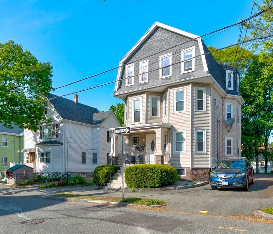
90 Safford St
Quincy, MA 02170