89 Oxford St N
89 Oxford St N,
Saint Paul,
MN
55104
2 Weeks Ago
|
Edit
Favorites
89 Oxford St N
Favorites
Pricing & Floor Plans
Check Back Soon for Upcoming Availability
Fees and Policies
Details
Property Information
-
Built in 1913
-
4 units/2 stories
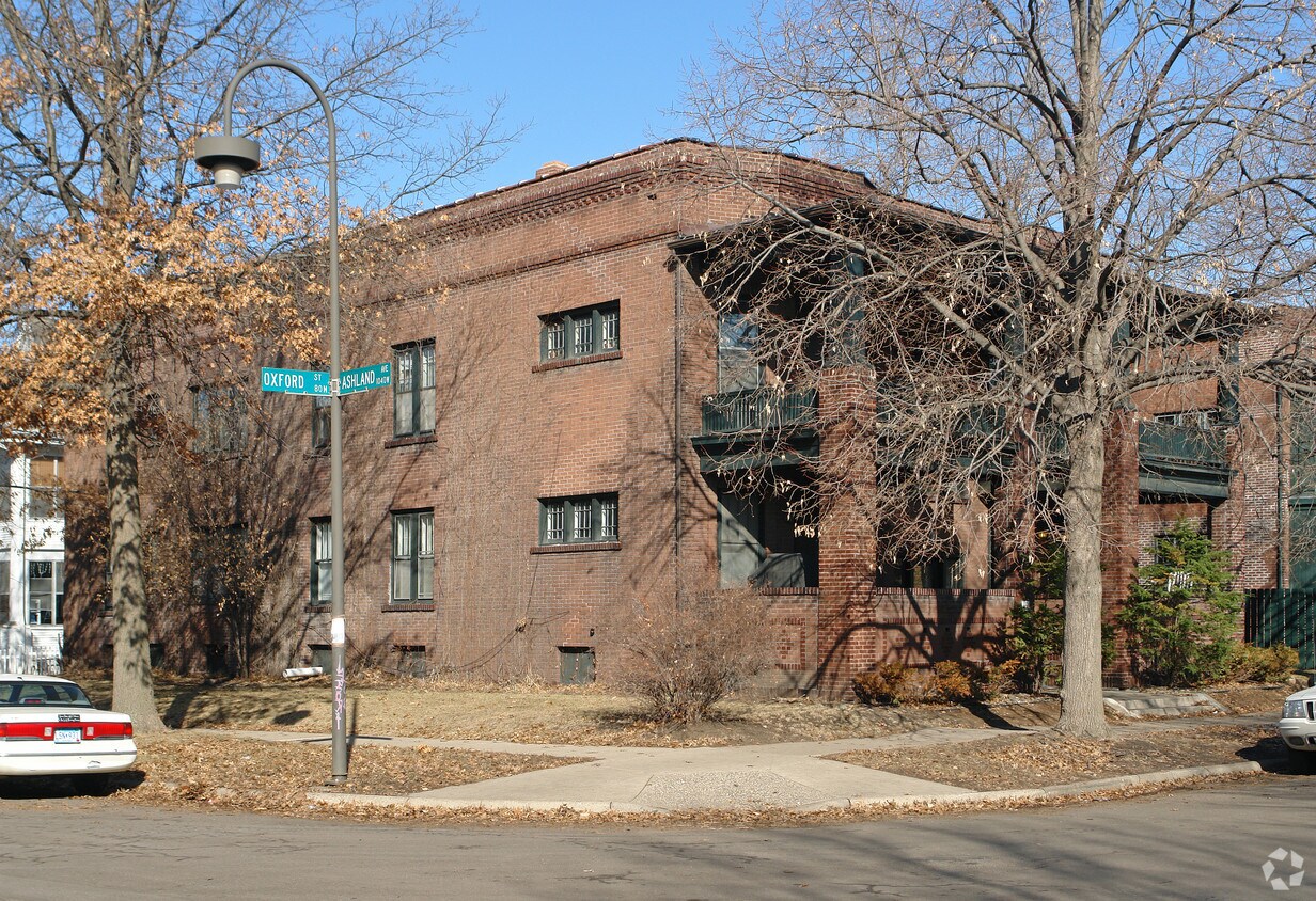
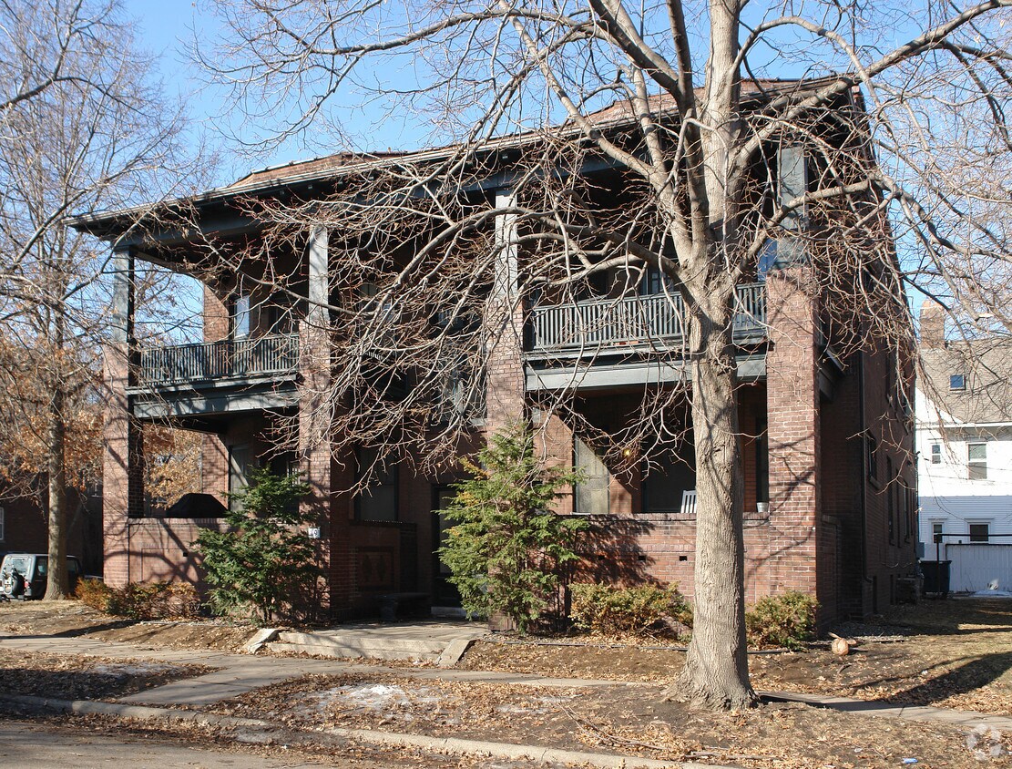
About 89 Oxford St N Saint Paul, MN 55104
89 Oxford St N offers a mixture of quality and design. This property is situated in the Summit-University area of St. Paul. The professional leasing staff will assist you in finding your perfect new place. At 89 Oxford St N you're home.
89 Oxford St N is an apartment community located in Ramsey County and the 55104 ZIP Code. This area is served by the St. Paul Public attendance zone.
Location
Get Directions
Summit-University borders Downtown Saint Paul to the west. This historic neighborhood is also home to one of F. Scott Fitzgerald’s houses. Filled with Victorian mansions, brick apartments, canopy streets, and lush parks, Summit-University maintains a quaint charm. A handful of locally-owned pubs, coffee shops, and restaurants in cozy settings heighten the neighborhood’s small-town charm. There are rental options for every budget, but residents certainly appreciate the area’s affordability.
Along with access to good public schools, Summit-University is convenient to Concordia University-Saint Paul and Macalester College. Interstate 94 and US Route 12 run through Summit-University so residents can easily drive into downtown or Minneapolis. If you prefer public transportation, there are several rail stations located along the northern border of the neighborhood.
Learn more about living in Summit-UniversityBelow are rent ranges for similar nearby apartments
Average Prices by Area
Compare neighborhood and city base rent averages by bedroom.
| Summit-University | Saint Paul, MN | |
|---|---|---|
| Studio | $1,005 | $1,111 |
| 1 Bedroom | $1,191 | $1,268 |
| 2 Bedrooms | $1,597 | $1,603 |
| 3 Bedrooms | $1,925 | $2,146 |
Education
| Colleges & Universities | Distance | ||
|---|---|---|---|
| Colleges & Universities | Distance | ||
| Walk: | 17 min | 0.9 mi | |
| Drive: | 3 min | 1.6 mi | |
| Drive: | 7 min | 2.5 mi | |
| Drive: | 6 min | 2.8 mi |
89 Oxford St N is within 17 minutes or 0.9 mile from Concordia Univ.-Saint Paul. It is also near Macalester College and Saint Paul College.
Schools


Public Elementary School
Grades PK-5
355 Students
Attendance Zone
Public Middle School
Grades 6-8
559 Students
Attendance Zone
Public High School
Grades 9-12
1,691 Students
Attendance Zone
Private Elementary & Middle School
Grades PK-8
261 Students
Nearby
Private Elementary, Middle & High School
Grades PK-12
154 Students
Nearby
School data provided by
 The GreatSchools Rating helps parents compare schools within a state based on a variety of school quality indicators and provides a helpful picture of how effectively each school serves all of its students. Ratings are on a scale of 1 (below average) to 10 (above average) and can include test scores, college readiness, academic progress, advanced courses, equity, discipline and attendance data. We also advise parents to visit schools, consider other information on school performance and programs, and consider family needs as part of the school selection process.
View GreatSchools Rating Methodology
Data provided by GreatSchools.org © 2026. All rights reserved.
View GreatSchools Rating Methodology
Data provided by GreatSchools.org © 2026. All rights reserved.
Transportation options available in Saint Paul include Lexington Pkwy Station, located 1.0 mile from 89 Oxford St N. 89 Oxford St N is near Minneapolis-St Paul International/Wold-Chamberlain, located 7.4 miles or 15 minutes away.
| Transit / Subway | Distance | ||
|---|---|---|---|
| Transit / Subway | Distance | ||
| Walk: | 18 min | 1.0 mi | |
| Drive: | 3 min | 1.4 mi | |
| Drive: | 4 min | 1.9 mi | |
| Drive: | 4 min | 1.9 mi | |
| Drive: | 4 min | 2.0 mi |
| Commuter Rail | Distance | ||
|---|---|---|---|
| Commuter Rail | Distance | ||
|
|
Drive: | 7 min | 4.0 mi |
|
|
Drive: | 16 min | 8.2 mi |
|
|
Drive: | 24 min | 16.8 mi |
|
|
Drive: | 34 min | 25.6 mi |
|
|
Drive: | 35 min | 27.2 mi |
| Airports | Distance | ||
|---|---|---|---|
| Airports | Distance | ||
|
Minneapolis-St Paul International/Wold-Chamberlain
|
Drive: | 15 min | 7.4 mi |
Time and distance from 89 Oxford St N.
| Shopping Centers | Distance | ||
|---|---|---|---|
| Shopping Centers | Distance | ||
| Walk: | 11 min | 0.6 mi | |
| Walk: | 12 min | 0.6 mi | |
| Walk: | 13 min | 0.7 mi |
89 Oxford St N has 3 shopping centers within 0.7 mile, which is about a 13-minute walk. The miles and minutes will be for the farthest away property.
| Parks and Recreation | Distance | ||
|---|---|---|---|
| Parks and Recreation | Distance | ||
|
Macalester College Observatory
|
Drive: | 3 min | 1.6 mi |
|
Irvine Park
|
Drive: | 5 min | 2.4 mi |
|
Highland Park and Golf Course
|
Drive: | 6 min | 2.6 mi |
|
Science Museum of Minnesota
|
Drive: | 6 min | 2.7 mi |
|
Western Park
|
Drive: | 5 min | 2.8 mi |
89 Oxford St N has 5 parks within 2.8 miles, including Macalester College Observatory, Irvine Park, and Western Park.
| Hospitals | Distance | ||
|---|---|---|---|
| Hospitals | Distance | ||
| Drive: | 4 min | 2.2 mi | |
| Drive: | 5 min | 3.0 mi | |
| Drive: | 6 min | 3.5 mi |
89 Oxford St N has 3 hospitals within 3.5 miles, the nearest is Allina United Hospital which is 2.2 miles away and a 4 minute drive.
| Military Bases | Distance | ||
|---|---|---|---|
| Military Bases | Distance | ||
| Drive: | 14 min | 6.1 mi |
89 Oxford St N is 6.1 miles and a 14 minute drive from Fort Snelling Military Reservation.
You May Also Like
-
Cedar Hills
11050 Cedar Hills Blvd
Minnetonka, MN 55305
$1,395 - $1,900 Plus Fees
1-3 Br 12 Month Lease 13.4 mi
-
Bristol Village Apartments
7301 Bristol Village Dr
Bloomington, MN 55438
$1,603 - $2,003 Total Monthly Price
1-2 Br 12 Month Lease 14.4 mi
-
Lake Place Luxury Apartments & Townhomes
11445-11447 Anderson Lakes Pky
Eden Prairie, MN 55344
$1,530 - $1,880 Plus Fees
1-2 Br 15.3 mi
Does 89 Oxford St N have in-unit laundry?
89 Oxford St N does not offer in-unit laundry or shared facilities. Please contact the property to learn about nearby laundry options.
What utilities are included in rent at 89 Oxford St N?
Utilities are not included in rent. Residents should plan to set up and pay for all services separately.
Is parking available at 89 Oxford St N?
Contact this property for parking details.
Is 89 Oxford St N pet-friendly?
89 Oxford St N does not allow pets, though service animals are always welcome in accordance with applicable laws.
Does 89 Oxford St N have move-in specials?
89 Oxford St N is not currently offering any rent specials. Check back soon, as promotions change frequently.
Does 89 Oxford St N offer Matterport 3D tours?
While 89 Oxford St N does not offer Matterport 3D tours, renters can request a tour directly through our online platform.
Similar Rentals Nearby
-
-
-
1 Bed$2,039+2 Beds$2,544+3 Beds$5,779+Total Monthly PriceTotal Monthly Price NewPrices include required monthly fees of $4.Base Rent:1 Bed$2,035+2 Beds$2,540+3 Beds$5,775+2 Months Free
Pets Allowed Fitness Center Pool Dishwasher Refrigerator Clubhouse Maintenance on site
-
1 Bed$1,771+2 Beds$2,476+Total Monthly PriceTotal Monthly Price NewPrices include required monthly fees of $50.Base Rent:1 Bed$1,721+2 Beds$2,426+1 Month Free
Pets Allowed Fitness Center Pool In Unit Washer & Dryer Walk-In Closets High-Speed Internet Controlled Access
-
-
-
-
-
-


What Are Walk Score®, Transit Score®, and Bike Score® Ratings?
Walk Score® measures the walkability of any address. Transit Score® measures access to public transit. Bike Score® measures the bikeability of any address.
What is a Sound Score Rating?
A Sound Score Rating aggregates noise caused by vehicle traffic, airplane traffic and local sources
Property Manager Responded