$3,500
/ Month
809 Browns Valley Rd Unit B
Watsonville, CA 95076
Favorites
831-515-8421
-
Bedrooms
3
-
Bathrooms
3
-
Square Feet
--
-
Available
Available Now
809 Browns Valley Rd Unit B

Favorites
About This Home
$3,500 deposit,
Available Now
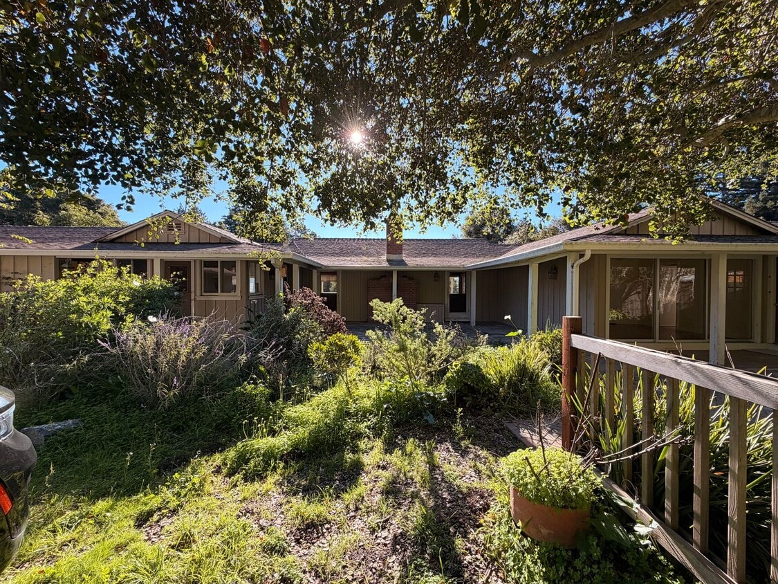
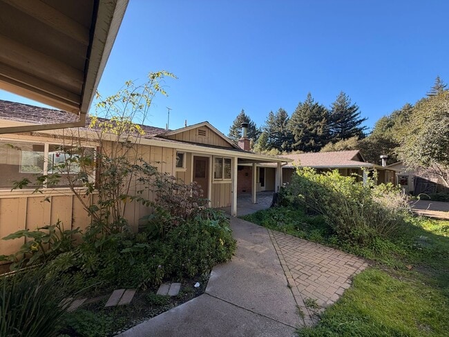
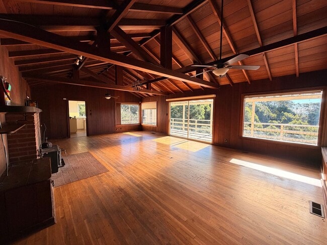
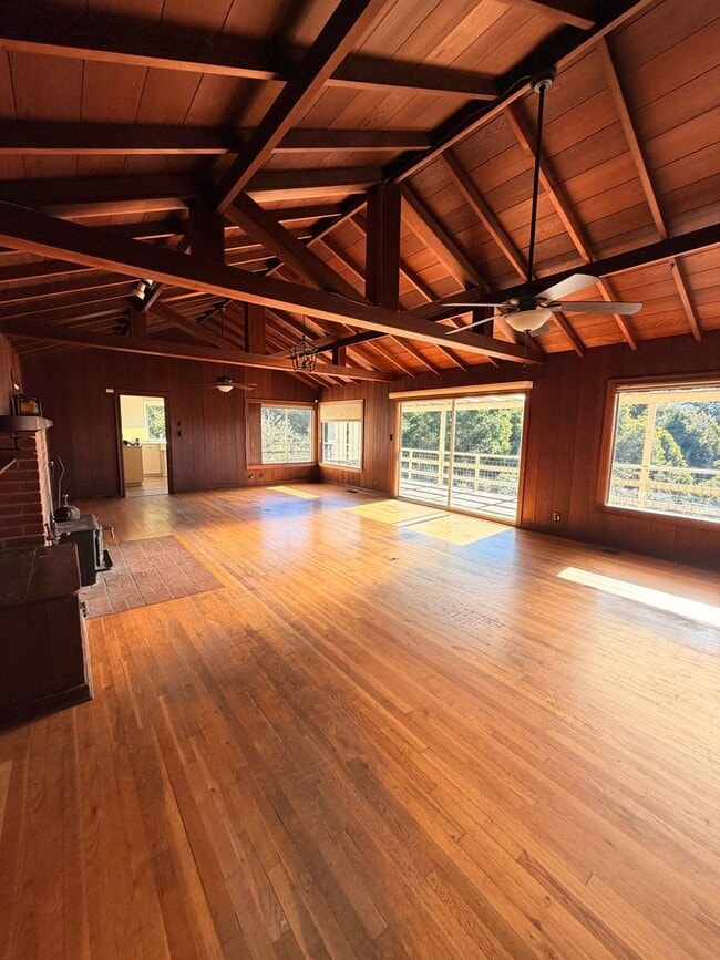
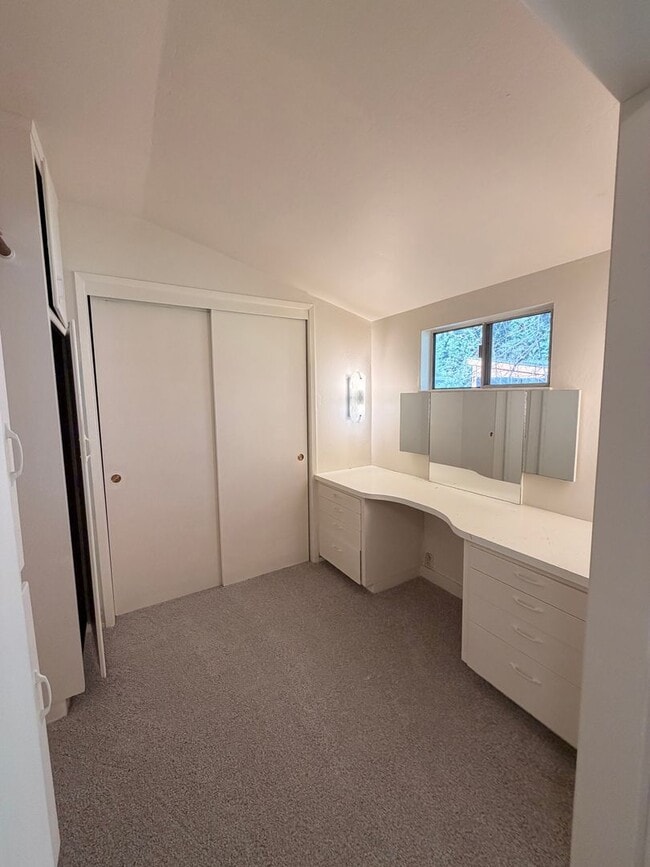
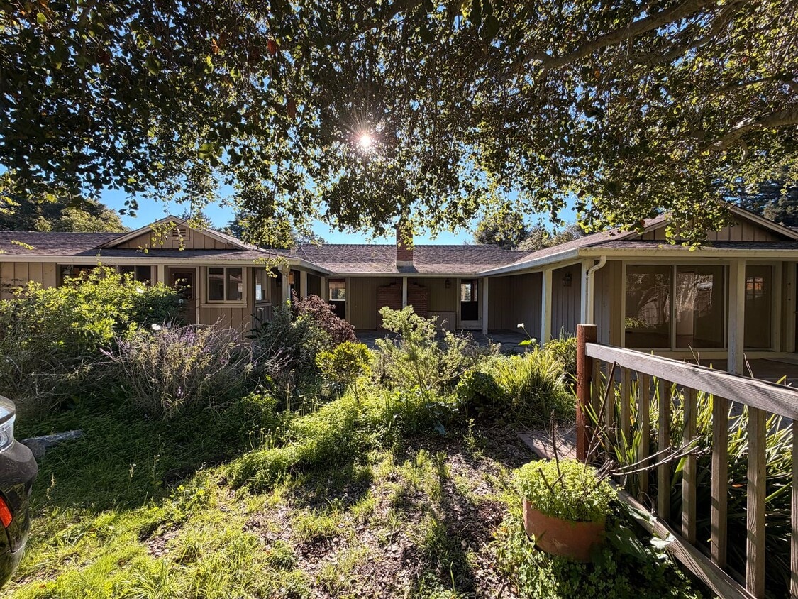
Escape to a truly special home tucked into the serene beauty of Byrne Milliron Forest, located several miles past the Corralitos Meat Market. This unique setting offers the peace and privacy of a forest retreat while still being within a reasonable drive to Corralitos, Watsonville, Aptos, and Highway 1 access. This spacious 3-bedroom, 3-bathroom home includes a built-in office space and showcases breathtaking panoramic views spanning the ocean and Monterey Bay. The large, light-filled living room features warm wood detailing and vaulted ceilings, with expansive windows that frame the surrounding nature and stunning scenery. Step outside to enjoy the sun-drenched oversized deck, perfect for entertaining, relaxing, or soaking in the views. There is also space to garden, making this an ideal home for anyone who enjoys outdoor living. Additional highlights include a 2-car garage along with extra storage, providing plenty of room for equipment, hobbies, and seasonal items. This property is located on land shared with two other single-family homes and is regulated by Land Trust Santa Cruz County, offering a rare opportunity to live in protected open space. Month-to-Month Lease Water Source is a Well and is not Potable No Utilities Included
809 Browns Valley Rd is an apartment community located in Santa Cruz County and the 95076 ZIP Code.
* Price shown is base rent. Excludes user-selected optional fees and variable or usage-based fees and required charges due at or prior to move-in or at move-out. Price, availability, fees, and any applicable rent special are subject to change without notice.
* Square footage definitions vary. Displayed square footage is approximate.
Contact
- Listed by Anderson Christie Real Estate | Anderson Christie Real Estate
- Phone Number
- Contact
Location
Get Directions
Watsonville sits at the southern end of Santa Cruz County, where the Pajaro Valley's agricultural fields stretch toward Monterey Bay and the everyday rhythm of life stays rooted in the land. The city has long anchored the region's strawberry and apple industries, earning a reputation as one of California's most productive farming communities. That agricultural identity shapes the city's character in real ways, from the well-attended weekly farmers market to the Santa Cruz County Fair, held here each September and drawing crowds from across the county. Watsonville is compact at roughly seven square miles, yet its downtown core, surrounding residential streets, and outlying areas each carry a distinct feel. Santa Cruz sits about 23 miles to the northwest and Monterey is a comparable drive south, giving residents access to two coastal cities without the price tags those markets carry.
Learn more about living in Watsonville
Education
| Colleges & Universities | Distance | ||
|---|---|---|---|
| Colleges & Universities | Distance | ||
| Drive: | 26 min | 11.8 mi | |
| Drive: | 47 min | 21.5 mi | |
| Drive: | 43 min | 22.1 mi | |
| Drive: | 78 min | 43.2 mi |
809 Browns Valley Rd Unit B is within 26 minutes or 11.8 miles from Cabrillo College. It is also near Gavilan College, Gilroy and UC Santa Cruz.
Getting Around
 What do Walkability, Transit, Drivability, and Bikeability mean?
Walkability measures the walking distance to day-to-day needs.
Transit measures access to public transportation.
Drivability measures congestion, parking availability, and access to major roads.
Bikeability measures the suitability for cycling.
How It Works
What do Walkability, Transit, Drivability, and Bikeability mean?
Walkability measures the walking distance to day-to-day needs.
Transit measures access to public transportation.
Drivability measures congestion, parking availability, and access to major roads.
Bikeability measures the suitability for cycling.
How It Works
Not Walkable
Walkability
0
/ 100
Minimal Public Transit
Transit
0
/ 100
Exceptionally Drivable
Drivability
100
/ 100
Somewhat Bikeable
Bikeability
20
/ 100
Scores provided by
What do Walkability, Transit, Drivability, and Bikeability mean?
Walkability measures the walking distance to day-to-day needs.
Transit measures access to public transportation.
Drivability measures congestion, parking availability, and access to major roads.
Bikeability measures the suitability for cycling.
How It Works
Calm
Soundscore™
99
/ 100
Traffic
CalmAirport
CalmBusinesses
CalmScores provided by
HowLoud What is a Sound Score Rating? A Sound Score Rating aggregates noise caused by vehicle traffic, airplane traffic and local sources. How It WorksYou May Also Like
Similar Rentals Nearby
809 Browns Valley Rd
Watsonville, CA 95076