
$1,995
/ Month
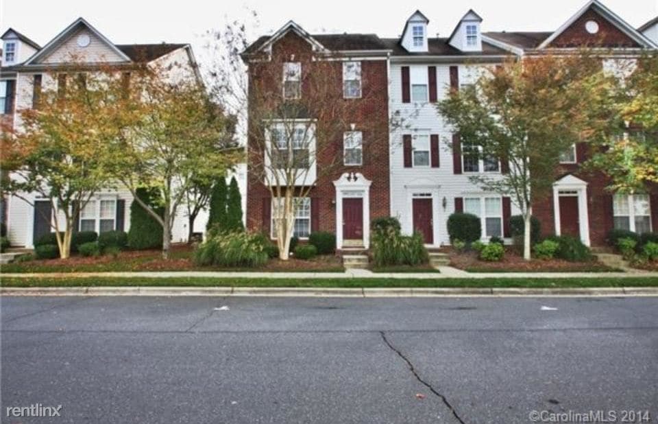
8039 Bristle Toe Ln
Charlotte, NC 28277
2 Weeks Ago
|
Edit
Favorites
-
Bedrooms
2
-
Bathrooms
3
-
Square Feet
2,080 sq ft
8039 Bristle Toe Ln

Favorites
About This Home
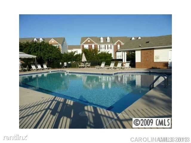
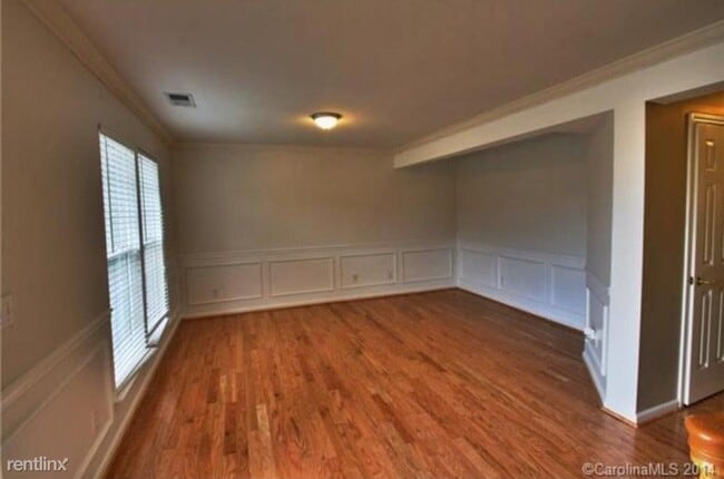
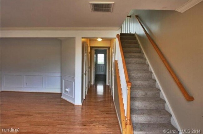
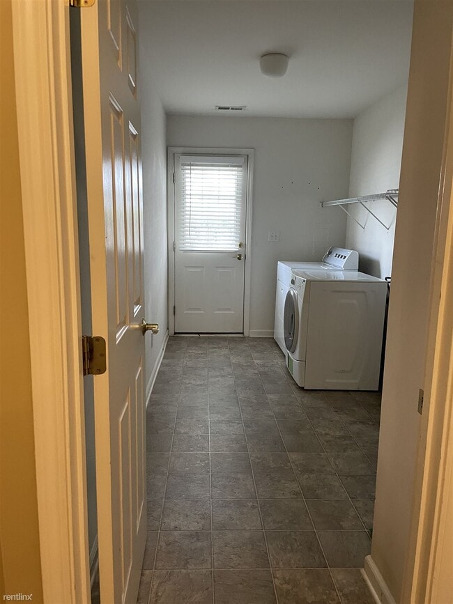
- Beautiful townhome at the center of Ballantyne. Closer to shopping, dining, movies (Stonecrest shopping center) and highway 485. Next to St Mathews Catholic School. Lower level has attached car garage, living room with hardwood floor (can be used as a bedroom/office), half bath and laundry room. Main level has a great room, kitchen, dining area, half bath and a private deck. Upper level has the spacious master suite with a private bath and walk-in closet, a guest bedroom and a full bath. Opposite to the community swimming pool. Washer and Dryer included and in unit. New A/C unit installed. Lawn and exterior maintenance included. Application: (RLNE8251095) Other Amenities: Parking, Pool, Garage, Balcony, Deck. Appliances: Dishwasher, Air Conditioning, Refrigerator, Range, Oven, Garbage Disposal, Washer & Dryer, Microwave. Utilities: Heat Included, Resident Pays Electricity, Resident Pays Gas, Resident Pays Water, High-Speed Internet Available, Trash Pick-up Included. Pet policies: Small Dogs Allowed.
Unique Features
- Oven, High-Speed Internet Available, Garage
8039 Bristle Toe Ln is a townhome located in Mecklenburg County and the 28277 ZIP Code.
* Price shown is base rent. Excludes user-selected optional fees and variable or usage-based fees and required charges due at or prior to move-in or at move-out. Price, availability, fees, and any applicable rent special are subject to change without notice.
* Square footage definitions vary. Displayed square footage is approximate.
Townhome Features
- Washer/Dryer
- Air Conditioning
- Dishwasher
Fees and Policies
The fees below are based on community-supplied data and may exclude additional fees and utilities.
- Dogs Allowed
-
Fees not specified
-
Weight limit--
-
Pet Limit--
Details
Utilities Included
-
Heat
Contact
- Listed by Hemlane
Location
Get Directions
Amenities
- Washer/Dryer
- Air Conditioning
- Dishwasher
- Oven, High-Speed Internet Available, Garage
Expenses
Utilities Included
Heat
Included
Sitting on the southern edge of Charlotte at the South Carolina state line, the Ballantyne neighborhood is well-known as a sought-after residential community as well as a prime shopping and dining destination. The neighborhood is anchored by a cluster of popular shopping plazas and restaurants at the intersection of Johnston Road and Ballantyne Commons Parkway, which features local favorites like Rush Espresso Cafe and Zapata’s Mexican.
The retail district is surrounded by tranquil neighborhoods full of beautiful homes and luxury apartments on gorgeous tree-lined streets. Located right alongside I-485, living in Ballantyne provides convenient access to the local highways, allowing you to easily reach anywhere in the city for work or leisure anytime.
Learn more about living in Ballantyne
Education
| Colleges & Universities | Distance | ||
|---|---|---|---|
| Colleges & Universities | Distance | ||
| Drive: | 16 min | 9.7 mi | |
| Drive: | 16 min | 10.3 mi | |
| Drive: | 23 min | 12.3 mi | |
| Drive: | 24 min | 15.6 mi |
8039 Bristle Toe Ln is within 16 minutes or 10.3 miles from Central Piedmont C.C., Levine. It is also near Central Piedmont C.C., Harper and Queens University of Charlotte.
Transportation options available in Charlotte include I-485/South Boulevard, located 7.4 miles from 8039 Bristle Toe Ln. 8039 Bristle Toe Ln is near Charlotte/Douglas International, located 16.7 miles or 27 minutes away, and Concord-Padgett Regional, located 34.3 miles or 42 minutes away.
| Transit / Subway | Distance | ||
|---|---|---|---|
| Transit / Subway | Distance | ||
|
|
Drive: | 11 min | 7.4 mi |
|
|
Drive: | 13 min | 8.2 mi |
|
|
Drive: | 14 min | 9.3 mi |
|
|
Drive: | 16 min | 10.5 mi |
|
|
Drive: | 18 min | 11.3 mi |
| Commuter Rail | Distance | ||
|---|---|---|---|
| Commuter Rail | Distance | ||
|
|
Drive: | 28 min | 15.7 mi |
|
|
Drive: | 41 min | 31.6 mi |
| Drive: | 55 min | 44.9 mi |
| Airports | Distance | ||
|---|---|---|---|
| Airports | Distance | ||
|
Charlotte/Douglas International
|
Drive: | 27 min | 16.7 mi |
|
Concord-Padgett Regional
|
Drive: | 42 min | 34.3 mi |
Time and distance from 8039 Bristle Toe Ln.
| Shopping Centers | Distance | ||
|---|---|---|---|
| Shopping Centers | Distance | ||
| Walk: | 7 min | 0.4 mi | |
| Walk: | 8 min | 0.5 mi | |
| Drive: | 3 min | 1.2 mi |
8039 Bristle Toe Ln has 3 shopping centers within 1.2 miles, which is about a 3-minute drive. The miles and minutes will be for the farthest away property.
| Parks and Recreation | Distance | ||
|---|---|---|---|
| Parks and Recreation | Distance | ||
|
Ballantyne's Backyard
|
Drive: | 6 min | 2.4 mi |
|
Stream Park
|
Drive: | 6 min | 2.9 mi |
|
Brixham Park
|
Drive: | 7 min | 3.2 mi |
|
Marvin Efird Park
|
Drive: | 15 min | 6.8 mi |
|
Stallings Municipal Park
|
Drive: | 13 min | 9.8 mi |
8039 Bristle Toe Ln has 5 parks within 9.8 miles, including Ballantyne's Backyard, Stream Park, and Brixham Park.
| Hospitals | Distance | ||
|---|---|---|---|
| Hospitals | Distance | ||
| Drive: | 5 min | 2.6 mi | |
| Drive: | 9 min | 6.2 mi | |
| Drive: | 12 min | 8.5 mi |
8039 Bristle Toe Ln has 3 hospitals within 8.5 miles, the nearest is Novant Health Ballantyne Medical Center which is 2.6 miles away and a 5 minute drive.
| Military Bases | Distance | ||
|---|---|---|---|
| Military Bases | Distance | ||
| Drive: | 127 min | 90.0 mi |
8039 Bristle Toe Ln is 90.0 miles and a 127 minute drive from Fort Jackson.
You May Also Like
-
Trailside NoDa
1030 Stitch Bend Way
Charlotte, NC 28206
$1,685 - $3,108
2-3 Br 14.0 mi
-
NOVEL University Place by Crescent Communities
5315 Waters Edge Village Dr
Charlotte, NC 28262
$1,699 - $3,902
2-3 Br 18.4 mi
-
University Townhomes at Charlotte
10035 Dabney Dr
Charlotte, NC 28262
$734 - $750
3-4 Br 18.9 mi
Similar Rentals Nearby


What Are Walk Score®, Transit Score®, and Bike Score® Ratings?
Walk Score® measures the walkability of any address. Transit Score® measures access to public transit. Bike Score® measures the bikeability of any address.
What is a Sound Score Rating?
A Sound Score Rating aggregates noise caused by vehicle traffic, airplane traffic and local sources
8039 Bristle Toe Ln
Charlotte, NC 28277