
$1,900
/ Month
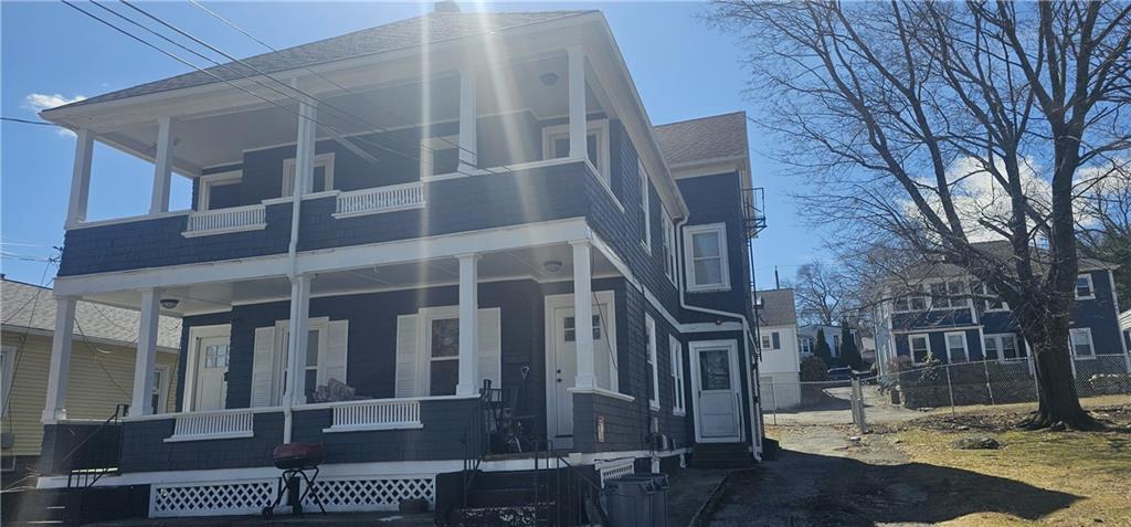
80 Serrel Sweet Rd
Johnston, RI 02919
Today
|
Edit
Favorites
401-864-4010
-
Bedrooms
2
-
Bathrooms
1
-
Square Feet
950 sq ft
-
Available
Available Now
Highlights
- No Cooling
- Baseboard Heating
80 Serrel Sweet Rd

Favorites
About This Home
$1,900 deposit,
Available Now
MLS ID 1408500
80 Serrel Sweet Rd is an apartment community located in Providence County and the 02919 ZIP Code.
* Price shown is base rent. Excludes user-selected optional fees and variable or usage-based fees and required charges due at or prior to move-in or at move-out. Price, availability, fees, and any applicable rent special are subject to change without notice.
* Square footage definitions vary. Displayed square footage is approximate.
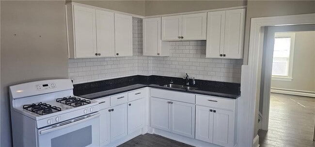
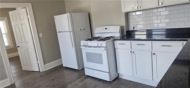
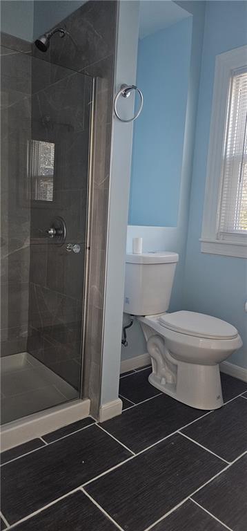
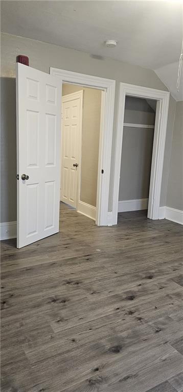
Home Details
Bedrooms and Bathrooms
1 Full Bathroom
2 Bedrooms
Home Design
Apartment
Interior Spaces
950 Sq Ft Home
Listing and Financial Details
Property Available on 3/26/26
12 Month Lease Term
Assessor Parcel Number 80SERRELSWEETRDJOHN
Utilities
No Cooling
Baseboard Heating
Heating System Uses Gas
Community Details
Overview
No Home Owners Association
Pet Policy
Pets Allowed
Fees and Policies
The fees listed below are community-provided and may exclude utilities or add-ons. All payments are made directly to the property and are non-refundable unless otherwise specified. Use the Cost Calculator to determine costs based on your needs.
Property Fee Disclaimer: Based on community-supplied data and independent market research. Subject to change without notice. May exclude fees for mandatory or optional services and usage-based utilities.
Contact
- Listed by Isabel Amado | SD Realty Associates
- Phone Number
- Contact
-
Source
State Wide MLS of Rhode Island, Inc.
Copyright © 2026 State Wide MLS of Rhode Island, Inc. All rights reserved. All information provided by the listing agent/broker is deemed reliable but is not guaranteed and should be independently verified.
Location
Get Directions
With easy access to I-95 and both Cranston and Providence, many people choose to live in Johnston and work in the bigger cities nearby. Johnston has four local public elementary schools, one middle school, and one high school. Additional private school options are located in Providence.
Johnston houses the Clemence Irons House, a historic example of a stone ender house and part of the National Register of Historic Places. It is also one of the oldest homes in Rhode Island. The Marion J. Mohr Public Library in Johnston is home to the Mohr Genealogy Group, which hosts monthly genealogy meetups. The Library also hosts a range of other educational and storytime programs for adults and children. Nearby, the Mogehan Sun and Foxwoods casinos in Uncasville and Ledyard, CT, host concerts, sporting events, and other cultural attractions.
Learn more about living in Johnston
Education
| Colleges & Universities | Distance | ||
|---|---|---|---|
| Colleges & Universities | Distance | ||
| Drive: | 6 min | 3.3 mi | |
| Drive: | 8 min | 4.0 mi | |
| Drive: | 12 min | 6.7 mi | |
| Drive: | 14 min | 6.8 mi |
80 Serrel Sweet Rd is within 6 minutes or 3.3 miles from Rhode Island College. It is also near Providence College and C.C. of Rhode Island, Flanagan.
Getting Around
 What do Walkability, Transit, Drivability, and Bikeability mean?
Walkability measures the walking distance to day-to-day needs.
Transit measures access to public transportation.
Drivability measures congestion, parking availability, and access to major roads.
Bikeability measures the suitability for cycling.
How It Works
What do Walkability, Transit, Drivability, and Bikeability mean?
Walkability measures the walking distance to day-to-day needs.
Transit measures access to public transportation.
Drivability measures congestion, parking availability, and access to major roads.
Bikeability measures the suitability for cycling.
How It Works
Fairly Walkable
Walkability
50
/ 100
Limited Public Transit
Transit
20
/ 100
Exceptionally Drivable
Drivability
90
/ 100
Fairly Bikeable
Bikeability
40
/ 100
Scores provided by
Active
Soundscore™
75
/ 100
Traffic
ActiveAirport
CalmBusinesses
ActiveScores provided by
HowLoud What is a Sound Score Rating? A Sound Score Rating aggregates noise caused by vehicle traffic, airplane traffic and local sources. How It WorksYou May Also Like
-
The Penstone Apartments & Townhomes
55 Summer St
South Walpole, MA 02071
$4,130 - $6,350 Total Monthly Price
2-3 Br 20.5 mi
-
King Philip Lofts
386 Kilburn St
Fall River, MA 02724
$2,095 - $2,895 Plus Fees
2-3 Br 20.7 mi
-
Sacred Heart Lofts
160 Seabury St
Fall River, MA 02720
$1,995 - $2,995 Plus Fees
2-3 Br 12 Month Lease 20.9 mi
Similar Rentals Nearby
-
-
-
-
-
-
-
-
-
2 Beds$2,773+3 Beds$3,896+Total Monthly PriceTotal Monthly Price NewPrices include base rent and required monthly fees. Variable costs based on usage may apply.Specials
Pets Allowed Fitness Center Pool Dishwasher Kitchen In Unit Washer & Dryer Walk-In Closets
-


What Are Walk Score®, Transit Score®, and Bike Score® Ratings?
Walk Score® measures the walkability of any address. Transit Score® measures access to public transit. Bike Score® measures the bikeability of any address.
What is a Sound Score Rating?
A Sound Score Rating aggregates noise caused by vehicle traffic, airplane traffic and local sources.
80 Serrel Sweet Rd
Johnston, RI 02919