
Vanguard
1001 Marshall Ave,
Cincinnati, OH 45219
Studio - 5 Beds $683 - $1,479

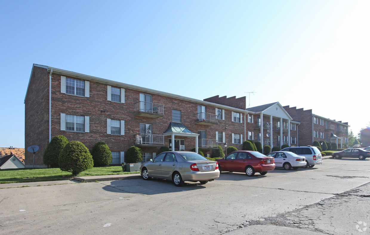

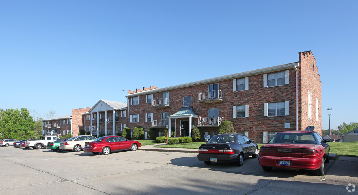
791-795 Neeb Rd offers a combination of style, comfort and livability. Based in the 45233 area of Cincinnati on Neeb Rd., you have a quick connection to a mixture of great entertainment options found in the surrounding area. From availability to location, the professional leasing staff is ready to help you find your perfect home. Be sure to come for a visit to check out the apartment floorplan options. Stop by to find out the current floorplan availability.
791-795 Neeb Rd is an apartment community located in Hamilton County and the 45233 ZIP Code. This area is served by the Oak Hills Local attendance zone.
Dishwasher
High Speed Internet Access
Refrigerator
Smoke Free
Delhi Hills (pronounced DEL-high) located on the west side of Cincinnati in Delhi Township may be small in terms of geography, but it has much to offer in terms of community and easy access to area amenities. Situated on a bluff overlooking the Ohio River and Kentucky-Ohio border, this densely populated residential area lies just seven easy miles into Cincinnati's bustling city center. U.S. forms the area’s southern border with the river, making it easy to commute around this vibrant area. There’s a diverse mix of apartments ranging from the low-rise and affordable to mid-rise and more luxurious communities.
Learn more about living in Delhi Hills| Colleges & Universities | Distance | ||
|---|---|---|---|
| Colleges & Universities | Distance | ||
| Drive: | 3 min | 1.2 mi | |
| Drive: | 20 min | 8.6 mi | |
| Drive: | 22 min | 8.9 mi | |
| Drive: | 30 min | 14.7 mi |


Transportation options available in Cincinnati include Elm & Liberty Station, located 7.6 miles from 791-795 Neeb Rd. 791-795 Neeb Rd is near Cincinnati/Northern Kentucky International, located 8.2 miles or 40 minutes away.
| Transit / Subway | Distance | ||
|---|---|---|---|
| Transit / Subway | Distance | ||
| Drive: | 19 min | 7.6 mi | |
| Drive: | 18 min | 7.6 mi | |
| Drive: | 19 min | 7.6 mi | |
| Drive: | 18 min | 7.8 mi | |
| Drive: | 18 min | 7.8 mi |
| Commuter Rail | Distance | ||
|---|---|---|---|
| Commuter Rail | Distance | ||
|
|
Drive: | 18 min | 7.0 mi |
| Airports | Distance | ||
|---|---|---|---|
| Airports | Distance | ||
|
Cincinnati/Northern Kentucky International
|
Drive: | 40 min | 8.2 mi |
Time and distance from 791-795 Neeb Rd.
| Shopping Centers | Distance | ||
|---|---|---|---|
| Shopping Centers | Distance | ||
| Drive: | 4 min | 1.7 mi | |
| Drive: | 5 min | 2.3 mi | |
| Drive: | 5 min | 2.3 mi |
| Parks and Recreation | Distance | ||
|---|---|---|---|
| Parks and Recreation | Distance | ||
|
Embshoff Woods
|
Drive: | 10 min | 4.0 mi |
|
Imago Earth Center
|
Drive: | 10 min | 4.1 mi |
|
Wilson Commons
|
Drive: | 12 min | 4.8 mi |
|
Fernbank Park
|
Drive: | 11 min | 5.8 mi |
|
Mt. Airy Forest
|
Drive: | 17 min | 7.1 mi |
| Hospitals | Distance | ||
|---|---|---|---|
| Hospitals | Distance | ||
| Drive: | 17 min | 7.3 mi | |
| Drive: | 20 min | 8.7 mi | |
| Drive: | 28 min | 15.0 mi |
| Military Bases | Distance | ||
|---|---|---|---|
| Military Bases | Distance | ||
| Drive: | 83 min | 59.5 mi | |
| Drive: | 89 min | 64.5 mi | |
| Drive: | 92 min | 67.8 mi |
What Are Walk Score®, Transit Score®, and Bike Score® Ratings?
Walk Score® measures the walkability of any address. Transit Score® measures access to public transit. Bike Score® measures the bikeability of any address.
What is a Sound Score Rating?
A Sound Score Rating aggregates noise caused by vehicle traffic, airplane traffic and local sources
791-795 Neeb Rd
Cincinnati, OH 45233


