
$2,200
/ Month
7902 Parnell St
Houston, TX 77051
Today
|
Edit
Favorites
843-709-6078
-
Bedrooms
3
-
Bathrooms
2.5
-
Square Feet
1,966 sq ft
-
Available
Available Now
7902 Parnell St

Favorites
About This Home
$2,200 deposit,
Available Now
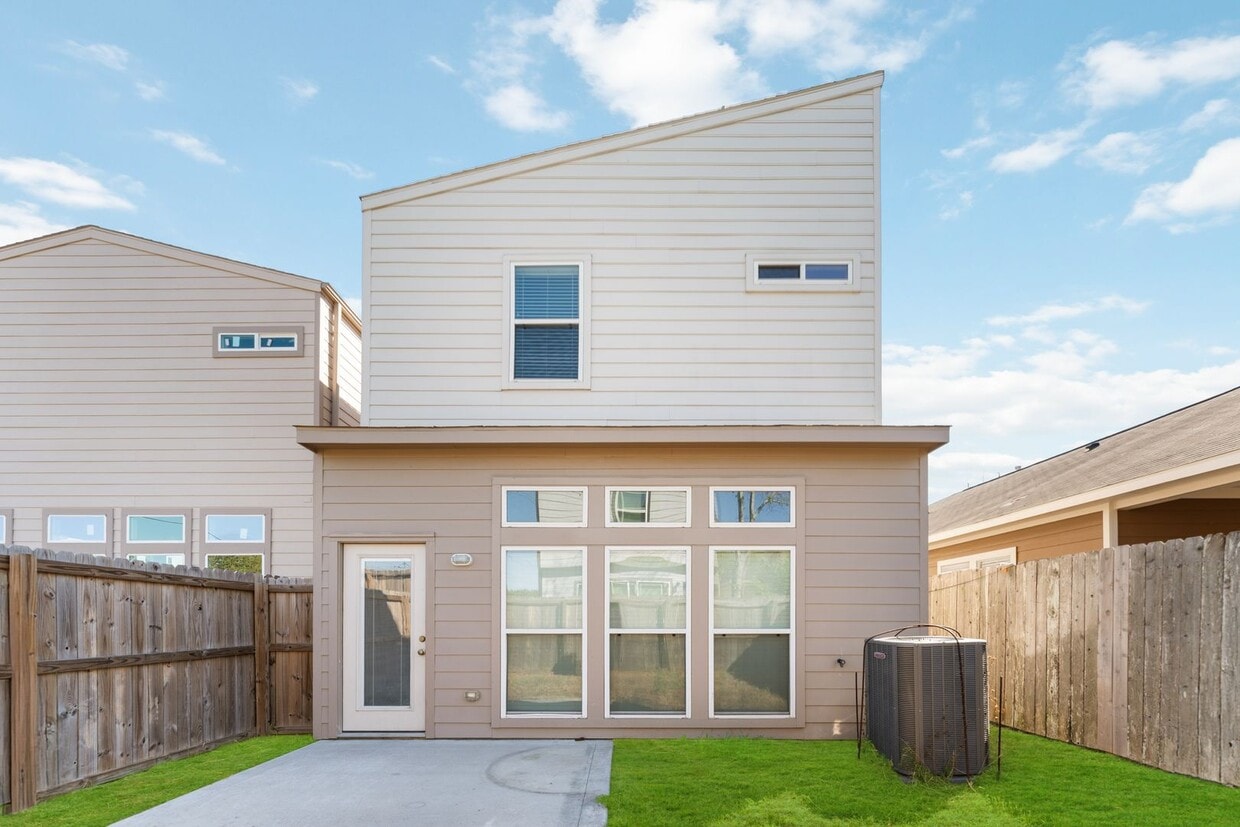
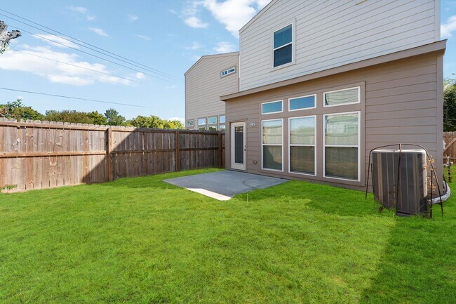
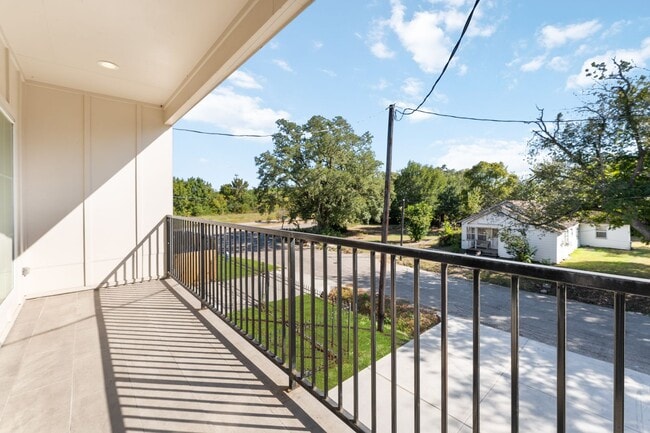
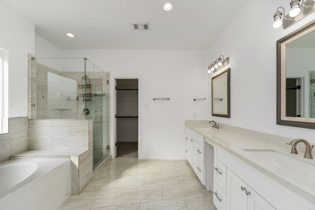
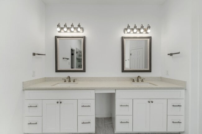
Welcome to a lovely 3-bedroom, 2.5-bathroom home offering plenty of comfort and style. This home features an open floor plan with a bright living area and a functional kitchen that provides ample space for your daily needs. Washer and dryer connections are available for your convenience. Located in a quiet neighborhood, this property offers easy access to major highways, schools, shopping, and dining. If you’re looking for a spacious and convenient home in Houston, this is a great choice! Schedule your showing today.
7902 Parnell St is a house located in Harris County and the 77051 ZIP Code. This area is served by the Houston Independent attendance zone.
* Price shown is base rent. Excludes user-selected optional fees and variable or usage-based fees and required charges due at or prior to move-in or at move-out. Price, availability, fees, and any applicable rent special are subject to change without notice.
* Square footage definitions vary. Displayed square footage is approximate.
Fees and Policies
The fees below are based on community-supplied data and may exclude additional fees and utilities.
- One-Time Basics
- Due at Move-In
- Security Deposit - RefundableCharged per unit.$2,200
- Due at Move-In
Property Fee Disclaimer: Based on community-supplied data and independent market research. Subject to change without notice. May exclude fees for mandatory or optional services and usage-based utilities.
Contact
- Listed by J.H.W | J.H.W Enterprises Property Management Inc
- Phone Number
- Contact
Location
Get Directions
Nestled just eight miles south of Downtown Houston, residents of Sunnyside find its close proximity to city attractions and low cost of living attractive. The community borders the 610 Loop and is inside the Beltway 8, making it simple for locals to commute to work.
There’s definitely a suburban vibe to the area. Students of Sunnyside are zoned to the Houston Independent School District. Residents look forward to the amenities at Sunnyside Park, including the playground, sports courts, walking/biking trails, and the gym that’s located in the community center.
Cullen Boulevard and Reed Road house many local restaurants and quick-bite establishments. It’s only a short ride to Houston attractions like the zoo, aquarium, and the Children’s Museum of Houston. Need to get to William P. Hobby Airport? You’re only a 15-minute drive away.
Learn more about living in Sunnyside
Education
| Colleges & Universities | Distance | ||
|---|---|---|---|
| Colleges & Universities | Distance | ||
| Drive: | 8 min | 4.2 mi | |
| Drive: | 8 min | 4.4 mi | |
| Drive: | 9 min | 4.6 mi | |
| Drive: | 13 min | 6.3 mi |
7902 Parnell St is within 8 minutes or 4.4 miles from UT Health Houston. It is also near Texas Southern University and Baylor College of Medicine.
Schools


Public Elementary School
Grades PK-5
385 Students
Attendance Zone
Public Middle School
Grades 6-8
439 Students
Attendance Zone
Public High School
Grades 9-12
827 Students
Attendance Zone
Private Elementary, Middle & High School
Grades PK-11
Nearby
Private High School
Grades 9-12
211 Students
Nearby
School data provided by
 The GreatSchools Rating helps parents compare schools within a state based on a variety of school quality indicators and provides a helpful picture of how effectively each school serves all of its students. Ratings are on a scale of 1 (below average) to 10 (above average) and can include test scores, college readiness, academic progress, advanced courses, equity, discipline and attendance data. We also advise parents to visit schools, consider other information on school performance and programs, and consider family needs as part of the school selection process.
View GreatSchools Rating Methodology
Data provided by GreatSchools.org © 2025. All rights reserved.
View GreatSchools Rating Methodology
Data provided by GreatSchools.org © 2025. All rights reserved.
Transportation options available in Houston include Fannin South, located 2.1 miles from 7902 Parnell St. 7902 Parnell St is near William P Hobby, located 10.0 miles or 20 minutes away, and George Bush Intcntl/Houston, located 25.6 miles or 35 minutes away.
| Transit / Subway | Distance | ||
|---|---|---|---|
| Transit / Subway | Distance | ||
|
|
Drive: | 4 min | 2.1 mi |
|
|
Drive: | 5 min | 3.0 mi |
|
|
Drive: | 6 min | 3.7 mi |
| Drive: | 8 min | 4.7 mi | |
|
|
Drive: | 9 min | 5.0 mi |
| Commuter Rail | Distance | ||
|---|---|---|---|
| Commuter Rail | Distance | ||
|
|
Drive: | 14 min | 8.4 mi |
| Airports | Distance | ||
|---|---|---|---|
| Airports | Distance | ||
|
William P Hobby
|
Drive: | 20 min | 10.0 mi |
|
George Bush Intcntl/Houston
|
Drive: | 35 min | 25.6 mi |
Time and distance from 7902 Parnell St.
| Shopping Centers | Distance | ||
|---|---|---|---|
| Shopping Centers | Distance | ||
| Drive: | 2 min | 1.4 mi | |
| Drive: | 3 min | 1.5 mi | |
| Drive: | 4 min | 2.3 mi |
7902 Parnell St has 3 shopping centers within 2.3 miles, which is about a 4-minute drive. The miles and minutes will be for the farthest away property.
| Parks and Recreation | Distance | ||
|---|---|---|---|
| Parks and Recreation | Distance | ||
|
Houston Zoo
|
Drive: | 8 min | 4.4 mi |
|
Children's Museum of Houston
|
Drive: | 8 min | 4.6 mi |
|
Hermann Park
|
Drive: | 9 min | 4.7 mi |
|
Houston Maritime Museum
|
Drive: | 8 min | 4.8 mi |
|
Cockrell Butterfly Center
|
Drive: | 9 min | 5.1 mi |
7902 Parnell St has 5 parks within 5.1 miles, including Houston Zoo, Houston Maritime Museum, and Hermann Park.
| Hospitals | Distance | ||
|---|---|---|---|
| Hospitals | Distance | ||
| Drive: | 5 min | 2.3 mi | |
| Drive: | 6 min | 3.4 mi | |
| Drive: | 6 min | 3.8 mi |
7902 Parnell St has 3 hospitals within 3.8 miles, the nearest is Harris Health System which is 2.3 miles away and a 5 minute drive.
| Military Bases | Distance | ||
|---|---|---|---|
| Military Bases | Distance | ||
| Drive: | 35 min | 24.4 mi | |
| Drive: | 63 min | 50.0 mi |
7902 Parnell St is 24.4 miles from Lyndon B Johnson Space Center, and is convenient to other military bases, including Pelican Spit Military Reservation.
You May Also Like
Similar Rentals Nearby


What Are Walk Score®, Transit Score®, and Bike Score® Ratings?
Walk Score® measures the walkability of any address. Transit Score® measures access to public transit. Bike Score® measures the bikeability of any address.
What is a Sound Score Rating?
A Sound Score Rating aggregates noise caused by vehicle traffic, airplane traffic and local sources

7902 Parnell St
Houston, TX 77051