
$1,700 / Month
7537 Banning Way Unit Lower
Inver Grove Heights, MN 55077
2 Weeks Ago
Favorites
7537 Banning Way Unit Lower

Favorites
Check Back Soon for Upcoming Availability
| Beds | Baths | Average SF |
|---|---|---|
| 3 Bedrooms 3 Bedrooms 3 Br | 1 Bath 1 Bath 1 Ba | 1,200 SF |
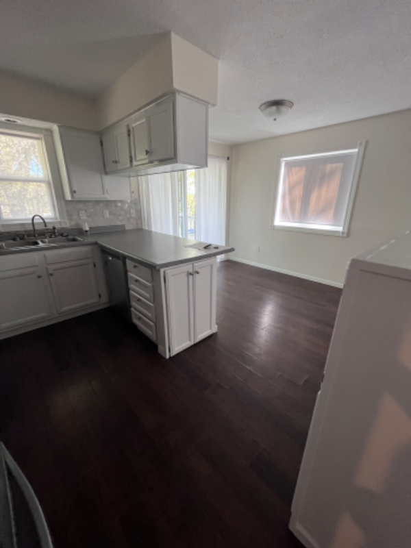
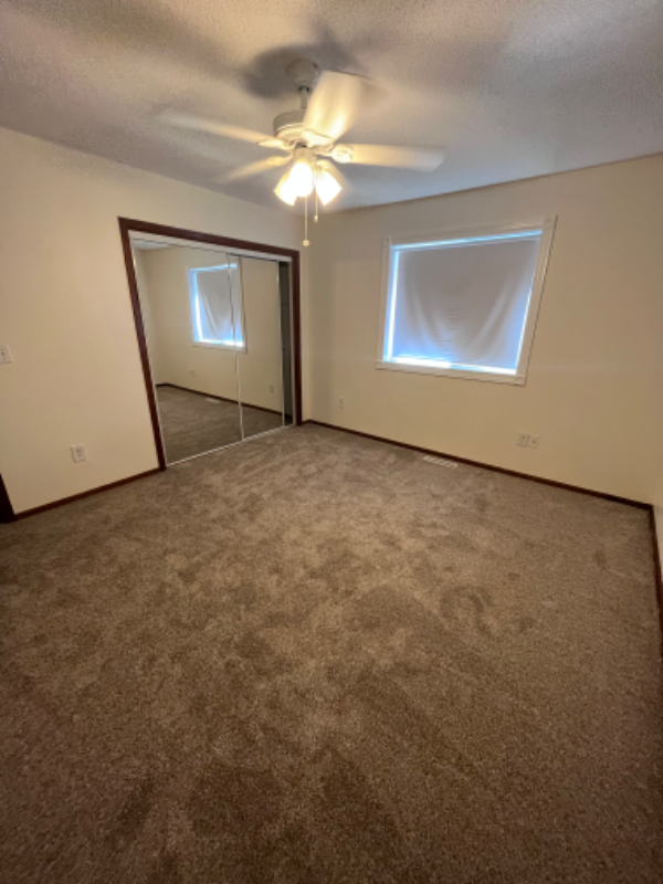
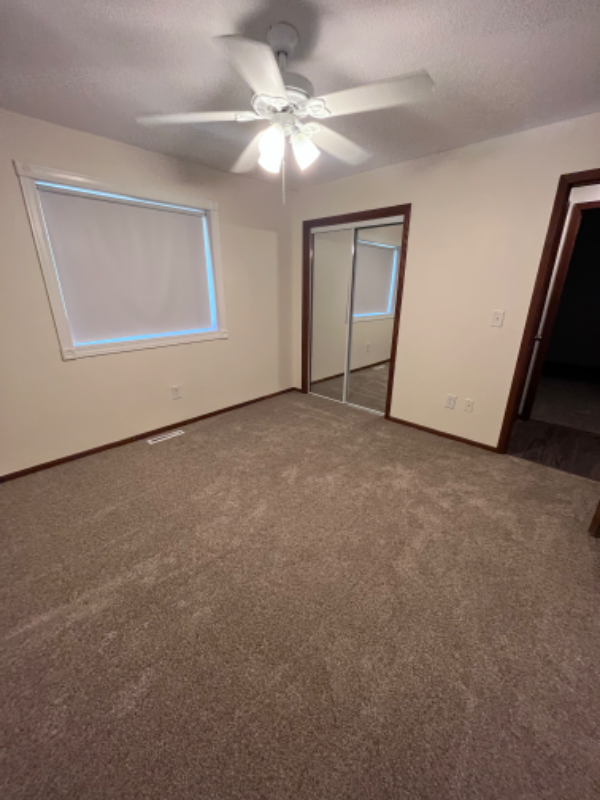
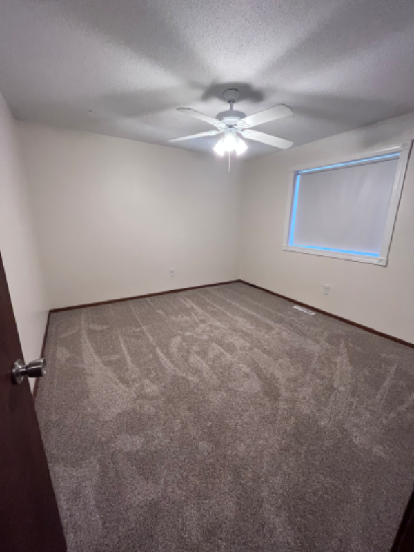
About This Property
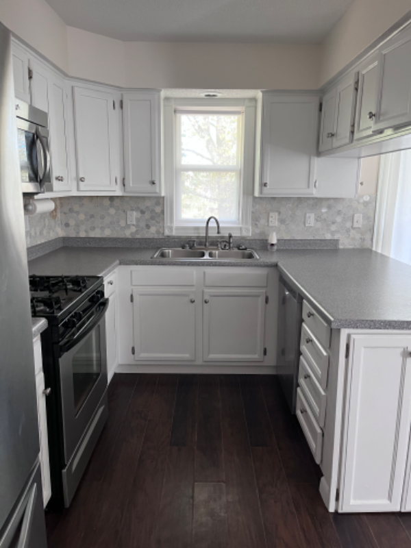
Property Id: 1283569 Spacious, updated 3 bedroom lower unit with walk out to large private lot with lots of lawn for the kids and walking paths. 1 full bathroom with bathtub and granite countertop. Stainless steel kitchen appliances with new luxury vinyl plank throughout. Updated entry and laundry room with large washer and dryer. 1 car garage and 12 x 16 shed for storage. Safe and quiet suburban neighborhood with plenty of off street parking. Unit has been updated and ready to move in 2/1/24 Many walking paths, parks, lakes and ponds in the area. Near community center A must see place that will make a beautiful home!! Small pets only with deposit and possible monthly fee, no smoking, Background check/application fees will apply. Electric, Gas and Trash not included in rent. Approx $120/mo for al
7537 Banning Way is an apartment community located in Dakota County and the 55077 ZIP Code.
Features
Washer/Dryer
Dishwasher
Microwave
Refrigerator
- Washer/Dryer
- Cable Ready
- Dishwasher
- Disposal
- Microwave
- Oven
- Refrigerator
- Freezer
- Tile Floors
- Bicycle Storage
- Lawn
Fees and Policies
The fees below are based on community-supplied data and may exclude additional fees and utilities.
- Dogs Allowed
-
Fees not specified
-
Weight limit--
-
Pet Limit--
- Parking
-
Garage--
Details
Utilities Included
-
Water
-
Sewer
Location
Get Directions
Just off the eastern bank of the Mississippi River, Inver Grove Heights, Minnesota has all the natural beauty expected from the state known for its grassy rolling plains. South of the Twin Cities, Inver Grove Heights is a suburb of Saint Paul. This residential city provides easy access to the surrounding areas thanks to the highway that runs through the city, Highway 52.
Residents of this quiet town enjoy several events and volunteer opportunities that keeps people of Inver Grove Heights connected. There are also many local parks and a community center that provides the community with a variety of recreation opportunities and programs. The new development within the area makes Inver Grove a city with a pleasant mix of both old and new.
Learn more about living in Inver Grove HeightsBelow are rent ranges for similar nearby apartments
Amenities
- Washer/Dryer
- Cable Ready
- Dishwasher
- Disposal
- Microwave
- Oven
- Refrigerator
- Freezer
- Tile Floors
- Lawn
- Bicycle Storage
Expenses
Utilities Included
Water, Sewer
Included
Education
| Colleges & Universities | Distance | ||
|---|---|---|---|
| Colleges & Universities | Distance | ||
| Drive: | 5 min | 1.6 mi | |
| Drive: | 13 min | 6.7 mi | |
| Drive: | 15 min | 9.6 mi | |
| Drive: | 17 min | 10.1 mi |
7537 Banning Way Unit Lower is within 5 minutes or 1.6 miles from Inver Hills Community College. It is also near Argosy University, Twin Cities and Saint Paul College.
Transportation options available in Inver Grove Heights include Central Station, located 8.9 miles from 7537 Banning Way Unit Lower. 7537 Banning Way Unit Lower is near Minneapolis-St Paul International/Wold-Chamberlain, located 11.0 miles or 19 minutes away.
| Transit / Subway | Distance | ||
|---|---|---|---|
| Transit / Subway | Distance | ||
| Drive: | 14 min | 8.9 mi | |
| Drive: | 14 min | 8.9 mi | |
| Drive: | 15 min | 9.1 mi | |
|
|
Drive: | 16 min | 9.2 mi |
|
|
Drive: | 17 min | 10.1 mi |
| Commuter Rail | Distance | ||
|---|---|---|---|
| Commuter Rail | Distance | ||
|
|
Drive: | 15 min | 9.1 mi |
|
|
Drive: | 32 min | 16.5 mi |
|
|
Drive: | 35 min | 25.6 mi |
|
|
Drive: | 46 min | 33.8 mi |
|
|
Drive: | 47 min | 35.4 mi |
| Airports | Distance | ||
|---|---|---|---|
| Airports | Distance | ||
|
Minneapolis-St Paul International/Wold-Chamberlain
|
Drive: | 19 min | 11.0 mi |
Time and distance from 7537 Banning Way Unit Lower.
| Shopping Centers | Distance | ||
|---|---|---|---|
| Shopping Centers | Distance | ||
| Drive: | 4 min | 1.5 mi | |
| Drive: | 5 min | 1.8 mi | |
| Drive: | 5 min | 2.0 mi |
7537 Banning Way Unit Lower has 3 shopping centers within 2.0 miles, which is about a 5-minute drive. The miles and minutes will be for the farthest away property.
| Parks and Recreation | Distance | ||
|---|---|---|---|
| Parks and Recreation | Distance | ||
|
Dodge Nature Center
|
Drive: | 11 min | 5.7 mi |
|
Cherokee Regional Park
|
Drive: | 17 min | 9.0 mi |
|
Highland Park and Golf Course
|
Drive: | 16 min | 9.4 mi |
|
Crosby Farm Regional Park
|
Drive: | 16 min | 9.4 mi |
|
Fort Snelling State Park
|
Drive: | 21 min | 11.3 mi |
7537 Banning Way Unit Lower has 5 parks within 11.3 miles, including Dodge Nature Center, Cherokee Regional Park, and Highland Park and Golf Course.
| Hospitals | Distance | ||
|---|---|---|---|
| Hospitals | Distance | ||
| Drive: | 15 min | 9.4 mi | |
| Drive: | 15 min | 9.8 mi | |
| Drive: | 16 min | 9.8 mi |
7537 Banning Way Unit Lower has 3 hospitals within 9.8 miles, the nearest is St. Joseph's Hospital which is 9.4 miles away and a 15 minute drive.
| Military Bases | Distance | ||
|---|---|---|---|
| Military Bases | Distance | ||
| Drive: | 17 min | 9.8 mi |
7537 Banning Way Unit Lower is 9.8 miles and a 17 minute drive from Fort Snelling Military Reservation.
You May Also Like
Similar Rentals Nearby


What Are Walk Score®, Transit Score®, and Bike Score® Ratings?
Walk Score® measures the walkability of any address. Transit Score® measures access to public transit. Bike Score® measures the bikeability of any address.
What is a Sound Score Rating?
A Sound Score Rating aggregates noise caused by vehicle traffic, airplane traffic and local sources
7537 Banning Way
Inver Grove Heights, MN 55077