$2,200
/ Month
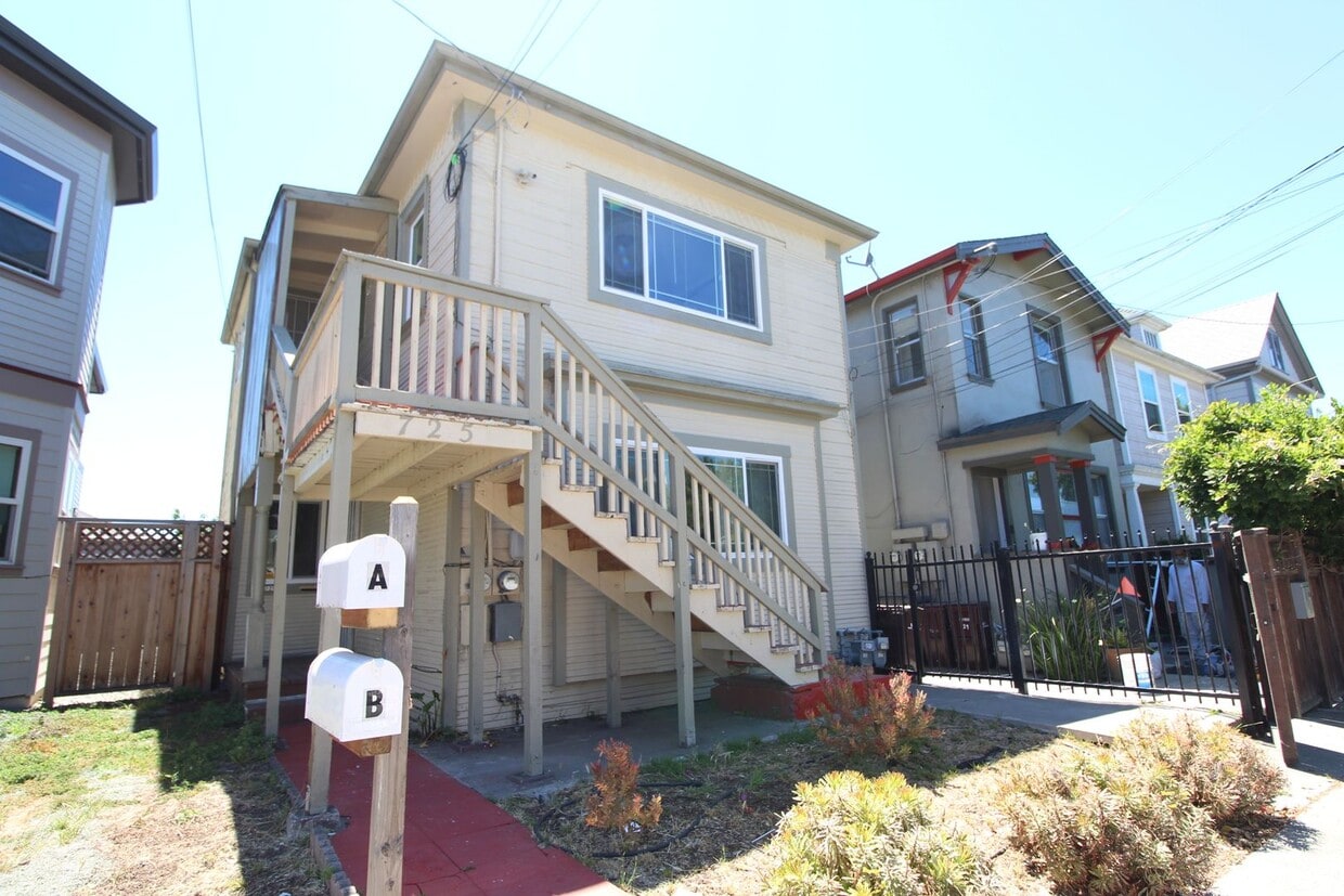
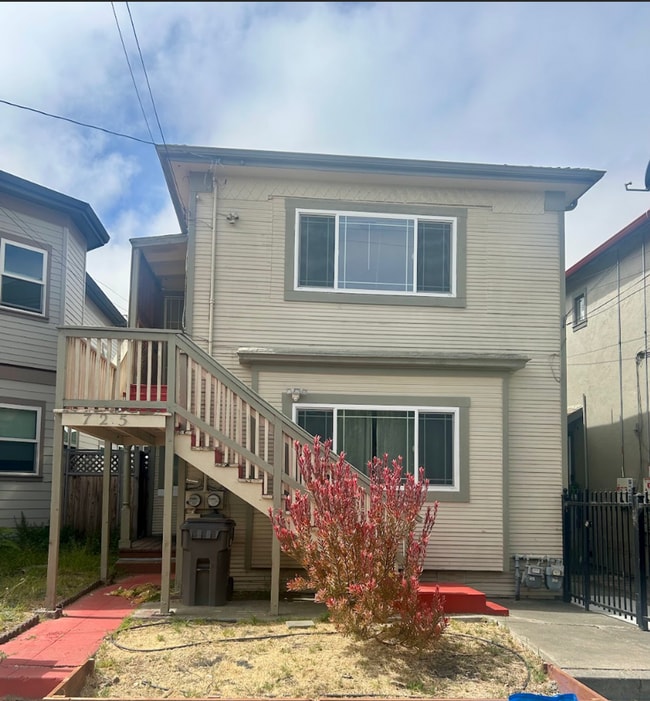
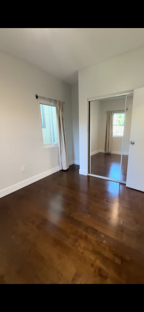
725 44th St Unit B
Oakland, CA 94609
Today
|
Edit
Favorites
510-470-0067
-
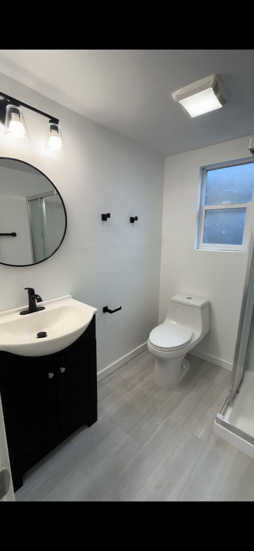
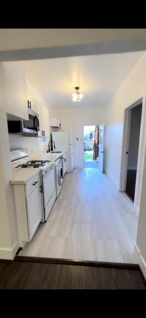
Bedrooms
2
-
Bathrooms
1
-
Square Feet
--
-
Available
Available Now
725 44th St Unit B

Favorites
Fees and Policies
The fees listed below are community-provided and may exclude utilities or add-ons. All payments are made directly to the property and are non-refundable unless otherwise specified. Use the Cost Calculator to determine costs based on your needs.
-
One-Time Basics
-
Due at Move-In
-
Security Deposit - RefundableCharged per unit.$2,200
-
-
Due at Move-In
Property Fee Disclaimer: Based on community-supplied data and independent market research. Subject to change without notice. May exclude fees for mandatory or optional services and usage-based utilities.
Contact
- Listed by Prime Property Management Inc. | Prime Property Management Inc.
- Phone Number
- Contact
Location
Get Directions
The Longfellow neighborhood sits about three miles northwest of Oakland, near the junction of the 580 Freeway and State Route 24, and three miles south of the University of California, Berkeley. Downtown San Francisco is a short 10-mile drive or a quick ride on BART away (catch the high-speed train at the MacArthur Station).
Due to its fantastic location near UC Berkeley, San Francisco, and Downtown Oakland, combined with quality schools and reasonable rents, Longfellow is considered one of Oakland's up-and-coming neighborhoods. Add in plentiful bike lanes, historic architecture, and mountain views, and apartments in Longfellow provide everything you want in the Bay area -- without the high price tag.
Learn more about living in Longfellow
Education
| Colleges & Universities | Distance | ||
|---|---|---|---|
| Colleges & Universities | Distance | ||
| Drive: | 3 min | 1.2 mi | |
| Drive: | 5 min | 2.4 mi | |
| Drive: | 8 min | 2.8 mi | |
| Drive: | 7 min | 4.4 mi |
725 44th St Unit B is within 3 minutes or 1.2 miles from Samuel Merritt University. It is also near Lincoln University, Oakland and Berkeley City College.
Transportation options available in Oakland include Ashby Station, located 1.6 miles from 725 44th St Unit B. 725 44th St Unit B is near Metro Oakland International, located 11.9 miles or 18 minutes away, and San Francisco International, located 22.5 miles or 34 minutes away.
| Transit / Subway | Distance | ||
|---|---|---|---|
| Transit / Subway | Distance | ||
|
|
Drive: | 5 min | 1.6 mi |
|
|
Drive: | 5 min | 1.7 mi |
|
|
Drive: | 4 min | 2.1 mi |
|
|
Drive: | 4 min | 2.3 mi |
|
|
Drive: | 5 min | 2.4 mi |
| Commuter Rail | Distance | ||
|---|---|---|---|
| Commuter Rail | Distance | ||
| Drive: | 5 min | 2.1 mi | |
|
|
Drive: | 6 min | 3.7 mi |
|
|
Drive: | 7 min | 4.5 mi |
| Drive: | 16 min | 10.1 mi | |
| Drive: | 16 min | 10.7 mi |
| Airports | Distance | ||
|---|---|---|---|
| Airports | Distance | ||
|
Metro Oakland International
|
Drive: | 18 min | 11.9 mi |
|
San Francisco International
|
Drive: | 34 min | 22.5 mi |
Getting Around
 What do Walkability, Transit, Drivability, and Bikeability mean?
Walkability measures the walking distance to day-to-day needs.
Transit measures access to public transportation.
Drivability measures congestion, parking availability, and access to major roads.
Bikeability measures the suitability for cycling.
How It Works
What do Walkability, Transit, Drivability, and Bikeability mean?
Walkability measures the walking distance to day-to-day needs.
Transit measures access to public transportation.
Drivability measures congestion, parking availability, and access to major roads.
Bikeability measures the suitability for cycling.
How It Works
Very Walkable
Walkability
80
/ 100
Exceptional Public Transit
Transit
90
/ 100
Moderately Drivable
Drivability
70
/ 100
Moderately Bikeable
Bikeability
70
/ 100
Scores provided by
Active
Soundscore™
68
/ 100
Traffic
BusyAirport
CalmBusinesses
ActiveScores provided by
HowLoud What is a Sound Score Rating? A Sound Score Rating aggregates noise caused by vehicle traffic, airplane traffic and local sources. How It WorksTime and distance from 725 44th St Unit B.
| Shopping Centers | Distance | ||
|---|---|---|---|
| Shopping Centers | Distance | ||
| Walk: | 8 min | 0.4 mi | |
| Walk: | 9 min | 0.5 mi | |
| Walk: | 12 min | 0.6 mi |
725 44th St Unit B has 3 shopping centers within 0.6 mile, which is about a 12-minute walk. The miles and minutes will be for the farthest away property.
| Parks and Recreation | Distance | ||
|---|---|---|---|
| Parks and Recreation | Distance | ||
|
Morcom Rose Garden
|
Drive: | 5 min | 1.9 mi |
|
Lakeside Park Garden Center
|
Drive: | 5 min | 2.4 mi |
|
Lakeside Park
|
Drive: | 5 min | 2.5 mi |
|
Rotary Nature Center
|
Drive: | 6 min | 2.8 mi |
|
San Francisco Bay Trail (at Emeryville)
|
Drive: | 6 min | 3.1 mi |
725 44th St Unit B has 5 parks within 3.1 miles, including Morcom Rose Garden, Lakeside Park Garden Center, and Rotary Nature Center.
| Hospitals | Distance | ||
|---|---|---|---|
| Hospitals | Distance | ||
| Walk: | 8 min | 0.4 mi | |
| Drive: | 2 min | 1.2 mi | |
| Drive: | 3 min | 1.2 mi |
725 44th St Unit B has 3 hospitals within 1.2 miles, the nearest is Children's Hospital & Research Center Oakland which is 0.4 mile away and a 8 minute walk.
| Military Bases | Distance | ||
|---|---|---|---|
| Military Bases | Distance | ||
| Drive: | 13 min | 5.4 mi | |
| Drive: | 14 min | 5.9 mi |
725 44th St Unit B is 5.4 miles from Oakland Army Base, and is convenient to other military bases, including Alameda/US Naval Air Station Alameda.
You May Also Like
Similar Rentals Nearby


What Are Walk Score®, Transit Score®, and Bike Score® Ratings?
Walk Score® measures the walkability of any address. Transit Score® measures access to public transit. Bike Score® measures the bikeability of any address.
What is a Sound Score Rating?
A Sound Score Rating aggregates noise caused by vehicle traffic, airplane traffic and local sources.

725 44th St
Oakland, CA 94609