

$1,150
/ Month
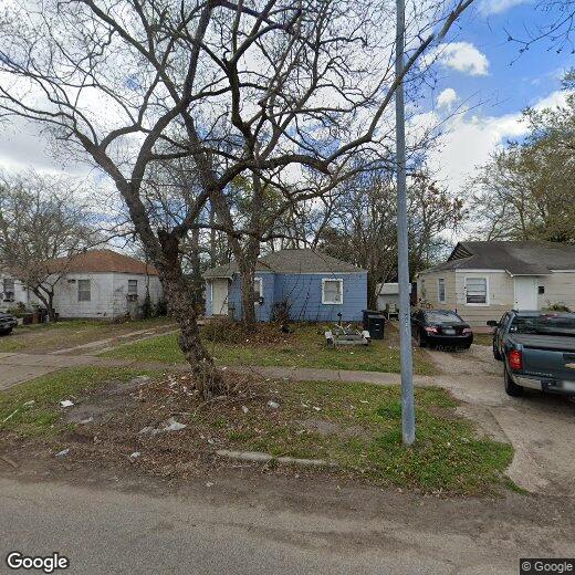
6719 Narcissus St
Houston, TX 77087
Today
Favorites
713-822-5223
-
Bedrooms
2
-
Bathrooms
1
-
Square Feet
798 sq ft
-
Available
Available Now
Highlights
- Window Unit Cooling System
- No Heating
- 1-Story Property
6719 Narcissus St

Favorites
About This Home
Available Now
Inside the loop 2 bedroom and 1 bath home,ease of prompt access to major freeways 45 and 610. Large backyard to enjoy for gatherings. Driveway that leads to the backyard. Walking distance to HCC,schools,and community park Pecan Park for an active lifestyle. Perfect location when commuting is a major priority. Recently renovated interior,Kitchen and Bathroom. MLS# 81128675
6719 Narcissus St is a house located in Harris County and the 77087 ZIP Code. This area is served by the Houston Independent attendance zone.
* Price shown is base rent. Excludes user-selected optional fees and variable or usage-based fees and required charges due at or prior to move-in or at move-out. Price, availability, fees, and any applicable rent special are subject to change without notice.
* Square footage definitions vary. Displayed square footage is approximate.
Home Details
Home Type
Single Family Detached Home
Year Built
Built in 1951
Bedrooms and Bathrooms
1 Full Bathroom
2 Bedrooms
Interior Spaces
798 Sq Ft Home
1-Story Property
Listing and Financial Details
Property Available on 10/28/25
12 Month Lease Term
Lot Details
5,500 Sq Ft Lot
Schools
Southmayd Elementary School
Deady Middle School
Milby High School
Utilities
Window Unit Cooling System
No Heating
Community Details
Overview
Pecan Park R/P Subdivision
Pet Policy
Call for details about the types of pets allowed
Pet Deposit Required
Contact
- Listed by Nayellie Romero | JLA Realty
- Phone Number
- Contact
-
Source
 Houston Association of REALTORS®
Copyright © 2025 Houston Association of Realtors. All rights reserved. All information provided by the listing agent/broker is deemed reliable but is not guaranteed and should be independently verified.
Location
Get Directions
Nestled along Interstates 45 and 610, Pecan Park is a bustling suburb filled with tree-lined streets, affordable rentals, and various conveniences. Great schools keep families flocking to Pecan Park, including Sanchez Elementary School and Milby High School in the Houston Intendent School District. Houston Community College’s Eastside Campus also sits in Pecan Park along Rustic Street.
Ingrando Park is the perfect place for kids to play basketball, baseball, or enjoy the picnic areas and community center. Just outside of this neighborhood lies various department stores, retailers, and restaurants. Renters will not only enjoy the affordable apartments in this neighborhood, but the easy commute as well, located just six miles southeast of Downtown Houston.
Learn more about living in Pecan Park
Education
| Colleges & Universities | Distance | ||
|---|---|---|---|
| Colleges & Universities | Distance | ||
| Drive: | 7 min | 3.6 mi | |
| Drive: | 9 min | 4.7 mi | |
| Drive: | 11 min | 5.8 mi | |
| Drive: | 13 min | 6.9 mi |
6719 Narcissus St is within 7 minutes or 3.6 miles from University of Houston. It is also near Texas Southern University and Houston Community College.
Schools


Public Elementary School
Grades PK-5
366 Students
Attendance Zone
Public Middle School
Grades 6-8
588 Students
Attendance Zone
Public High School
Grades 9-12
2,107 Students
Attendance Zone
Private Elementary & Middle School
Grades PK-8
80 Students
Nearby
Private High School
Grades 9-12
211 Students
Nearby
Private High School
Grades 9-12
522 Students
Nearby
School data provided by
 The GreatSchools Rating helps parents compare schools within a state based on a variety of school quality indicators and provides a helpful picture of how effectively each school serves all of its students. Ratings are on a scale of 1 (below average) to 10 (above average) and can include test scores, college readiness, academic progress, advanced courses, equity, discipline and attendance data. We also advise parents to visit schools, consider other information on school performance and programs, and consider family needs as part of the school selection process.
View GreatSchools Rating Methodology
Data provided by GreatSchools.org © 2025. All rights reserved.
View GreatSchools Rating Methodology
Data provided by GreatSchools.org © 2025. All rights reserved.
Transportation options available in Houston include Magnolia Park Transit Center Eb, located 2.8 miles from 6719 Narcissus St. 6719 Narcissus St is near William P Hobby, located 6.5 miles or 15 minutes away, and George Bush Intcntl/Houston, located 26.8 miles or 34 minutes away.
| Transit / Subway | Distance | ||
|---|---|---|---|
| Transit / Subway | Distance | ||
| Drive: | 5 min | 2.8 mi | |
| Drive: | 5 min | 2.8 mi | |
| Drive: | 6 min | 3.0 mi | |
| Drive: | 6 min | 3.0 mi | |
| Drive: | 6 min | 3.3 mi |
| Commuter Rail | Distance | ||
|---|---|---|---|
| Commuter Rail | Distance | ||
|
|
Drive: | 11 min | 7.0 mi |
| Airports | Distance | ||
|---|---|---|---|
| Airports | Distance | ||
|
William P Hobby
|
Drive: | 15 min | 6.5 mi |
|
George Bush Intcntl/Houston
|
Drive: | 34 min | 26.8 mi |
Time and distance from 6719 Narcissus St.
| Shopping Centers | Distance | ||
|---|---|---|---|
| Shopping Centers | Distance | ||
| Walk: | 7 min | 0.4 mi | |
| Walk: | 10 min | 0.6 mi | |
| Walk: | 14 min | 0.7 mi |
6719 Narcissus St has 3 shopping centers within 0.7 mile, which is about a 14-minute walk. The miles and minutes will be for the farthest away property.
| Parks and Recreation | Distance | ||
|---|---|---|---|
| Parks and Recreation | Distance | ||
|
Sims Bayou Urban Nature Center
|
Drive: | 5 min | 3.1 mi |
|
Discovery Green
|
Drive: | 10 min | 5.7 mi |
|
Children's Museum of Houston
|
Drive: | 12 min | 6.9 mi |
|
Hermann Park
|
Drive: | 13 min | 6.9 mi |
|
Cockrell Butterfly Center
|
Drive: | 13 min | 7.5 mi |
6719 Narcissus St has 5 parks within 7.5 miles, including Sims Bayou Urban Nature Center, Discovery Green, and Hermann Park.
| Hospitals | Distance | ||
|---|---|---|---|
| Hospitals | Distance | ||
| Drive: | 8 min | 5.0 mi | |
| Drive: | 10 min | 6.0 mi | |
| Drive: | 12 min | 7.3 mi |
6719 Narcissus St has 3 hospitals within 7.3 miles, the nearest is St. Joseph Medical Center which is 5.0 miles away and a 8 minute drive.
| Military Bases | Distance | ||
|---|---|---|---|
| Military Bases | Distance | ||
| Drive: | 30 min | 20.5 mi | |
| Drive: | 58 min | 46.0 mi |
6719 Narcissus St is 20.5 miles from Lyndon B Johnson Space Center, and is convenient to other military bases, including Pelican Spit Military Reservation.
You May Also Like
Similar Rentals Nearby


What Are Walk Score®, Transit Score®, and Bike Score® Ratings?
Walk Score® measures the walkability of any address. Transit Score® measures access to public transit. Bike Score® measures the bikeability of any address.
What is a Sound Score Rating?
A Sound Score Rating aggregates noise caused by vehicle traffic, airplane traffic and local sources
6719 Narcissus St
Houston, TX 77087