

$1,200
/ Month
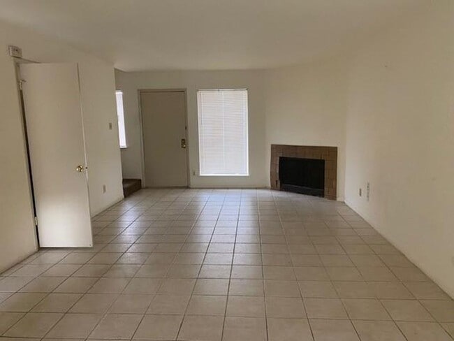
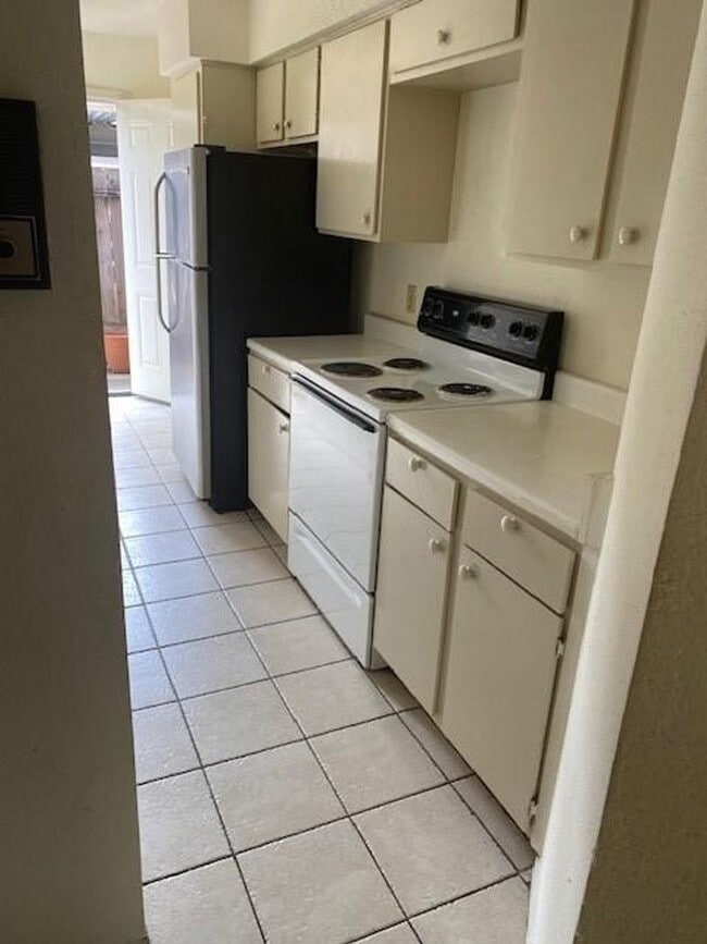
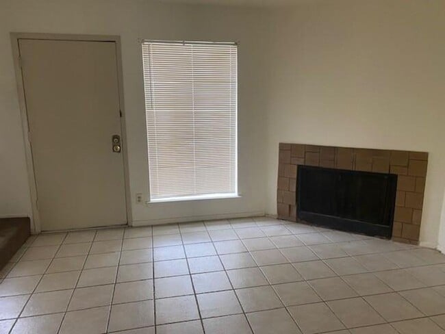
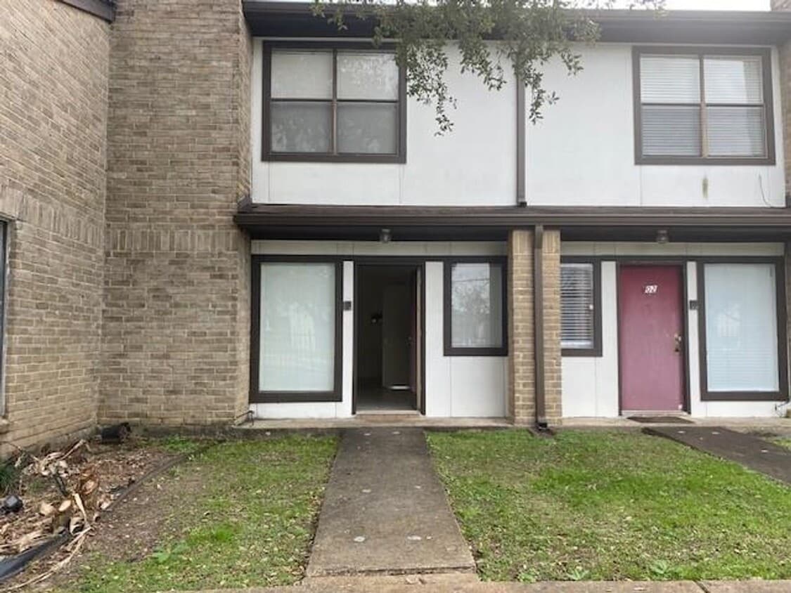
6633 W Airport Blvd
Houston, TX 77035
1 Day Ago
|
Edit
Favorites
-
Bedrooms
2
-
Bathrooms
2.5
-
Square Feet
1,305 sq ft
6633 W Airport Blvd

Favorites
Fees and Policies
The fees listed below are community-provided and may exclude utilities or add-ons. All payments are made directly to the property and are non-refundable unless otherwise specified. Use the Cost Calculator to determine costs based on your needs.
-
One-Time Basics
-
Due at Move-In
-
Security Deposit - RefundableCharged per unit.$1,200
-
-
Due at Move-In
Property Fee Disclaimer: Based on community-supplied data and independent market research. Subject to change without notice. May exclude fees for mandatory or optional services and usage-based utilities.
Contact
- Listed by 1 Stop Property Management | 1 Stop Property Management
Location
Get Directions
Greater Fondren Southwest is part of the Brays Oaks District of Houston, Texas. This large neighborhood stretches from Brays Bayou Park to the north and US Route 90 to the south. The Sam Houston Tollway forms the western border of the neighborhood.
Named for oilman Walter Fondren, this historic neighborhood contains some hidden gems and is rapidly gaining in popularity due in part to its proximity to Downtown Houston, which is just 15 miles northeast. Houston Baptist University is just outside the neighborhood and is easily reached by heading north on Fondren Road. Greater Fondren Southwest is considered one of Houston's Super Neighborhoods. There’s an amazing mix of low-lying apartments and single-family homes for rent, meaning every renter will find their perfect fit.
Learn more about living in Greater Fondren Southwest
Education
| Colleges & Universities | Distance | ||
|---|---|---|---|
| Colleges & Universities | Distance | ||
| Drive: | 8 min | 4.1 mi | |
| Drive: | 9 min | 4.2 mi | |
| Drive: | 15 min | 9.0 mi | |
| Drive: | 14 min | 9.0 mi |
6633 W Airport Blvd is within 8 minutes or 4.1 miles from Houston Christian University. It is also near Houston Baptist University and The Art Institute of Houston.
Schools


Public Elementary School
Grades PK-5
617 Students
Attendance Zone
Public Middle School
Grades 6-8
840 Students
Attendance Zone
Public High School
Grades 9-12
2,243 Students
Attendance Zone
Private Elementary, Middle & High School
Grades PK-12
299 Students
Nearby
Private Elementary & Middle School
Grades PK-8
153 Students
Nearby
Private Elementary School
Grades PK-5
21 Students
Nearby
School data provided by
 The GreatSchools Rating helps parents compare schools within a state based on a variety of school quality indicators and provides a helpful picture of how effectively each school serves all of its students. Ratings are on a scale of 1 (below average) to 10 (above average) and can include test scores, college readiness, academic progress, advanced courses, equity, discipline and attendance data. We also advise parents to visit schools, consider other information on school performance and programs, and consider family needs as part of the school selection process.
View GreatSchools Rating Methodology
Data provided by GreatSchools.org © 2026. All rights reserved.
View GreatSchools Rating Methodology
Data provided by GreatSchools.org © 2026. All rights reserved.
Transportation options available in Houston include Fannin South Stn Sb, located 7.9 miles from 6633 W Airport Blvd. 6633 W Airport Blvd is near William P Hobby, located 19.4 miles or 32 minutes away, and George Bush Intcntl/Houston, located 34.4 miles or 45 minutes away.
| Transit / Subway | Distance | ||
|---|---|---|---|
| Transit / Subway | Distance | ||
| Drive: | 12 min | 7.9 mi | |
|
|
Drive: | 13 min | 8.5 mi |
| Drive: | 13 min | 8.8 mi | |
| Drive: | 14 min | 9.3 mi | |
| Drive: | 15 min | 9.6 mi |
| Commuter Rail | Distance | ||
|---|---|---|---|
| Commuter Rail | Distance | ||
|
|
Drive: | 24 min | 15.3 mi |
| Airports | Distance | ||
|---|---|---|---|
| Airports | Distance | ||
|
William P Hobby
|
Drive: | 32 min | 19.4 mi |
|
George Bush Intcntl/Houston
|
Drive: | 45 min | 34.4 mi |
Getting Around
 What do Walkability, Transit, Drivability, and Bikeability mean?
Walkability measures the walking distance to day-to-day needs.
Transit measures access to public transportation.
Drivability measures congestion, parking availability, and access to major roads.
Bikeability measures the suitability for cycling.
How It Works
What do Walkability, Transit, Drivability, and Bikeability mean?
Walkability measures the walking distance to day-to-day needs.
Transit measures access to public transportation.
Drivability measures congestion, parking availability, and access to major roads.
Bikeability measures the suitability for cycling.
How It Works
Moderately Walkable
Walkability
60
/ 100
Some Public Transit
Transit
40
/ 100
Exceptionally Drivable
Drivability
90
/ 100
Fairly Bikeable
Bikeability
50
/ 100
Scores provided by
Active
Soundscore™
74
/ 100
Traffic
ActiveAirport
CalmBusinesses
ActiveScores provided by
HowLoud What is a Sound Score Rating? A Sound Score Rating aggregates noise caused by vehicle traffic, airplane traffic and local sources. How It WorksTime and distance from 6633 W Airport Blvd.
| Shopping Centers | Distance | ||
|---|---|---|---|
| Shopping Centers | Distance | ||
| Walk: | 6 min | 0.3 mi | |
| Walk: | 16 min | 0.9 mi |
6633 W Airport Blvd has 2 shopping centers within 0.9 mile, which is about a 16-minute walk. The miles and minutes will be for the farthest away property.
| Parks and Recreation | Distance | ||
|---|---|---|---|
| Parks and Recreation | Distance | ||
|
Club Creek Park and Vietnam Veterans Memorial
|
Drive: | 11 min | 5.1 mi |
|
Nature Discovery Center
|
Drive: | 11 min | 6.4 mi |
|
Arthur Storey Park
|
Drive: | 13 min | 7.3 mi |
|
Buffalo Bayou Paddling Trail
|
Drive: | 15 min | 8.4 mi |
|
Houston Maritime Museum
|
Drive: | 14 min | 9.1 mi |
6633 W Airport Blvd has 5 parks within 9.1 miles, including Club Creek Park and Vietnam Veterans Memorial, Nature Discovery Center, and Arthur Storey Park.
| Hospitals | Distance | ||
|---|---|---|---|
| Hospitals | Distance | ||
| Drive: | 10 min | 5.6 mi | |
| Drive: | 11 min | 5.9 mi | |
| Drive: | 12 min | 8.4 mi |
6633 W Airport Blvd has 3 hospitals within 8.4 miles, the nearest is West Oaks Hospital which is 5.6 miles away and a 10 minute drive.
| Military Bases | Distance | ||
|---|---|---|---|
| Military Bases | Distance | ||
| Drive: | 44 min | 31.5 mi | |
| Drive: | 73 min | 57.1 mi |
6633 W Airport Blvd is 31.5 miles from Lyndon B Johnson Space Center, and is convenient to other military bases, including Pelican Spit Military Reservation.
You May Also Like
Similar Rentals Nearby
-
-
2 Beds$1,981+3 Beds$2,741Total Monthly PriceTotal Monthly Price NewPrices include required monthly fees of $91.Base Rent:2 Beds$1,890+3 Beds$2,650Specials
Pets Allowed Fitness Center Pool Dishwasher Refrigerator Kitchen
-
-
-
-
-
-
-
-


What Are Walk Score®, Transit Score®, and Bike Score® Ratings?
Walk Score® measures the walkability of any address. Transit Score® measures access to public transit. Bike Score® measures the bikeability of any address.
What is a Sound Score Rating?
A Sound Score Rating aggregates noise caused by vehicle traffic, airplane traffic and local sources.
6633 W Airport Blvd
Houston, TX 77035