
$4,995 Total Monthly Price

66 Old Amherst Rd

,

Sunderland, MA 01375

Share Listing
Favorites
413-600-0283
  • Bedrooms

    5

  • Bathrooms

    2

  • Square Feet

    2,750 sq ft

  • Available

    Available Jul 1, 2027

66 Old Amherst Rd
Share Listing
Favorites

About This Home

$4,995 deposit, Available Jul 1, 2027

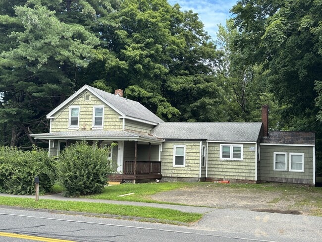
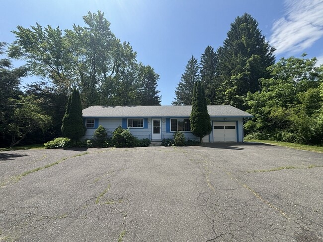
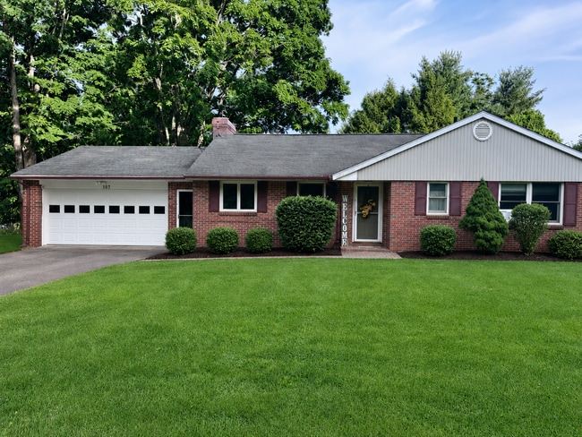
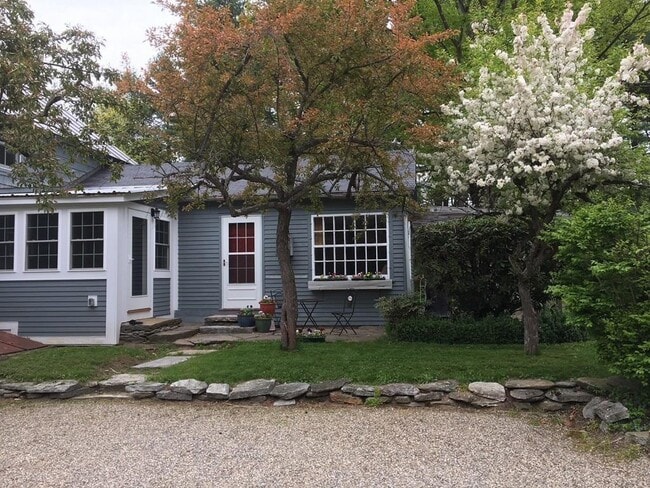
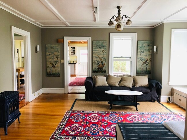
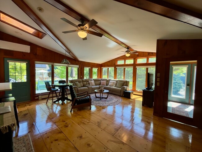
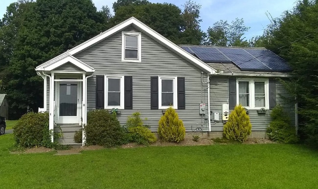
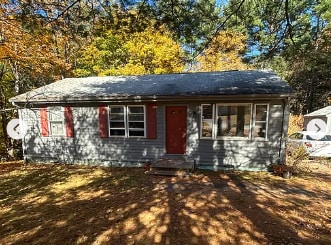
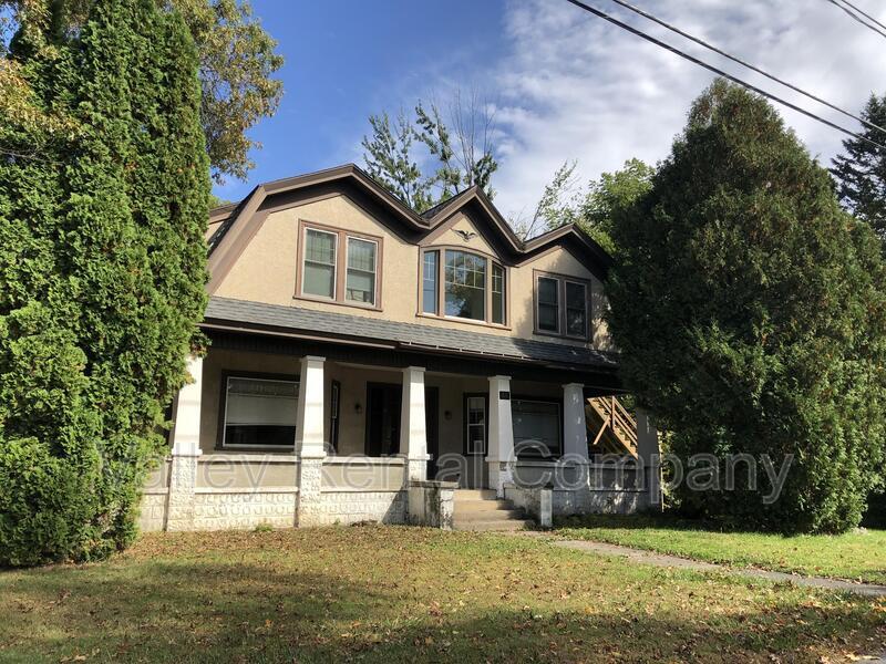
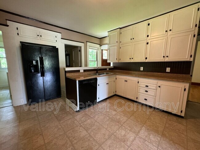
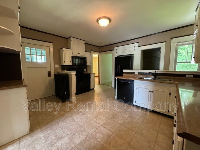
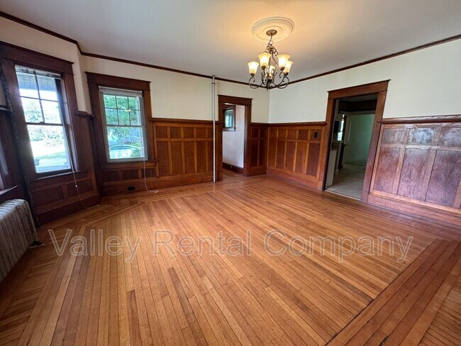
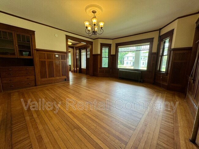
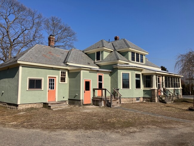
Charming Home Full of Character in a Prime Location! If you're seeking a home with plenty of charm and space, look no further! This beautiful property features 5 generously sized bedrooms plus a bonus room, 2 full bathrooms, and an updated kitchen with all the modern amenities. Enjoy spacious living and dining areas, along with ample storage throughout the home. This inviting residence truly has it all. Pets are negotiable. Rent Includes: -Lawn Care -24-Hour Emergency Maintenance Tenant Responsible for: -Heat (Oil) -Water/Sewer -Hot Water -Electricity -Snow Removal -Trash Removal -Cable/Internet For more information or to schedule an in person showing: Phone: Email: Website:

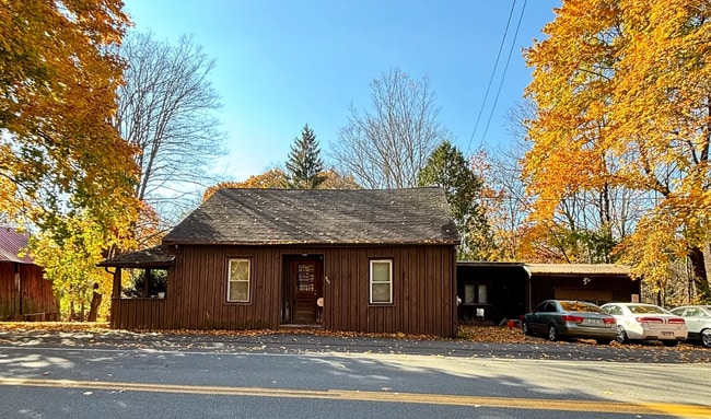
66 Old Amherst Rd is a house located in Franklin County and the 01375 ZIP Code.

* Price shown is total price based on community-supplied monthly required fees. Excludes user-selected optional fees and variable or usage-based fees and required charges due at or prior to move-in or at move-out. Price, availability, fees, and any applicable rent special are subject to change without notice.
* Square footage definitions vary. Displayed square footage is approximate.

Fees and Policies

The fees listed below are community-provided and may exclude utilities or add-ons. All payments are made directly to the property and are non-refundable unless otherwise specified.

  • Dogs Allowed
  • Fees not specified
  • Cats Allowed
  • Fees not specified

Contact

  • Listed by Valley Rental Company
  • Phone Number
  • Contact
| Edit

Under 30 minutes

Commute Time is calculated at rush hour.
City - Sunderland

Sunderland was originally named 'Swampfield' -- a name so discouraging that early colonists renamed it after the Earl of Sunderland to draw in settlers. That small act of rebranding stuck, and today this Connecticut River town carries a quiet character that sets it apart from its busier neighbors. Historic Main Street is lined with 19th-century architecture, farms stretch to the horizon, and Mount Sugarloaf and Mount Toby State Forest frame the eastern edge of town. Nine miles north of Amherst, Sunderland offers easy access to the Five College Consortium corridor while maintaining a quieter setting.

Rentals here lean toward single-family homes, Cape Cods, Colonial Revival houses, and saltbox-style properties that reflect the town's deep New England roots. Townhomes and smaller multi-family buildings round out the options, with very few high-rises.

UMass Amherst, roughly 18 minutes south, anchors the regional economy.

Learn more about living in Sunderland 
Education
Colleges & Universities Distance
Drive: 13 min 7.1 mi
Drive: 15 min 7.4 mi
Drive: 22 min 10.9 mi
Drive: 22 min 13.8 mi
66 Old Amherst Rd is within 13 minutes or 7.1 miles from UMass Amherst. It is also near Amherst College and Hampshire College.
Transportation
Commuter Rail Distance
Drive: 18 min 12.1 mi
Drive: 21 min 13.5 mi
Drive: 33 min 24.4 mi
Drive: 40 min 31.5 mi
Drive: 40 min 31.8 mi
Getting Around
Somewhat Walkable
Walkability
30 / 100
Limited Public Transit
Transit
30 / 100
Exceptionally Drivable
Drivability
90 / 100
Somewhat Bikeable
Bikeability
30 / 100

Scores provided by

What do Walkability, Transit, Drivability, and Bikeability mean? Walkability measures the walking distance to day-to-day needs. Transit measures access to public transportation. Drivability measures congestion, parking availability, and access to major roads. Bikeability measures the suitability for cycling. How It Works
-
Soundscore
- / 100

Traffic

-

Airport

-

Businesses

-

Scores provided by

HowLoud What is a Sound Score Rating? A Sound Score Rating aggregates noise caused by vehicle traffic, airplane traffic and local sources. How It Works
Points of Interest

Time and distance from 66 Old Amherst Rd.

Shopping Centers Distance
Walk: 20 min 1.0 mi
Drive: 13 min 7.5 mi
Drive: 14 min 7.8 mi
66 Old Amherst Rd has 3 shopping centers within 7.8 miles, which is about a 14-minute drive. The miles and minutes will be for the farthest away property.
Parks and Recreation Distance
Mount Sugarloaf State Reservation
Drive: 9 min 2.8 mi
Richard Cronin National Salmon Station
Drive: 5 min 2.9 mi
Silvio O. Conte National Fish & Wildlife Refuge
Drive: 6 min 3.2 mi
Magic Wings Butterfly Conservatory & Gardens
Drive: 9 min 5.0 mi
Orchard Hill Observatory
Drive: 14 min 7.0 mi
66 Old Amherst Rd has 5 parks within 7.0 miles, including Mount Sugarloaf State Reservation, Richard Cronin National Salmon Station, and Silvio O. Conte National Fish & Wildlife Refuge.
Hospitals Distance
Hospitals Distance
Drive: 20 min 12.8 mi
Drive: 19 min 13.3 mi
66 Old Amherst Rd is 12.8 miles from Baystate Franklin Medical Center, and is convenient to other hospitals, including Cooley Dickinson Hospital.
Military Bases Distance
Drive: 41 min 28.2 mi
Drive: 42 min 29.2 mi
Drive: 78 min 59.5 mi
66 Old Amherst Rd has 3 military bases within 59.5 miles, the nearest is Westover Air Reserve Base which is 28.2 miles away and a 41 minute drive.

You May Also Like

Similar Rentals Nearby