$4,150 / Month
656 Post St
San Francisco, CA 94109
Today
Favorites
415-494-7009
-
Bedrooms
1
-
Bathrooms
1
-
Square Feet
1,100 sq ft
-
Available
Available Jul 1
Highlights
- Patio
- Hardwood Floors
- Smoke Free
656 Post St

Favorites
About This Home
$4,150 deposit,
Available Jul 1
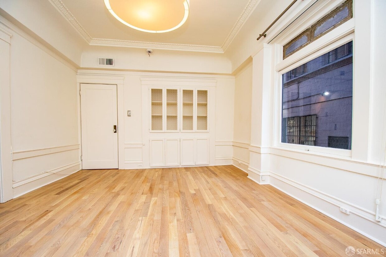
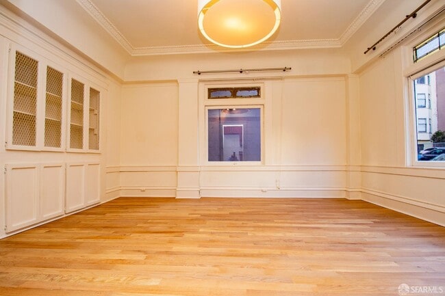
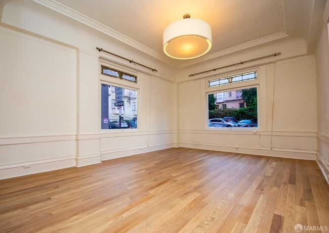
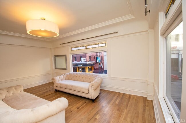
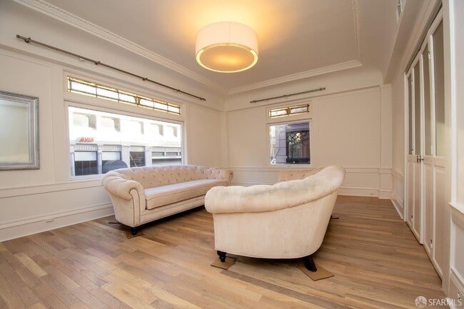
Live in the heart of San Francisco in this spacious 1,100 sq. ft. space, perfectly positioned just a 10-minute stroll to Union Square, the Financial District, and BART/Muni stationsan unbeatable walk-to-everything location! Inside, you'll be greeted by solid hardwood floors, a spacious living room, a formal dining room, a bedroom with two large closets, and custom-built-ins. A beautifully updated bathroom adds a touch of contemporary comfort to your daily routine. This flexible layout is ideal for a professional seeking to create a dedicated home office or creative studio, all within steps of vibrant cafes, shopping, and transit. ​Rent includes water and garbage. Parking is available for lease next to the building. Small pet negotiable. This is an opportunity to make this inviting space your new urban pad. Experience the ultimate city living! Arrange to take a closer look today!
656 Post St is an apartment community located in San Francisco County and the 94109 ZIP Code.
* Price shown is base rent and may not include non-optional fees and utilities.
Price, availability, fees, and any applicable rent special are subject to change without notice.
* Square footage definitions vary. Displayed square footage is approximate.
Features
Air Conditioning
Hardwood Floors
Granite Countertops
Tub/Shower
- Air Conditioning
- Smoke Free
- Tub/Shower
- Sprinkler System
- Granite Countertops
- Oven
- Range
- Breakfast Nook
- Hardwood Floors
- Carpet
- Patio
Fees and Policies
The fees below are based on community-supplied data and may exclude additional fees and utilities.
- Parking
-
Surface Lot--
-
Garage--
Contact
- Listed by Ray Amouzandeh | Ray Amouzandeh, Broker
- Phone Number
- Website View Property Website
- Contact
-
Source
San Francisco Association of Realtors
Copyright © 2025 San Francisco Association of REALTORS. All rights reserved. All information provided by the listing agent/broker is deemed reliable but is not guaranteed and should be independently verified.
Location
Get Directions
Amenities
- Air Conditioning
- Smoke Free
- Tub/Shower
- Sprinkler System
- Granite Countertops
- Oven
- Range
- Breakfast Nook
- Hardwood Floors
- Carpet
- Patio
San Francisco’s Lower Nob Hill sits in the heart of Downtown, offering residents a premier location in one of California’s most popular cities. Situated between Union Square and US-101, locals can easily travel through the city, but why leave when there are so many conveniences right in this neighborhood? Union Square is San Francisco’s expansive and famous shopping plaza known for its upscale shops, restaurants, hotels, and nightlife spots.
Lower Nob’s light rail and bus stations are abundant, making commuting as easy as ever. This neighborhood is a great place for job opportunities due to the vast number of businesses in the area. Lower Nob is home to Saint Francis Memorial Hospital, the Masonic, and Dragon’s Gate, a landmark arch that’s the iconic gateway to Chinatown, Lower Nob’s neighbor. This neighborhood features an array of upscale apartments, houses, and condos that will fit any renter’s preferences and style.
Learn more about living in Lower Nob
Education
| Colleges & Universities | Distance | ||
|---|---|---|---|
| Colleges & Universities | Distance | ||
| Walk: | 2 min | 0.1 mi | |
| Walk: | 16 min | 0.8 mi | |
| Drive: | 6 min | 1.7 mi | |
| Drive: | 6 min | 2.1 mi |
656 Post St is within 2 minutes or 0.1 mile from Academy of Art University. It is also near Golden Gate Univ., San Fran. and UC San Francisco, Mount Zion.
Transportation options available in San Francisco include Powell And Post, located 0.2 mile from 656 Post St. 656 Post St is near San Francisco International, located 14.4 miles or 23 minutes away, and Metro Oakland International, located 19.6 miles or 30 minutes away.
| Transit / Subway | Distance | ||
|---|---|---|---|
| Transit / Subway | Distance | ||
|
|
Walk: | 4 min | 0.2 mi |
|
|
Walk: | 5 min | 0.3 mi |
|
|
Walk: | 5 min | 0.3 mi |
| Walk: | 6 min | 0.3 mi | |
|
|
Walk: | 6 min | 0.3 mi |
| Commuter Rail | Distance | ||
|---|---|---|---|
| Commuter Rail | Distance | ||
| Drive: | 4 min | 1.4 mi | |
| Drive: | 4 min | 1.5 mi | |
| Drive: | 6 min | 2.9 mi | |
| Drive: | 6 min | 3.0 mi | |
| Drive: | 12 min | 6.6 mi |
| Airports | Distance | ||
|---|---|---|---|
| Airports | Distance | ||
|
San Francisco International
|
Drive: | 23 min | 14.4 mi |
|
Metro Oakland International
|
Drive: | 30 min | 19.6 mi |
Time and distance from 656 Post St.
| Shopping Centers | Distance | ||
|---|---|---|---|
| Shopping Centers | Distance | ||
| Walk: | 10 min | 0.5 mi | |
| Walk: | 10 min | 0.5 mi | |
| Walk: | 11 min | 0.6 mi |
656 Post St has 3 shopping centers within 0.6 mile, which is about a 11-minute walk. The miles and minutes will be for the farthest away property.
| Parks and Recreation | Distance | ||
|---|---|---|---|
| Parks and Recreation | Distance | ||
|
Children's Creativity Museum
|
Walk: | 15 min | 0.8 mi |
|
San Francisco Maritime National Historical Park
|
Drive: | 5 min | 1.8 mi |
|
Aquarium of The Bay
|
Drive: | 6 min | 2.2 mi |
|
Buena Vista Park
|
Drive: | 9 min | 3.1 mi |
|
Randall Museum
|
Drive: | 10 min | 3.3 mi |
656 Post St has 5 parks within 3.3 miles, including Children's Creativity Museum, San Francisco Maritime National Historical Park, and Aquarium of The Bay.
| Hospitals | Distance | ||
|---|---|---|---|
| Hospitals | Distance | ||
| Walk: | 7 min | 0.4 mi | |
| Walk: | 10 min | 0.5 mi | |
| Walk: | 14 min | 0.8 mi |
656 Post St has 3 hospitals within 0.8 mile, the nearest is Saint Francis Memorial Hospital which is 0.4 mile away and a 7 minute walk.
| Military Bases | Distance | ||
|---|---|---|---|
| Military Bases | Distance | ||
| Drive: | 16 min | 5.5 mi | |
| Drive: | 13 min | 5.7 mi | |
| Drive: | 27 min | 14.1 mi |
656 Post St has 3 military bases within 14.1 miles, the nearest is East Fort Miley which is 5.5 miles away and a 16 minute drive.
You May Also Like
Similar Rentals Nearby


What Are Walk Score®, Transit Score®, and Bike Score® Ratings?
Walk Score® measures the walkability of any address. Transit Score® measures access to public transit. Bike Score® measures the bikeability of any address.
What is a Sound Score Rating?
A Sound Score Rating aggregates noise caused by vehicle traffic, airplane traffic and local sources

656 Post St
San Francisco, CA 94109