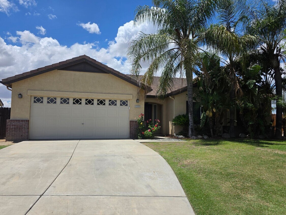
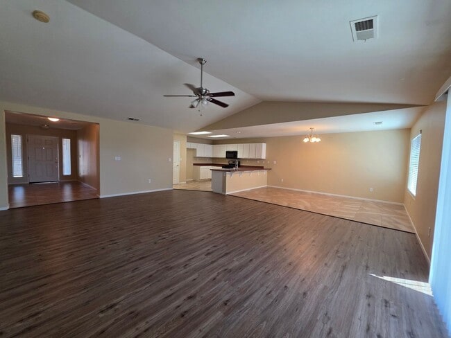
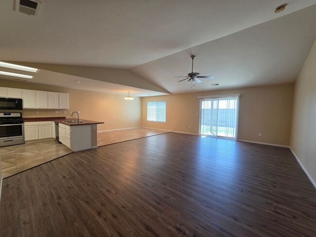
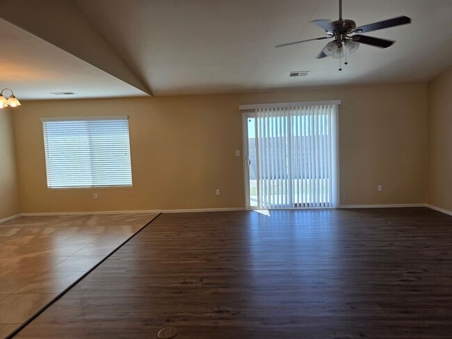
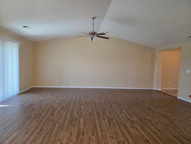
$2,600 / Month

6309 Lost Peak Ct

,

Bakersfield, CA 93311

Share Listing
Favorites
661-327-4496
  • Bedrooms

    4

  • Bathrooms

    2

  • Square Feet

    2,012 sq ft

  • Available

    Available Now

6309 Lost Peak Ct
Share Listing
Favorites

About This Home

$1,000 deposit, Available Now

Clean & Spacious SW 4-Bedroom + 2-Bathroom House: Carpet, Ceramic Tile, Blinds, Gas Stove, Dishwasher, Garb Disp, Microwave, Lots of Cabinet Space, Ceiling Fans, Dining Area, Office Space, Master Bedroom w/Large Walk-In Closet, Indoor Laundry Hookups-G&E, A/C, Fenced Yard, Covered Patio, Attached 2-Car Garage w/Opener, Tankless Water Heater, Sprinklers-F&B, Gardener-F&B, Non Smoking Home, 10-Month Lease Required *Approximately 2012 Sq Ft. *Small Pets 20lbs or less -okay upon approval - Security Deposit will increase. *Applicants are required to maintain renters insurance of 300k & submit proof of coverage for the duration of their residency. *Applicants without pets are required to maintain renters insurance of 100k & submit proof of coverage for the duration of their residency. *Schools: Buena Vista Elementary School, Earl Warren Junior High School, Independence High School *For further information please contact our office "Realty Management Services" located @ 300 H Street, Bakersfield, CA. 93304, , DRE License #01492538. -Cross Streets: Panama Lane & San Angelo Way (Popular Intersection: Panama Lane & Buena Vista Rd.)

Unique Features

  • 2 car garage w/opener
  • Gardener (Front&Back)
  • Laundry Hookups (Gas & Electric)
  • Office Space
  • Trash
  • Walk-In Closet

6309 Lost Peak Ct is a house located in Kern County and the 93311 ZIP Code.

* Price shown is base rent. Excludes user-selected optional fees and variable or usage-based fees and required charges due at or prior to move-in or at move-out. Price, availability, fees, and any applicable rent special are subject to change without notice.
* Square footage definitions vary. Displayed square footage is approximate.

House Features

  • Dishwasher

Contact

  • Listed by Realty Management Services | Realty Management Services
  • Phone Number
  • Contact
| Edit

Under 30 minutes

Commute Time is calculated at rush hour.
City - Bakersfield

Positioned right where the San Joaquin Valley meets the Sierra Nevada, Bakersfield is a thriving community that wears its unique heritage on its sleeve. While one of California’s largest cities today, Bakersfield’s local character is heavily influenced by its agricultural background. Horse shows are popular, with many filling the calendar, and locals love to take advantage of the outlying landscape in off-road vehicles. Festivals throughout the year celebrate the city’s diverse cultural influences, including Native American, Basque, Greek, and Scottish events.

Musical traditions run deep in Bakersfield, and largely define the community.

Learn more about living in Bakersfield 
Amenities
  • Dishwasher
  • 2 car garage w/opener
  • Gardener (Front&Back)
  • Laundry Hookups (Gas & Electric)
  • Office Space
  • Trash
  • Walk-In Closet
Education
Colleges & Universities Distance
Drive: 12 min 5.5 mi
Drive: 27 min 16.5 mi
6309 Lost Peak Ct is within 12 minutes or 5.5 miles from Cal State Bakersfield. It is also near Bakersfield College.
Transportation

6309 Lost Peak Ct is near Meadows Field, located 14.6 miles or 29 minutes away.

Commuter Rail Distance
Drive: 22 min 12.4 mi
Airports Distance
Airports Distance
Meadows Field
Drive: 29 min 14.6 mi
Getting Around
Somewhat Walkable
Walkability
20 / 100
Minimal Public Transit
Transit
0 / 100
Very Drivable
Drivability
80 / 100
Fairly Bikeable
Bikeability
40 / 100

Scores provided by

What do Walkability, Transit, Drivability, and Bikeability mean? Walkability measures the walking distance to day-to-day needs. Transit measures access to public transportation. Drivability measures congestion, parking availability, and access to major roads. Bikeability measures the suitability for cycling. How It Works
-
Soundscore
- / 100

Traffic

-

Airport

-

Businesses

-

Scores provided by

HowLoud What is a Sound Score Rating? A Sound Score Rating aggregates noise caused by vehicle traffic, airplane traffic and local sources. How It Works
Points of Interest

Time and distance from 6309 Lost Peak Ct.

Shopping Centers Distance
Walk: 10 min 0.5 mi
Drive: 4 min 2.3 mi
Drive: 5 min 2.6 mi
6309 Lost Peak Ct has 3 shopping centers within 2.6 miles, which is about a 5-minute drive. The miles and minutes will be for the farthest away property.
Parks and Recreation Distance
Buena Vista Museum of Natural History
Drive: 20 min 11.8 mi
Kern County Museum
Drive: 22 min 13.2 mi
6309 Lost Peak Ct has 2 parks within 13.2 miles, including Buena Vista Museum of Natural History, and Kern County Museum.
Hospitals Distance
Hospitals Distance
Drive: 10 min 5.8 mi
Drive: 18 min 11.0 mi
Drive: 19 min 11.0 mi
6309 Lost Peak Ct has 3 hospitals within 11.0 miles, the nearest is Bakersfield Behavioral Healthcare Hospital which is 5.8 miles away and a 10 minute drive.
Military Bases Distance
Drive: 116 min 93.3 mi
Drive: 149 min 100.0 mi
6309 Lost Peak Ct is 93.3 miles from Edwards Air Force Base East Kern, and is convenient to other military bases, including Edwards Air Force Base North Antelope Valley.

You May Also Like

Similar Rentals Nearby