$1,000
/ Month
6253 N Broad St
Philadelphia, PA 19141
2 Weeks Ago
|
Edit
Favorites
6253 N Broad St

Favorites
Check Back Soon for Upcoming Availability
| Beds | Baths | Average SF |
|---|---|---|
| 2 Bedrooms 2 Bedrooms 2 Br | 1 Bath 1 Bath 1 Ba | — |
About This Property
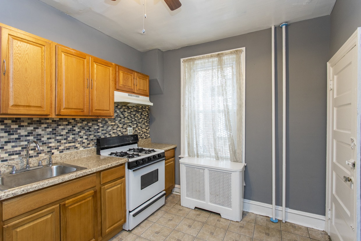
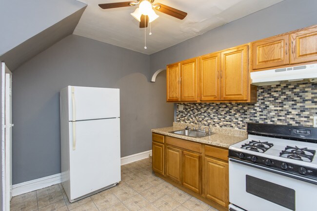
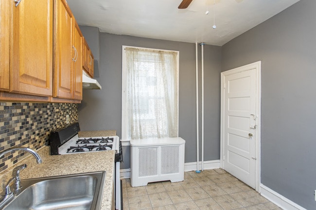
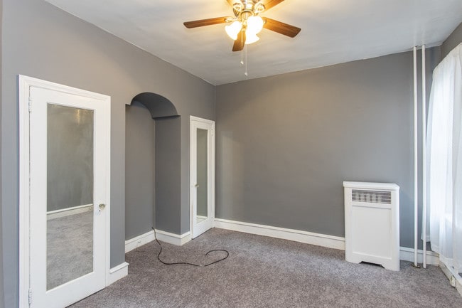
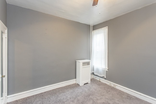
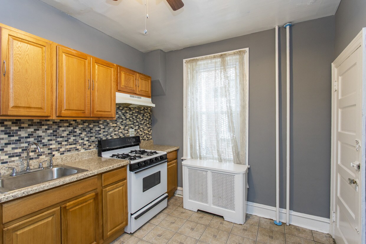
Welcome to this wonderful East Oaklane 2 bedroom unit! Newly painted! Close to public transportation, many universities in the area, local eateries, and major roadways. $35 monthly water fee will cover all cold water usage. Professionally managed by Slate Property Management
6253 N Broad St is a townhome located in Philadelphia County and the 19141 ZIP Code. This area is served by the The School District of Philadelphia attendance zone.
6253 N Broad St,
Philadelphia,
PA
19141
Oak Lane-East Oak Lane is a quaint suburb that sits approximately eight miles north of Downtown Philadelphia via State Route 611. The neighborhood’s residential streets are lined with historic, stately homes and mature trees. Residents of Oak Lane-East Oak Lane enjoy a relaxed lifestyle in the suburbs within the city limits of Philly. The majority of existing houses and churches in the area were constructed in the late 1800s when builders created magnificent Victorian architecture. Large yards, Victorian estates, and Philadelphia-style double homes characterize the neighborhood, although there are affordable apartments and condos within the neighborhood as well. Public transit is available in Oak Lane-East Oak Lane, and the streets are fairly pedestrian- and bike-friendly.
Learn more about living in Oak Lane-East Oak LaneBelow are rent ranges for similar nearby apartments
Education
| Colleges & Universities | Distance | ||
|---|---|---|---|
| Colleges & Universities | Distance | ||
| Walk: | 5 min | 0.3 mi | |
| Drive: | 5 min | 1.5 mi | |
| Drive: | 7 min | 3.0 mi | |
| Drive: | 10 min | 3.9 mi |
6253 N Broad St is within 5 minutes or 0.3 mile from C.C. of Philadelphia, NW Ctr. It is also near La Salle University and Salus University.
Schools


Public Elementary School
Grades PK-5
298 Students
Attendance Zone
Public Middle School
Grades 6-8
364 Students
Attendance Zone
Public High School
Grades 9-12
498 Students
Attendance Zone
Private Elementary, Middle & High School
Grades PK-12
142 Students
Nearby
School data provided by
 The GreatSchools Rating helps parents compare schools within a state based on a variety of school quality indicators and provides a helpful picture of how effectively each school serves all of its students. Ratings are on a scale of 1 (below average) to 10 (above average) and can include test scores, college readiness, academic progress, advanced courses, equity, discipline and attendance data. We also advise parents to visit schools, consider other information on school performance and programs, and consider family needs as part of the school selection process.
View GreatSchools Rating Methodology
Data provided by GreatSchools.org © 2026. All rights reserved.
View GreatSchools Rating Methodology
Data provided by GreatSchools.org © 2026. All rights reserved.
Transportation options available in Philadelphia include Olney Transit Center, located 0.7 mile from 6253 N Broad St. 6253 N Broad St is near Philadelphia International, located 18.3 miles or 34 minutes away, and Trenton Mercer, located 28.2 miles or 47 minutes away.
| Transit / Subway | Distance | ||
|---|---|---|---|
| Transit / Subway | Distance | ||
| Walk: | 13 min | 0.7 mi | |
| Walk: | 15 min | 0.8 mi | |
|
|
Drive: | 4 min | 1.3 mi |
|
|
Drive: | 5 min | 1.7 mi |
|
|
Drive: | 6 min | 2.6 mi |
| Commuter Rail | Distance | ||
|---|---|---|---|
| Commuter Rail | Distance | ||
| Drive: | 4 min | 1.6 mi | |
|
|
Drive: | 4 min | 1.8 mi |
|
|
Drive: | 6 min | 1.9 mi |
|
|
Drive: | 5 min | 2.1 mi |
|
|
Drive: | 5 min | 2.3 mi |
| Airports | Distance | ||
|---|---|---|---|
| Airports | Distance | ||
|
Philadelphia International
|
Drive: | 34 min | 18.3 mi |
|
Trenton Mercer
|
Drive: | 47 min | 28.2 mi |
Walkability Near 6253 N Broad St Philadelphia, PA 19141
Getting Around
 What do Walkability, Transit, Drivability, and Bikeability mean?
Walkability measures the walking distance to day-to-day needs.
Transit measures access to public transportation.
Drivability measures congestion, parking availability, and access to major roads.
Bikeability measures the suitability for cycling.
How It Works
What do Walkability, Transit, Drivability, and Bikeability mean?
Walkability measures the walking distance to day-to-day needs.
Transit measures access to public transportation.
Drivability measures congestion, parking availability, and access to major roads.
Bikeability measures the suitability for cycling.
How It Works
Moderately Walkable
Walkability
70
/ 100
Strong Public Transit
Transit
80
/ 100
Fairly Drivable
Drivability
40
/ 100
Fairly Bikeable
Bikeability
40
/ 100
Scores provided by
Busy
Soundscore™
67
/ 100
Traffic
BusyAirport
CalmBusinesses
BusyScores provided by
HowLoud What is a Sound Score Rating? A Sound Score Rating aggregates noise caused by vehicle traffic, airplane traffic and local sources. How It WorksTime and distance from 6253 N Broad St.
| Shopping Centers | Distance | ||
|---|---|---|---|
| Shopping Centers | Distance | ||
| Walk: | 7 min | 0.4 mi | |
| Drive: | 3 min | 1.5 mi | |
| Drive: | 5 min | 1.8 mi |
6253 N Broad St has 3 shopping centers within 1.8 miles, which is about a 5-minute drive. The miles and minutes will be for the farthest away property.
| Parks and Recreation | Distance | ||
|---|---|---|---|
| Parks and Recreation | Distance | ||
|
Awbury Arboretum
|
Drive: | 5 min | 2.1 mi |
|
Tacony Creek Park
|
Drive: | 8 min | 4.1 mi |
|
Wagner Free Institute of Science
|
Drive: | 15 min | 5.1 mi |
|
The Morris Arboretum
|
Drive: | 14 min | 5.9 mi |
|
Lorimer Park
|
Drive: | 15 min | 6.8 mi |
6253 N Broad St has 5 parks within 6.8 miles, including Awbury Arboretum, Tacony Creek Park, and Wagner Free Institute of Science.
| Hospitals | Distance | ||
|---|---|---|---|
| Hospitals | Distance | ||
| Walk: | 16 min | 0.8 mi | |
| Drive: | 8 min | 2.9 mi | |
| Drive: | 9 min | 3.1 mi |
6253 N Broad St has 3 hospitals within 3.1 miles, the nearest is Albert Einstein Medical Center which is 0.8 mile away and a 16 minute walk.
| Military Bases | Distance | ||
|---|---|---|---|
| Military Bases | Distance | ||
| Drive: | 26 min | 12.1 mi |
6253 N Broad St is 12.1 miles and a 26 minute drive from Willow Grove Naval Air Station.
You May Also Like
Similar Rentals Nearby
-
-
-
-
-
-
-
-
1 / 25

-
-


What Are Walk Score®, Transit Score®, and Bike Score® Ratings?
Walk Score® measures the walkability of any address. Transit Score® measures access to public transit. Bike Score® measures the bikeability of any address.
What is a Sound Score Rating?
A Sound Score Rating aggregates noise caused by vehicle traffic, airplane traffic and local sources.
6253 N Broad St
Philadelphia, PA 19141