
$1,500
/ Month
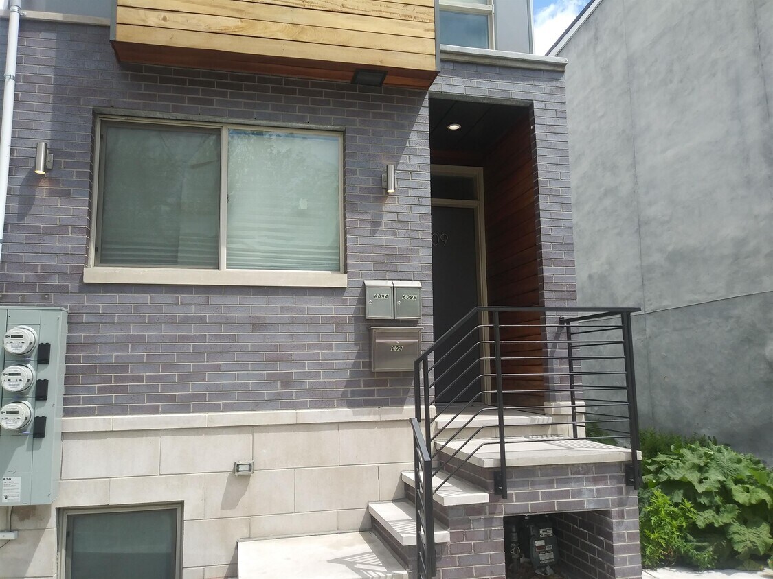
609 Cecil B. Moore Ave
Philadelphia, PA 19122
Favorites
609 Cecil B. Moore Ave

Favorites
Check Back Soon for Upcoming Availability
| Beds | Baths | Average SF |
|---|---|---|
| 2 Bedrooms 2 Bedrooms 2 Br | 1.5 Baths 1.5 Baths 1.5 Ba | — |
About This Property
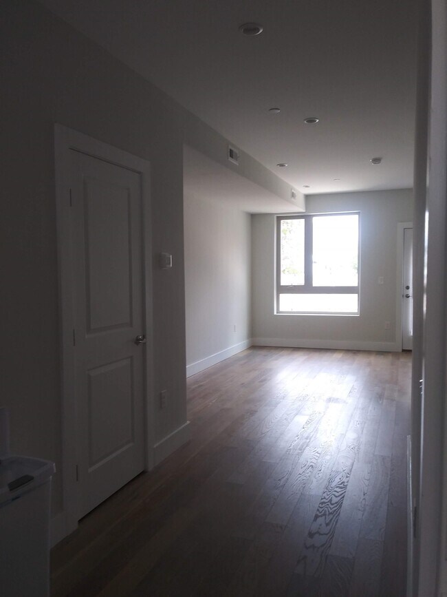
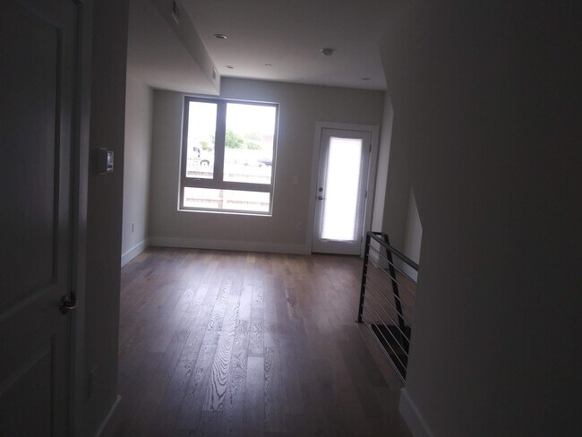
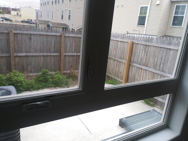
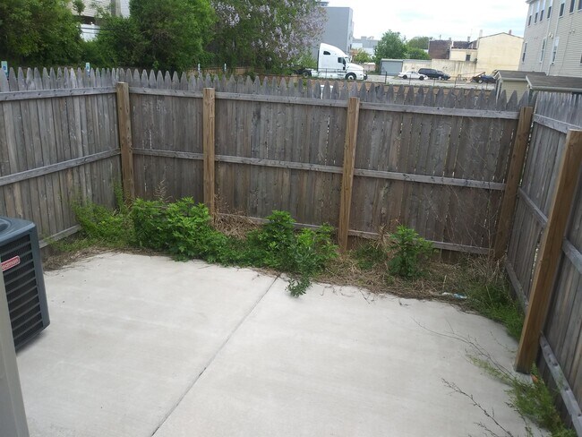
Beautiful new construction 2 bedroom/1.5 bath bi-level unit now available near Temple University! Enjoy the spacious bedrooms, large windows with lots of natural light, open layout, full kitchen with stainless appliances, tasteful and modern finishes, in-unit washer/dryer, and more. This unit has a private back patio, easy street parking, and is short walking distance to Temple campus and Girard Ave. Location is also convenient to Fishtown/Northern Liberties, all forms of public transportation, grocery stores, shops, restaurants (Helm, Taco Riendo), coffee shops (ReAnimator, Thunder Cafe), parks - you name it! Move-in Ready, Proof of Income, No Evictions.
609 Cecil B. Moore Ave is a townhome located in Philadelphia County and the 19122 ZIP Code. This area is served by the The School District of Philadelphia attendance zone.
609 Cecil B. Moore Ave,
Philadelphia,
PA
19122
Not to be confused with Northeast Philadelphia, North Philadelphia East encompasses the smaller subsets of Ludlow, Yorktown, West Kensington, Poplar, and Callowhill. This composite area runs from the Vine Street Expressway, stretching north to Erie Avenue. Broad Street acts as its eastern border, and the western edge runs a jagged line separating North Philadelphia East from the nearby Kensington, Port Richmond, and Fishtown neighborhoods. With such a long stretch of city, the neighborhood offers a diverse blend of important city landmarks, such as renowned musical venues the Electric Factory and Union Transfer, and Temple University, North Philadelphia's premiere site of higher learning.
Learn more about living in North Philadelphia EastBelow are rent ranges for similar nearby apartments
| Beds | Average Size | Lowest | Typical | Premium |
|---|---|---|---|---|
| Studio Studio Studio | 492-493 Sq Ft | $425 | $1,547 | $8,460 |
| 1 Bed 1 Bed 1 Bed | 705-708 Sq Ft | $400 | $1,943 | $6,789 |
| 2 Beds 2 Beds 2 Beds | 998-1001 Sq Ft | $725 | $2,282 | $11,725 |
| 3 Beds 3 Beds 3 Beds | 1372-1373 Sq Ft | $599 | $2,030 | $7,368 |
| 4 Beds 4 Beds 4 Beds | 1670 Sq Ft | $300 | $2,229 | $4,900 |
Education
| Colleges & Universities | Distance | ||
|---|---|---|---|
| Colleges & Universities | Distance | ||
| Walk: | 14 min | 0.7 mi | |
| Drive: | 6 min | 2.2 mi | |
| Drive: | 5 min | 2.2 mi | |
| Drive: | 6 min | 2.4 mi |
609 Cecil B. Moore Ave is within 14 minutes or 0.7 mile from Temple University, Main Campus. It is also near C.C. of Philadelphia and Temple Univ., Health Center.
Schools


Public Elementary & Middle School
Grades PK-8
202 Students
Attendance Zone
Public High School
Grades 9-12
547 Students
Nearby
Public High School
Grades 9-12
229 Students
Nearby
Private Elementary, Middle & High School
Grades PK-12
272 Students
Nearby
Private Elementary School
Grades PK-5
Nearby
School data provided by
 The GreatSchools Rating helps parents compare schools within a state based on a variety of school quality indicators and provides a helpful picture of how effectively each school serves all of its students. Ratings are on a scale of 1 (below average) to 10 (above average) and can include test scores, college readiness, academic progress, advanced courses, equity, discipline and attendance data. We also advise parents to visit schools, consider other information on school performance and programs, and consider family needs as part of the school selection process.
View GreatSchools Rating Methodology
Data provided by GreatSchools.org © 2026. All rights reserved.
View GreatSchools Rating Methodology
Data provided by GreatSchools.org © 2026. All rights reserved.
Transportation options available in Philadelphia include Girard Av & 7Th St, located 0.5 mile from 609 Cecil B. Moore Ave. 609 Cecil B. Moore Ave is near Philadelphia International, located 13.8 miles or 24 minutes away, and Trenton Mercer, located 32.6 miles or 49 minutes away.
| Transit / Subway | Distance | ||
|---|---|---|---|
| Transit / Subway | Distance | ||
| Walk: | 10 min | 0.5 mi | |
| Walk: | 11 min | 0.6 mi | |
| Walk: | 12 min | 0.6 mi | |
| Walk: | 12 min | 0.6 mi | |
| Walk: | 12 min | 0.7 mi |
| Commuter Rail | Distance | ||
|---|---|---|---|
| Commuter Rail | Distance | ||
|
|
Walk: | 10 min | 0.5 mi |
|
|
Drive: | 4 min | 1.7 mi |
|
|
Drive: | 4 min | 1.8 mi |
|
|
Drive: | 5 min | 2.2 mi |
|
|
Drive: | 6 min | 2.2 mi |
| Airports | Distance | ||
|---|---|---|---|
| Airports | Distance | ||
|
Philadelphia International
|
Drive: | 24 min | 13.8 mi |
|
Trenton Mercer
|
Drive: | 49 min | 32.6 mi |
Walkability Near 609 Cecil B. Moore Ave Philadelphia, PA 19122
Getting Around
 What do Walkability, Transit, Drivability, and Bikeability mean?
Walkability measures the walking distance to day-to-day needs.
Transit measures access to public transportation.
Drivability measures congestion, parking availability, and access to major roads.
Bikeability measures the suitability for cycling.
How It Works
What do Walkability, Transit, Drivability, and Bikeability mean?
Walkability measures the walking distance to day-to-day needs.
Transit measures access to public transportation.
Drivability measures congestion, parking availability, and access to major roads.
Bikeability measures the suitability for cycling.
How It Works
Exceptionally Walkable
Walkability
100
/ 100
Exceptional Public Transit
Transit
90
/ 100
Fairly Drivable
Drivability
50
/ 100
Moderately Bikeable
Bikeability
70
/ 100
Scores provided by
-
Soundscore™
-
/ 100
Traffic
-Airport
-Businesses
-Scores provided by
HowLoud What is a Sound Score Rating? A Sound Score Rating aggregates noise caused by vehicle traffic, airplane traffic and local sources. How It WorksTime and distance from 609 Cecil B. Moore Ave.
| Shopping Centers | Distance | ||
|---|---|---|---|
| Shopping Centers | Distance | ||
| Walk: | 12 min | 0.7 mi | |
| Walk: | 14 min | 0.7 mi | |
| Walk: | 14 min | 0.7 mi |
609 Cecil B. Moore Ave has 3 shopping centers within 0.7 mile, which is about a 14-minute walk. The miles and minutes will be for the farthest away property.
| Parks and Recreation | Distance | ||
|---|---|---|---|
| Parks and Recreation | Distance | ||
|
Wagner Free Institute of Science
|
Drive: | 3 min | 1.1 mi |
|
Edgar Allan Poe Nat'l Historic Site
|
Drive: | 3 min | 1.3 mi |
|
Independence National Historical Park
|
Drive: | 4 min | 1.8 mi |
|
The Academy of Natural Sciences
|
Drive: | 6 min | 2.7 mi |
|
Fels Planetarium
|
Drive: | 6 min | 3.2 mi |
609 Cecil B. Moore Ave has 5 parks within 3.2 miles, including Wagner Free Institute of Science, Edgar Allan Poe Nat'l Historic Site, and Independence National Historical Park.
| Hospitals | Distance | ||
|---|---|---|---|
| Hospitals | Distance | ||
| Drive: | 4 min | 2.2 mi | |
| Drive: | 5 min | 2.3 mi | |
| Drive: | 6 min | 2.5 mi |
609 Cecil B. Moore Ave has 3 hospitals within 2.5 miles, the nearest is Hahnemann University Hospital which is 2.2 miles away and a 4 minute drive.
| Military Bases | Distance | ||
|---|---|---|---|
| Military Bases | Distance | ||
| Drive: | 15 min | 8.1 mi | |
| Drive: | 39 min | 18.4 mi | |
| Drive: | 40 min | 20.5 mi |
609 Cecil B. Moore Ave has 3 military bases within 20.5 miles, the nearest is Philadelphia Naval Busi Center which is 8.1 miles away and a 15 minute drive.
You May Also Like
-
The Glen at Bucks Apartments and Townhomes
675 E Street Rd
Warminster, PA 18974
$2,140 - $2,825
2-3 Br 15.2 mi
-
Racquet Club Apartments and Townhomes
1970 Veterans Hwy
Levittown, PA 19056
$1,935 - $2,465
2-3 Br 17.7 mi
-
Valley Run
2601 Carpenter Station Rd
Wilmington, DE 19810
$1,825 - $2,540
2-3 Br 20.1 mi
Similar Rentals Nearby


What Are Walk Score®, Transit Score®, and Bike Score® Ratings?
Walk Score® measures the walkability of any address. Transit Score® measures access to public transit. Bike Score® measures the bikeability of any address.
What is a Sound Score Rating?
A Sound Score Rating aggregates noise caused by vehicle traffic, airplane traffic and local sources.
609 Cecil B. Moore Ave
Philadelphia, PA 19122