
Harbor Point
24 Oyster Bay Rd,
Boston, MA 02125
1-3 Beds $2,033 - $4,800
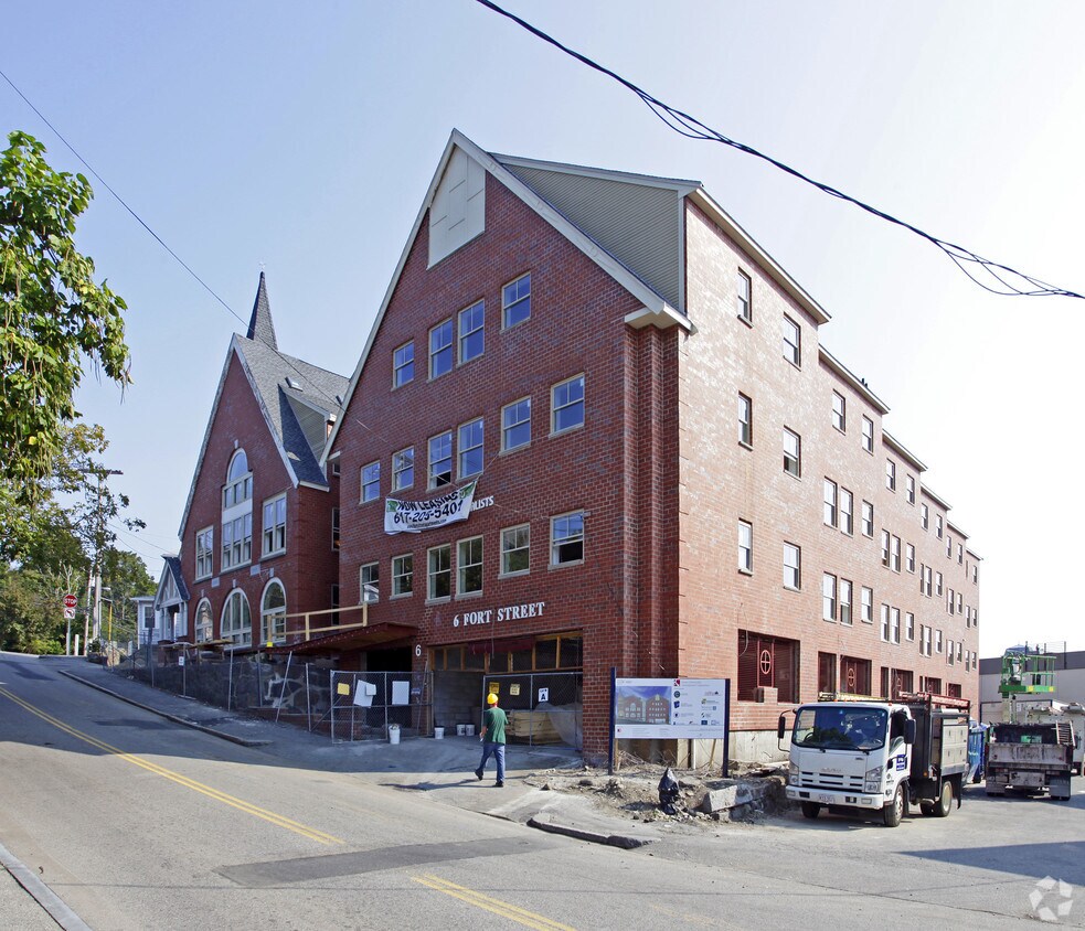
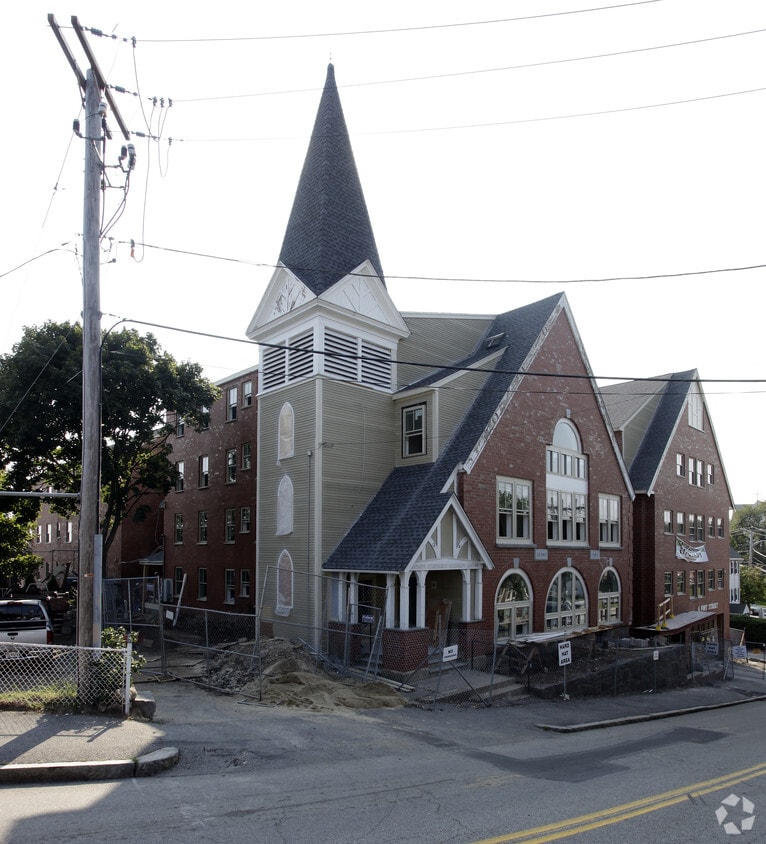

Welcome home to 6 Fort St. Located at 6 Fort St. in Quincy, this community is an ideal place to live. Come for a visit to see the available floorplan options. The community staff is ready for you to come by for a visit. Drop by the leasing office to schedule your tour.
6 Fort St is an apartment community located in Norfolk County and the 02169 ZIP Code. This area is served by the Quincy attendance zone.
Quincy Center covers the historic downtown district of Quincy, Massachusetts. Known as the “City of Presidents,” Quincy boasts unique shops, local restaurants, and admired historic sites. In fact, Quincy Center houses the United States First Parish Church, which is the location of both President John Adams and his son, President John Quincy Adams’ burial sites.
If you become a resident of this vibrant town, you can visit the Adams’ birthplaces and explore their historic homes, which are the oldest presidential birthplaces in the country. If you’re a political history buff, Quincy Center is the place for you! With an abundance of upscale apartments and the occasional historic house, condo, and townhome, finding your perfect rental in this area should be a breeze.
A coastal neighborhood situated on Quincy Bay, Quincy Center is just 10 miles south of Downtown Boston.
Learn more about living in Quincy Center| Colleges & Universities | Distance | ||
|---|---|---|---|
| Colleges & Universities | Distance | ||
| Drive: | 12 min | 7.0 mi | |
| Drive: | 16 min | 7.1 mi | |
| Drive: | 17 min | 8.7 mi | |
| Drive: | 16 min | 9.4 mi |


Transportation options available in Quincy include Quincy Adams Station, located 1.5 miles from 6 Fort St. 6 Fort St is near General Edward Lawrence Logan International, located 12.3 miles or 20 minutes away.
| Transit / Subway | Distance | ||
|---|---|---|---|
| Transit / Subway | Distance | ||
|
|
Drive: | 3 min | 1.5 mi |
|
|
Drive: | 4 min | 1.9 mi |
|
|
Drive: | 6 min | 2.9 mi |
|
|
Drive: | 8 min | 3.7 mi |
|
|
Drive: | 9 min | 4.5 mi |
| Commuter Rail | Distance | ||
|---|---|---|---|
| Commuter Rail | Distance | ||
|
|
Walk: | 11 min | 0.6 mi |
| Drive: | 6 min | 3.1 mi | |
|
|
Drive: | 6 min | 3.4 mi |
|
|
Drive: | 10 min | 5.3 mi |
|
|
Drive: | 12 min | 5.9 mi |
| Airports | Distance | ||
|---|---|---|---|
| Airports | Distance | ||
|
General Edward Lawrence Logan International
|
Drive: | 20 min | 12.3 mi |
Time and distance from 6 Fort St.
| Shopping Centers | Distance | ||
|---|---|---|---|
| Shopping Centers | Distance | ||
| Walk: | 2 min | 0.1 mi | |
| Walk: | 4 min | 0.2 mi | |
| Walk: | 6 min | 0.4 mi |
| Parks and Recreation | Distance | ||
|---|---|---|---|
| Parks and Recreation | Distance | ||
|
Adams National Historical Park
|
Drive: | 2 min | 1.2 mi |
|
Squantum Point Park
|
Drive: | 12 min | 4.6 mi |
|
Webb Memorial State Park
|
Drive: | 12 min | 5.3 mi |
|
Dorchester Shores Reservation
|
Drive: | 12 min | 6.9 mi |
|
Blue Hills Reservation
|
Drive: | 13 min | 7.5 mi |
| Hospitals | Distance | ||
|---|---|---|---|
| Hospitals | Distance | ||
| Drive: | 9 min | 4.4 mi | |
| Drive: | 8 min | 4.6 mi | |
| Drive: | 11 min | 6.9 mi |
What Are Walk Score®, Transit Score®, and Bike Score® Ratings?
Walk Score® measures the walkability of any address. Transit Score® measures access to public transit. Bike Score® measures the bikeability of any address.
What is a Sound Score Rating?
A Sound Score Rating aggregates noise caused by vehicle traffic, airplane traffic and local sources


