$1,575
/ Month
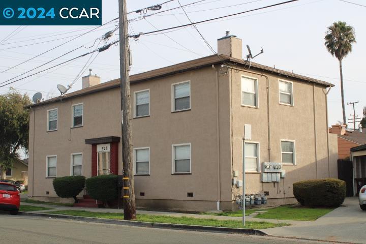
578 Civic Center St Unit D
Richmond, CA 94804
2 Weeks Ago
Favorites
578 Civic Center St Unit D

Favorites
Check Back Soon for Upcoming Availability
| Beds | Baths | Average SF |
|---|---|---|
| 1 Bedroom 1 Bedroom 1 Br | 1 Bath 1 Bath 1 Ba | 2,700 SF |
About This Property
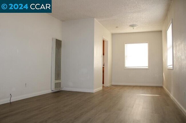
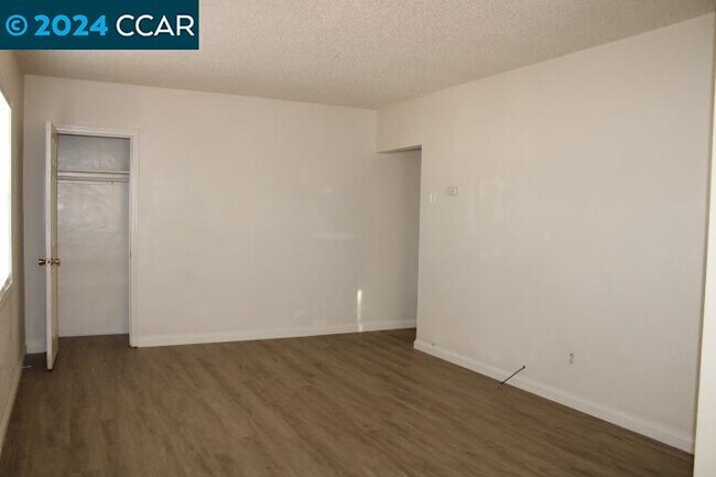
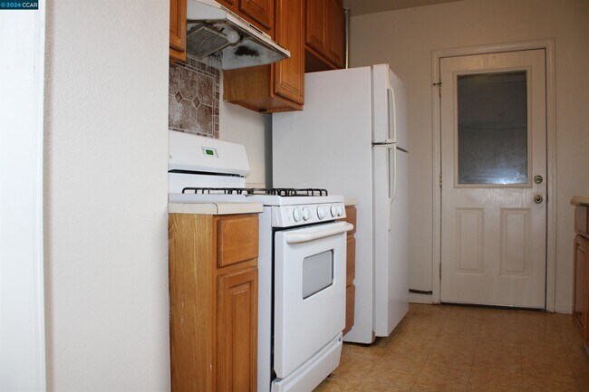
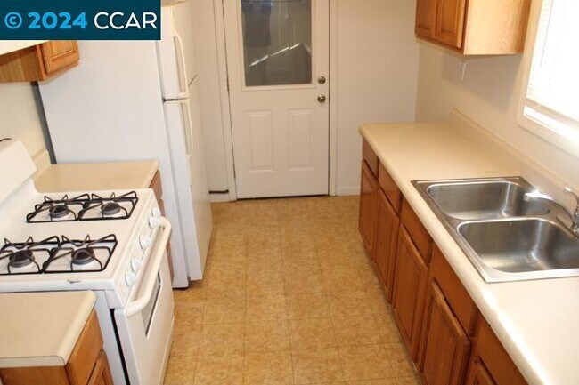
One bedroom one bathroom upstairs unit in a four plex with one covered carport space. Stove/oven & refrigerator Laminate flooring in living room/hall and linoleum in kitchen & bathroom. Window coverings. Shared fenced backyard. Not far from schools. Section 8 Welcome. No Pets. No Smoking. Sec. Dep. $1,575. SQ. FT. is of whole building. Owner pays water & garbage. 11 MONTH LEASE
578 Civic Center St is an apartment community located in Contra Costa County and the 94804 ZIP Code.
Location
Get Directions
With reasonable rents and a great deal of community spirit, the North and East neighborhood of Richmond proves itself ideal for residents who want to be active in community groups and who thrive on a little bit of urban grit. Community involvement runs strong here in this neighborhood that sits only 10 to 15 minutes away from the quirky scene in Berkeley.
When you want a break from city life, Wildcat Canyon Regional Park sits less than a mile from the east edge of North and East. Bring your mountain bike or just hike through the 2,400-acre park centered on Wildcat Creek. When you have to get back to work, AC Transit, BART, and the transbay buses can get you to Oakland, 11 miles away, or even across the Bay to San Francisco and places beyond.
Learn more about living in North & EastBelow are rent ranges for similar nearby apartments
| Beds | Average Size | Lowest | Typical | Premium |
|---|---|---|---|---|
| Studio Studio Studio | 446-447 Sq Ft | $1,331 | $1,507 | $2,050 |
| 1 Bed 1 Bed 1 Bed | 635 Sq Ft | $1,717 | $1,828 | $2,095 |
| 2 Beds 2 Beds 2 Beds | 911 Sq Ft | $2,045 | $2,377 | $3,195 |
| 3 Beds 3 Beds 3 Beds | 1050 Sq Ft | $2,903 | $3,019 | $3,600 |
| 4 Beds 4 Beds 4 Beds | 1422 Sq Ft | $3,466 | $3,744 | $4,300 |
Education
| Colleges & Universities | Distance | ||
|---|---|---|---|
| Colleges & Universities | Distance | ||
| Drive: | 6 min | 2.7 mi | |
| Drive: | 15 min | 8.3 mi | |
| Drive: | 18 min | 9.4 mi | |
| Drive: | 15 min | 10.9 mi |
578 Civic Center St Unit D is within 6 minutes or 2.7 miles from Contra Costa College. It is also near Berkeley City College and UC Berkeley.
Transportation options available in Richmond include Richmond Station, located 0.7 mile from 578 Civic Center St Unit D. 578 Civic Center St Unit D is near Metro Oakland International, located 21.3 miles or 29 minutes away, and San Francisco International, located 28.9 miles or 42 minutes away.
| Transit / Subway | Distance | ||
|---|---|---|---|
| Transit / Subway | Distance | ||
|
|
Walk: | 13 min | 0.7 mi |
|
|
Drive: | 4 min | 2.1 mi |
|
|
Drive: | 4 min | 2.1 mi |
|
|
Drive: | 8 min | 4.1 mi |
|
|
Drive: | 13 min | 7.7 mi |
| Commuter Rail | Distance | ||
|---|---|---|---|
| Commuter Rail | Distance | ||
| Walk: | 14 min | 0.7 mi | |
|
|
Drive: | 10 min | 6.9 mi |
|
|
Drive: | 13 min | 8.7 mi |
| Drive: | 18 min | 11.0 mi | |
| Drive: | 18 min | 11.9 mi |
| Airports | Distance | ||
|---|---|---|---|
| Airports | Distance | ||
|
Metro Oakland International
|
Drive: | 29 min | 21.3 mi |
|
San Francisco International
|
Drive: | 42 min | 28.9 mi |
Time and distance from 578 Civic Center St Unit D.
| Shopping Centers | Distance | ||
|---|---|---|---|
| Shopping Centers | Distance | ||
| Walk: | 20 min | 1.0 mi | |
| Drive: | 3 min | 1.2 mi | |
| Drive: | 4 min | 1.5 mi |
578 Civic Center St Unit D has 3 shopping centers within 1.5 miles, which is about a 4-minute walk. The miles and minutes will be for the farthest away property.
| Parks and Recreation | Distance | ||
|---|---|---|---|
| Parks and Recreation | Distance | ||
|
Marina Park & Green
|
Drive: | 5 min | 2.2 mi |
|
Rosie the Riveter WWII Home Front National Historical Park
|
Drive: | 6 min | 2.6 mi |
|
Shimada Friendship Park
|
Drive: | 6 min | 2.7 mi |
|
Miller/Knox Regional Shoreline
|
Drive: | 7 min | 3.6 mi |
|
Point Isabel Regional Shoreline
|
Drive: | 10 min | 4.7 mi |
578 Civic Center St Unit D has 5 parks within 4.7 miles, including Marina Park & Green, Rosie the Riveter WWII Home Front National Historical Park, and Shimada Friendship Park.
| Hospitals | Distance | ||
|---|---|---|---|
| Hospitals | Distance | ||
| Drive: | 17 min | 9.9 mi | |
| Drive: | 15 min | 10.8 mi | |
| Drive: | 15 min | 10.8 mi |
578 Civic Center St Unit D has 3 hospitals within 10.8 miles, the nearest is Alta Bates Summit Medical Center - Alta Bates Campus which is 9.9 miles away and a 17 minute drive.
| Military Bases | Distance | ||
|---|---|---|---|
| Military Bases | Distance | ||
| Drive: | 6 min | 2.7 mi | |
| Drive: | 10 min | 4.8 mi | |
| Drive: | 23 min | 15.0 mi |
578 Civic Center St Unit D has 3 military bases within 15.0 miles, the nearest is Armory West Contra Costa which is 2.7 miles away and a 6 minute drive.
You May Also Like
Similar Rentals Nearby


What Are Walk Score®, Transit Score®, and Bike Score® Ratings?
Walk Score® measures the walkability of any address. Transit Score® measures access to public transit. Bike Score® measures the bikeability of any address.
What is a Sound Score Rating?
A Sound Score Rating aggregates noise caused by vehicle traffic, airplane traffic and local sources

578 Civic Center St
Richmond, CA 94804