


$2,400
/ Month
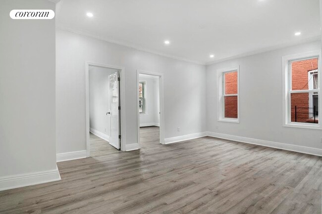
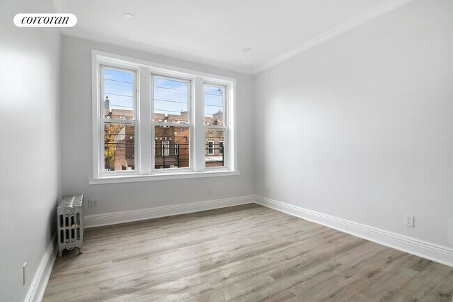
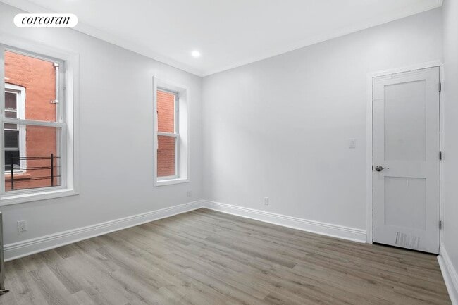
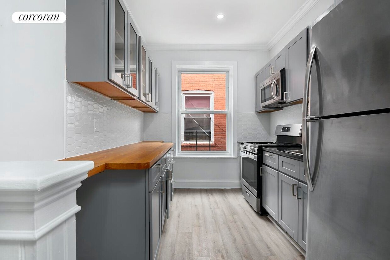
566 Osborn St
Brooklyn, NY 11212
2 Weeks Ago
Favorites
-
Bedrooms
3
-
Bathrooms
1
-
Square Feet
--
566 Osborn St

Favorites
About This Home
---- SCHEDULE A SHOWING ONLINE AT: ----
566 Osborn St is a condo located in Kings County and the 11212 ZIP Code.
* Price shown is base rent and may not include non-optional fees and utilities. Price, availability, fees, and any applicable rent special are subject to change without notice.
* Square footage definitions vary. Displayed square footage is approximate.
Contact
- Listed by Locayt
Location
Get Directions
Brownsville is a residential neighborhood located about 19 miles southeast of Manhattan in the borough of Brooklyn. Renters appreciate the neighborhood’s affordable housing and accessibility to the city. Several famous people once called Brownsville home, including the Three Stooges. Brownsville boasts walkable streets and excellent access to public transportation. This close-knit community boasts a family-friendly vibe with access to several community parks like Betsy Head Park. Residents live next to the heart of Brooklyn, making Brownsville a great place for commuters.
Learn more about living in Brownsville
Education
| Colleges & Universities | Distance | ||
|---|---|---|---|
| Colleges & Universities | Distance | ||
| Drive: | 10 min | 3.5 mi | |
| Drive: | 11 min | 3.9 mi | |
| Drive: | 15 min | 4.9 mi | |
| Drive: | 15 min | 5.0 mi |
566 Osborn St is within 10 minutes or 3.5 miles from Medgar Evers College, CUNY. It is also near Brooklyn College and Saint Joseph's Coll, Brooklyn.
Transportation options available in Brooklyn include New Lots Avenue (L Line), located 0.4 mile from 566 Osborn St. 566 Osborn St is near John F Kennedy International, located 8.8 miles or 14 minutes away, and LaGuardia, located 10.0 miles or 24 minutes away.
| Transit / Subway | Distance | ||
|---|---|---|---|
| Transit / Subway | Distance | ||
|
|
Walk: | 8 min | 0.4 mi |
|
|
Walk: | 8 min | 0.4 mi |
|
|
Walk: | 11 min | 0.6 mi |
|
|
Walk: | 14 min | 0.7 mi |
|
|
Drive: | 5 min | 1.4 mi |
| Commuter Rail | Distance | ||
|---|---|---|---|
| Commuter Rail | Distance | ||
|
|
Drive: | 5 min | 1.7 mi |
|
|
Drive: | 12 min | 3.8 mi |
|
|
Drive: | 15 min | 5.8 mi |
|
|
Drive: | 17 min | 6.5 mi |
|
|
Drive: | 16 min | 6.7 mi |
| Airports | Distance | ||
|---|---|---|---|
| Airports | Distance | ||
|
John F Kennedy International
|
Drive: | 14 min | 8.8 mi |
|
LaGuardia
|
Drive: | 24 min | 10.0 mi |
Time and distance from 566 Osborn St.
| Shopping Centers | Distance | ||
|---|---|---|---|
| Shopping Centers | Distance | ||
| Drive: | 4 min | 1.3 mi | |
| Drive: | 3 min | 1.4 mi | |
| Drive: | 4 min | 1.5 mi |
566 Osborn St has 3 shopping centers within 1.5 miles, which is about a 4-minute drive. The miles and minutes will be for the farthest away property.
| Parks and Recreation | Distance | ||
|---|---|---|---|
| Parks and Recreation | Distance | ||
|
Betsy Head Memorial Playground
|
Walk: | 14 min | 0.8 mi |
|
Linden Playground
|
Drive: | 3 min | 1.2 mi |
|
Fresh Creek Park
|
Drive: | 6 min | 2.2 mi |
|
Highland Park Childrens Garden
|
Drive: | 6 min | 2.6 mi |
|
St. John's Park
|
Drive: | 8 min | 3.0 mi |
566 Osborn St has 5 parks within 3.0 miles, including Betsy Head Memorial Playground, Linden Playground, and Fresh Creek Park.
| Hospitals | Distance | ||
|---|---|---|---|
| Hospitals | Distance | ||
| Walk: | 11 min | 0.6 mi | |
| Drive: | 6 min | 2.1 mi | |
| Drive: | 6 min | 2.3 mi |
566 Osborn St has 3 hospitals within 2.3 miles, the nearest is Brookdale Hospital Medical Center which is 0.6 mile away and a 11 minute walk.
| Military Bases | Distance | ||
|---|---|---|---|
| Military Bases | Distance | ||
| Drive: | 15 min | 7.1 mi | |
| Drive: | 23 min | 8.6 mi |
566 Osborn St is 7.1 miles from US Navy Reserve, and is convenient to other military bases, including US Coast Guard Heliport.
You May Also Like
Similar Rentals Nearby


What Are Walk Score®, Transit Score®, and Bike Score® Ratings?
Walk Score® measures the walkability of any address. Transit Score® measures access to public transit. Bike Score® measures the bikeability of any address.
What is a Sound Score Rating?
A Sound Score Rating aggregates noise caused by vehicle traffic, airplane traffic and local sources
566 Osborn St
Brooklyn, NY 11212