
$2,800
/ Month
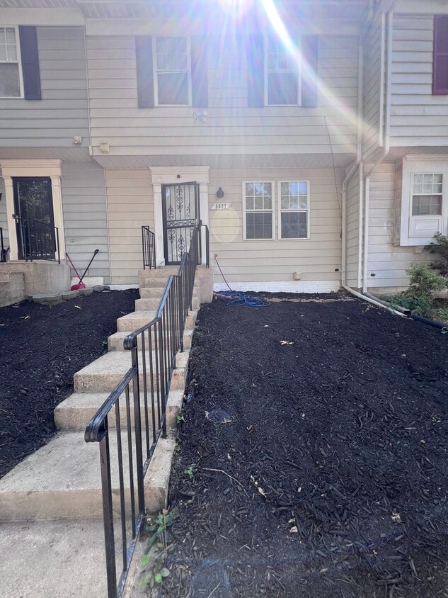
5627 Onslow Way
Capitol Heights, MD 20743
Today
Favorites
301-221-9549
-
Bedrooms
3
-
Bathrooms
4
-
Square Feet
1,253 sq ft
-
Available
Available Sep 1
5627 Onslow Way

Favorites
About This Home
$5,000 deposit,
Available Sep 1
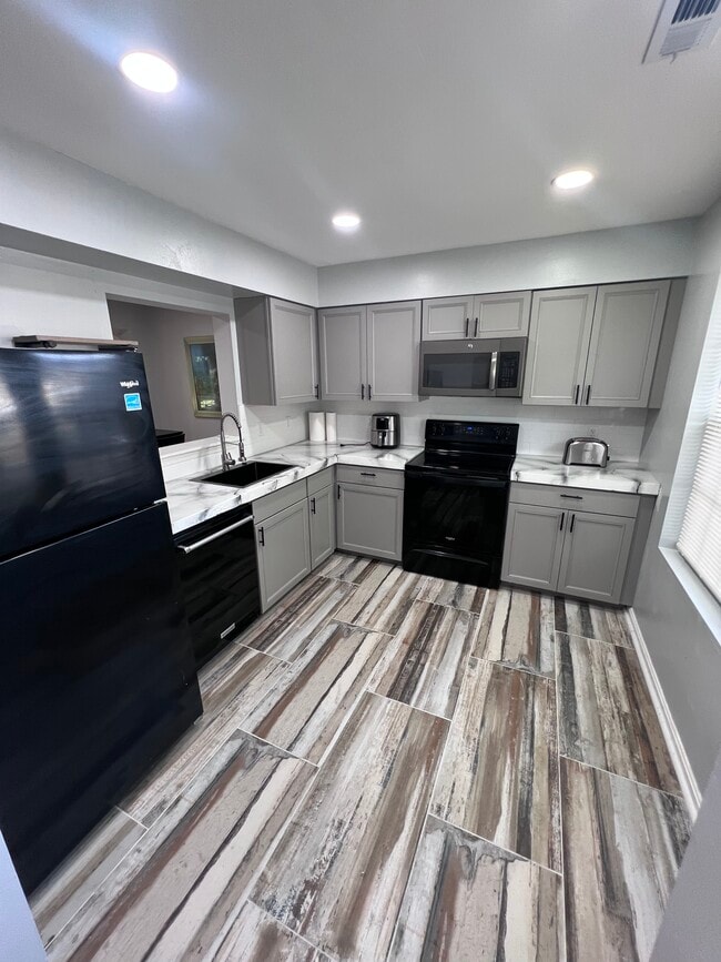
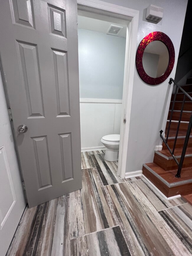
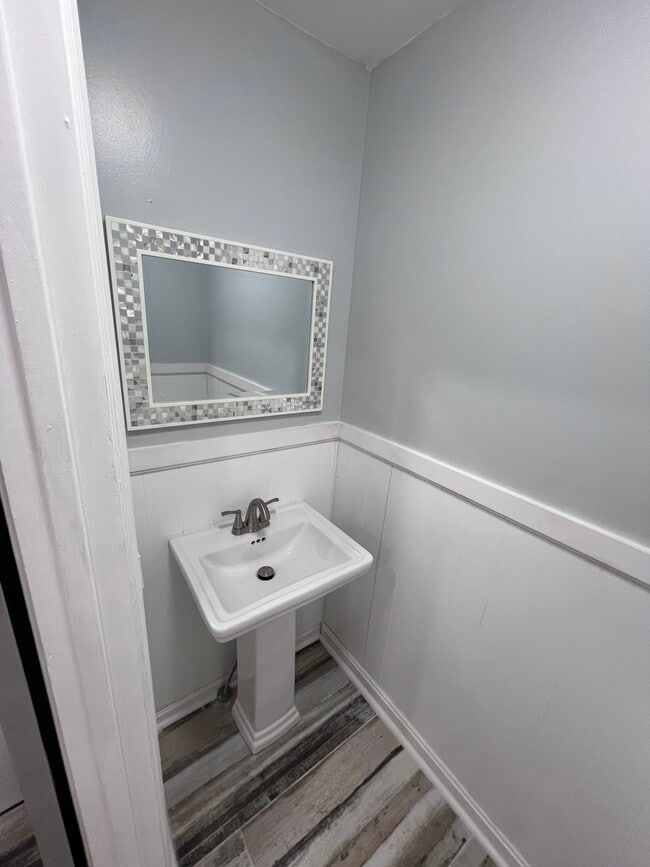
Amazing 3 bedroom, 4 bathroom townhouse in Capitol Heights. Amenities included: balcony, central air, central heat, deck, dishwasher, hardwood floors, updated kitchen, updated bathroom, storage, washer dryer, and yard. No Utilities included. Is not pet friendly. Date Available: Sep 1st 2025. $2,800/month rent. $5,000 security deposit required. Please submit the form on this page or contact Nikiya Jackson at to learn more. This property is managed by a responsible landlord using Avail landlord software.
5627 Onslow Way is a townhome located in Prince George's County and the 20743 ZIP Code. This area is served by the Prince George's County Public Schools attendance zone.
* Price shown is base rent and may not include non-optional fees and utilities. Price, availability, fees, and any applicable rent special are subject to change without notice.
* Square footage definitions vary. Displayed square footage is approximate.
Townhome Features
- Washer/Dryer
- Washer/Dryer Hookup
- Dishwasher
- Balcony
Contact
- Listed by Nikiya Jackson
- Phone Number
- Contact
Location
Get Directions
Amenities
- Washer/Dryer
- Washer/Dryer Hookup
- Dishwasher
- Balcony
Capitol Heights -- named for its location near Washington, DC -- provides the perfect location: near DC, near the Capital Beltway, and minutes away from FedEx Field, home of the NFL's Washington Football Team. It is also close to the Anacostia River, the United States National Arboretum, and Joint Base Anacostia-Bolling. Nearby Fort Circle Park provides Capitol Heights residents with 10 miles of hiking trails -- it is also a popular concert venue and is home to Fort Dupont Ice Rink.
Capitol Heights is a terrific location for your DC-area apartment, only about seven miles southeast of downtown. Hop on the Metro at the Capitol Heights Metro Station for a fast, car-free commute. Despite being so close to the historic sites of DC, Capitol Heights was a rural area with no paved roads or streetlights. In 1910, the 200 residents in the area named their town "Capitol Heights," but it wasn't until 1980 and the arrival of the Metro Blue Line that the town began to grow.
Learn more about living in Capitol Heights
Education
| Colleges & Universities | Distance | ||
|---|---|---|---|
| Colleges & Universities | Distance | ||
| Drive: | 14 min | 6.2 mi | |
| Drive: | 13 min | 6.3 mi | |
| Drive: | 13 min | 7.1 mi | |
| Drive: | 15 min | 7.1 mi |
5627 Onslow Way is within 14 minutes or 6.2 miles from Gallaudet University. It is also near Univ. of Md. Univ. Coll. and Prince George's Comm. Coll..
Schools


Public Elementary School
Grades PK-6
225 Students
Attendance Zone
Public Middle School
Grades 6-8
693 Students
Attendance Zone
Public High School
Grades 9-12
1,834 Students
Attendance Zone
Private Elementary & Middle School
Grades PK-8
Nearby
Private High School
Grades 9-12
Nearby
School data provided by
 The GreatSchools Rating helps parents compare schools within a state based on a variety of school quality indicators and provides a helpful picture of how effectively each school serves all of its students. Ratings are on a scale of 1 (below average) to 10 (above average) and can include test scores, college readiness, academic progress, advanced courses, equity, discipline and attendance data. We also advise parents to visit schools, consider other information on school performance and programs, and consider family needs as part of the school selection process.
View GreatSchools Rating Methodology
Data provided by GreatSchools.org © 2025. All rights reserved.
View GreatSchools Rating Methodology
Data provided by GreatSchools.org © 2025. All rights reserved.
Transportation options available in Capitol Heights include Capitol Heights, Blue/Silver Line Center Platform, located 1.4 miles from 5627 Onslow Way. 5627 Onslow Way is near Ronald Reagan Washington Ntl, located 12.6 miles or 24 minutes away, and Baltimore/Washington International Thurgood Marshall, located 29.9 miles or 47 minutes away.
| Transit / Subway | Distance | ||
|---|---|---|---|
| Transit / Subway | Distance | ||
|
Capitol Heights, Blue/Silver Line Center Platform
|
Drive: | 5 min | 1.4 mi |
|
|
Drive: | 4 min | 1.8 mi |
|
|
Drive: | 7 min | 2.6 mi |
|
|
Drive: | 12 min | 4.3 mi |
|
|
Drive: | 10 min | 4.4 mi |
| Commuter Rail | Distance | ||
|---|---|---|---|
| Commuter Rail | Distance | ||
|
|
Drive: | 13 min | 6.4 mi |
|
|
Drive: | 14 min | 6.6 mi |
|
|
Drive: | 17 min | 7.9 mi |
| Drive: | 17 min | 9.1 mi | |
|
|
Drive: | 17 min | 9.1 mi |
| Airports | Distance | ||
|---|---|---|---|
| Airports | Distance | ||
|
Ronald Reagan Washington Ntl
|
Drive: | 24 min | 12.6 mi |
|
Baltimore/Washington International Thurgood Marshall
|
Drive: | 47 min | 29.9 mi |
Time and distance from 5627 Onslow Way.
| Shopping Centers | Distance | ||
|---|---|---|---|
| Shopping Centers | Distance | ||
| Drive: | 5 min | 1.6 mi | |
| Drive: | 6 min | 1.7 mi | |
| Drive: | 5 min | 1.8 mi |
5627 Onslow Way has 3 shopping centers within 1.8 miles, which is about a 5-minute drive. The miles and minutes will be for the farthest away property.
| Parks and Recreation | Distance | ||
|---|---|---|---|
| Parks and Recreation | Distance | ||
|
Fort Dupont Park
|
Drive: | 10 min | 3.7 mi |
|
Walker Mill Regional Park
|
Drive: | 9 min | 3.9 mi |
|
Kingman and Heritage Island Park
|
Drive: | 10 min | 4.4 mi |
|
Suitland Bog
|
Drive: | 11 min | 4.6 mi |
|
National Arboretum
|
Drive: | 16 min | 7.3 mi |
5627 Onslow Way has 5 parks within 7.3 miles, including Fort Dupont Park, Walker Mill Regional Park, and Kingman and Heritage Island Park.
| Hospitals | Distance | ||
|---|---|---|---|
| Hospitals | Distance | ||
| Drive: | 12 min | 5.1 mi | |
| Drive: | 17 min | 7.1 mi | |
| Drive: | 17 min | 7.3 mi |
5627 Onslow Way has 3 hospitals within 7.3 miles, the nearest is University of Maryland Prince George's Hospital Center which is 5.1 miles away and a 12 minute drive.
| Military Bases | Distance | ||
|---|---|---|---|
| Military Bases | Distance | ||
| Drive: | 15 min | 6.7 mi | |
| Drive: | 16 min | 7.3 mi |
5627 Onslow Way is 6.7 miles from Washington Navy Yard, and is convenient to other military bases, including Andrews Airforce Base.
You May Also Like
Similar Rentals Nearby


What Are Walk Score®, Transit Score®, and Bike Score® Ratings?
Walk Score® measures the walkability of any address. Transit Score® measures access to public transit. Bike Score® measures the bikeability of any address.
What is a Sound Score Rating?
A Sound Score Rating aggregates noise caused by vehicle traffic, airplane traffic and local sources

5627 Onslow Way
Capitol Heights, MD 20743