
$1,800
/ Month
5619 Pine Row
Houston, TX 77049
Today
|
Edit
Favorites
832-256-3744
-
Bedrooms
3
-
Bathrooms
2
-
Square Feet
1,880 sq ft
-
Available
Available Now
Highlights
- Traditional Architecture
- Community Pool
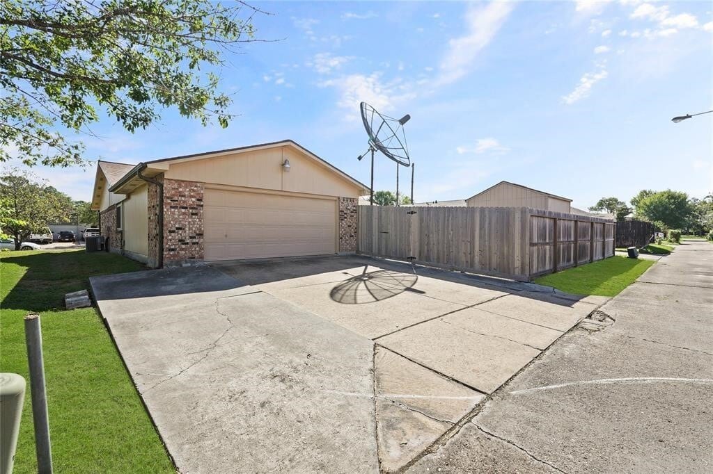
- 2 Car Attached Garage
- Cooling System Powered By Gas
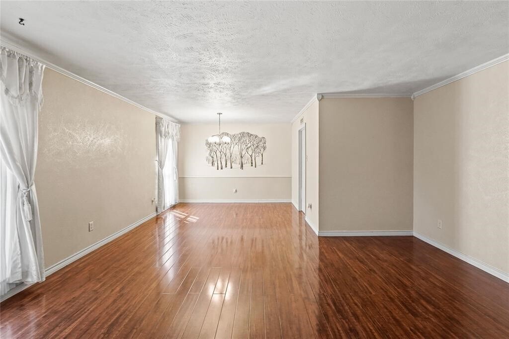
- Living Room
- Tile Flooring
5619 Pine Row

Favorites
About This Home
Available Now
SPACIOUS 3-BEDROM,2 BATH RESIDENCE FEATURING FORMAL AND FAMILY LIVING AREAS THAT PROVIDE FLEXIBILITY FOR ENTERTAINING,AND RELAXING. MLS# 78636535
5619 Pine Row is a house located in Harris County and the 77049 ZIP Code. This area is served by the Galena Park Independent attendance zone.
* Price shown is base rent. Excludes user-selected optional fees and variable or usage-based fees and required charges due at or prior to move-in or at move-out. Price, availability, fees, and any applicable rent special are subject to change without notice.
* Square footage definitions vary. Displayed square footage is approximate.
Home Details
Home Type
Single Family Detached Home
Year Built
Built in 1979
Bedrooms and Bathrooms
2 Full Bathrooms
3 Bedrooms
Flooring
Tile
Carpet
Home Design
Traditional Architecture
Interior Spaces
Living Room
Dining Room
Family Room
1,880 Sq Ft Home
1-Story Property
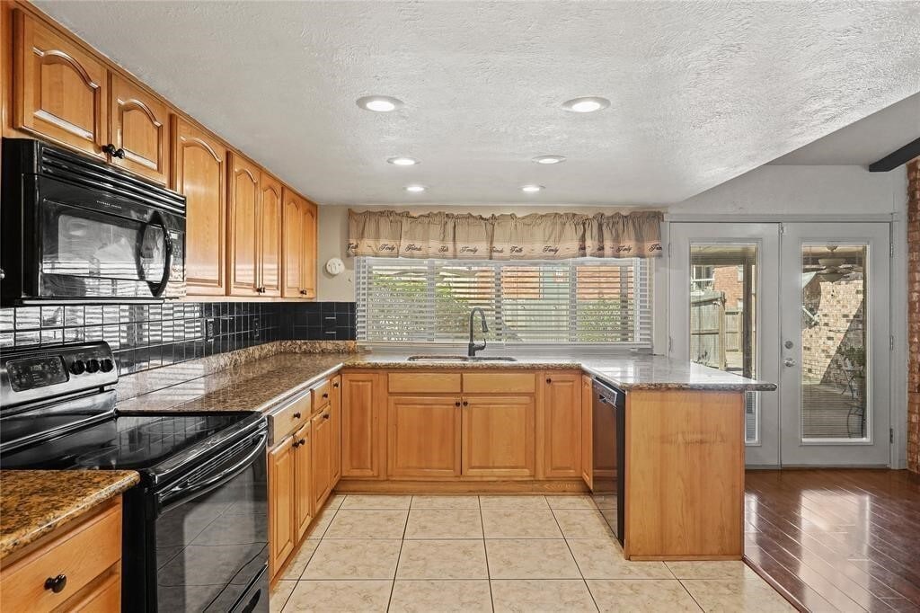
Kitchen
Kitchen Island
Microwave
Listing and Financial Details
Property Available on 1/8/26
Long Term Lease
Parking
2 Car Attached Garage
Schools
Tice Elementary School
Cunningham Middle School
North Shore Senior High School
Utilities
Cooling System Powered By Gas
Central Heating and Cooling System
No Utilities
Community Details
Overview
Pine Trails Subdivision
Pet Policy
No Pets Allowed
Pet Deposit Required
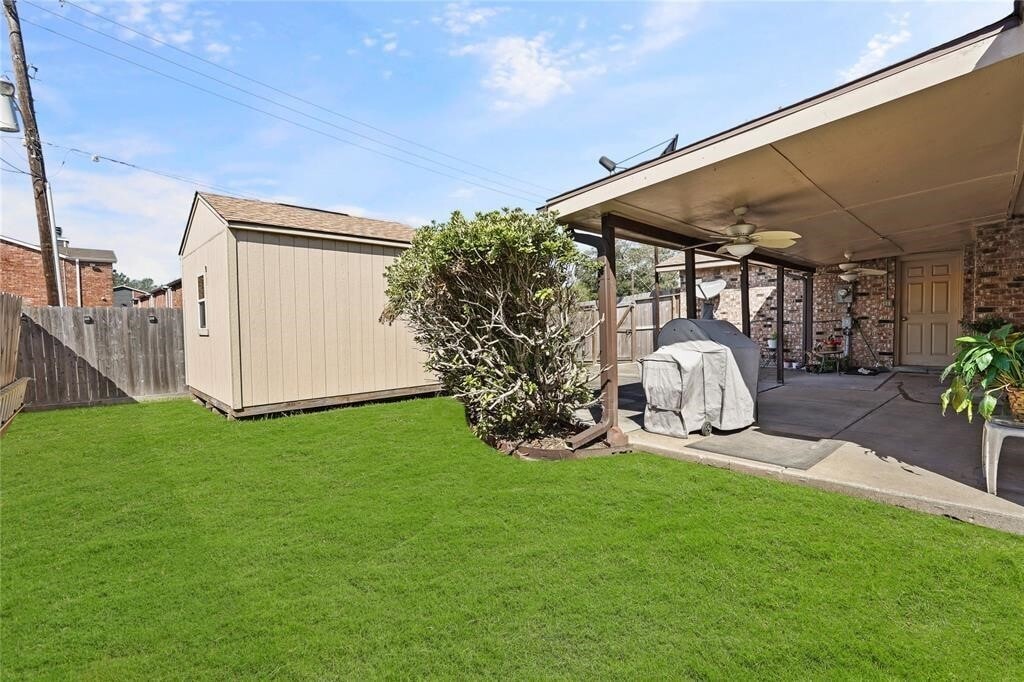
Recreation
Community Pool
Contact
- Listed by Maricarmen Escobar | Jane Byrd Properties International LLC
- Phone Number
- Contact
-
Source
 Houston Association of REALTORS®
Copyright © 2026 Houston Association of Realtors. All rights reserved. All information provided by the listing agent/broker is deemed reliable but is not guaranteed and should be independently verified.
Location
Get Directions
Characterized by thick woods and a variety of home prices and styles, North Shore sits on top of the Houston Ship Channel east of Loop 610. Located a 19-minute drive and about 11 miles northeast of Downtown, this primarily residential area straddles Interstate 10.
A number of smaller communities make up this neighborhood, including Songwood, Holiday Forest, Wood Bayou, Cimarron, Home Owned Estates, Woodland Acres, Hidden Forest, and Greens Bayou. Many of these areas contain mid-century ranch-style homes.
The Galena Park and Houston Independent School Districts serve the area, with neighborhoods east of Greens Bayou and south of Market Street falling under Galena Park, while the rest lie in Houston ISD. North Shore residents enjoy close proximity to the sprawling Herman Brown Park, a major nature area and recreational facility.
Learn more about living in North Shore
Education
| Colleges & Universities | Distance | ||
|---|---|---|---|
| Colleges & Universities | Distance | ||
| Drive: | 3 min | 1.2 mi | |
| Drive: | 17 min | 11.4 mi | |
| Drive: | 22 min | 13.3 mi | |
| Drive: | 24 min | 14.5 mi |
5619 Pine Row is within 3 minutes or 1.2 miles from San Jacinto College, North. It is also near Univ. of Houston, Downtown and University of Houston.
Schools


Public Elementary School
Grades PK-5
668 Students
Attendance Zone
Public Elementary & Middle School
Grades 6
1,030 Students
Attendance Zone
Public Middle School
Grades 7-8
928 Students
Attendance Zone
Public High School
Grades 9-12
4,569 Students
Attendance Zone
Private Elementary School
Grades PK-5
Nearby
Private Elementary, Middle & High School
Grades PK-12
343 Students
Nearby
School data provided by
 The GreatSchools Rating helps parents compare schools within a state based on a variety of school quality indicators and provides a helpful picture of how effectively each school serves all of its students. Ratings are on a scale of 1 (below average) to 10 (above average) and can include test scores, college readiness, academic progress, advanced courses, equity, discipline and attendance data. We also advise parents to visit schools, consider other information on school performance and programs, and consider family needs as part of the school selection process.
View GreatSchools Rating Methodology
Data provided by GreatSchools.org © 2026. All rights reserved.
View GreatSchools Rating Methodology
Data provided by GreatSchools.org © 2026. All rights reserved.
Transportation options available in Houston include Cesar Chavez / 67Th St Eb, located 10.2 miles from 5619 Pine Row. 5619 Pine Row is near William P Hobby, located 17.1 miles or 31 minutes away, and George Bush Intcntl/Houston, located 21.8 miles or 27 minutes away.
| Transit / Subway | Distance | ||
|---|---|---|---|
| Transit / Subway | Distance | ||
| Drive: | 16 min | 10.2 mi | |
| Drive: | 16 min | 10.3 mi | |
| Drive: | 16 min | 10.3 mi | |
| Drive: | 16 min | 10.4 mi | |
| Drive: | 17 min | 11.0 mi |
| Commuter Rail | Distance | ||
|---|---|---|---|
| Commuter Rail | Distance | ||
|
|
Drive: | 19 min | 12.2 mi |
| Airports | Distance | ||
|---|---|---|---|
| Airports | Distance | ||
|
William P Hobby
|
Drive: | 31 min | 17.1 mi |
|
George Bush Intcntl/Houston
|
Drive: | 27 min | 21.8 mi |
Time and distance from 5619 Pine Row.
| Shopping Centers | Distance | ||
|---|---|---|---|
| Shopping Centers | Distance | ||
| Walk: | 3 min | 0.2 mi | |
| Walk: | 11 min | 0.6 mi | |
| Walk: | 12 min | 0.6 mi |
5619 Pine Row has 3 shopping centers within 0.6 mile, which is about a 12-minute walk. The miles and minutes will be for the farthest away property.
| Parks and Recreation | Distance | ||
|---|---|---|---|
| Parks and Recreation | Distance | ||
|
Gene Green All-Inclusive Park
|
Drive: | 6 min | 2.7 mi |
|
Sheldon Lake State Park
|
Drive: | 14 min | 9.4 mi |
|
Sims Bayou Urban Nature Center
|
Drive: | 19 min | 12.1 mi |
|
Baytown Nature Center
|
Drive: | 21 min | 14.4 mi |
|
San Jacinto Battleground State Historic Site
|
Drive: | 26 min | 15.8 mi |
5619 Pine Row has 5 parks within 15.8 miles, including Gene Green All-Inclusive Park, Sheldon Lake State Park, and Sims Bayou Urban Nature Center.
| Hospitals | Distance | ||
|---|---|---|---|
| Hospitals | Distance | ||
| Drive: | 7 min | 3.6 mi | |
| Drive: | 20 min | 13.6 mi |
5619 Pine Row is 3.6 miles from Ad Hospital East, and is convenient to other hospitals, including Hca Houston Healthcare Southeast.
| Military Bases | Distance | ||
|---|---|---|---|
| Military Bases | Distance | ||
| Drive: | 40 min | 23.9 mi | |
| Drive: | 70 min | 53.6 mi |
5619 Pine Row is 23.9 miles from Lyndon B Johnson Space Center, and is convenient to other military bases, including Pelican Spit Military Reservation.
You May Also Like
Similar Rentals Nearby
-
-

-

-
1 / 20

-
-
-
-

-
-


What Are Walk Score®, Transit Score®, and Bike Score® Ratings?
Walk Score® measures the walkability of any address. Transit Score® measures access to public transit. Bike Score® measures the bikeability of any address.
What is a Sound Score Rating?
A Sound Score Rating aggregates noise caused by vehicle traffic, airplane traffic and local sources

5619 Pine Row
Houston, TX 77049