$1,500 / Month
542 Hazel St N
Saint Paul, MN 55119
Today
Favorites
651-500-0311
-
Bedrooms
2
-
Bathrooms
1
-
Square Feet
888 sq ft
-
Available
Available Now
Highlight
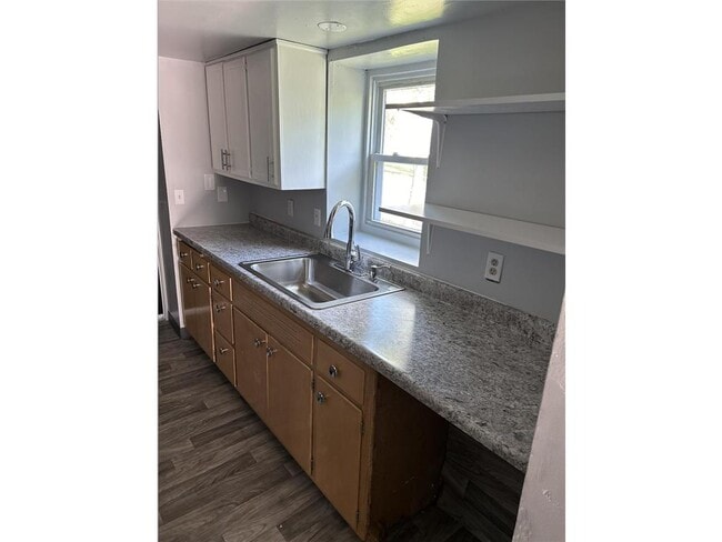
- Forced Air Heating System
542 Hazel St N

Favorites
About This Home
$1,500 deposit,
Available Now
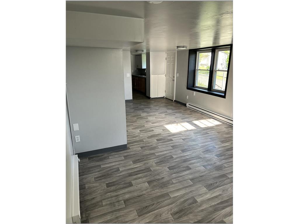
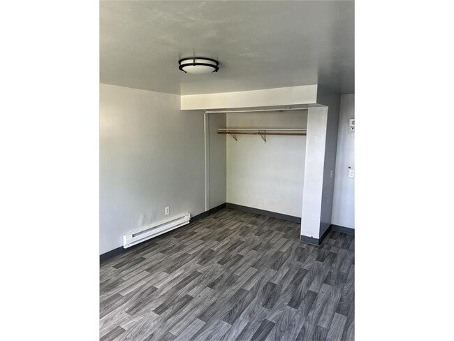
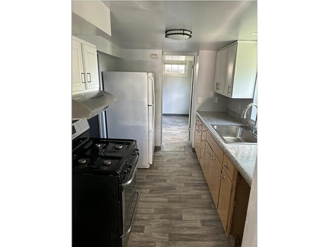
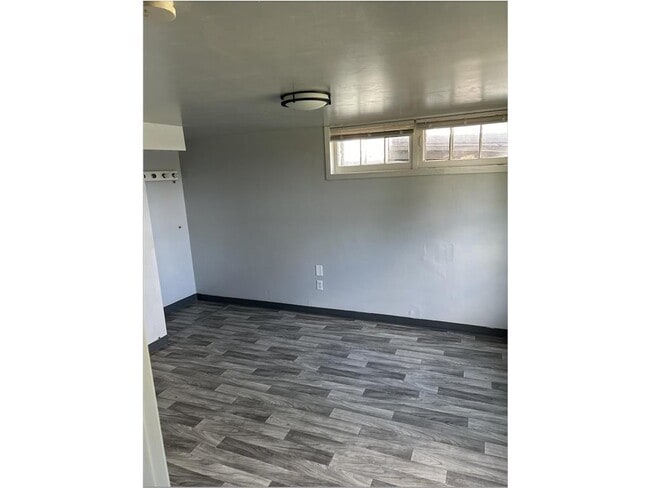
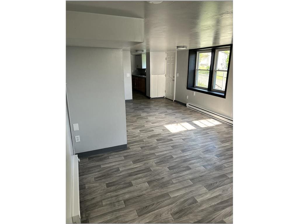
Now Available – Freshly Renovated 2-Bedroom Garden-Level Apartment! Make yourself at home in this beautifully updated 2-bedroom, 1-bath garden-level unit, located on the peaceful eastern edge of Saint Paul's vibrant East Side. Enjoy the charm and comfort of a private triplex setting with only a few neighbors. Conveniently located just a 10-minute walk from grocery stores, retail shops, the library, and Conway Rec Center—perfect for saving on gas and staying connected to the community. Most housing vouchers are welcome. Don’t miss this opportunity—schedule your tour today!
542 Hazel St N is a townhome located in Ramsey County and the 55119 ZIP Code. This area is served by the St. Paul Public attendance zone.
* Price shown is base rent and may not include non-optional fees and utilities.
Price, availability, fees, and any applicable rent special are subject to change without notice.
* Square footage definitions vary. Displayed square footage is approximate.
Home Details
Home Type
Triplex
Year Built
Built in 1921
Bedrooms and Bathrooms
1 Full Bathroom
2 Bedrooms
Interior Spaces
888 Sq Ft Home
2-Story Property
Listing and Financial Details
Property Available on 6/11/25
Assessor Parcel Number 352922240169
Tenant pays for gas, trash collection
The owner pays for water
Lot Details
Lot Dimensions are 4x137
Parking
On-Street Parking
Utilities
Forced Air Heating System
Community Details
Overview
No Home Owners Association
Wild Rose Add Subdivision
Fees and Policies
The fees below are based on community-supplied data and may exclude additional fees and utilities.
- Parking
-
Street--
Contact
- Listed by Mioshi Seto | Metro Home Realty
- Phone Number
- Contact
-
Source
 NorthstarMLS®
Copyright © 2025 Regional Multiple Listing Service of Minnesota [NorthStarMLS]. All rights reserved. All information provided by the listing agent/broker is deemed reliable but is not guaranteed and should be independently verified.
Location
Get Directions
Amenities
- Air Conditioning
- Heating
- Basement
Nestled along Interstate 94, Conway sits approximately six miles east of Downtown Saint Paul. The neighborhood is home to a lush community park and recreation center, a shopping center, and affordable apartments for rent. Conway is also home to an array of modest single-family homes that sit along tree-lined streets with paved sidewalks. Although the neighborhood is walkable, many residents choose to commute via vehicle or public transit due to the abundant bus stops in the neighborhood and its proximity to Saint Paul. Residents of Conway live just minutes from the Minnesota State Capitol and the well-known museums, theaters, and parks that await within Saint Paul.
Learn more about living in Conway
Education
| Colleges & Universities | Distance | ||
|---|---|---|---|
| Colleges & Universities | Distance | ||
| Drive: | 6 min | 3.3 mi | |
| Drive: | 10 min | 5.6 mi | |
| Drive: | 11 min | 7.6 mi | |
| Drive: | 13 min | 7.8 mi |
542 Hazel St N is within 6 minutes or 3.3 miles from Metropolitan State University. It is also near Saint Paul College and Century College.
Schools


Public Elementary School
Grades PK-5
266 Students
Attendance Zone
Public Middle School
Grades 6-8
693 Students
Attendance Zone
Public High School
Grades 9-12
1,717 Students
Attendance Zone
Private Elementary School
Grades K-6
Nearby
Private Elementary & Middle School
Grades PK-8
147 Students
Nearby
Private Elementary, Middle & High School
Grades PK-12
466 Students
Nearby
School data provided by
 The GreatSchools Rating helps parents compare schools within a state based on a variety of school quality indicators and provides a helpful picture of how effectively each school serves all of its students. Ratings are on a scale of 1 (below average) to 10 (above average) and can include test scores, college readiness, academic progress, advanced courses, equity, discipline and attendance data. We also advise parents to visit schools, consider other information on school performance and programs, and consider family needs as part of the school selection process.
View GreatSchools Rating Methodology
Data provided by GreatSchools.org © 2025. All rights reserved.
View GreatSchools Rating Methodology
Data provided by GreatSchools.org © 2025. All rights reserved.
Transportation options available in Saint Paul include Union Depot Station, located 4.1 miles from 542 Hazel St N. 542 Hazel St N is near Minneapolis-St Paul International/Wold-Chamberlain, located 13.6 miles or 21 minutes away.
| Transit / Subway | Distance | ||
|---|---|---|---|
| Transit / Subway | Distance | ||
| Drive: | 7 min | 4.1 mi | |
| Drive: | 7 min | 4.5 mi | |
| Drive: | 7 min | 4.6 mi | |
| Drive: | 8 min | 4.6 mi | |
| Drive: | 8 min | 4.9 mi |
| Commuter Rail | Distance | ||
|---|---|---|---|
| Commuter Rail | Distance | ||
|
|
Drive: | 7 min | 3.8 mi |
| Drive: | 25 min | 14.4 mi | |
| Drive: | 27 min | 19.9 mi | |
| Drive: | 37 min | 28.4 mi | |
| Drive: | 39 min | 30.1 mi |
| Airports | Distance | ||
|---|---|---|---|
| Airports | Distance | ||
|
Minneapolis-St Paul International/Wold-Chamberlain
|
Drive: | 21 min | 13.6 mi |
Time and distance from 542 Hazel St N.
| Shopping Centers | Distance | ||
|---|---|---|---|
| Shopping Centers | Distance | ||
| Walk: | 13 min | 0.7 mi | |
| Walk: | 16 min | 0.9 mi | |
| Walk: | 16 min | 0.9 mi |
542 Hazel St N has 3 shopping centers within 0.9 mile, which is about a 16-minute walk. The miles and minutes will be for the farthest away property.
| Parks and Recreation | Distance | ||
|---|---|---|---|
| Parks and Recreation | Distance | ||
|
Maplewood Nature Center
|
Drive: | 6 min | 2.5 mi |
|
Indian Mounds Park
|
Drive: | 6 min | 2.8 mi |
|
Phalen Park
|
Drive: | 8 min | 3.7 mi |
|
Phelan Regional Park
|
Drive: | 9 min | 3.9 mi |
|
Keller Regional Park
|
Drive: | 10 min | 4.6 mi |
542 Hazel St N has 5 parks within 4.6 miles, including Maplewood Nature Center, Indian Mounds Park, and Phalen Park.
| Hospitals | Distance | ||
|---|---|---|---|
| Hospitals | Distance | ||
| Drive: | 9 min | 4.4 mi | |
| Drive: | 7 min | 4.4 mi | |
| Drive: | 7 min | 4.6 mi |
542 Hazel St N has 3 hospitals within 4.6 miles, the nearest is Healtheast Woodwinds Hospital which is 4.4 miles away and a 9 minute drive.
| Military Bases | Distance | ||
|---|---|---|---|
| Military Bases | Distance | ||
| Drive: | 20 min | 12.4 mi |
542 Hazel St N is 12.4 miles and a 20 minute drive from Fort Snelling Military Reservation.
You May Also Like
Similar Rentals Nearby


What Are Walk Score®, Transit Score®, and Bike Score® Ratings?
Walk Score® measures the walkability of any address. Transit Score® measures access to public transit. Bike Score® measures the bikeability of any address.
What is a Sound Score Rating?
A Sound Score Rating aggregates noise caused by vehicle traffic, airplane traffic and local sources
542 Hazel St N
Saint Paul, MN 55119